Great Todber Hill

Hill, Mountain in Yorkshire Ribble Valley

England

Great Todber Hill

Old Guide Stone by A682, Rimington Lane junction with Hardacre Lane (East face) The Guide Stone is located in angle of minor roads, next to grey metal junction box on the West side of the road.  Parish of Rimington (Ribble Valley District). Carved stone post, erected in the 18th Century, old edge chips. An earlier photograph can be found here: <a title="https://www.geograph.org.uk/photo/6076649" href="https://www.geograph.org.uk/photo/6076649">Link</a> 

Inscription reads:- 
TO / {hand to left}  / BurnLey /(1) 2 m : : TO / {hand to right} / (?) /5 ms / TO E {hand to left} / Gisbern / 1m 

Grade II listed. 
List Entry Number: 1165264 <span class="nowrap"><a title="https://historicengland.org.uk/listing/the-list/list-entry/1165264" rel="nofollow ugc noopener" href="https://historicengland.org.uk/listing/the-list/list-entry/1165264">Link</a><img style="margin-left:2px;" alt="External link" title="External link - shift click to open in new window" src="https://s1.geograph.org.uk/img/external.png" width="10" height="10"/></span> 

Milestone Society National ID: YW_XGIS
Old Guide Stone by A682, Rimington Lane junction with Hardacre Lane (East face) Credit: Hilary Jones

Great Todber Hill is a prominent landmark located in the county of Yorkshire, England. Situated in the southern part of the county, it belongs to the Pennine range of hills, which stretches across Northern England. With an elevation of approximately 552 meters (1,811 feet), it is classified as a hill rather than a mountain.

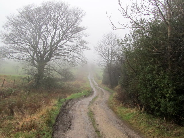
Great Todber Hill is renowned for its picturesque landscapes, offering breathtaking views of the surrounding countryside. The hill is covered in lush greenery, with patches of heather and wildflowers adding bursts of color to the terrain. It is home to a variety of plant and animal species, including grouse and other upland birds, making it a popular spot for birdwatching enthusiasts.

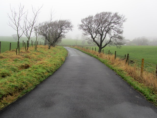
Hikers and nature lovers are drawn to Great Todber Hill due to its tranquil atmosphere and well-maintained walking trails. The paths meander through the hillside, allowing visitors to explore its diverse terrain, which includes rocky outcrops and gentle slopes. On clear days, the summit provides panoramic vistas, offering glimpses of nearby valleys and distant hills.

Great Todber Hill holds historical significance as well, with evidence of ancient settlements and burial mounds in the surrounding area. The hill is steeped in folklore and local legends, adding an element of mystique to its allure.

Accessible by foot or by car, Great Todber Hill is a must-visit destination for those seeking natural beauty and a sense of tranquility in the heart of Yorkshire.

If you have any feedback on the listing, please let us know in the comments section below.

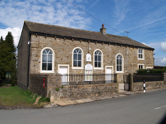
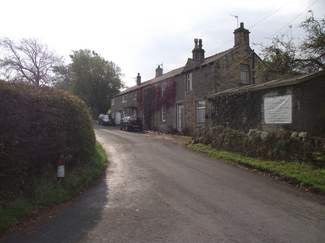
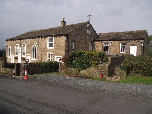
Great Todber Hill Images

Images are sourced within 2km of 53.9153/-2.2518956 or Grid Reference SD8346. Thanks to Geograph Open Source API. All images are credited.

Old Guide Stone by A682, Rimington Lane junction with Hardacre Lane (East face) The Guide Stone is located in angle of minor roads, next to grey metal junction box on the West side of the road.  Parish of Rimington (Ribble Valley District). Carved stone post, erected in the 18th Century, old edge chips. An earlier photograph can be found here: <a title="https://www.geograph.org.uk/photo/6076649" href="https://www.geograph.org.uk/photo/6076649">Link</a> 

Inscription reads:- 
TO / {hand to left}  / BurnLey /(1) 2 m : : TO / {hand to right} / (?) /5 ms / TO E {hand to left} / Gisbern / 1m 

Grade II listed. 
List Entry Number: 1165264 <span class="nowrap"><a title="https://historicengland.org.uk/listing/the-list/list-entry/1165264" rel="nofollow ugc noopener" href="https://historicengland.org.uk/listing/the-list/list-entry/1165264">Link</a><img style="margin-left:2px;" alt="External link" title="External link - shift click to open in new window" src="https://s1.geograph.org.uk/img/external.png" width="10" height="10"/></span> 

Milestone Society National ID: YW_XGIS
Old Guide Stone by A682, Rimington Lane junction with Hardacre Lane (East face)
The Guide Stone is located in angle of minor roads, next to grey metal junction box on the West side of the road.  Parish of Rimington (Ribble Valley District). Carved stone post, erected in the 18th Century, old edge chips. An earlier photograph can be found here: Link  Inscription reads:- TO / {hand to left} / BurnLey /(1) 2 m : : TO / {hand to right} / (?) /5 ms / TO E {hand to left} / Gisbern / 1m Grade II listed. List Entry Number: 1165264 LinkExternal link Milestone Society National ID: YW_XGIS
Old Guide Stone by A682, Rimington Lane junction with Hardacre Lane (West Face) The Guide Stone is located in angle of minor roads, next to grey metal junction box on the West side of the road.  Parish of Rimington (Ribble Valley District). Carved stone post, erected in the 18th Century, old edge chips. East face photograph can be found here: <a title="https://www.geograph.org.uk/photo/7383066" href="https://www.geograph.org.uk/photo/7383066">Link</a> 

Inscription reads:- 
TO / {hand to left}  / BurnLey /(1) 2 m : : TO / {hand to right} / (?) / 5 ms / TO E {hand to left} / Gisbern / 1m 

Grade II listed. 
List Entry Number: 1165264 <span class="nowrap"><a title="https://historicengland.org.uk/listing/the-list/list-entry/1165264" rel="nofollow ugc noopener" href="https://historicengland.org.uk/listing/the-list/list-entry/1165264">Link</a><img style="margin-left:2px;" alt="External link" title="External link - shift click to open in new window" src="https://s1.geograph.org.uk/img/external.png" width="10" height="10"/></span> 

Milestone Society National ID: YW_XGIS
Old Guide Stone by A682, Rimington Lane junction with Hardacre Lane (West Face)
The Guide Stone is located in angle of minor roads, next to grey metal junction box on the West side of the road.  Parish of Rimington (Ribble Valley District). Carved stone post, erected in the 18th Century, old edge chips. East face photograph can be found here: Link Inscription reads:- TO / {hand to left} / BurnLey /(1) 2 m : : TO / {hand to right} / (?) / 5 ms / TO E {hand to left} / Gisbern / 1m Grade II listed. List Entry Number: 1165264 LinkExternal link Milestone Society National ID: YW_XGIS
Salem Congregational Chapel The Chapel at the junction of Long Lover Lane,Martin Top lane and Newby Lane, the post box can just be seen, it is built into the wall on the left.
Salem Congregational Chapel
The Chapel at the junction of Long Lover Lane,Martin Top lane and Newby Lane, the post box can just be seen, it is built into the wall on the left.
Cottages on Martin Top Lane At the junction of Stopper Lane and Martin Top Lane.
Cottages on Martin Top Lane
At the junction of Stopper Lane and Martin Top Lane.
Salem Congregational Church and Manse At Martin Top near Newby.
Salem Congregational Church and Manse
At Martin Top near Newby.
Brogden Lane beside Kirk Clough Part of the narrow lane that runs from the north end of Barnoldswick to the A682 Gisburn/Nelson Road
Brogden Lane beside Kirk Clough
Part of the narrow lane that runs from the north end of Barnoldswick to the A682 Gisburn/Nelson Road
Driveway to Brogden Hall Access to Brogden Hall Farm from Brogden Lane
Driveway to Brogden Hall
Access to Brogden Hall Farm from Brogden Lane
On Brogden Lane The lane on a misty winters day as it descends toward Brogden Hall en route to Barnoldswick
On Brogden Lane
The lane on a misty winters day as it descends toward Brogden Hall en route to Barnoldswick
Flass House Farm in the Mist Brogden Lane passing Flass House Farm on a miserable misty winters day
Flass House Farm in the Mist
Brogden Lane passing Flass House Farm on a miserable misty winters day
Coal Pit Lane Unmetalled Lane descending gradually towards the Ribble Valley, recently adopted by the Pennine Bridleway.
Coal Pit Lane
Unmetalled Lane descending gradually towards the Ribble Valley, recently adopted by the Pennine Bridleway.
Access Drive to Coverdale The driveway seen on a rather grim misty day, from Coal Pit Lane
Access Drive to Coverdale
The driveway seen on a rather grim misty day, from Coal Pit Lane
Coal Pit Lane in Winter A bleak midwinter scene along Coal Pit Lane - recently adopted by the Pennine Bridleway National Trail
Coal Pit Lane in Winter
A bleak midwinter scene along Coal Pit Lane - recently adopted by the Pennine Bridleway National Trail
Coal Pit Lane on Talbot Hill Narrow lane on a grim midwinter day
Coal Pit Lane on Talbot Hill
Narrow lane on a grim midwinter day
Gisburn:  Sheep pasture on Talbot Hill A few sheep can just be discerned half-heartedly cropping the pasture.
Gisburn: Sheep pasture on Talbot Hill
A few sheep can just be discerned half-heartedly cropping the pasture.
Gisburn:  Coal Pit Lane Looking southeast.  Coal Pit Lane was once part of the ancient route from Gisburn to Colne.  It joined up with Gisburn Old Road near the top of Weets Hill.  However, the connection is no longer possible, as Coal Pit Lane ceases to be metalled in another 500 yards at Bonny Blacks Farm, and although bridleway rights exist further on, eventually the way becomes quite impassable, even for a pedestrian.  As it is not a through road, there is very little traffic along Coal Pit Lane, (even Bonny Blacks can be reached much more easily by a different route).
Gisburn: Coal Pit Lane
Looking southeast. Coal Pit Lane was once part of the ancient route from Gisburn to Colne. It joined up with Gisburn Old Road near the top of Weets Hill. However, the connection is no longer possible, as Coal Pit Lane ceases to be metalled in another 500 yards at Bonny Blacks Farm, and although bridleway rights exist further on, eventually the way becomes quite impassable, even for a pedestrian. As it is not a through road, there is very little traffic along Coal Pit Lane, (even Bonny Blacks can be reached much more easily by a different route).
Gisburn:  Hardhouse Farm A caravan site adjoins, but tents are not allowed.
Gisburn: Hardhouse Farm
A caravan site adjoins, but tents are not allowed.
Rimington:  Salem Congregational  Chapel Built in 1861.  The far end of the building is actually the manse, while a small Sunday School (out of view) adjoins the far end.  The chapel is still in use.  The road in front of the chapel has the name 'Long Lover's Lane', which must rank high in my order of favourite road names, after Hull's 'Land of Green Ginger'.
Rimington: Salem Congregational Chapel
Built in 1861. The far end of the building is actually the manse, while a small Sunday School (out of view) adjoins the far end. The chapel is still in use. The road in front of the chapel has the name 'Long Lover's Lane', which must rank high in my order of favourite road names, after Hull's 'Land of Green Ginger'.
Rimington:  Salem Sunday School Built in 1906 at the eastern end of the chapel/manse building.
Rimington: Salem Sunday School
Built in 1906 at the eastern end of the chapel/manse building.
Show me another place!

Great Todber Hill is located at Grid Ref: SD8346 (Lat: 53.9153, Lng: -2.2518956)

Division: West Riding

Administrative County: Lancashire

District: Ribble Valley

Police Authority: Lancashire

What 3 Words

///piano.stripped.darts. Near Barnoldswick, Lancashire

Related Wikis

Middop

Middop is a rural hamlet and civil parish in Lancashire, England. It is in Ribble Valley district. Middop is near the villages of Rimington and Gisburn...

Gisburn

Gisburn (formerly Gisburne) is a village and civil parish within the Ribble Valley borough of Lancashire, England. Historically within the West Riding...

Gisburn Tunnel

Gisburn Tunnel is a short railway tunnel on the Ribble Valley line in Lancashire, England. The tunnel is 157 yards (144 m) long, just to the east of Gisburn...

Gisburn railway station

Gisburn railway station served the small village of Gisburn, which is now in Lancashire, England, but was in the West Riding of Yorkshire at the time....

Weets Hill

Weets Hill is a hill in the West Craven area of Pendle, Lancashire, England. It is 2+1⁄2 miles (4.0 km) south-west of the town of Barnoldswick and is 4...

Rimington

Rimington is a rural village and civil parish in the Ribble Valley, Lancashire, England. The population of the civil parish was 382 at the 2001 Census...

Gisburne Park

Gisburne Park is an 18th-century country house and associated park in Gisburn, Lancashire, England, in the Ribble Valley some 6 miles (10 km) north-east...

Bracewell and Brogden

Bracewell and Brogden is a civil parish in the West Craven area of the Borough of Pendle in Lancashire, England. According to the 2001 census it had a...

Nearby Amenities

Located within 500m of 53.9153,-2.2518956
Cringlands Hill
Natural: peak
Source: OS 1:25k
Lat/Long: 53.9183564/-2.2486128
Pub
The Steamer Inn
Lat/Long: 53.9152559/-2.2575953
Barrier: swing_gate
Lat/Long: 53.9139257/-2.2560822
The data included in this document is from www.openstreetmap.org. The data is made available under ODbL.

Have you been to Great Todber Hill?

Leave your review of Great Todber Hill below (or comments, questions and feedback).