West Fold Hill

Hill, Mountain in Yorkshire Craven

England

West Fold Hill

Footpath leading southwest from Sell Gill Holes near Horton in Ribblesdale
Footpath leading southwest from Sell Gill Holes near Horton in Ribblesdale Credit: Colin Park

West Fold Hill is a prominent natural landmark located in the picturesque region of Yorkshire, England. It is classified as a hill and is part of the North York Moors National Park, renowned for its stunning landscapes and diverse wildlife. Standing at an elevation of approximately 500 meters, West Fold Hill offers breathtaking panoramic views of the surrounding countryside.

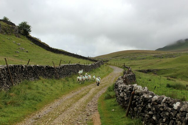
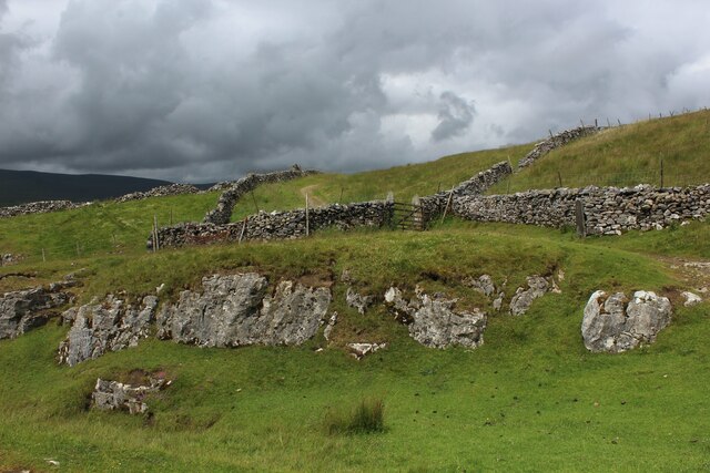
The hill is characterized by its rolling green slopes, covered with heather and grasses, which create a vivid and vibrant landscape throughout the year. The terrain is relatively gentle, making it accessible for hikers and nature enthusiasts of all levels. The hilltop is marked by a few rocky outcrops, adding an interesting geological element to its natural beauty.

West Fold Hill is home to a diverse range of flora and fauna, including several rare species. The open moorland provides a habitat for various bird species, such as curlews, lapwings, and skylarks, which can often be spotted soaring above the hill. The surrounding woodlands are inhabited by mammals like deer, foxes, and badgers.

The hill boasts a network of well-maintained footpaths, enabling visitors to explore its stunning vistas and immerse themselves in the tranquility of the countryside. It is a popular destination for outdoor activities such as hiking, birdwatching, and photography.

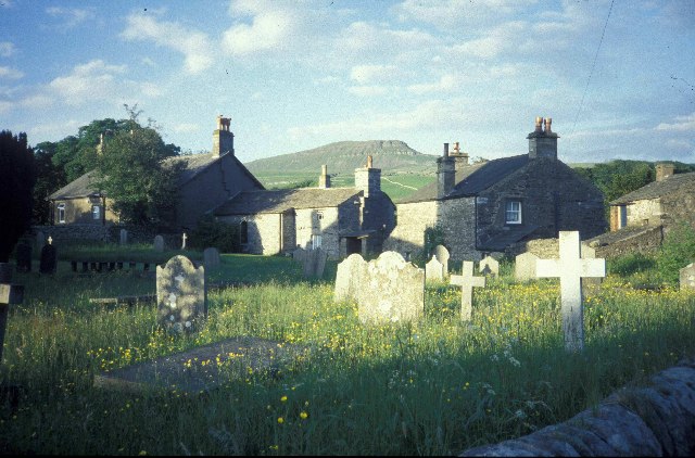
West Fold Hill is not only a natural gem but also holds historical significance. The remnants of ancient settlements, including stone circles and burial mounds, can be found in the vicinity, offering a glimpse into the region's rich heritage.

Overall, West Fold Hill is a must-visit destination for those seeking a blend of natural beauty, wildlife, and a touch of history in the heart of Yorkshire.

If you have any feedback on the listing, please let us know in the comments section below.

West Fold Hill Images

Images are sourced within 2km of 54.168519/-2.2677851 or Grid Reference SD8274. Thanks to Geograph Open Source API. All images are credited.

Footpath leading southwest from Sell Gill Holes near Horton in Ribblesdale
Hull Pot, Pen-y-Ghent
Hull Pot Beck, Pen-y-Ghent
Hull Pot, Pen-y-Ghent
Path crossing Hull Pot Beck, Pen-y-Ghent The stepping stones are submerged!
Path crossing Hull Pot Beck, Pen-y-Ghent
The stepping stones are submerged!
The Pennine Way near Whitber Pasture
The Pennine Way near Sell Gill Holes
The Pennine Way near Sell Gill Hill
The Pennine Way near Penyghent Long Churn
Ascending Horton Scar Lane Gradual ascent on a walled track, adopted by the Pennine Way National Trail
Ascending Horton Scar Lane
Gradual ascent on a walled track, adopted by the Pennine Way National Trail
Sheep on Horton Scar Lane Walled track adopted by the Pennine Way National Trail, ascending towards Pen-y-Ghent and moorland surroundings.
Sheep on Horton Scar Lane
Walled track adopted by the Pennine Way National Trail, ascending towards Pen-y-Ghent and moorland surroundings.
On Whitber Hill Section of the Three Peaks challenge walk - a testing hike of 25 miles that is to be completed within 10 hours.
Once it was a slog through peat creating wide swathes of disturbed sloppy moorland - but now the authorities that be have created hard paths over much of the route, making it much easier to succeed while protecting the environment
On Whitber Hill
Section of the Three Peaks challenge walk - a testing hike of 25 miles that is to be completed within 10 hours. Once it was a slog through peat creating wide swathes of disturbed sloppy moorland - but now the authorities that be have created hard paths over much of the route, making it much easier to succeed while protecting the environment
Footbridge over Sell Gill Section of the Three Peaks challenge walk - a testing hike of 25 miles that is to be completed within 10 hours.
Once it was a slog through peat creating wide swathes of disturbed sloppy moorland - but now the authorities that be have created hard paths over much of the route, making it much easier to succeed while protecting the environment
Footbridge over Sell Gill
Section of the Three Peaks challenge walk - a testing hike of 25 miles that is to be completed within 10 hours. Once it was a slog through peat creating wide swathes of disturbed sloppy moorland - but now the authorities that be have created hard paths over much of the route, making it much easier to succeed while protecting the environment
Barn Ruins by Sell Gill Ruins of a barn with a splendid view down Ribblesdale as seen from the Pennine Way at Sell Gill.
Barn Ruins by Sell Gill
Ruins of a barn with a splendid view down Ribblesdale as seen from the Pennine Way at Sell Gill.
Pennine Way at Sell Gill The Pennine Way National Trail is joined by the Ribble Way long distance footpath along this section of an ancient packhorse route called Harber Scar Road.
Pennine Way at Sell Gill
The Pennine Way National Trail is joined by the Ribble Way long distance footpath along this section of an ancient packhorse route called Harber Scar Road.
The Pennine Way on Pen-y-ghent
Show me another place!

West Fold Hill is located at Grid Ref: SD8274 (Lat: 54.168519, Lng: -2.2677851)

Division: West Riding

Administrative County: North Yorkshire

District: Craven

Police Authority: North Yorkshire

What 3 Words

///hound.narrow.limiting. Near Settle, North Yorkshire

Related Wikis

Pen-y-ghent

Pen-y-ghent or Penyghent is a fell in the Yorkshire Dales, England. It is the lowest of Yorkshire's Three Peaks at 2,277 feet (694 m); the other two being...

Plover Hill

Plover Hill is an area of moorland lying to the north of Pen-y-ghent in the Yorkshire Dales and connected to it by an unbroken area of high ground. Whilst...

Horton in Ribblesdale

Horton in Ribblesdale is a small village and civil parish in the Craven district of North Yorkshire, England. It is situated in Ribblesdale on the Settle...

Three Peaks Cyclo-Cross

The Three Peaks Cyclo-Cross is an annual cyclo-cross event over the Yorkshire three peaks of Ingleborough, Whernside and Pen-y-ghent, in Yorkshire, England...
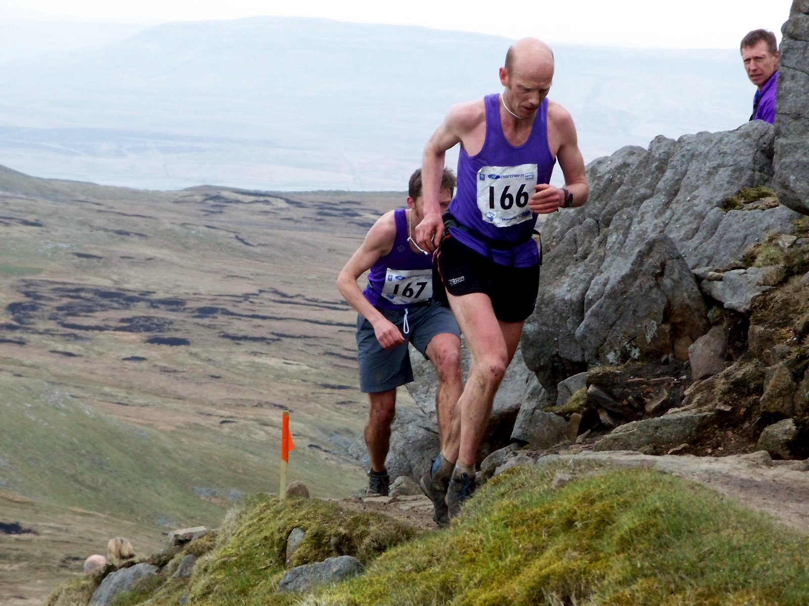
Three Peaks Race

The Three Peaks Race is a fell race held annually on the last weekend in April, starting and finishing in Horton in Ribblesdale. The course traverses the...

Brackenbottom

Brackenbottom is a village in Ribblesdale, North Yorkshire, England. == External links == Media related to Brackenbottom at Wikimedia Commons

Horton-in-Ribblesdale railway station

Horton-in-Ribblesdale is a railway station on the Settle and Carlisle Line, which runs between Carlisle and Leeds via Settle. The station, situated 47...

Ribblesdale

Ribblesdale is one of the Yorkshire Dales in England. It is the dale or upper valley of the River Ribble in North Yorkshire. Towns and villages in Ribblesdale...

Related Videos

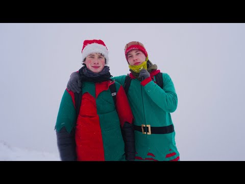
HIKING A MOUNTAIN IN 0° TEMPERATURES (CHRISTMAS EDITION)

Hiking, a mountain in 0° temperatures (Christmas edition) #adventure #challenge #explore #nature #outdoors #travel #extreme ...

Hiking the Jogle Day 35 - Dealing with bad weather on the Pennine Way!!

Me and Di (my girlfriend) are hiking from John O' Groats to Land's End and wild camping all the way. This is a daily vlog of our ...

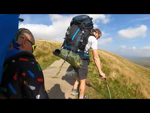
Pen-y-ghent & Hull Pot Guide, Yorkshire Three Peaks | English Countryside Walk

If you're looking to walk up one of the Yorkshire Three Peaks then you could be considering Pen-y-ghent. Standing at 694 meters, ...

Yorkshire Three Peaks full hiking and wild camping

A 72 minute timelapse of the full Yorkshire Three Peaks route from Pen-y-ghent to Whernside and then to Ingleborough. Over two ...

Nearby Amenities

Located within 500m of 54.168519,-2.2677851
Hull Pot
Natural: cave_entrance
Source: GPS;local_knowlede
Tourism: attraction
Lat/Long: 54.1665643/-2.2706575
Ford: yes
Lat/Long: 54.1668205/-2.2709041
Waterway: waterfall
Lat/Long: 54.1667677/-2.2709519
Ford: yes
Seasonal: no
Lat/Long: 54.1703516/-2.2684667
Natural: cave_entrance
Source: OS 1:25k
Lat/Long: 54.1662402/-2.2665724
Natural: cave_entrance
Source: OS 1:25k
Lat/Long: 54.1664843/-2.2674741
Marble Quarry Hill
Natural: peak
Source: OS 1:25k
Lat/Long: 54.1697851/-2.2637555
Barrier: stile
Lat/Long: 54.1703669/-2.2683308
Natural: sinkhole
Source: Bing
Lat/Long: 54.1675134/-2.2724871
Natural: sinkhole
Source: Bing
Lat/Long: 54.1661941/-2.2721867
Natural: sinkhole
Source: Bing
Lat/Long: 54.168518/-2.2752336
Natural: sinkhole
Source: Bing
Lat/Long: 54.1659554/-2.273399
Natural: sinkhole
Source: Bing
Lat/Long: 54.166408/-2.2720364
Natural: sinkhole
Source: Bing
Lat/Long: 54.1666149/-2.2717468
Natural: sinkhole
Source: Bing
Lat/Long: 54.166439/-2.2701374
Natural: sinkhole
Source: Bing
Lat/Long: 54.1662883/-2.2711245
Natural: sinkhole
Source: Bing
Lat/Long: 54.169071/-2.2710494
Natural: sinkhole
Source: Bing
Lat/Long: 54.1676513/-2.2709207
Natural: sinkhole
Source: Bing
Lat/Long: 54.1677584/-2.2713605
Natural: sinkhole
Source: Bing
Lat/Long: 54.1677141/-2.271103
Natural: sinkhole
Source: Bing
Lat/Long: 54.16919/-2.271103
Natural: sinkhole
Source: Bing
Lat/Long: 54.1657419/-2.2735385
Natural: sinkhole
Source: Bing
Lat/Long: 54.1656665/-2.2735385
Natural: sinkhole
Source: Bing
Lat/Long: 54.1662757/-2.2734527
Natural: sinkhole
Source: Bing
Lat/Long: 54.1678648/-2.2715858
Natural: sinkhole
Source: Bing
Lat/Long: 54.1663828/-2.2732703
Natural: sinkhole
Source: Bing
Lat/Long: 54.1655911/-2.273517
Natural: sinkhole
Source: Bing
Lat/Long: 54.1662195/-2.2735921
Natural: sinkhole
Source: Bing
Lat/Long: 54.1669604/-2.2729377
Natural: sinkhole
Source: Bing
Lat/Long: 54.1651643/-2.26662
Natural: sinkhole
Source: Bing
Lat/Long: 54.1654155/-2.266384
Natural: sinkhole
Source: Bing
Lat/Long: 54.1658923/-2.266341
Natural: sinkhole
Source: Bing
Lat/Long: 54.1664701/-2.2656759
Natural: sinkhole
Source: Bing
Lat/Long: 54.1653395/-2.2661694
Natural: sinkhole
Source: Bing
Lat/Long: 54.1665204/-2.2654398
Natural: sinkhole
Source: Bing
Lat/Long: 54.1662943/-2.2659977
Natural: sinkhole
Source: Bing
Lat/Long: 54.1652516/-2.2664913
Natural: sinkhole
Source: Bing
Lat/Long: 54.1666209/-2.2652252
Natural: sinkhole
Source: Bing
Lat/Long: 54.1656159/-2.2662552
Natural: sinkhole
Source: Bing
Lat/Long: 54.1715297/-2.2699875
Natural: sinkhole
Source: Bing
Lat/Long: 54.1660305/-2.2662338
Natural: sinkhole
Source: Bing
Lat/Long: 54.1694871/-2.2604488
Natural: sinkhole
Source: Bing
Lat/Long: 54.1693427/-2.2605131
Natural: sinkhole
Source: Bing
Lat/Long: 54.1696064/-2.2603737
Ford: yes
Lat/Long: 54.167809/-2.2633668
Natural: sinkhole
Source: Bing
Lat/Long: 54.1668547/-2.2696169
Natural: sinkhole
Source: Bing
Lat/Long: 54.167026/-2.2699395
Natural: sinkhole
Source: Bing
Lat/Long: 54.1658489/-2.2685815
Natural: sinkhole
Source: Bing
Lat/Long: 54.1659411/-2.2722128
Natural: sinkhole
Source: Bing
Lat/Long: 54.1660114/-2.2722653
Natural: sinkhole
Source: Bing
Lat/Long: 54.1661124/-2.2722278
Natural: sinkhole
Source: Bing
Lat/Long: 54.1654492/-2.2718452
Natural: sinkhole
Source: Bing
Lat/Long: 54.1655678/-2.2718302
Natural: sinkhole
Source: Bing
Lat/Long: 54.16566/-2.2717702
Natural: sinkhole
Source: Bing
Lat/Long: 54.1646981/-2.2706147
Natural: sinkhole
Source: Bing
Lat/Long: 54.1649748/-2.2705322
Natural: sinkhole
Source: Bing
Lat/Long: 54.1651241/-2.2702021
Natural: sinkhole
Source: Bing
Lat/Long: 54.165879/-2.2738253
West Fold Hill
Ele: 415
Natural: peak
Lat/Long: 54.1683487/-2.2672525
Natural: sinkhole
Lat/Long: 54.1666952/-2.2694221
Natural: sinkhole
Lat/Long: 54.1681095/-2.2717337
Natural: sinkhole
Lat/Long: 54.1694466/-2.2698955
Natural: sinkhole
Lat/Long: 54.169386/-2.2700185
Natural: sinkhole
Lat/Long: 54.1695566/-2.2699149
Natural: sinkhole
Lat/Long: 54.1697007/-2.2723116
Natural: sinkhole
Lat/Long: 54.1711264/-2.2725577
Natural: sinkhole
Lat/Long: 54.1711984/-2.272616
Natural: sinkhole
Lat/Long: 54.1709671/-2.2730111
Natural: sinkhole
Lat/Long: 54.1708648/-2.2732443
Natural: sinkhole
Lat/Long: 54.1709103/-2.273484
Waterway: waterfall
Lat/Long: 54.166643/-2.2706261
Natural: sinkhole
Lat/Long: 54.169203/-2.2717006
The data included in this document is from www.openstreetmap.org. The data is made available under ODbL.

Have you been to West Fold Hill?

Leave your review of West Fold Hill below (or comments, questions and feedback).