Castle Law

Hill, Mountain in Roxburghshire

Scotland

Castle Law

Kirk Yetholm Under Staerough Hill.
Viewed from the B6352 heading towards Wooler.
Kirk Yetholm Credit: Russel Wills

Castle Law is a prominent hill located in the region of Roxburghshire, Scotland. Standing at an elevation of approximately 441 meters (1,447 feet), it is classified as a hill rather than a mountain. The hill is situated near the village of Roberton, offering picturesque views of the surrounding landscape.

Castle Law gets its name from the remains of an ancient fortification that once occupied its summit. The fort, believed to date back to the Iron Age, consisted of a series of stone walls and ditches. Although the fort's purpose and history remain somewhat mysterious, its strategic location suggests that it may have served as a defensive stronghold or a signaling point during ancient times.

The ascent to Castle Law is relatively moderate, making it accessible to hikers of various skill levels. A well-defined footpath leads visitors to the hill's summit, where they can explore the remnants of the fort and enjoy panoramic vistas of the rolling countryside. On a clear day, one can even spot the Eildon Hills and the Cheviot Hills in the distance.

Castle Law and its surrounding area are also home to a diverse range of flora and fauna. The hillside is adorned with heather, grasses, and wildflowers, creating a colorful scene during the summer months. Wildlife enthusiasts may spot various bird species, such as curlews and lapwings, as well as mammals like hares and rabbits.

Overall, Castle Law offers visitors a chance to immerse themselves in the rich history and natural beauty of Roxburghshire, making it a popular destination for both locals and tourists alike.

If you have any feedback on the listing, please let us know in the comments section below.

Castle Law Images

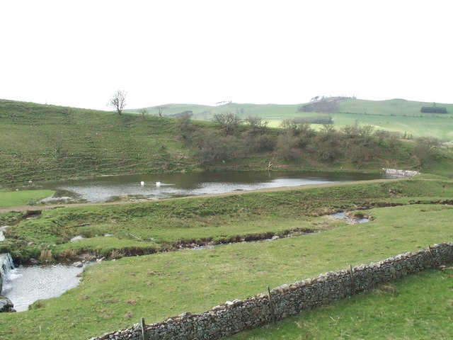
Images are sourced within 2km of 55.565546/-2.2785003 or Grid Reference NT8230. Thanks to Geograph Open Source API. All images are credited.

Kirk Yetholm Under Staerough Hill.
Viewed from the B6352 heading towards Wooler.
Kirk Yetholm
Under Staerough Hill. Viewed from the B6352 heading towards Wooler.
Kirk Yetholm Friends of Nature House Picture taken April 2014 looking down from the lane below the village green.  This historic building was originally the village school (Ragged School) constructed 1860's to educate the local Gipsy families.  Possible that the materials used were surplus from the nearby church.

Building was purchased by SYHA (Hostelling Scotland) in 1938 with intention of becoming a hostel but due to the war, opening delayed until 1942.  Subsequently put up for sale in 2012 along with the other Borders hostel sites at Melrose and Broadmeadows.

Purchase and operation as Friends of Nature House ( <span class="nowrap"><a title="www.friendsofnature.org.uk" rel="nofollow ugc noopener" href="http://www.friendsofnature.org.uk">Link</a><img style="margin-left:2px;" alt="External link" title="External link - shift click to open in new window" src="https://s1.geograph.org.uk/img/external.png" width="10" height="10"/></span> ) since summer 2012 and operational ever since.  Continues also with affiliation to SYHA.

2022 marks the 80th Anniversary of the building offering accommodation principally to walkers, cyclists and those who love nature.
Kirk Yetholm Friends of Nature House
Picture taken April 2014 looking down from the lane below the village green. This historic building was originally the village school (Ragged School) constructed 1860's to educate the local Gipsy families. Possible that the materials used were surplus from the nearby church. Building was purchased by SYHA (Hostelling Scotland) in 1938 with intention of becoming a hostel but due to the war, opening delayed until 1942. Subsequently put up for sale in 2012 along with the other Borders hostel sites at Melrose and Broadmeadows. Purchase and operation as Friends of Nature House ( LinkExternal link ) since summer 2012 and operational ever since. Continues also with affiliation to SYHA. 2022 marks the 80th Anniversary of the building offering accommodation principally to walkers, cyclists and those who love nature.
Direction Sign – Signpost at Venchen Cottages Located at Venchen Cottages on the north side of the junction of the B6352 and the road to Yetholm Mains. 2 arms and annulus finial. 

Milestone Society National ID: RX_NT8329A
Direction Sign – Signpost at Venchen Cottages
Located at Venchen Cottages on the north side of the junction of the B6352 and the road to Yetholm Mains. 2 arms and annulus finial. Milestone Society National ID: RX_NT8329A
Old milestone This stone is on the back road from Catch-a-Penny tollhouse towards Town Yetholm.   In 2012 a Milestone Society member found it and dug it out  <a href="https://www.geograph.org.uk/photo/6043096">NT8128 : Old Milestone north west of Town Yetholm, Yetholm Parish</a>.   It took us 3 attempts to locate it hidden in very long grass on the banking south east of the entrance to Cherrytrees.   But it does need uplifting slightly and straightening.
Old milestone
This stone is on the back road from Catch-a-Penny tollhouse towards Town Yetholm. In 2012 a Milestone Society member found it and dug it out NT8128 : Old Milestone north west of Town Yetholm, Yetholm Parish. It took us 3 attempts to locate it hidden in very long grass on the banking south east of the entrance to Cherrytrees. But it does need uplifting slightly and straightening.
Old milestone Cherrytrees is just round the corner looking northwest from the Kelso 7 milestone.   It was uncovered on the banking of this minor road from Catch-a-Penny tollhouse to Town Yetholm.
Old milestone
Cherrytrees is just round the corner looking northwest from the Kelso 7 milestone. It was uncovered on the banking of this minor road from Catch-a-Penny tollhouse to Town Yetholm.
Direction Sign – Signpost at Venchen Cottages Located at Venchen Cottages on the north side of the junction of the B6352 and the road to Yetholm Mains. 2 arms and annulus finial. Made at the Thomas Brown & Sons, Cammo Foundry in Duns. The foundry operated from the 1850s to 1920s. See also <a title="https://www.geograph.org.uk/photo/7262645" href="https://www.geograph.org.uk/photo/7262645">Link</a>.

Milestone Society National ID: RX_NT8329A
Direction Sign – Signpost at Venchen Cottages
Located at Venchen Cottages on the north side of the junction of the B6352 and the road to Yetholm Mains. 2 arms and annulus finial. Made at the Thomas Brown & Sons, Cammo Foundry in Duns. The foundry operated from the 1850s to 1920s. See also Link. Milestone Society National ID: RX_NT8329A
Direction Sign – Signpost north of Town Yetholm Located on the north side of the T junction at The Stank, north of Town Yetholm. 3 arms, 2 modern, and lost finial. Made at the Thomas Brown & Sons, Cammo Foundry in Duns. The foundry operated from the 1850s to 1920s. See also <a title="https://www.geograph.org.uk/photo/2887188" href="https://www.geograph.org.uk/photo/2887188">Link</a>.

Milestone Society National ID: RX_NT8228
Direction Sign – Signpost north of Town Yetholm
Located on the north side of the T junction at The Stank, north of Town Yetholm. 3 arms, 2 modern, and lost finial. Made at the Thomas Brown & Sons, Cammo Foundry in Duns. The foundry operated from the 1850s to 1920s. See also Link. Milestone Society National ID: RX_NT8228
Cherrytrees Farm Cottages No.4 was for sale at £168,000 fixed price.
Cherrytrees Farm Cottages
No.4 was for sale at £168,000 fixed price.
Field, Cherrytrees
Field, Cherrytrees
Kirk Yetholm Centre of the village, with the green and the Border Hotel. End / beginning of the Pennine Way.
Kirk Yetholm
Centre of the village, with the green and the Border Hotel. End / beginning of the Pennine Way.
Yetholm Mains Looking from England SOUTH into Scotland!
Yetholm Mains
Looking from England SOUTH into Scotland!
Field, Bowmont Hill Farm and Bowmont Hill
The Kelso Laddie and Bari Gadgi ride through Kirk Yetholm on their annual ride from Kelso.
The Kelso Laddie
and Bari Gadgi ride through Kirk Yetholm on their annual ride from Kelso.
Bowmont Valley Looking SW up the Bowmont valley towards Yetholm
Bowmont Valley
Looking SW up the Bowmont valley towards Yetholm
Is this the first loch in Scotland? The border between England and Scotland is along the wall in the foreground so the small loch beyond is roughly 30-40 metres within Scotland. Is there any loch that is completely contained within Scotland that is closer to the border than this?
Is this the first loch in Scotland?
The border between England and Scotland is along the wall in the foreground so the small loch beyond is roughly 30-40 metres within Scotland. Is there any loch that is completely contained within Scotland that is closer to the border than this?
Bowmont Water Looking upstream over this small pool towards Kirk Yetholm. The immediate hill is "Staerough" with the distant hill on the right being "Wideopen" ....
Move Downstream <a href="https://www.geograph.org.uk/photo/165377">NT8430 : Bowmont Water</a>
Bowmont Water
Looking upstream over this small pool towards Kirk Yetholm. The immediate hill is "Staerough" with the distant hill on the right being "Wideopen" .... Move Downstream NT8430 : Bowmont Water
Bowmont Water Looking upstream, the hill on the right skyline is Staerough.
Follow Upstream <a href="https://www.geograph.org.uk/photo/162381">NT8329 : Bowmont Water</a>
Follow Downstream <a href="https://www.geograph.org.uk/photo/162387">NT8533 : Bowmont Water</a>
Bowmont Water
Looking upstream, the hill on the right skyline is Staerough. Follow Upstream NT8329 : Bowmont Water Follow Downstream NT8533 : Bowmont Water
Cottages and Green at Kirk Yetholm This picturesque little village lies close to the border with England.
Cottages and Green at Kirk Yetholm
This picturesque little village lies close to the border with England.
Show me another place!

Castle Law is located at Grid Ref: NT8230 (Lat: 55.565546, Lng: -2.2785003)

Unitary Authority: The Scottish Borders

Police Authority: The Lothians and Scottish Borders

What 3 Words

///haircuts.hiking.shred. Near Kirknewton, Northumberland

Nearby Locations

Castle Law

Related Wikis

Kirk Yetholm

Kirk Yetholm ('kirk yet-ham') is a village in the Scottish Borders region of Scotland, 8 miles (13 kilometres) southeast of Kelso and less than 1 mile...

Yetholm

Yetholm is the parish that contained the villages of Kirk Yetholm and Town Yetholm in the east of the former county of Roxburghshire, nowadays in the Scottish...

Town Yetholm

Town Yetholm ('town yet-ham') is a small village in the Scottish Borders in the valley of the Bowmont Water opposite Kirk Yetholm. The town colours are...

Hoselaw Loch and Din Moss

Hoselaw Loch and Din Moss is a nature reserve near Kelso in the Scottish Borders area of Scotland, in the former Roxburghshire. The reserve is designated...

Nearby Amenities

Located within 500m of 55.565546,-2.2785003
Power: pole
Lat/Long: 55.5617566/-2.2805695
Power: pole
Lat/Long: 55.5622718/-2.2801159
Power: pole
Lat/Long: 55.562743/-2.2797212
Power: pole
Lat/Long: 55.5633528/-2.2791599
Power: pole
Lat/Long: 55.5639039/-2.2786524
Power: pole
Lat/Long: 55.5652425/-2.2772729
Power: pole
Lat/Long: 55.5658577/-2.2768424
Power: pole
Lat/Long: 55.5664925/-2.2763772
Power: pole
Lat/Long: 55.567125/-2.2759197
Power: pole
Lat/Long: 55.5677554/-2.2754699
Power: pole
Lat/Long: 55.5683967/-2.2750047
Power: pole
Lat/Long: 55.5690118/-2.2745626
Castle Law
Ele: 266
Natural: peak
Lat/Long: 55.5656148/-2.2783329
The data included in this document is from www.openstreetmap.org. The data is made available under ODbL.

Have you been to Castle Law?

Leave your review of Castle Law below (or comments, questions and feedback).