Beefstand Hill

Hill, Mountain in Roxburghshire

Scotland

Beefstand Hill

The Pennine Way on Lamb Hill
The Pennine Way on Lamb Hill Credit: Dave Kelly

Beefstand Hill is a prominent landmark located in the county of Roxburghshire in the Scottish Borders region of Scotland. Rising to a height of approximately 517 meters (1,696 feet), it is classified as a hill rather than a mountain. Despite its modest elevation, Beefstand Hill offers stunning panoramic views of the surrounding countryside.

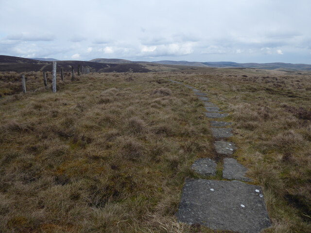
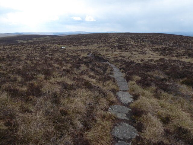
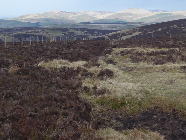
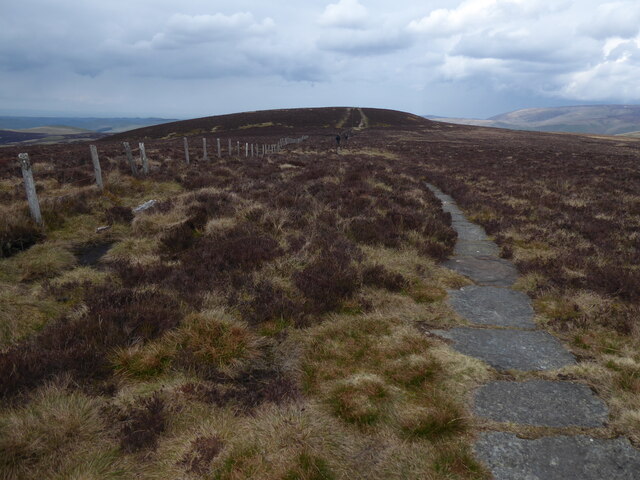
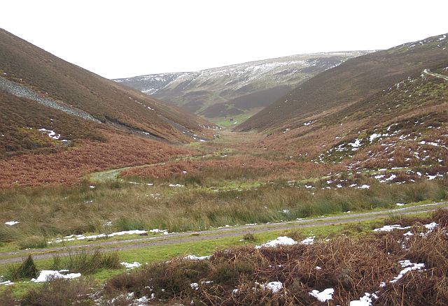
Situated about 7 kilometers (4 miles) northwest of the town of Hawick, Beefstand Hill is easily accessible for outdoor enthusiasts and hikers. The hill is characterized by its gentle slopes and grassy terrain, making it a relatively straightforward climb for those looking to explore the area on foot. The summit provides a commanding vantage point, allowing visitors to admire the picturesque landscapes of Roxburghshire, including rolling hills, lush green valleys, and meandering rivers.

Beefstand Hill is also notable for its historical significance. It is believed to have been an important location during the turbulent times of the Border Reivers, a period of conflict and raiding between the 13th and 17th centuries. The hill's strategic position made it an ideal lookout point, providing a clear view of potential approaching threats.

Today, Beefstand Hill continues to attract locals and tourists alike, drawn by its natural beauty and historical allure. Hikers and nature enthusiasts can enjoy a pleasant and invigorating walk to the summit, while history enthusiasts can appreciate the hill's past significance in the region.

If you have any feedback on the listing, please let us know in the comments section below.

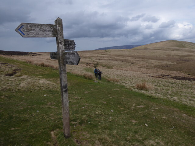
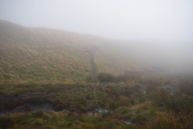
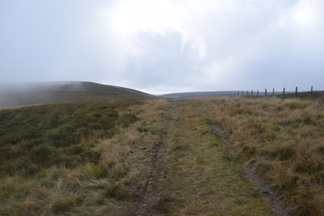
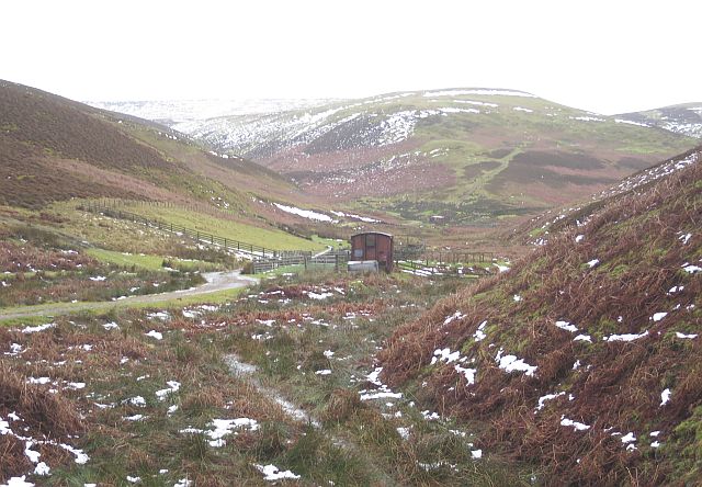
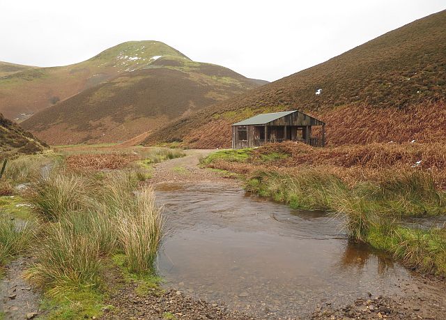
Beefstand Hill Images

Images are sourced within 2km of 55.422943/-2.283941 or Grid Reference NT8214. Thanks to Geograph Open Source API. All images are credited.

The Pennine Way on Lamb Hill
The Pennine Way near Beefstand Hill
The Pennine Way near Mozie Law
The Pennine Way near Plea Knowe
Cairn on the summit of The Kip The cone-shaped Kip is extremely prominent when viewed from the Mountain Refuge Hut at Yearning Saddle close to the border between England and Scotland. The hut can be seen in this photograph just left of centre in the middle distance. The hill in the far distance is Thirl Moor in Upper Coquetdale. For a selection of free to download walking routes in the area visit <span class="nowrap"><a title="www.cheviotwalks.co.uk" rel="nofollow ugc noopener" href="http://www.cheviotwalks.co.uk">Link</a><img style="margin-left:2px;" alt="External link" title="External link - shift click to open in new window" src="https://s1.geograph.org.uk/img/external.png" width="10" height="10"/></span>
Cairn on the summit of The Kip
The cone-shaped Kip is extremely prominent when viewed from the Mountain Refuge Hut at Yearning Saddle close to the border between England and Scotland. The hut can be seen in this photograph just left of centre in the middle distance. The hill in the far distance is Thirl Moor in Upper Coquetdale. For a selection of free to download walking routes in the area visit LinkExternal link
Foul Step - in the mist The Pennine Way at the aptly named Foul Step, crossing the boggy area above the head-water of Foulstep Sike.
Foul Step - in the mist
The Pennine Way at the aptly named Foul Step, crossing the boggy area above the head-water of Foulstep Sike.
The Street  towards Black Braes The Street is an old drove road heading from Scotland to the site of The Slimefoot Inn by Trows Road End - much used as a smuggling route. In clearing mist and low cloud.
The Street towards Black Braes
The Street is an old drove road heading from Scotland to the site of The Slimefoot Inn by Trows Road End - much used as a smuggling route. In clearing mist and low cloud.
The Street approaching Swinside Law The Street is an ancient drove road.
The Street approaching Swinside Law
The Street is an ancient drove road.
Rough Knowe Taken from The Street, looking across the valley of the Rowhope Burn to Rough Knowe. The cleugh in the bottom right is Outer Green Cleugh.
Rough Knowe
Taken from The Street, looking across the valley of the Rowhope Burn to Rough Knowe. The cleugh in the bottom right is Outer Green Cleugh.
Enclosure boundary of old settlement south of Lamb Hill The bank is the western angle of a large rectangular enclosure, itself only part of a large and complex settlement which was probably largely pastoral dealing in the cross border trade. Although undated, the conditions of the banks and regularity of the features suggest a possible medieval date. 

See earlier photo here <a href="https://www.geograph.org.uk/photo/1812404">NT8112 : Moorland north-west of Yearning Law</a>
Pastscape: <span class="nowrap"><a title="http://www.pastscape.org.uk/hob.aspx?hob_id=388" rel="nofollow ugc noopener" href="http://www.pastscape.org.uk/hob.aspx?hob_id=388">Link</a><img style="margin-left:2px;" alt="External link" title="External link - shift click to open in new window" src="https://s1.geograph.org.uk/img/external.png" width="10" height="10"/></span> <span class="nowrap"><a title="https://web.archive.org/web/20170803090203/http://www.pastscape.org.uk/hob.aspx?hob_id=388" rel="nofollow ugc noopener" href="https://web.archive.org/web/20170803090203/http://www.pastscape.org.uk/hob.aspx?hob_id=388">Archive Link</a><img style="margin-left:2px;" alt="External link" title="External link - shift click to open in new window" src="https://s1.geograph.org.uk/img/external.png" width="10" height="10"/></span>
Enclosure boundary of old settlement south of Lamb Hill
The bank is the western angle of a large rectangular enclosure, itself only part of a large and complex settlement which was probably largely pastoral dealing in the cross border trade. Although undated, the conditions of the banks and regularity of the features suggest a possible medieval date. See earlier photo here NT8112 : Moorland north-west of Yearning Law Pastscape: LinkExternal link Archive LinkExternal link
Ditched oval enclosure south of Lamb Hill Settlement This ovoid ditched feature with a domed turf-covered mound inside (resembling a grounded flying saucer) is about 18 x 14m and fits the 1977 description of Yearning Law Burial Cairn <span class="nowrap"><a title="http://archaeologydataservice.ac.uk/archsearch/record?titleId=954419" rel="nofollow ugc noopener" href="http://archaeologydataservice.ac.uk/archsearch/record?titleId=954419">Link</a><img style="margin-left:2px;" alt="External link" title="External link - shift click to open in new window" src="https://s1.geograph.org.uk/img/external.png" width="10" height="10"/></span>

The six-digit grid reference (NT 814 125) given for this supposed late prehistoric monument is about 140m due east of the feature shown here.

Alternatively, the enclosure could be related to the large presumed-medieval pastoral settlement 150m or so north-west which shows a large assembly of banked features <a href="https://www.geograph.org.uk/photo/5483143">NT8112 : Enclosure boundary of old settlement south of Lamb Hill</a>.

It may even be an even later, post-medieval agricultural feature referred to as a stack-stand, a description applied to an apparently similar feature located about 500m west. However this has also been interpreted as a sheepfold <span class="nowrap"><a title="http://www.keystothepast.info/article/10339/Site-Details?PRN=N433" rel="nofollow ugc noopener" href="http://www.keystothepast.info/article/10339/Site-Details?PRN=N433">Link</a><img style="margin-left:2px;" alt="External link" title="External link - shift click to open in new window" src="https://s1.geograph.org.uk/img/external.png" width="10" height="10"/></span>

The view is towards Yearning Law.
Ditched oval enclosure south of Lamb Hill Settlement
This ovoid ditched feature with a domed turf-covered mound inside (resembling a grounded flying saucer) is about 18 x 14m and fits the 1977 description of Yearning Law Burial Cairn LinkExternal link The six-digit grid reference (NT 814 125) given for this supposed late prehistoric monument is about 140m due east of the feature shown here. Alternatively, the enclosure could be related to the large presumed-medieval pastoral settlement 150m or so north-west which shows a large assembly of banked features NT8112 : Enclosure boundary of old settlement south of Lamb Hill. It may even be an even later, post-medieval agricultural feature referred to as a stack-stand, a description applied to an apparently similar feature located about 500m west. However this has also been interpreted as a sheepfold LinkExternal link The view is towards Yearning Law.
Unnamed burn below Lamb Hill
Blind Burn east of Yearning Hall The conifers close to the ruin of Yearning Hall up on the ridge to the left are quite small in a photograph taken around 1980 and may have been planted soon after the house was abandoned in the 1940s.
The Old Tracks through the Cheviots by David Jones with Coquetdale Community Archaeology (2017)

The grass in the foreground is wavy hair-grass (Deschampsia flexuosa), growing like a red mist, waving in the breeze, on a patch of hillside that was probably burnt as part of a muir-burn of an area of old heather.
Blind Burn east of Yearning Hall
The conifers close to the ruin of Yearning Hall up on the ridge to the left are quite small in a photograph taken around 1980 and may have been planted soon after the house was abandoned in the 1940s. The Old Tracks through the Cheviots by David Jones with Coquetdale Community Archaeology (2017) The grass in the foreground is wavy hair-grass (Deschampsia flexuosa), growing like a red mist, waving in the breeze, on a patch of hillside that was probably burnt as part of a muir-burn of an area of old heather.
Light & land-use in the Cheviot Hills View from the grasslands over the upper Blind Burn towards the heather moors of Beefstand Hill.
Light & land-use in the Cheviot Hills
View from the grasslands over the upper Blind Burn towards the heather moors of Beefstand Hill.
Big Dun Rig Big Dun Rig is the hill at the head of this valley, and the slope on the left is Hard Rig. The river was in spate so I was unable to get across it on to the track, but there is a rough sheep track that just and no more got me into the square before it came to a sudden end where the river had eroded it away, leaving only a bog in front of me.
Big Dun Rig
Big Dun Rig is the hill at the head of this valley, and the slope on the left is Hard Rig. The river was in spate so I was unable to get across it on to the track, but there is a rough sheep track that just and no more got me into the square before it came to a sudden end where the river had eroded it away, leaving only a bog in front of me.
Philip Hope A side valley, its track unreachable to me because the Heatherhope Burn was in spate.
Philip Hope
A side valley, its track unreachable to me because the Heatherhope Burn was in spate.
Shooting Hut The ford is one of several, all impassable today because of the melting snow. I had to stick to a sheep track on the left to bypass them all. On the skyline is Greenbrough Hill.
Shooting Hut
The ford is one of several, all impassable today because of the melting snow. I had to stick to a sheep track on the left to bypass them all. On the skyline is Greenbrough Hill.
Show me another place!

Beefstand Hill is located at Grid Ref: NT8214 (Lat: 55.422943, Lng: -2.283941)

Unitary Authority: The Scottish Borders

Police Authority: The Lothians and Scottish Borders

What 3 Words

///carbon.curly.digested. Near Rochester, Northumberland

Nearby Locations

Beefstand Hill

Related Wikis

Windy Gyle

Windy Gyle is a mountain in the Cheviot Hills range, on the border between England and Scotland. Like the other hills in the area, it is rounded and grass...

Barrow Burn Meadows

Barrow Burn Meadows is a Site of Special Scientific Interest (SSSI) in north Northumberland, England. The site is a species-rich hay meadow of a sort now...

Barrow Burn

Barrowburn is a hamlet in Upper Coquetdale in the county of Northumberland, England. It comprises a working farm with associated buildings and two holiday...

Hownam

Hownam or Hounam is a small village and parish situated 8 miles east of Jedburgh in the Scottish Borders area of Scotland, near the Anglo-Scottish border...

Nearby Amenities

Located within 500m of 55.422943,-2.283941
Beefstand Hill
Ele: 562
Natural: peak
Lat/Long: 55.4229348/-2.2841202
The data included in this document is from www.openstreetmap.org. The data is made available under ODbL.

Have you been to Beefstand Hill?

Leave your review of Beefstand Hill below (or comments, questions and feedback).