Hill of Swanley
Hill, Mountain in Kincardineshire
Scotland
Hill of Swanley

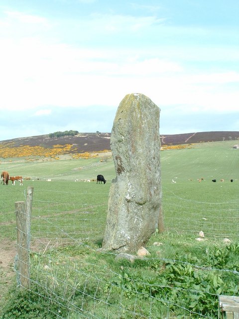
Hill of Swanley, located in the region of Kincardineshire, Scotland, is an impressive natural landmark that stands as a prominent hill in the area. Rising to an elevation of approximately 240 meters (787 feet), it offers stunning panoramic views of the surrounding countryside, making it a popular destination for outdoor enthusiasts and nature lovers.
The hill is characterized by its gentle slopes and verdant greenery, primarily covered in grass and scattered with patches of heather and wildflowers. Its distinctive shape and prominence make it easily recognizable from a distance, adding to its allure and charm.
Hill of Swanley is not only renowned for its natural beauty but also for its historical significance. It has been a site of human activity for thousands of years, with archaeological evidence suggesting that it was once inhabited during the Neolithic period. The hill's strategic position and panoramic views may have made it an ideal location for settlements and fortifications in ancient times.
Today, Hill of Swanley attracts hikers, walkers, and nature enthusiasts who come to explore its tranquil trails and take in the breathtaking vistas. The hill provides ample opportunities for outdoor activities such as picnicking, birdwatching, and photography. Its accessible location and well-maintained paths make it an ideal destination for individuals of all ages and fitness levels.
Whether one seeks a peaceful escape into nature, a glimpse into the area's rich history, or simply a chance to admire the stunning Scottish countryside, Hill of Swanley in Kincardineshire stands as a testament to the region's natural beauty and cultural heritage.
If you have any feedback on the listing, please let us know in the comments section below.
Hill of Swanley Images
Images are sourced within 2km of 56.976001/-2.3064205 or Grid Reference NO8187. Thanks to Geograph Open Source API. All images are credited.


Hill of Swanley is located at Grid Ref: NO8187 (Lat: 56.976001, Lng: -2.3064205)
Unitary Authority: Aberdeenshire
Police Authority: North East
What 3 Words
///wakes.warm.annotated. Near Stonehaven, Aberdeenshire
Nearby Locations
Related Wikis

Rickarton
Rickarton is a settlement in Aberdeenshire. It is situated on the A957 to the northwest of Stonehaven. Rickarton was served by the 105 bus between Stonehaven...
Mergie
Mergie is a settlement in Aberdeenshire approximately six miles west of Stonehaven, Scotland. Situated in the former Kincardineshire slightly south of...

Tewel
Tewel is a hamlet located approximately two miles west of Stonehaven, Kincardineshire on the Auchenblae Road in Northeast Scotland. It consists of: Tewel...

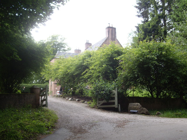
Rickarton House
Rickarton House is a 19th-century country house in Kincardineshire, Scotland. It lies approximately three-and-a-half miles northwest of Stonehaven in the...
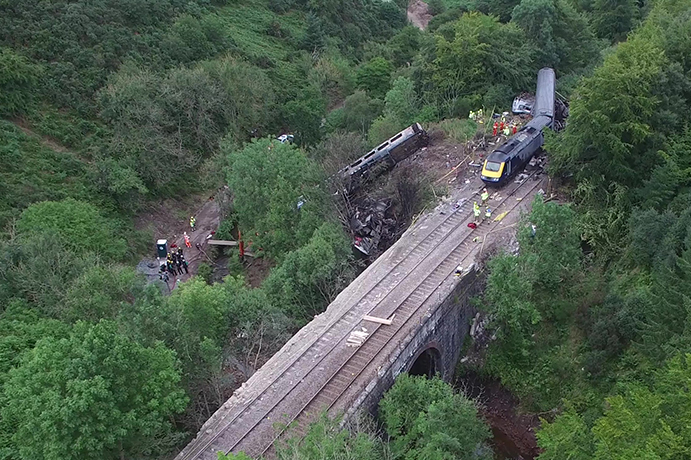
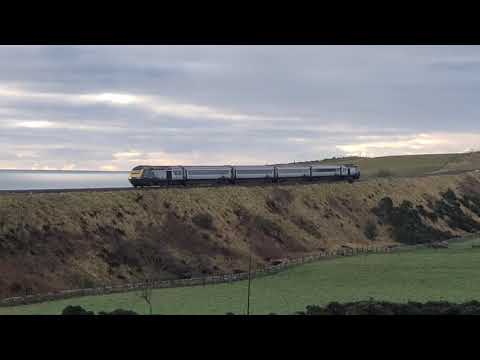
Stonehaven derailment
The Stonehaven derailment was a fatal railway accident that occurred at 09:38 BST on 12 August 2020, when a passenger train returning to Aberdeen hit a...

Cowton Burn
Cowton Burn is a stream that rises in the Mounth, or eastern range of the Grampian Mountains, on some of the northwest slopes of the Durris Forest west...
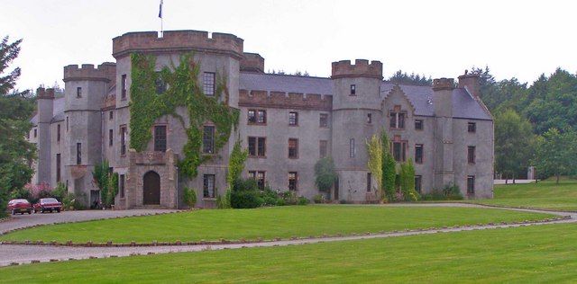
Fetteresso Castle
Fetteresso Castle is a 14th-century tower house, rebuilt in 1761 as a Scottish Gothic style Palladian manor, with clear evidence of prehistoric use of...
Lang Stane of Auquhollie
The Lang Stane of Auquhollie is an Ogam-inscribed standing stone some 6 kilometres north-west of Stonehaven in Scotland. Situated on south side of Meikle...
Related Videos
thank you to the drivers for the respect horns
carmont and bridge of muchalls 26/11/2020.
Nearby Amenities
Located within 500m of 56.976001,-2.3064205Have you been to Hill of Swanley?
Leave your review of Hill of Swanley below (or comments, questions and feedback).