Blackway Head

Hill, Mountain in Northumberland

England

Blackway Head

Bare ground of stream side adjacent to Nan Davison's Cleugh The cleugh is just out of view beyond the bare ground, descending left to right. A bridleway, the route of the Isaac Tea Trail, runs along the right edge of the groove; it can be seen in the distance emerging  from the stream's valley.
Bare ground of stream side adjacent to Nan Davison's Cleugh Credit: Trevor Littlewood

Blacklaw Head is a prominent hill located in the county of Northumberland, England. Situated in the North Pennines Area of Outstanding Natural Beauty, it offers breathtaking views of the surrounding landscape. With an elevation of approximately 400 meters (1,312 feet), it stands as one of the highest peaks in the region.

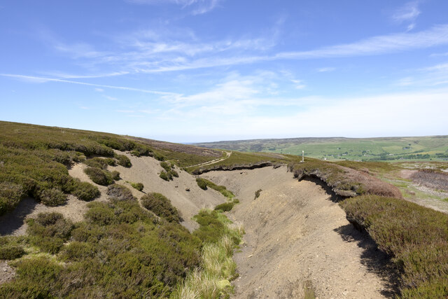
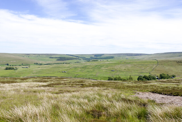
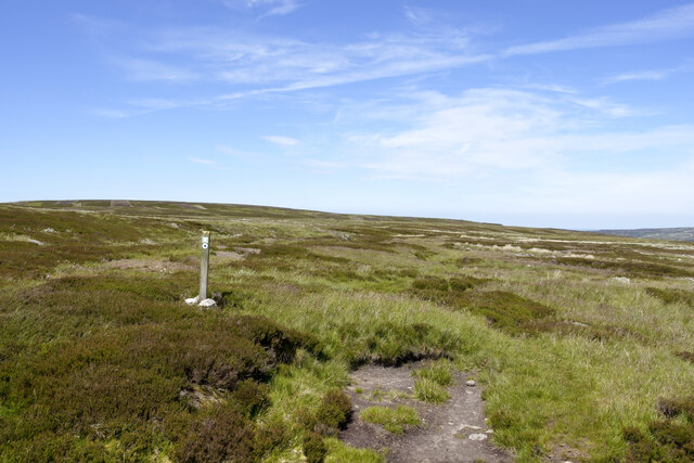
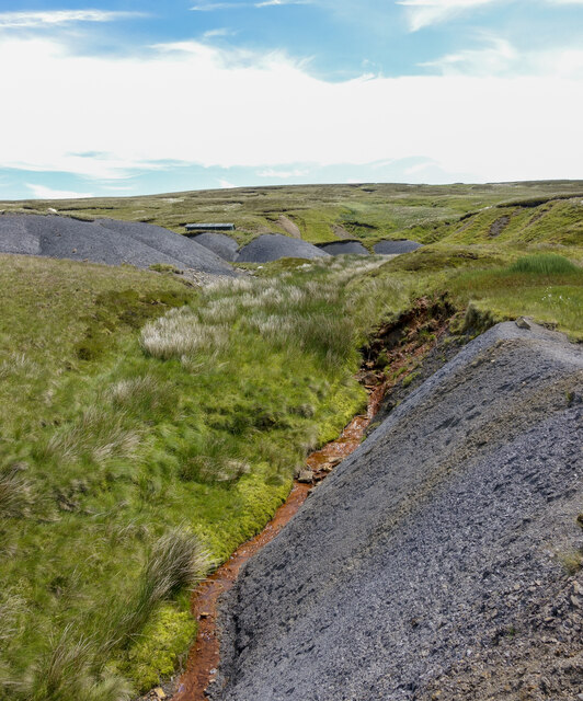
The hill is characterized by its distinctive conical shape and is predominantly covered in heather and grass, making it a haven for wildlife and plants. Its slopes are crisscrossed with walking trails that appeal to outdoor enthusiasts, offering a range of difficulty levels to cater to all abilities. These trails provide access to the summit, where visitors can enjoy panoramic vistas of the Northumberland countryside, including the Cheviot Hills and the Tyne Valley.

Blacklaw Head is also known for its rich history. The remains of an Iron Age fort can be found on its slopes, providing a glimpse into the area's past. The hill has also played a role in local folklore, with tales of supernatural happenings and mysterious sightings adding to its allure.

Due to its location within an Area of Outstanding Natural Beauty, Blacklaw Head is protected and preserved for future generations to enjoy. It attracts a steady stream of hikers, nature enthusiasts, and photographers, who are drawn to its natural beauty and tranquility.

In conclusion, Blacklaw Head in Northumberland is a prominent hill offering stunning views, diverse flora and fauna, and a rich historical and cultural heritage. It stands as a testament to the natural beauty and charm of the North Pennines region.

If you have any feedback on the listing, please let us know in the comments section below.

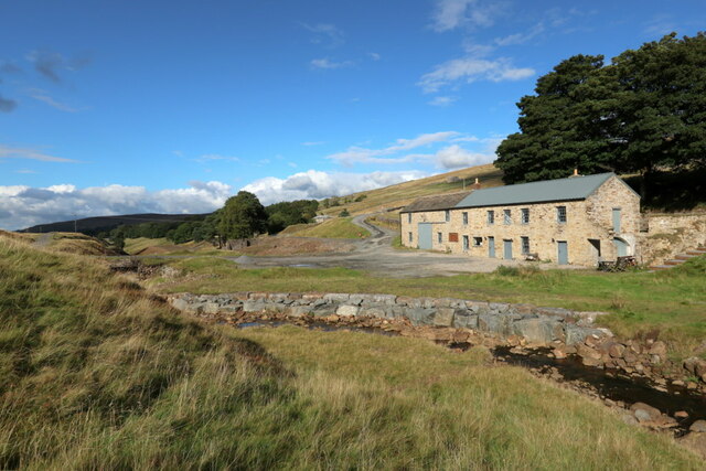
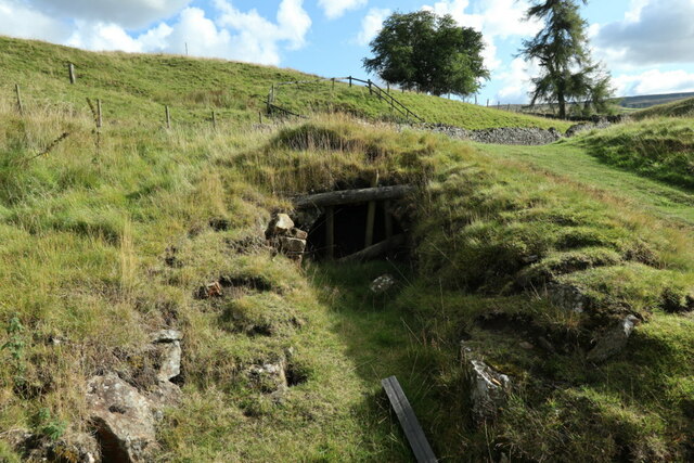
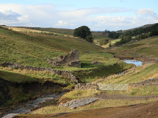
Blackway Head Images

Images are sourced within 2km of 54.817514/-2.2898986 or Grid Reference NY8147. Thanks to Geograph Open Source API. All images are credited.

Bare ground of stream side adjacent to Nan Davison's Cleugh The cleugh is just out of view beyond the bare ground, descending left to right. A bridleway, the route of the Isaac Tea Trail, runs along the right edge of the groove; it can be seen in the distance emerging  from the stream's valley.
Bare ground of stream side adjacent to Nan Davison's Cleugh
The cleugh is just out of view beyond the bare ground, descending left to right. A bridleway, the route of the Isaac Tea Trail, runs along the right edge of the groove; it can be seen in the distance emerging from the stream's valley.
Moorland below route of bridleway The heather and grass moorland is on a slope descending towards Swin Hope, a tributary valley of East Allendale; that main valley lies beyond the middle-distance ridge. The village of Allenheads is there, below the coniferous plantations.
Moorland below route of bridleway
The heather and grass moorland is on a slope descending towards Swin Hope, a tributary valley of East Allendale; that main valley lies beyond the middle-distance ridge. The village of Allenheads is there, below the coniferous plantations.
Bridleway crossing moorland beside Blackway Head The bridleway is passing the minor moorland rise on its west side; it's also the route used by the named walk, Isaac's Tea Trail.
Bridleway crossing moorland beside Blackway Head
The bridleway is passing the minor moorland rise on its west side; it's also the route used by the named walk, Isaac's Tea Trail.
Moorland on south side of Blackway Head The foreground bog is adjacent to the route of a bridleway now incorporated into the named walk, Isaac's Tea Trail. The shallow dome on the horizon to the right is the minor summit at Blackway Head; to the left of it is the location named as Three Curricks.
Moorland on south side of Blackway Head
The foreground bog is adjacent to the route of a bridleway now incorporated into the named walk, Isaac's Tea Trail. The shallow dome on the horizon to the right is the minor summit at Blackway Head; to the left of it is the location named as Three Curricks.
Ochreous stream beside shaley slope Ochre is an iron oxide or hydroxide present in certain rocks and often found in uplands staining pools and watercourses. The flow of the stream in the image (Bridge Cleugh) is particularly strongly affected.
The loose, shaley material beside the stream is a natural feature. The similar piles higher on the slope have been bulldozed to create a flat parking area for a shooting hut - its roof can be seen.
Ochreous stream beside shaley slope
Ochre is an iron oxide or hydroxide present in certain rocks and often found in uplands staining pools and watercourses. The flow of the stream in the image (Bridge Cleugh) is particularly strongly affected. The loose, shaley material beside the stream is a natural feature. The similar piles higher on the slope have been bulldozed to create a flat parking area for a shooting hut - its roof can be seen.
Carrshield lead mines and ore works The small building on the west bank of River West Allen is next to the adit of Scraithole Mine. This was the second mine at the Carrshield complex. Scraithole Mine was operated during the 19th century by the Beaumont Company, and was reopened in the 1950s when it continued to be operational until 1981. Access to this mine was also through an adit; the entrance is situated on the left bank of the river immediately east of the track to Greenpit, opposite Bluerow Cottages <a href="https://www.geograph.org.uk/photo/7292516">NY8046 : Scraithole Mine, Carrshield</a>.
Carrshield lead mines and ore works
The small building on the west bank of River West Allen is next to the adit of Scraithole Mine. This was the second mine at the Carrshield complex. Scraithole Mine was operated during the 19th century by the Beaumont Company, and was reopened in the 1950s when it continued to be operational until 1981. Access to this mine was also through an adit; the entrance is situated on the left bank of the river immediately east of the track to Greenpit, opposite Bluerow Cottages NY8046 : Scraithole Mine, Carrshield.
Barneycraig Mine Shop, Carrshield The two storeyed lodging shop is the largest in the north Pennines and retains several original internal features including arched furnace openings and a blacksmiths' forge. Inside and surrounding the lodging shop there are a series of culverts, some of which are thought to have been used to drain the mines; others are thought to be related to the water management system associated with ore processing at the northern end of the monument.

Also see: <a href="https://www.geograph.org.uk/photo/7292526">NY8046 : Plaque, Barneycraig Mine Shop, Carrshield</a> and <a href="https://www.geograph.org.uk/photo/7292245">NY8046 : Barneycraig Mine Shop, Carrshield</a>

The range of buildings is Grade II Listed (1042932): <span class="nowrap"><a title="https://historicengland.org.uk/listing/the-list/list-entry/1042932" rel="nofollow ugc noopener" href="https://historicengland.org.uk/listing/the-list/list-entry/1042932">Link</a><img style="margin-left:2px;" alt="External link" title="External link - shift click to open in new window" src="https://s1.geograph.org.uk/img/external.png" width="10" height="10"/></span>

With funding from Historic England and the Heritage Lottery Fund, the North Pennines Area of Outstanding Natural Beauty Partnership renovated the building using traditional methods and existing materials, converting the upper floors into a basic Camping Barn. It is now owned and managed by Allen Valleys Enterprise Limited, for the benefit of the local community.  ​
<span class="nowrap"><a title="https://www.carrshieldcampingbarn.co.uk/" rel="nofollow ugc noopener" href="https://www.carrshieldcampingbarn.co.uk/">Link</a><img style="margin-left:2px;" alt="External link" title="External link - shift click to open in new window" src="https://s1.geograph.org.uk/img/external.png" width="10" height="10"/></span> <span class="nowrap"><a title="https://web.archive.org/web/20221003161945/https://www.carrshieldcampingbarn.co.uk/" rel="nofollow ugc noopener" href="https://web.archive.org/web/20221003161945/https://www.carrshieldcampingbarn.co.uk/">Archive Link</a><img style="margin-left:2px;" alt="External link" title="External link - shift click to open in new window" src="https://s1.geograph.org.uk/img/external.png" width="10" height="10"/></span>
Barneycraig Mine Shop, Carrshield
The two storeyed lodging shop is the largest in the north Pennines and retains several original internal features including arched furnace openings and a blacksmiths' forge. Inside and surrounding the lodging shop there are a series of culverts, some of which are thought to have been used to drain the mines; others are thought to be related to the water management system associated with ore processing at the northern end of the monument. Also see: NY8046 : Plaque, Barneycraig Mine Shop, Carrshield and NY8046 : Barneycraig Mine Shop, Carrshield The range of buildings is Grade II Listed (1042932): LinkExternal link With funding from Historic England and the Heritage Lottery Fund, the North Pennines Area of Outstanding Natural Beauty Partnership renovated the building using traditional methods and existing materials, converting the upper floors into a basic Camping Barn. It is now owned and managed by Allen Valleys Enterprise Limited, for the benefit of the local community. ​ LinkExternal link Archive LinkExternal link
Barneycraig Mine Shop, Carrshield Notice attached to front wall of restored building now used as a bunk-house <a href="https://www.geograph.org.uk/photo/7292241">NY8046 : Barneycraig Mine Shop, Carrshield</a>.

"I should think it no hardship to have remained 24 hours in a mine, but I would be terrified of being ordered to be shut up quarter of an hour in the bedroom of a lodging shop’. 
Assistant Commissioner, Dr W.R. Mitchell (1842), Royal Commission Report on Employment of Children (Mines).
Barneycraig Mine Shop, Carrshield
Notice attached to front wall of restored building now used as a bunk-house NY8046 : Barneycraig Mine Shop, Carrshield. "I should think it no hardship to have remained 24 hours in a mine, but I would be terrified of being ordered to be shut up quarter of an hour in the bedroom of a lodging shop’. Assistant Commissioner, Dr W.R. Mitchell (1842), Royal Commission Report on Employment of Children (Mines).
Barneycraig Mine Shop, Carrshield The monument includes the remains of two lead mines and an ore works, situated on the base and lower slopes of the valley of the West Allen at Carrshield. The visible remains of the lead industry at Carrshield are complex and represent several phases of mining over three centuries. The latest phase of the mining dominates, although earlier remains will survive beneath these, as well as in the areas untouched by later mining. The earliest known mining activity at the site was the Barney Crag Horse level, situated at the southern end of the complex; this mine was opened during the 1760s and continued in use throughout the 19th century. The access to this mine was through an adit, or horizontal tunnel into the valley side.

The second mine at the complex was Scraithole Mine which was operated during the 19th century by the Beaumont Company, and was reopened in the 1950s when it continued to be operational until 1981. Access to this mine was also through an adit; the entrance is situated on the left bank of the river immediately east of the track to Greenpit, opposite Bluerow Cottages.

Historic England Scheduled Monument (1015849): <span class="nowrap"><a title="https://historicengland.org.uk/listing/the-list/list-entry/1015849" rel="nofollow ugc noopener" href="https://historicengland.org.uk/listing/the-list/list-entry/1015849">Link</a><img style="margin-left:2px;" alt="External link" title="External link - shift click to open in new window" src="https://s1.geograph.org.uk/img/external.png" width="10" height="10"/></span>

Barney Crag Industrial Complex, RCHME Report (1992): <span class="nowrap"><a title="https://historicengland.org.uk/research/results/reports/7293/BarneyCragIndustrialComplexCarrShieldNorthumberland" rel="nofollow ugc noopener" href="https://historicengland.org.uk/research/results/reports/7293/BarneyCragIndustrialComplexCarrShieldNorthumberland">Link</a><img style="margin-left:2px;" alt="External link" title="External link - shift click to open in new window" src="https://s1.geograph.org.uk/img/external.png" width="10" height="10"/></span> <span class="nowrap"><a title="https://web.archive.org/web/20221003171209/https://historicengland.org.uk/research/results/reports/7293/BarneyCragIndustrialComplexCarrShieldNorthumberland" rel="nofollow ugc noopener" href="https://web.archive.org/web/20221003171209/https://historicengland.org.uk/research/results/reports/7293/BarneyCragIndustrialComplexCarrShieldNorthumberland">Archive Link</a><img style="margin-left:2px;" alt="External link" title="External link - shift click to open in new window" src="https://s1.geograph.org.uk/img/external.png" width="10" height="10"/></span>

Carne, P. and Jenkins, C. (2015). Barney Craig Mine Water Treatment Scheme, Carrshield, Northumberland - heritage assessment. Archaeological Services, Durham University.
<span class="nowrap"><a title="https://doi.org/10.5284/1037930" rel="nofollow ugc noopener" href="https://doi.org/10.5284/1037930">Link</a><img style="margin-left:2px;" alt="External link" title="External link - shift click to open in new window" src="https://s1.geograph.org.uk/img/external.png" width="10" height="10"/></span>

In 2016, Northern Archaeological Associates was commissioned to assist with the remedial works at Carrshield designed to redirect water into the River West Allen away from the spoil heaps of the former mine workings. This consisted of the archaeological monitoring of soil removal, repair of the mine tailings retaining wall and the partial demolition of a miner’s cottage at nearby Low Blue Row to make it safe.
<span class="nowrap"><a title="https://www.northernarchaeologicalassociates.co.uk/drainage-works-carrshield-and-coalcleugh" rel="nofollow ugc noopener" href="https://www.northernarchaeologicalassociates.co.uk/drainage-works-carrshield-and-coalcleugh">Link</a><img style="margin-left:2px;" alt="External link" title="External link - shift click to open in new window" src="https://s1.geograph.org.uk/img/external.png" width="10" height="10"/></span> <span class="nowrap"><a title="https://web.archive.org/web/20221005120609/https://www.northernarchaeologicalassociates.co.uk/drainage-works-carrshield-and-coalcleugh" rel="nofollow ugc noopener" href="https://web.archive.org/web/20221005120609/https://www.northernarchaeologicalassociates.co.uk/drainage-works-carrshield-and-coalcleugh">Archive Link</a><img style="margin-left:2px;" alt="External link" title="External link - shift click to open in new window" src="https://s1.geograph.org.uk/img/external.png" width="10" height="10"/></span>
Barneycraig Mine Shop, Carrshield
The monument includes the remains of two lead mines and an ore works, situated on the base and lower slopes of the valley of the West Allen at Carrshield. The visible remains of the lead industry at Carrshield are complex and represent several phases of mining over three centuries. The latest phase of the mining dominates, although earlier remains will survive beneath these, as well as in the areas untouched by later mining. The earliest known mining activity at the site was the Barney Crag Horse level, situated at the southern end of the complex; this mine was opened during the 1760s and continued in use throughout the 19th century. The access to this mine was through an adit, or horizontal tunnel into the valley side. The second mine at the complex was Scraithole Mine which was operated during the 19th century by the Beaumont Company, and was reopened in the 1950s when it continued to be operational until 1981. Access to this mine was also through an adit; the entrance is situated on the left bank of the river immediately east of the track to Greenpit, opposite Bluerow Cottages. Historic England Scheduled Monument (1015849): LinkExternal link Barney Crag Industrial Complex, RCHME Report (1992): LinkExternal link Archive LinkExternal link Carne, P. and Jenkins, C. (2015). Barney Craig Mine Water Treatment Scheme, Carrshield, Northumberland - heritage assessment. Archaeological Services, Durham University. LinkExternal link In 2016, Northern Archaeological Associates was commissioned to assist with the remedial works at Carrshield designed to redirect water into the River West Allen away from the spoil heaps of the former mine workings. This consisted of the archaeological monitoring of soil removal, repair of the mine tailings retaining wall and the partial demolition of a miner’s cottage at nearby Low Blue Row to make it safe. LinkExternal link Archive LinkExternal link
Mine adit near Barneycraig Mine Shop, Carrshield Lead mine adit portal, probably C18th. Built of roughly squared rubble with a round-arched tunnel. The actual portal has fallen but the arching survives intact from 4 metres back. This was the Barneycraig Horse Level, working the rich Barneycraig Vein, and was driven c.1760 and continued in use throughout the C19th.

The adit portal is Grade II Listed (1155612): <span class="nowrap"><a title="https://historicengland.org.uk/listing/the-list/list-entry/1155612" rel="nofollow ugc noopener" href="https://historicengland.org.uk/listing/the-list/list-entry/1155612">Link</a><img style="margin-left:2px;" alt="External link" title="External link - shift click to open in new window" src="https://s1.geograph.org.uk/img/external.png" width="10" height="10"/></span>
Mine adit near Barneycraig Mine Shop, Carrshield
Lead mine adit portal, probably C18th. Built of roughly squared rubble with a round-arched tunnel. The actual portal has fallen but the arching survives intact from 4 metres back. This was the Barneycraig Horse Level, working the rich Barneycraig Vein, and was driven c.1760 and continued in use throughout the C19th. The adit portal is Grade II Listed (1155612): LinkExternal link
Ruin by River West Allen, Carrshield The ruined building is named Mill House on the 25" OS map (1898).
Ruin by River West Allen, Carrshield
The ruined building is named Mill House on the 25" OS map (1898).
Ruin at Barney Crag Lead Mine The ruined building on the far bank of the River West Allen is shown here: <a href="https://www.geograph.org.uk/photo/7292404">NY8047 : Ruin by River West Allen, Carrshield</a>

The excavated and partially restored ruin on the right is described in the report on the archaeology at 'Barney Crag Industrial Complex' for the Royal Commission of Historic Monuments of England published in 1992: "A ruinous structure (B4) is the remnant of Low Blue Row, a terrace of dwellings
now partly destroyed and partly overlain by the tailings heap (W2). The Row was still extant in 1895 but had been reduced almost to its present state by 1919 (OS second and third edition maps)."

Low Blue Row was described by the surveyors of the first edition Ordnance Survey (c.1860) as: "A Row of Neat Cottages with gardens attached".
Barney Crag Mine (Lead): "An extensive lead mine with all the Neccesary Apparatus Attached the property of Wentworth B. Beaumont Esq."
<span class="nowrap"><a title="http://namebooks.org.uk/browse/main/?OSref=332&Page=135" rel="nofollow ugc noopener" href="http://namebooks.org.uk/browse/main/?OSref=332&Page=135">Link</a><img style="margin-left:2px;" alt="External link" title="External link - shift click to open in new window" src="https://s1.geograph.org.uk/img/external.png" width="10" height="10"/></span> <span class="nowrap"><a title="https://web.archive.org/web/20221005123159/http://namebooks.org.uk/browse/main/?OSref=332&Page=135" rel="nofollow ugc noopener" href="https://web.archive.org/web/20221005123159/http://namebooks.org.uk/browse/main/?OSref=332&Page=135">Archive Link</a><img style="margin-left:2px;" alt="External link" title="External link - shift click to open in new window" src="https://s1.geograph.org.uk/img/external.png" width="10" height="10"/></span>
Ruin at Barney Crag Lead Mine
The ruined building on the far bank of the River West Allen is shown here: NY8047 : Ruin by River West Allen, Carrshield The excavated and partially restored ruin on the right is described in the report on the archaeology at 'Barney Crag Industrial Complex' for the Royal Commission of Historic Monuments of England published in 1992: "A ruinous structure (B4) is the remnant of Low Blue Row, a terrace of dwellings now partly destroyed and partly overlain by the tailings heap (W2). The Row was still extant in 1895 but had been reduced almost to its present state by 1919 (OS second and third edition maps)." Low Blue Row was described by the surveyors of the first edition Ordnance Survey (c.1860) as: "A Row of Neat Cottages with gardens attached". Barney Crag Mine (Lead): "An extensive lead mine with all the Neccesary Apparatus Attached the property of Wentworth B. Beaumont Esq." LinkExternal link Archive LinkExternal link
Scraithole Mine, Carrshield The small building on the west bank of River West Allen is next to the adit of Scraithole Mine. This was the second mine at the Carrshield complex. Scraithole Mine was operated during the 19th century by the Beaumont Company, and was reopened in the 1950s when it continued to be operational until 1981. Access to this mine was also through an adit; the entrance is situated on the left bank of the river immediately east of the track to Greenpit, opposite Bluerow Cottages.
Scraithole Mine, Carrshield
The small building on the west bank of River West Allen is next to the adit of Scraithole Mine. This was the second mine at the Carrshield complex. Scraithole Mine was operated during the 19th century by the Beaumont Company, and was reopened in the 1950s when it continued to be operational until 1981. Access to this mine was also through an adit; the entrance is situated on the left bank of the river immediately east of the track to Greenpit, opposite Bluerow Cottages.
Plaque, Barneycraig Mine Shop, Carrshield Information plaque on end wall of former Mine Shop building <a href="https://www.geograph.org.uk/photo/7292241">NY8046 : Barneycraig Mine Shop, Carrshield</a>
Plaque, Barneycraig Mine Shop, Carrshield
Information plaque on end wall of former Mine Shop building NY8046 : Barneycraig Mine Shop, Carrshield
West Allen Dale above Carrshield The monument includes the remains of two lead mines and an ore works, situated on the base and lower slopes of the valley of the West Allen at Carrshield. The visible remains of the lead industry at Carrshield are complex and represent several phases of mining over three centuries. The latest phase of the mining dominates, although earlier remains will survive beneath these, as well as in the areas untouched by later mining. The earliest known mining activity at the site was the Barney Crag Horse level, situated at the southern end of the complex; this mine was opened during the 1760s and continued in use throughout the 19th century. The access to this mine was through an adit, or horizontal tunnel into the valley side.

The second mine at the complex was Scraithole Mine which was operated during the 19th century by the Beaumont Company, and was reopened in the 1950s when it continued to be operational until 1981. Access to this mine was also through an adit; the entrance is situated on the left bank of the river immediately east of the track to Greenpit, opposite Bluerow Cottages.

Historic England Scheduled Monument (1015849): <span class="nowrap"><a title="https://historicengland.org.uk/listing/the-list/list-entry/1015849" rel="nofollow ugc noopener" href="https://historicengland.org.uk/listing/the-list/list-entry/1015849">Link</a><img style="margin-left:2px;" alt="External link" title="External link - shift click to open in new window" src="https://s1.geograph.org.uk/img/external.png" width="10" height="10"/></span>

Barney Crag Industrial Complex, RCHME Report (1992): <span class="nowrap"><a title="https://historicengland.org.uk/research/results/reports/7293/BarneyCragIndustrialComplexCarrShieldNorthumberland" rel="nofollow ugc noopener" href="https://historicengland.org.uk/research/results/reports/7293/BarneyCragIndustrialComplexCarrShieldNorthumberland">Link</a><img style="margin-left:2px;" alt="External link" title="External link - shift click to open in new window" src="https://s1.geograph.org.uk/img/external.png" width="10" height="10"/></span> <span class="nowrap"><a title="https://web.archive.org/web/20221003171209/https://historicengland.org.uk/research/results/reports/7293/BarneyCragIndustrialComplexCarrShieldNorthumberland" rel="nofollow ugc noopener" href="https://web.archive.org/web/20221003171209/https://historicengland.org.uk/research/results/reports/7293/BarneyCragIndustrialComplexCarrShieldNorthumberland">Archive Link</a><img style="margin-left:2px;" alt="External link" title="External link - shift click to open in new window" src="https://s1.geograph.org.uk/img/external.png" width="10" height="10"/></span>

Carne, P. and Jenkins, C. (2015). Barney Craig Mine Water Treatment Scheme, Carrshield, Northumberland - heritage assessment. Archaeological Services, Durham University.
<span class="nowrap"><a title="https://doi.org/10.5284/1037930" rel="nofollow ugc noopener" href="https://doi.org/10.5284/1037930">Link</a><img style="margin-left:2px;" alt="External link" title="External link - shift click to open in new window" src="https://s1.geograph.org.uk/img/external.png" width="10" height="10"/></span>

In 2016, Northern Archaeological Associates was commissioned to assist with the remedial works at Carrshield designed to redirect water into the River West Allen away from the spoil heaps of the former mine workings. This consisted of the archaeological monitoring of soil removal, repair of the mine tailings retaining wall and the partial demolition of a miner’s cottage at nearby Low Blue Row to make it safe.
<span class="nowrap"><a title="https://www.northernarchaeologicalassociates.co.uk/drainage-works-carrshield-and-coalcleugh" rel="nofollow ugc noopener" href="https://www.northernarchaeologicalassociates.co.uk/drainage-works-carrshield-and-coalcleugh">Link</a><img style="margin-left:2px;" alt="External link" title="External link - shift click to open in new window" src="https://s1.geograph.org.uk/img/external.png" width="10" height="10"/></span> <span class="nowrap"><a title="https://web.archive.org/web/20221005120609/https://www.northernarchaeologicalassociates.co.uk/drainage-works-carrshield-and-coalcleugh" rel="nofollow ugc noopener" href="https://web.archive.org/web/20221005120609/https://www.northernarchaeologicalassociates.co.uk/drainage-works-carrshield-and-coalcleugh">Archive Link</a><img style="margin-left:2px;" alt="External link" title="External link - shift click to open in new window" src="https://s1.geograph.org.uk/img/external.png" width="10" height="10"/></span>
West Allen Dale above Carrshield
The monument includes the remains of two lead mines and an ore works, situated on the base and lower slopes of the valley of the West Allen at Carrshield. The visible remains of the lead industry at Carrshield are complex and represent several phases of mining over three centuries. The latest phase of the mining dominates, although earlier remains will survive beneath these, as well as in the areas untouched by later mining. The earliest known mining activity at the site was the Barney Crag Horse level, situated at the southern end of the complex; this mine was opened during the 1760s and continued in use throughout the 19th century. The access to this mine was through an adit, or horizontal tunnel into the valley side. The second mine at the complex was Scraithole Mine which was operated during the 19th century by the Beaumont Company, and was reopened in the 1950s when it continued to be operational until 1981. Access to this mine was also through an adit; the entrance is situated on the left bank of the river immediately east of the track to Greenpit, opposite Bluerow Cottages. Historic England Scheduled Monument (1015849): LinkExternal link Barney Crag Industrial Complex, RCHME Report (1992): LinkExternal link Archive LinkExternal link Carne, P. and Jenkins, C. (2015). Barney Craig Mine Water Treatment Scheme, Carrshield, Northumberland - heritage assessment. Archaeological Services, Durham University. LinkExternal link In 2016, Northern Archaeological Associates was commissioned to assist with the remedial works at Carrshield designed to redirect water into the River West Allen away from the spoil heaps of the former mine workings. This consisted of the archaeological monitoring of soil removal, repair of the mine tailings retaining wall and the partial demolition of a miner’s cottage at nearby Low Blue Row to make it safe. LinkExternal link Archive LinkExternal link
Scraithole Mine, Carrshield The small building on the west bank of River West Allen is next to the adit of Scraithole Mine. This was the second mine at the Carrshield complex. Scraithole Mine was operated during the 19th century by the Beaumont Company, and was reopened in the 1950s when it continued to be operational until 1981. Access to this mine was also through an adit; the entrance is situated on the left bank of the river immediately east of the track to Greenpit, opposite Bluerow Cottages.
Scraithole Mine, Carrshield
The small building on the west bank of River West Allen is next to the adit of Scraithole Mine. This was the second mine at the Carrshield complex. Scraithole Mine was operated during the 19th century by the Beaumont Company, and was reopened in the 1950s when it continued to be operational until 1981. Access to this mine was also through an adit; the entrance is situated on the left bank of the river immediately east of the track to Greenpit, opposite Bluerow Cottages.
Carrshield lead mines and ore works The monument includes the remains of two lead mines and an ore works, situated on the base and lower slopes of the valley of the West Allen at Carrshield. The visible remains of the lead industry at Carrshield are complex and represent several phases of mining over three centuries. The latest phase of the mining dominates, although earlier remains will survive beneath these, as well as in the areas untouched by later mining. The earliest known mining activity at the site was the Barney Crag Horse level, situated at the southern end of the complex; this mine was opened during the 1760s and continued in use throughout the 19th century. The access to this mine was through an adit, or horizontal tunnel into the valley side.

The second mine at the complex was Scraithole Mine which was operated during the 19th century by the Beaumont Company, and was reopened in the 1950s when it continued to be operational until 1981. Access to this mine was also through an adit; the entrance is situated on the left bank of the river immediately east of the track to Greenpit, opposite Bluerow Cottages.

Historic England Scheduled Monument (1015849): <span class="nowrap"><a title="https://historicengland.org.uk/listing/the-list/list-entry/1015849" rel="nofollow ugc noopener" href="https://historicengland.org.uk/listing/the-list/list-entry/1015849">Link</a><img style="margin-left:2px;" alt="External link" title="External link - shift click to open in new window" src="https://s1.geograph.org.uk/img/external.png" width="10" height="10"/></span>

Barney Crag Industrial Complex, RCHME Report (1992): <span class="nowrap"><a title="https://historicengland.org.uk/research/results/reports/7293/BarneyCragIndustrialComplexCarrShieldNorthumberland" rel="nofollow ugc noopener" href="https://historicengland.org.uk/research/results/reports/7293/BarneyCragIndustrialComplexCarrShieldNorthumberland">Link</a><img style="margin-left:2px;" alt="External link" title="External link - shift click to open in new window" src="https://s1.geograph.org.uk/img/external.png" width="10" height="10"/></span> <span class="nowrap"><a title="https://web.archive.org/web/20221003171209/https://historicengland.org.uk/research/results/reports/7293/BarneyCragIndustrialComplexCarrShieldNorthumberland" rel="nofollow ugc noopener" href="https://web.archive.org/web/20221003171209/https://historicengland.org.uk/research/results/reports/7293/BarneyCragIndustrialComplexCarrShieldNorthumberland">Archive Link</a><img style="margin-left:2px;" alt="External link" title="External link - shift click to open in new window" src="https://s1.geograph.org.uk/img/external.png" width="10" height="10"/></span>

Carne, P. and Jenkins, C. (2015). Barney Craig Mine Water Treatment Scheme, Carrshield, Northumberland - heritage assessment. Archaeological Services, Durham University.
<span class="nowrap"><a title="https://doi.org/10.5284/1037930" rel="nofollow ugc noopener" href="https://doi.org/10.5284/1037930">Link</a><img style="margin-left:2px;" alt="External link" title="External link - shift click to open in new window" src="https://s1.geograph.org.uk/img/external.png" width="10" height="10"/></span>

In 2016, Northern Archaeological Associates was commissioned to assist with the remedial works at Carrshield designed to redirect water into the River West Allen away from the spoil heaps of the former mine workings. This consisted of the archaeological monitoring of soil removal, repair of the mine tailings retaining wall and the partial demolition of a miner’s cottage at nearby Low Blue Row to make it safe.
<span class="nowrap"><a title="https://www.northernarchaeologicalassociates.co.uk/drainage-works-carrshield-and-coalcleugh" rel="nofollow ugc noopener" href="https://www.northernarchaeologicalassociates.co.uk/drainage-works-carrshield-and-coalcleugh">Link</a><img style="margin-left:2px;" alt="External link" title="External link - shift click to open in new window" src="https://s1.geograph.org.uk/img/external.png" width="10" height="10"/></span> <span class="nowrap"><a title="https://web.archive.org/web/20221005120609/https://www.northernarchaeologicalassociates.co.uk/drainage-works-carrshield-and-coalcleugh" rel="nofollow ugc noopener" href="https://web.archive.org/web/20221005120609/https://www.northernarchaeologicalassociates.co.uk/drainage-works-carrshield-and-coalcleugh">Archive Link</a><img style="margin-left:2px;" alt="External link" title="External link - shift click to open in new window" src="https://s1.geograph.org.uk/img/external.png" width="10" height="10"/></span>
Carrshield lead mines and ore works
The monument includes the remains of two lead mines and an ore works, situated on the base and lower slopes of the valley of the West Allen at Carrshield. The visible remains of the lead industry at Carrshield are complex and represent several phases of mining over three centuries. The latest phase of the mining dominates, although earlier remains will survive beneath these, as well as in the areas untouched by later mining. The earliest known mining activity at the site was the Barney Crag Horse level, situated at the southern end of the complex; this mine was opened during the 1760s and continued in use throughout the 19th century. The access to this mine was through an adit, or horizontal tunnel into the valley side. The second mine at the complex was Scraithole Mine which was operated during the 19th century by the Beaumont Company, and was reopened in the 1950s when it continued to be operational until 1981. Access to this mine was also through an adit; the entrance is situated on the left bank of the river immediately east of the track to Greenpit, opposite Bluerow Cottages. Historic England Scheduled Monument (1015849): LinkExternal link Barney Crag Industrial Complex, RCHME Report (1992): LinkExternal link Archive LinkExternal link Carne, P. and Jenkins, C. (2015). Barney Craig Mine Water Treatment Scheme, Carrshield, Northumberland - heritage assessment. Archaeological Services, Durham University. LinkExternal link In 2016, Northern Archaeological Associates was commissioned to assist with the remedial works at Carrshield designed to redirect water into the River West Allen away from the spoil heaps of the former mine workings. This consisted of the archaeological monitoring of soil removal, repair of the mine tailings retaining wall and the partial demolition of a miner’s cottage at nearby Low Blue Row to make it safe. LinkExternal link Archive LinkExternal link
Show me another place!

Blackway Head is located at Grid Ref: NY8147 (Lat: 54.817514, Lng: -2.2898986)

Unitary Authority: Northumberland

Police Authority: Northumbria

What 3 Words

///unicorns.cheetahs.taking. Near Alston, Cumbria

Related Wikis

Carr Shield

Carrshield is a village in Northumberland, in England. It is situated in the Pennines approximately between Penrith and Hexham. It is a small village with...

Allendale Moors

Allendale Moors is a Site of Special Scientific Interest (SSSI) in Northumberland, England. The upland moorland ridge site is listed for its heath, flush...

Coalcleugh

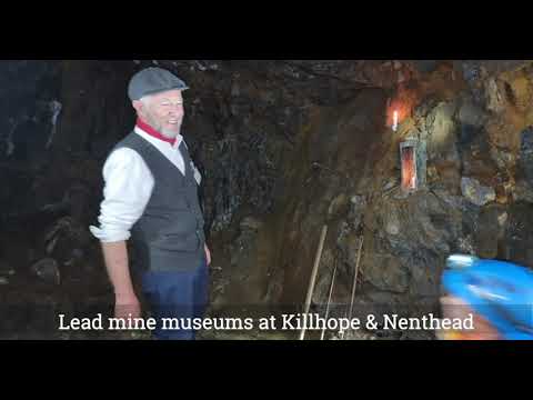
Coalcleugh is a hamlet in Northumberland, England. It is situated in the Pennines between Penrith and Hexham. In the past it was well known as a lead mining...

Throssel Hole Buddhist Abbey

Throssel Hole Buddhist Abbey is a Buddhist monastery and retreat centre located in Northumberland, in northern England. The monastic order is equally for...

Old Moss Lead Vein

Old Moss Lead Vein, also known as Killhope Head, is a Site of Special Scientific Interest in the Wear Valley district of County Durham, England. It consists...

Killhope Cross

Killhope Cross (elevation 627 m; 2,057 ft) is a mountain pass in the English Pennines. The pass divides Weardale to the east and Cumbria to the west. The...

Allenheads

Allenheads is a former mining village in the Pennines to the north of Weardale in Northumberland, England. Lead extraction was the settlement's industry...

Killhope

Killhope is a small settlement at the very highest end of Weardale in the civil parish of Stanhope, in County Durham, England. Killhope Pass, the road...

Related Videos

Carrshield Camping Barn - A few activities, part 1

Just what is there in the North Pennines? This video will hopefully give you some ideas of what you could be doing when you ...

July 2021 selection of photographs

A selection of photographs taken whilst walking around the moors and valleys of the North Pennines from the village of Carrshield ...

Nearby Amenities

Located within 500m of 54.817514,-2.2898986
Blackway Head
Ele: 571
Place: locality
Lat/Long: 54.8196695/-2.291174
The data included in this document is from www.openstreetmap.org. The data is made available under ODbL.

Have you been to Blackway Head?

Leave your review of Blackway Head below (or comments, questions and feedback).