Black Hill

Hill, Mountain in Northumberland

England

Black Hill

Dryburn Moor Looking NNE from just south of Dryburn Bridge on the Allendale to Carrshield road across <a href="https://www.geograph.org.uk/photo/413043">NY7952 : Dry Burn Cleugh</a> towards Middle Edge. The top of <a href="https://www.geograph.org.uk/photo/2158383">NY8053 : The southern Allendale lead smelting flue chimney</a> can be seen on the horizon (far right, above a patch of lighter coloured ground).
Dryburn Moor Credit: Mike Quinn

Black Hill is a prominent hill located in Northumberland, England. It is part of the Pennines, a range of hills and mountains that stretch across Northern England. With an elevation of 582 meters (1,909 feet), Black Hill is one of the highest points in Northumberland.

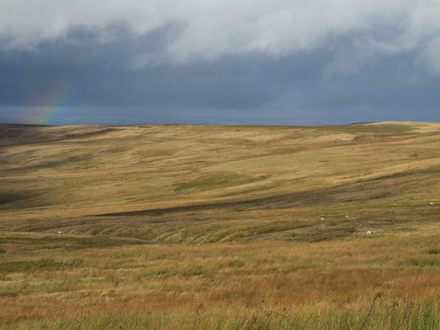
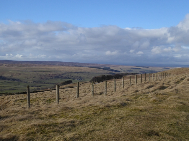
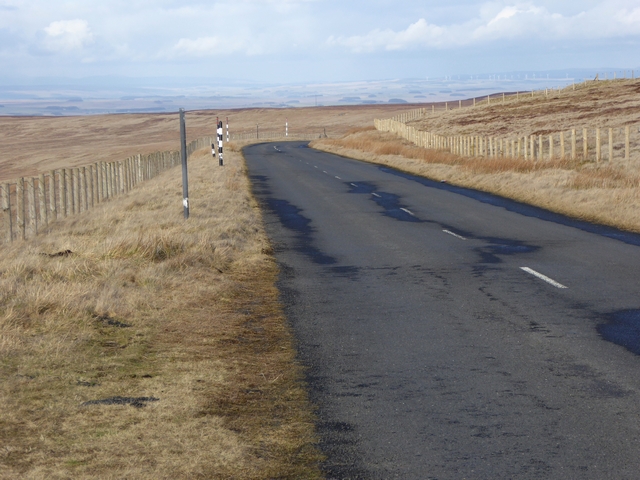
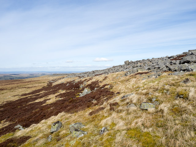
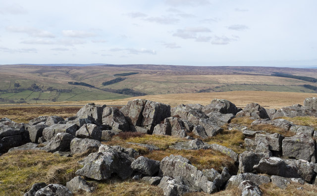
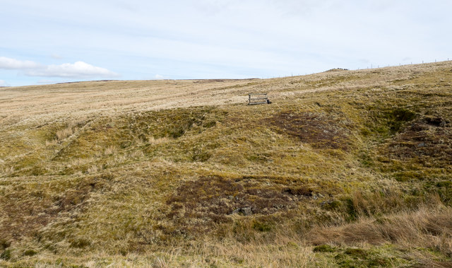
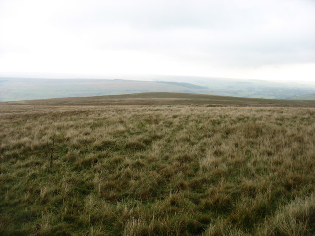
The hill is situated within the North Pennines Area of Outstanding Natural Beauty, offering breathtaking views of the surrounding countryside. Its distinctive dark color, which gives it its name, is due to the presence of peat on its slopes.

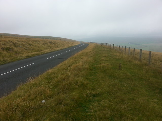
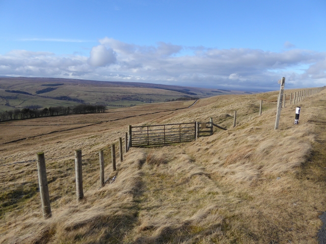
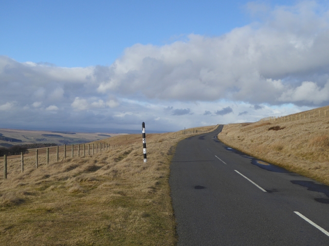
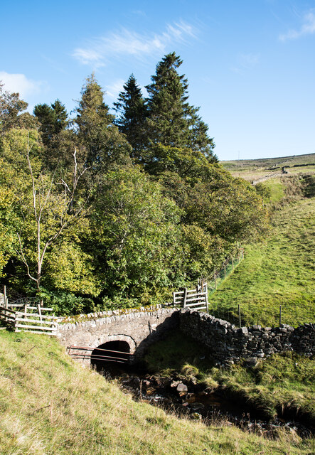
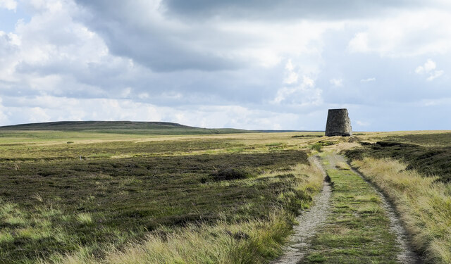
Black Hill is a popular destination for outdoor enthusiasts, hikers, and nature lovers. Several walking trails and footpaths traverse the hill, providing opportunities to explore its diverse landscapes. The summit offers panoramic vistas of the surrounding moorland, valleys, and distant hills, making it a favorite spot for photographers.

The hill is home to a variety of flora and fauna, including heather, bilberry bushes, and mosses. Birdwatchers can spot species such as curlews, lapwings, and golden plovers that inhabit the moorland. Additionally, the hill is known for its archaeological sites, including prehistoric cairns and burial mounds, adding to its historical significance.

Visitors to Black Hill can enjoy the tranquility and peacefulness of the area, immersing themselves in the beauty of the Northumberland landscape. The hill offers a chance to escape the hustle and bustle of everyday life and connect with nature, making it a must-visit destination for those seeking outdoor adventures and natural wonders.

If you have any feedback on the listing, please let us know in the comments section below.
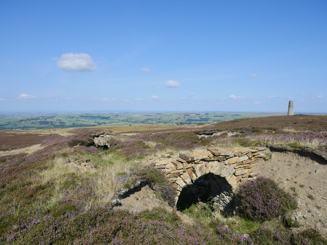
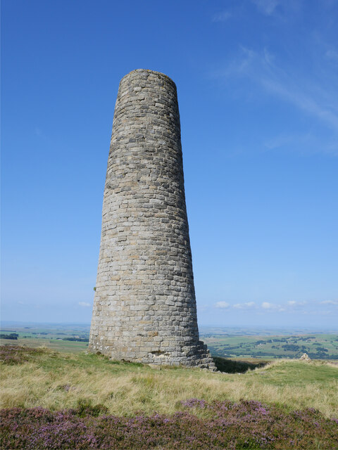
Black Hill Images

Images are sourced within 2km of 54.863368/-2.2990457 or Grid Reference NY8052. Thanks to Geograph Open Source API. All images are credited.

Dryburn Moor Looking NNE from just south of Dryburn Bridge on the Allendale to Carrshield road across <a href="https://www.geograph.org.uk/photo/413043">NY7952 : Dry Burn Cleugh</a> towards Middle Edge. The top of <a href="https://www.geograph.org.uk/photo/2158383">NY8053 : The southern Allendale lead smelting flue chimney</a> can be seen on the horizon (far right, above a patch of lighter coloured ground).
Dryburn Moor
Looking NNE from just south of Dryburn Bridge on the Allendale to Carrshield road across NY7952 : Dry Burn Cleugh towards Middle Edge. The top of NY8053 : The southern Allendale lead smelting flue chimney can be seen on the horizon (far right, above a patch of lighter coloured ground).
Descending Acton Moor
Path to Taylorburn On the hillside above West Allendale. Compare with the snowy scene at <a href="https://www.geograph.org.uk/photo/1705418">NY7950 : Path to Taylorburn</a>.
Path to Taylorburn
On the hillside above West Allendale. Compare with the snowy scene at NY7950 : Path to Taylorburn.
Moorland road to Allendale This moorland road linking the upper end of West Allendale with Allendale Town rises to almost 500 metres above sea level.
Moorland road to Allendale
This moorland road linking the upper end of West Allendale with Allendale Town rises to almost 500 metres above sea level.
Fence line above West Allendale
Gate and fence above West Allendale
Moorland road to Allendale This moorland road linking Carrshield and Allendale Town rises to almost 500 metres above sea level.
Moorland road to Allendale
This moorland road linking Carrshield and Allendale Town rises to almost 500 metres above sea level.
Greenleycleugh Crags Greenleycleugh Crags is a long, low band of rock on the flank of Brownley Hill overlooking West Allendale. The rock is broken into blocks with little in the way of any continuous rock face.
Greenleycleugh Crags
Greenleycleugh Crags is a long, low band of rock on the flank of Brownley Hill overlooking West Allendale. The rock is broken into blocks with little in the way of any continuous rock face.
Rocks of Greenleycleugh Crags Greenleycleugh Crags is a long, low band of rock on the flank of Brownley Hill overlooking West Allendale which is the valley beyond the blocks. The distant ground is Whitfield Moor.
Rocks of Greenleycleugh Crags
Greenleycleugh Crags is a long, low band of rock on the flank of Brownley Hill overlooking West Allendale which is the valley beyond the blocks. The distant ground is Whitfield Moor.
Moorland across Dryburn Cleugh Dryburn Cleugh is the groove immediately in the foreground of the image; Dryburn Moor lies beyond. The fencing to the right of the image centre surrounds an open shaft in the hill slope which angles down into the ground. In such a location, West Allendale in the North Pennines, it's tempting to think that there's a metal mining connection but the photographer is more inclined towards it being a naturally developed cavity.
Moorland across Dryburn Cleugh
Dryburn Cleugh is the groove immediately in the foreground of the image; Dryburn Moor lies beyond. The fencing to the right of the image centre surrounds an open shaft in the hill slope which angles down into the ground. In such a location, West Allendale in the North Pennines, it's tempting to think that there's a metal mining connection but the photographer is more inclined towards it being a naturally developed cavity.
On Dryburn Moor
On Dryburn Moor
Footbridge across Dry Burn Dry Burn runs in a steep-sided valley feeding into the River West Allen. The bridge is a footbridge  with a surprisingly narrow footway - surely no more than 50 cm. between the stones of the low parapets; it's now on the route of a walk known as Isaac's Tea Trail. (The burn was by no means dry, on the day the image was recorded.)
Footbridge across Dry Burn
Dry Burn runs in a steep-sided valley feeding into the River West Allen. The bridge is a footbridge with a surprisingly narrow footway - surely no more than 50 cm. between the stones of the low parapets; it's now on the route of a walk known as Isaac's Tea Trail. (The burn was by no means dry, on the day the image was recorded.)
Lane heading east-south-east on east side of West Allendale The lane is a byway and is on the eastern slope of West Allendale. It's a curious route: being a byway it's usable by all public means including vehicles, even powered ones, and yet it goes nowhere. It ends at a moorland gate where, in the image there's a clump of trees. Beyond that gate there's no public right of way although it is access land. There's not even a continuing, traceable route of any sort on the ground!
The small spot at the right side of the image just against the sky isn't a blemish - it's a hang glider.
Lane heading east-south-east on east side of West Allendale
The lane is a byway and is on the eastern slope of West Allendale. It's a curious route: being a byway it's usable by all public means including vehicles, even powered ones, and yet it goes nowhere. It ends at a moorland gate where, in the image there's a clump of trees. Beyond that gate there's no public right of way although it is access land. There's not even a continuing, traceable route of any sort on the ground! The small spot at the right side of the image just against the sky isn't a blemish - it's a hang glider.
Mossy domes and rushes on Dryburn Moor A view to the north over the moorland of Dryburn Moor with West Allendale beyond. OS maps show prominently, at the 1:50 000 scale and less so at 1:25 000, a track connecting the public road at Dryburn Bridge with the lane of a byway to the west. The image was recorded during an attempt to follow that route, but there's very little trace of it on the ground.
Mossy domes and rushes on Dryburn Moor
A view to the north over the moorland of Dryburn Moor with West Allendale beyond. OS maps show prominently, at the 1:50 000 scale and less so at 1:25 000, a track connecting the public road at Dryburn Bridge with the lane of a byway to the west. The image was recorded during an attempt to follow that route, but there's very little trace of it on the ground.
Carriers' Way passing smelt mill chimney The road follows the route of the Carriers' Way, an ancient transport route that in the past played a part in the transport of lead ore and other goods. The chimney is the southern one of two on moorland above the valleys, West and East Allendale.
Acton Moor / Black Hill is the higher ground in the distance.
Carriers' Way passing smelt mill chimney
The road follows the route of the Carriers' Way, an ancient transport route that in the past played a part in the transport of lead ore and other goods. The chimney is the southern one of two on moorland above the valleys, West and East Allendale. Acton Moor / Black Hill is the higher ground in the distance.
Allen Smelt Mill flue remains One of two lead smelt mill flues crossing moorland from Allendale, this one dating from 1835-37.  The flue is some two-and-a-half miles in length.  Despite being ruinous in sections, the incredible work of the stonemasons can still be appreciated.

This photograph was taken during the Coronavirus (COVID-19) pandemic of 2020/21.
Allen Smelt Mill flue remains
One of two lead smelt mill flues crossing moorland from Allendale, this one dating from 1835-37. The flue is some two-and-a-half miles in length. Despite being ruinous in sections, the incredible work of the stonemasons can still be appreciated. This photograph was taken during the Coronavirus (COVID-19) pandemic of 2020/21.
Allen Smelt Mill flue and chimney remains One of two lead smelt mill flues crossing moorland from Allendale, this one dating from 1835-37. The flue is some two-and-a-half miles in length. Despite being ruinous in sections, the incredible work of the stonemasons can still be appreciated.  The chimney in the background, the earlier of two on the moor, was built in 1840.  This chimney served an extension to an earlier flue, completed over the previous two years.

This photograph was taken during the Coronavirus (COVID-19) pandemic of 2020/21.
Allen Smelt Mill flue and chimney remains
One of two lead smelt mill flues crossing moorland from Allendale, this one dating from 1835-37. The flue is some two-and-a-half miles in length. Despite being ruinous in sections, the incredible work of the stonemasons can still be appreciated. The chimney in the background, the earlier of two on the moor, was built in 1840. This chimney served an extension to an earlier flue, completed over the previous two years. This photograph was taken during the Coronavirus (COVID-19) pandemic of 2020/21.
Chimney and cairn on the moor The 1840 Allen Smelt Mill flue chimney and a much smaller construction, a small cairn, to the right.  The seat just out of shot to the right provides a superb view across the area as far as the Tyneside conurbation. 

This photograph was taken during the Coronavirus (COVID-19) pandemic of 2020/21.
Chimney and cairn on the moor
The 1840 Allen Smelt Mill flue chimney and a much smaller construction, a small cairn, to the right. The seat just out of shot to the right provides a superb view across the area as far as the Tyneside conurbation. This photograph was taken during the Coronavirus (COVID-19) pandemic of 2020/21.
Show me another place!

Black Hill is located at Grid Ref: NY8052 (Lat: 54.863368, Lng: -2.2990457)

Unitary Authority: Northumberland

Police Authority: Northumbria

What 3 Words

///rocket.clashing.shadowing. Near Alston, Cumbria

Nearby Locations

Black Hill Acton Moor

Related Wikis

Throssel Hole Buddhist Abbey

Throssel Hole Buddhist Abbey is a Buddhist monastery and retreat centre located in Northumberland, in northern England. The monastic order is equally for...

Acton, Northumberland

Acton is a small hamlet in Northumberland, north-east England, about 3 miles (5 km) south of Allendale Town. Acton is usually Anglo-Saxon Old English...

Ninebanks

Ninebanks is a small village in south west Northumberland, England in the North Pennines Area of Outstanding Natural Beauty 8 miles (13 km) north-east...

Ouston, Ninebanks

Ouston is a small settlement in south west Northumberland, England in the North Pennines Area of Outstanding Natural Beauty 8 miles (13 km) north-east...

Nearby Amenities

Located within 500m of 54.863368,-2.2990457
Black Hill
Place: locality
Lat/Long: 54.8611773/-2.3047492
The data included in this document is from www.openstreetmap.org. The data is made available under ODbL.

Have you been to Black Hill?

Leave your review of Black Hill below (or comments, questions and feedback).