Hunters Hill

Hill, Mountain in Yorkshire Craven

England

Hunters Hill

Farmland view near Wigglesworth A mid-June view looking towards Teenley Hill from Church Lane. The foreground of this shot lies inside the square.
Farmland view near Wigglesworth Credit: Mary and Angus Hogg

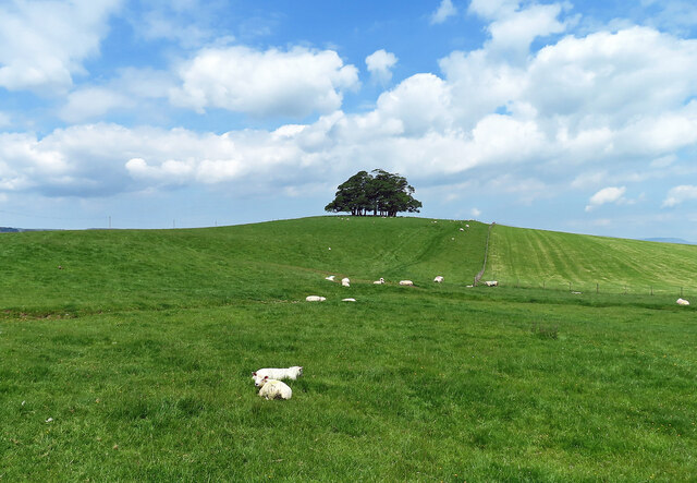
Hunters Hill is a prominent hill located in Yorkshire, England. Standing at an elevation of approximately 340 meters (1,115 feet), it is considered one of the notable peaks in the region. Situated in the picturesque Yorkshire Dales National Park, Hunters Hill offers breathtaking views of the surrounding countryside and is a popular destination for nature enthusiasts and hikers.

The hill is characterized by its gentle slopes, covered in lush green grass and scattered with vibrant wildflowers during the warmer months. Its distinct shape and prominent position make it easily recognizable from afar. At the summit of Hunters Hill, visitors can enjoy panoramic vistas of the rolling hills, meandering rivers, and quaint villages that make up the Yorkshire landscape.

The area surrounding Hunters Hill is rich in biodiversity, with a variety of plant and animal species calling it home. It is not uncommon to spot grazing sheep and deer as one explores the hillside. Additionally, the hill is also home to several species of birds, including peregrine falcons and kestrels, making it a haven for birdwatchers.

Hunters Hill attracts visitors throughout the year, with its beauty changing with each season. In the spring, the hillside is adorned with colorful blooms, while the autumn brings a stunning display of golden foliage. Winter coats the hilltop in a serene blanket of snow, creating a tranquil and ethereal atmosphere.

Overall, Hunters Hill offers a serene escape from the hustle and bustle of everyday life, providing visitors with an opportunity to immerse themselves in the natural beauty and tranquility of Yorkshire's countryside.

If you have any feedback on the listing, please let us know in the comments section below.
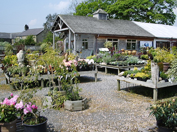
Hunters Hill Images

Images are sourced within 2km of 53.993166/-2.2933651 or Grid Reference SD8055. Thanks to Geograph Open Source API. All images are credited.

Farmland view near Wigglesworth A mid-June view looking towards Teenley Hill from Church Lane. The foreground of this shot lies inside the square.
Farmland view near Wigglesworth
A mid-June view looking towards Teenley Hill from Church Lane. The foreground of this shot lies inside the square.
Approaching Wigglesworth The cyclist is entering Wigglesworth on Church Lane.
Approaching Wigglesworth
The cyclist is entering Wigglesworth on Church Lane.
Happy and glorious Wigglesworth celebrated the Platinum Jubilee by erecting a stylish village sign.
Happy and glorious
Wigglesworth celebrated the Platinum Jubilee by erecting a stylish village sign.
Plough Inn, Wigglesworth An attractive village hostelry in Ribblesdale.
Plough Inn, Wigglesworth
An attractive village hostelry in Ribblesdale.
North Hill Plantation North Hill Plantation lies on the left-hand side of the road with Hole House Plantation on the right.
North Hill Plantation
North Hill Plantation lies on the left-hand side of the road with Hole House Plantation on the right.
Ribblesdale farmland view This ground lies on the north side of Wigglesworth village.
Ribblesdale farmland view
This ground lies on the north side of Wigglesworth village.
Stocks in the Plough Hotel Car Park at Wigglesworth A set of stocks located on the car park at the Plough Hotel in Wigglesworth. A sign by the stocks in Oldham, Hampshire, England has the follwowing text displayed  "In the year 1376 The Commons ordered that stocks be set up in every town and village "to encourage virtue and discourage evil doers."
Stocks in the Plough Hotel Car Park at Wigglesworth
A set of stocks located on the car park at the Plough Hotel in Wigglesworth. A sign by the stocks in Oldham, Hampshire, England has the follwowing text displayed "In the year 1376 The Commons ordered that stocks be set up in every town and village "to encourage virtue and discourage evil doers."
Who'd a thowt it Whoever thought of it, that way named it, that way
Who'd a thowt it
Whoever thought of it, that way named it, that way
Mere Syke Farm Under the reorganized counties of 1974 this house is the last one in Lancashire, being that I was standing in North Yorkshire when I took the photo
Mere Syke Farm
Under the reorganized counties of 1974 this house is the last one in Lancashire, being that I was standing in North Yorkshire when I took the photo
Fields below Rough Hill This is taken from the track that leads up to Moss Laithe Farm
Fields below Rough Hill
This is taken from the track that leads up to Moss Laithe Farm
Track to Moss Laithe Farm
Garden Makers Plant Centre At Coars Farm Just over the border in Lancashire, near to Wigglesworth. A nursery that grows most of its own plants.
Garden Makers Plant Centre
At Coars Farm Just over the border in Lancashire, near to Wigglesworth. A nursery that grows most of its own plants.
Cattle on Town Moor Local residents in fields between Tosside and Wigglesworth.
Cattle on Town Moor
Local residents in fields between Tosside and Wigglesworth.
Gardenmakers, Coar's Farm, Wigglesworth <span class="nowrap"><a title="http://www.gardenmakers.co.uk/" rel="nofollow ugc noopener" href="http://www.gardenmakers.co.uk/">Link</a><img style="margin-left:2px;" alt="External link" title="External link - shift click to open in new window" src="https://s1.geograph.org.uk/img/external.png" width="10" height="10"/></span>
Gardenmakers, Coar's Farm, Wigglesworth
The Plough at Wigglesworth
The Plough, Wigglesworth A large pub in a tiny hamlet
The Plough, Wigglesworth
A large pub in a tiny hamlet
Hayfield at Wigglesworth The hay is cut and drying in the sun before baling can begin.
Hayfield at Wigglesworth
The hay is cut and drying in the sun before baling can begin.
Entering Wigglesworth
Show me another place!

Hunters Hill is located at Grid Ref: SD8055 (Lat: 53.993166, Lng: -2.2933651)

Division: West Riding

Administrative County: North Yorkshire

District: Craven

Police Authority: North Yorkshire

What 3 Words

///campsites.skylights.activity. Near Hellifield, North Yorkshire

Nearby Locations

Hunters Hill

Related Wikis

Wigglesworth

Wigglesworth is a village and civil parish in the Craven district of North Yorkshire, England. The population of the civil parish taken at the 2011 Census...

Manor House, Gisburn Forest

Manor House is an historic building in Gisburn Forest, Lancashire, England. It was built in the early 18th century, but contains a section that is believed...

Long Preston railway station

Long Preston is a railway station on the Bentham Line, which runs between Leeds and Morecambe via Skipton. The station, situated 37+1⁄2 miles (60 km) north...

Halton West

Halton West is a village and civil parish in the Craven district of North Yorkshire, England. North Yorkshire County Council estimated the population in...

Related Videos

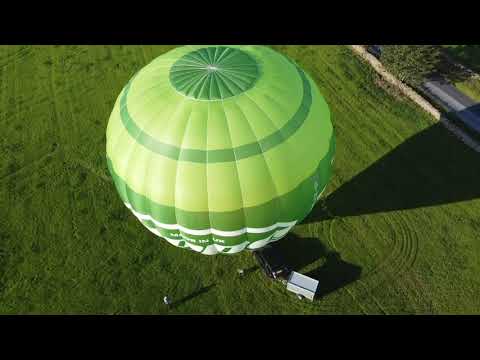
Early Morning take off with Airborne Adventures Ltd

A typical early morning take off from our launch site in Wigglesworth, near to Settle in the Yorkshire Dales. No couples getting ...

Nearby Amenities

Located within 500m of 53.993166,-2.2933651
Hunters Hill
Ele: 217
Is In Country Code: GB
Is In County: North Yorkshire
Is In Municipality: Craven
Man Made: survey_point
Natural: peak
Lat/Long: 53.9924877/-2.2939107
Man Made: tower
Source: bing
Lat/Long: 53.9920095/-2.2911699
Barrier: gate;stile
Lat/Long: 53.9917837/-2.2950663
Barrier: stile
Lat/Long: 53.9917107/-2.2941188
The data included in this document is from www.openstreetmap.org. The data is made available under ODbL.

Have you been to Hunters Hill?

Leave your review of Hunters Hill below (or comments, questions and feedback).