Keekham Beck Head

Hill, Mountain in Yorkshire

England

Keekham Beck Head

Old Boundary Marker on Mickle Fell Estate Boundary Marker southeast of Mickle Fell, 750 metres southeast of Hanging Seal. Inscribed 66. On the boundary of Stainmore parish, Westmorland, now Cumbria, and Lunedale parish, North Riding, now County Durham.

Milestone Society National ID: WE_CBDM066em
Old Boundary Marker on Mickle Fell Credit: Colin Smith

The requested URL returned error: 429 Too Many Requests

If you have any feedback on the listing, please let us know in the comments section below.

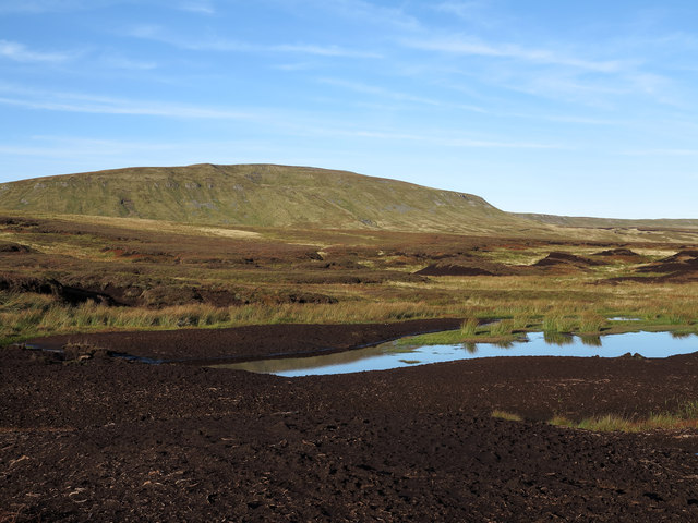
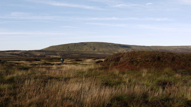
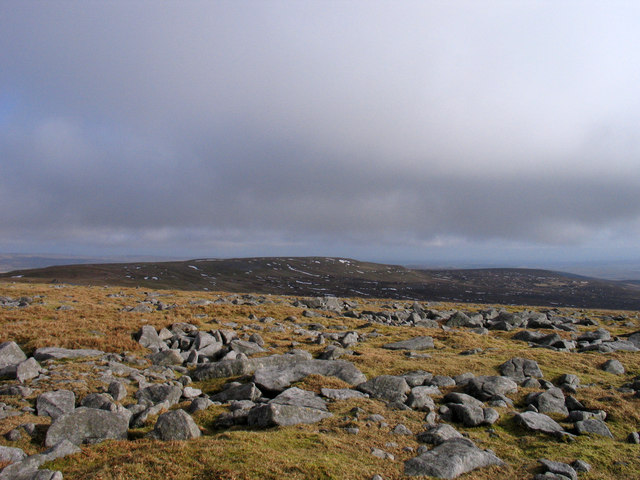
Keekham Beck Head Images

Images are sourced within 2km of 54.606861/-2.3035702 or Grid Reference NY8023. Thanks to Geograph Open Source API. All images are credited.

Old Boundary Marker on Mickle Fell Estate Boundary Marker southeast of Mickle Fell, 750 metres southeast of Hanging Seal. Inscribed 66. On the boundary of Stainmore parish, Westmorland, now Cumbria, and Lunedale parish, North Riding, now County Durham.

Milestone Society National ID: WE_CBDM066em
Old Boundary Marker on Mickle Fell
Estate Boundary Marker southeast of Mickle Fell, 750 metres southeast of Hanging Seal. Inscribed 66. On the boundary of Stainmore parish, Westmorland, now Cumbria, and Lunedale parish, North Riding, now County Durham. Milestone Society National ID: WE_CBDM066em
Old Boundary Marker on Mickle Fell Estate Boundary Marker southeast of Mickle Fell, fallen beside Force Beck 270 metres southeast of Hanging Seal. Inscribed 69. On the boundary of Stainmore parish, Westmorland, now Cumbria, and Lunedale parish, North Riding, now County Durham.

Milestone Society National ID: WE_CBDM069em
Old Boundary Marker on Mickle Fell
Estate Boundary Marker southeast of Mickle Fell, fallen beside Force Beck 270 metres southeast of Hanging Seal. Inscribed 69. On the boundary of Stainmore parish, Westmorland, now Cumbria, and Lunedale parish, North Riding, now County Durham. Milestone Society National ID: WE_CBDM069em
Old Boundary Marker on Mickle Fell Estate Boundary Marker on Mickle Fell 1820 metres north of Hanging Seal. Inscribed 86. Originally on the boundary of Appleby St Michael or Bongate parish and Warcop parish, Westmorland, and Lunedale parish, North Riding. Now Murton and Warcop parishes, Cumbria and Lunedale parish, County Durham.

Milestone Society National ID: WE_CBDM086em
Old Boundary Marker on Mickle Fell
Estate Boundary Marker on Mickle Fell 1820 metres north of Hanging Seal. Inscribed 86. Originally on the boundary of Appleby St Michael or Bongate parish and Warcop parish, Westmorland, and Lunedale parish, North Riding. Now Murton and Warcop parishes, Cumbria and Lunedale parish, County Durham. Milestone Society National ID: WE_CBDM086em
Old Boundary Marker north of Mickle Fell Estate Boundary Marker north of Mickle Fell and 2060 metres south of Maize Beck. Inscribed 88. Originally on the boundary of Appleby St Michael or Bongate parish, Westmorland, and Lunedale parish, North Riding. Now Murton parish, Cumbria and Lunedale parish, County Durham.

Milestone Society National ID: WE_CBDM088em
Old Boundary Marker north of Mickle Fell
Estate Boundary Marker north of Mickle Fell and 2060 metres south of Maize Beck. Inscribed 88. Originally on the boundary of Appleby St Michael or Bongate parish, Westmorland, and Lunedale parish, North Riding. Now Murton parish, Cumbria and Lunedale parish, County Durham. Milestone Society National ID: WE_CBDM088em
Rock outcrop on Mickle Fell Mickle Fell is a huge block of mountain surrounded by moorland some of which can be seen below and beyond the rocks. At the mountain's west end however there's some surprising steepness with small amounts of outcropping limestone.
Rock outcrop on Mickle Fell
Mickle Fell is a huge block of mountain surrounded by moorland some of which can be seen below and beyond the rocks. At the mountain's west end however there's some surprising steepness with small amounts of outcropping limestone.
Moorland north of White Sike Grassy moorland north of White Sike and south-west of Mickle Fell rises to scattered peat banks. This is certainly one of the most remote locations in England!
Moorland north of White Sike
Grassy moorland north of White Sike and south-west of Mickle Fell rises to scattered peat banks. This is certainly one of the most remote locations in England!
Bare peat and pool south-west of Mickle Fell This desolate and remote area lies to the north of Force Beck in the heart of the MOD's Warcop training area. Mickle Fell rises beyond the peat, pool and moorland.
Bare peat and pool south-west of Mickle Fell
This desolate and remote area lies to the north of Force Beck in the heart of the MOD's Warcop training area. Mickle Fell rises beyond the peat, pool and moorland.
Moorland near Scot Hill Scot Hill is a minor landscape feature to the east of Little Fell (Burton Fell). The view is towards Mickle Fell over moorland with peat bog and peat banks.
Moorland near Scot Hill
Scot Hill is a minor landscape feature to the east of Little Fell (Burton Fell). The view is towards Mickle Fell over moorland with peat bog and peat banks.
Rocks at summit area of Mickle Fell Mickle Fell is one of the most remote locations in England.
The view here is from beside its summit cairn, to the east, along the mountain's summit ridge and south face.
Rocks at summit area of Mickle Fell
Mickle Fell is one of the most remote locations in England. The view here is from beside its summit cairn, to the east, along the mountain's summit ridge and south face.
Ruin on summit ridge of Mickle Fell The ruin which must in its day have been a contender for the title of the most remote building in England stands on the summit ridge of Mickle Fell well to the east of the summit. The ridge can be seen extending well beyond the ruin.

Wainwright describes the ruin as the remains of a shooting box. In 'Westmorland Heritage' by A. Wainwright.
Ruin on summit ridge of Mickle Fell
The ruin which must in its day have been a contender for the title of the most remote building in England stands on the summit ridge of Mickle Fell well to the east of the summit. The ridge can be seen extending well beyond the ruin. Wainwright describes the ruin as the remains of a shooting box. In 'Westmorland Heritage' by A. Wainwright.
Fence line crossing Scot Sike Scot Sike is one of many tributaries to Connypot Beck that descend from the east side of Little Fell. Mickle Fell is the mountain at the right side of the image.
Fence line crossing Scot Sike
Scot Sike is one of many tributaries to Connypot Beck that descend from the east side of Little Fell. Mickle Fell is the mountain at the right side of the image.
Force Beck Force Beck is one of many tributary streams of Connypot Beck. The location is the moorland to the south of Mickle Fell which is the distant mountain.
The brown stone to the bottom left of the image is numbered 69 and is one of a series of many such stones which marked the old county boundary between Cumberland and Yorkshire - now Cumbria and County Durham. Most of these stones are still in place though some are missing - it's suspected that some have simply sunk into the peat bogs which are so common - the brown colouration of No. 69 could well be due a lengthy immersion in peat. That it now lies in the stream bed of Force Beck would be due to the erosion of peat by the stream liberating it.
Force Beck
Force Beck is one of many tributary streams of Connypot Beck. The location is the moorland to the south of Mickle Fell which is the distant mountain. The brown stone to the bottom left of the image is numbered 69 and is one of a series of many such stones which marked the old county boundary between Cumberland and Yorkshire - now Cumbria and County Durham. Most of these stones are still in place though some are missing - it's suspected that some have simply sunk into the peat bogs which are so common - the brown colouration of No. 69 could well be due a lengthy immersion in peat. That it now lies in the stream bed of Force Beck would be due to the erosion of peat by the stream liberating it.
Slope rising to Mickle Fell Grassy moorland rises towards the west end of Mickle Fell along the line of the County Durham/Cumbria boundary. The boundary is marked not just by the post and wire fence but by a remarkable series of boundary stones, number 80 being seen here.
Slope rising to Mickle Fell
Grassy moorland rises towards the west end of Mickle Fell along the line of the County Durham/Cumbria boundary. The boundary is marked not just by the post and wire fence but by a remarkable series of boundary stones, number 80 being seen here.
Mickle Fell Ancient Cairn Parked at Hilton on non firing day, walking into strong East wind, mainly cloudy,then back over Little Fell.  Durham (1974) administrative county top, Yorkshire, North Riding historic county top and Durham current county/UA top.
Highest point is 25m NE of cairn.
Name: Mickle Fell
Hill number: 2711
Height: 790m / 2592ft
Area: 35A: The Northern Pennines
Class: Ma,Hew,N,CoH, CoU,CoA
Grid ref: NY 80606 24548
Summit feature: no feature, grass
Drop: 212m
Col: 578m  NY749267
Mickle Fell Ancient Cairn
Parked at Hilton on non firing day, walking into strong East wind, mainly cloudy,then back over Little Fell. Durham (1974) administrative county top, Yorkshire, North Riding historic county top and Durham current county/UA top. Highest point is 25m NE of cairn. Name: Mickle Fell Hill number: 2711 Height: 790m / 2592ft Area: 35A: The Northern Pennines Class: Ma,Hew,N,CoH, CoU,CoA Grid ref: NY 80606 24548 Summit feature: no feature, grass Drop: 212m Col: 578m NY749267
Peat banks on north side of Mickle Fell Gentle grassy slopes with scattered peat banks below the Mickle Fell summit ridge.
Peat banks on north side of Mickle Fell
Gentle grassy slopes with scattered peat banks below the Mickle Fell summit ridge.
Mickle Fell Highest hill in Yorkshire, seen across the easy boglands separating it from Little Fell. An awkward hill, it's not actually shot up itself, but forms the overspill safety area for Warcop Ranges, and as a result spends a lot of time hiding behind a red flag. On this day there was no firing, and there was quite a bit of traffic on the hill.
Mickle Fell
Highest hill in Yorkshire, seen across the easy boglands separating it from Little Fell. An awkward hill, it's not actually shot up itself, but forms the overspill safety area for Warcop Ranges, and as a result spends a lot of time hiding behind a red flag. On this day there was no firing, and there was quite a bit of traffic on the hill.
Mickle Fell The upper block of Mickle Fell's west end is in this square. That is dry grassland. Here, and the rest of the square is peat bog, although easy to cross.
Mickle Fell
The upper block of Mickle Fell's west end is in this square. That is dry grassland. Here, and the rest of the square is peat bog, although easy to cross.
Boundary fence on Mickle Fell Meldon Hill in the distance
Boundary fence on Mickle Fell
Meldon Hill in the distance
Show me another place!

Keekham Beck Head is located at Grid Ref: NY8023 (Lat: 54.606861, Lng: -2.3035702)

Division: North Riding

Unitary Authority: County Durham

Police Authority: Durham

What 3 Words

///starter.purse.energetic. Near Holwick, Co. Durham

Nearby Locations

Keekham Beck Head

Related Wikis

Mickle Fell

Mickle Fell is a mountain in the Pennines, the range of hills and moors running down the middle of Northern England. It has a maximum elevation of 788...

Moor House-Upper Teesdale

Moor House-Upper Teesdale National Nature Reserve covers 7,400 ha of the Pennine moors in the north of England. It straddles Cumbria and County Durham...

Close House Mine

Close House Mine is a Site of Special Scientific Interest in the Teesdale district of west County Durham, England. It is a working opencast mine located...

Appleby Fells

Appleby Fells is a Site of Special Scientific Interest in the Eden district of Cumbria, England, near Appleby-in-Westmorland. The area is approximately...

Nearby Amenities

Located within 500m of 54.606861,-2.3035702
King's Pot Fold
Place: locality
Lat/Long: 54.6097374/-2.3094765
The data included in this document is from www.openstreetmap.org. The data is made available under ODbL.

Have you been to Keekham Beck Head?

Leave your review of Keekham Beck Head below (or comments, questions and feedback).