Braemoor Knowe
Hill, Mountain in Roxburghshire
Scotland
Braemoor Knowe

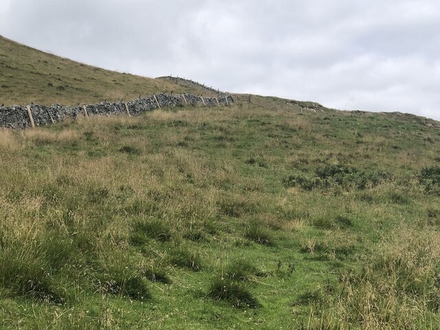
Braemoor Knowe is a prominent hill located in Roxburghshire, a historic county situated in the Scottish Borders region of Scotland. Standing at an elevation of approximately 440 meters (1,444 feet), it is classified as a hill rather than a mountain.
The hill is characterized by its distinct conical shape, making it a noticeable landmark in the surrounding landscape. It is covered with heather and grass, providing a vivid green hue during the warmer months and transforming into a beautiful golden tone in autumn. The slopes of Braemoor Knowe are gentle, making it relatively easy to climb for outdoor enthusiasts and hikers.
Located to the southeast of Jedburgh, Braemoor Knowe offers stunning panoramic views of the surrounding countryside. On a clear day, one can see the rolling hills and valleys of Roxburghshire, with the Cheviot Hills and Border Forest Park visible in the distance. The hill is also home to a diverse range of flora and fauna, including red grouse, rabbits, and various species of wildflowers.
Braemoor Knowe is a popular destination for nature lovers and outdoor enthusiasts seeking a peaceful and scenic location to explore. Its accessibility, combined with its natural beauty and breathtaking views, make it an ideal spot for hiking, picnicking, or simply enjoying the tranquility of the Scottish countryside.
If you have any feedback on the listing, please let us know in the comments section below.
Braemoor Knowe Images
Images are sourced within 2km of 55.482744/-2.332979 or Grid Reference NT7921. Thanks to Geograph Open Source API. All images are credited.


Braemoor Knowe is located at Grid Ref: NT7921 (Lat: 55.482744, Lng: -2.332979)
Unitary Authority: The Scottish Borders
Police Authority: The Lothians and Scottish Borders
What 3 Words
///oxidation.thatched.dispenser. Near Maxwellheugh, Scottish Borders
Nearby Locations
Related Wikis

Hownam
Hownam or Hounam is a small village and parish situated 8 miles east of Jedburgh in the Scottish Borders area of Scotland, near the Anglo-Scottish border...

Mowhaugh
Mowhaugh is a hamlet and farm steading near the Calroust Burn and the Bowmont Water, near Morebattle, in the Scottish Borders area of Scotland, and in...

Morebattle
Morebattle is a village in the Scottish Borders area of Scotland, on the B6401, seven miles south of Kelso, Scottish Borders, beside the Kale Water, a...
Linton, Scottish Borders
Linton is a small village in the Scottish Borders area of Scotland. It is situated a mile north of the village of Morebattle. == History == People have...

Cessford Castle
Cessford Castle is a large ruined mid-15th century L-plan castle near the village of Cessford, midway Jedburgh and Kelso, in the historic county of Roxburghshire...

Cessford, Scottish Borders
Cessford is a hamlet and former barony about a mile south of the B6401 road, in the Scottish Borders area of Scotland. The placename is from Gaelic 'ceis...

Cessford Burn
Cessford Burn is a small stream which eventually runs to meet the Kale Water and then joins the River Teviot, finally entering the River Tweed at Kelso...

Town Yetholm
Town Yetholm ('town yet-ham') is a small village in the Scottish Borders in the valley of the Bowmont Water opposite Kirk Yetholm. The town colours are...
Nearby Amenities
Located within 500m of 55.482744,-2.332979Have you been to Braemoor Knowe?
Leave your review of Braemoor Knowe below (or comments, questions and feedback).