Park Hill

Hill, Mountain in Westmorland Eden

England

Park Hill

Little Longrigg Scar
Little Longrigg Scar Credit: David Brown

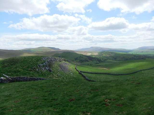
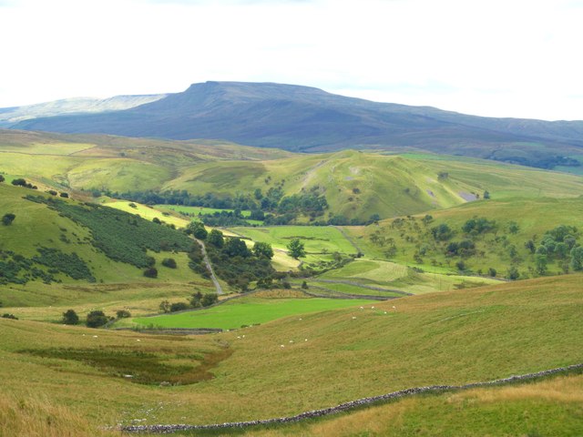
Park Hill is a picturesque hill located in the district of Westmorland, England. Situated in the southern part of the Lake District National Park, it offers breathtaking views of the surrounding countryside and is a popular destination for nature enthusiasts and hikers.

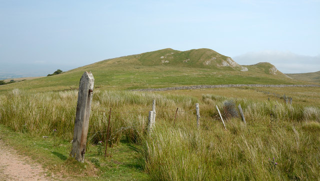
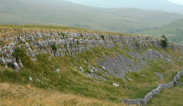
With an elevation of approximately 400 meters (1,300 feet), Park Hill stands tall and commands panoramic vistas of the beautiful Lake District landscape. The hill is characterized by its gentle slopes, lush green meadows, and scattered rocky outcrops, which add to its charm and natural beauty.

The area surrounding Park Hill is teeming with diverse flora and fauna, making it an ideal spot for wildlife spotting. Visitors may catch glimpses of native species such as red deer, foxes, and various bird species including buzzards and peregrine falcons.

There are several well-marked trails and footpaths that crisscross Park Hill, offering visitors the opportunity to explore its scenic beauty on foot. The hill is also a popular destination for paragliding and hang gliding enthusiasts, who take advantage of the favorable wind conditions and breathtaking views.

At the foot of Park Hill, there are quaint villages and small towns that provide amenities such as accommodation, eateries, and shops, catering to the needs of visitors. Additionally, the nearby Lake District National Park offers a wide range of recreational activities, including boating, fishing, and camping.

In conclusion, Park Hill in Westmorland is a must-visit destination for nature lovers and adventurers. Its stunning vistas, abundant wildlife, and accessible trails make it an ideal location for those seeking an immersive experience in the beauty of the Lake District.

If you have any feedback on the listing, please let us know in the comments section below.

Park Hill Images

Images are sourced within 2km of 54.466757/-2.3303795 or Grid Reference NY7807. Thanks to Geograph Open Source API. All images are credited.
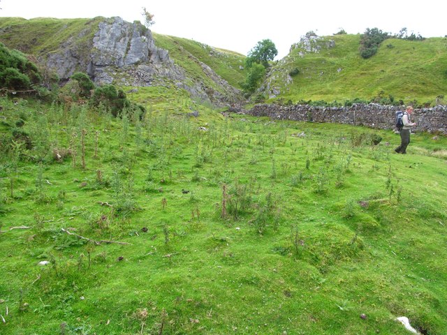
Little Longrigg Scar
Limestone edge on Birkett Hill
Birkett Hill Birkett Hill as seen from the farm/estate road that is also the route of the Coast to Coast Walk.
Birkett Hill
Birkett Hill as seen from the farm/estate road that is also the route of the Coast to Coast Walk.
Road on Hartley Fell This estate and/or farm road climbs from the village of Hartley, close to Kirkby Stephen, towards Nine Standards Rigg; it also acts as the route for the Coast to Coast Walk.
Road on Hartley Fell
This estate and/or farm road climbs from the village of Hartley, close to Kirkby Stephen, towards Nine Standards Rigg; it also acts as the route for the Coast to Coast Walk.
Little Longrigg Scar Little Longrigg Scar is an outcropping band of limestone; it's west-facing and about 3 km from Kirkby Stephen.
Little Longrigg Scar
Little Longrigg Scar is an outcropping band of limestone; it's west-facing and about 3 km from Kirkby Stephen.
Track to Hartley Fell The public bridleway passes through a bog. This is part of Wainwright's Coast to Coast route.
In the background is the north-eastern Birkett Hill (405m - slightly higher than the other).
Track to Hartley Fell
The public bridleway passes through a bog. This is part of Wainwright's Coast to Coast route. In the background is the north-eastern Birkett Hill (405m - slightly higher than the other).
Track to Hartley Fell This public bridleway is part of Wainwright's Coast to Coast route.
In the background is the south-western Birkett Hill (383m - slightly lower than the other).
Track to Hartley Fell
This public bridleway is part of Wainwright's Coast to Coast route. In the background is the south-western Birkett Hill (383m - slightly lower than the other).
Long Rigg An interesting carboniferous limestone feature forming a steep scarp and scar overlooking Hartley and Kirkby Stephen. The view here is northwards along the rigg towards the upper Eden valley and the northern Pennines.
Long Rigg
An interesting carboniferous limestone feature forming a steep scarp and scar overlooking Hartley and Kirkby Stephen. The view here is northwards along the rigg towards the upper Eden valley and the northern Pennines.
The view west from Long Rigg Looking west from the highest point on Long Rigg towards Kirkby Stephen and the distant High Street range in the Lake District.
The view west from Long Rigg
Looking west from the highest point on Long Rigg towards Kirkby Stephen and the distant High Street range in the Lake District.
The view SSW from Long Rigg The view from the highest point of Long Rigg, looking SSW towards Wild Boar Fell.
The view SSW from Long Rigg
The view from the highest point of Long Rigg, looking SSW towards Wild Boar Fell.
Little Longrigg Scar Exposed limestone on this steep edge overlooking Hartley. The view is towards the distant bulk of Wild Boar Fell.
Little Longrigg Scar
Exposed limestone on this steep edge overlooking Hartley. The view is towards the distant bulk of Wild Boar Fell.
Little Longrigg Scar Looking north towards the high point of 413m on Long Rigg. Northern Pennines in the distance.
Little Longrigg Scar
Looking north towards the high point of 413m on Long Rigg. Northern Pennines in the distance.
Traces of old industry at Little Longrigg The eye is drawn to the middle distance where there is evidence of some workings on the slopes of Birkett Hill. In the foreground is the crescent shaped outline of an old turf and stone dam, almost certainly used in the 18thC for the purpose of hushing on nearby slopes in the search for galena [lead ore].
Traces of old industry at Little Longrigg
The eye is drawn to the middle distance where there is evidence of some workings on the slopes of Birkett Hill. In the foreground is the crescent shaped outline of an old turf and stone dam, almost certainly used in the 18thC for the purpose of hushing on nearby slopes in the search for galena [lead ore].
Site of Hartley smelt mill This was once the site of a lead smelting mill, although evidence is now hard to find. Records show a single hearth mill here between 1714 & 1777, after which it may have fallen into disuse. Apart from a small area of flattened ground and a few protruding stones, there is little to see, although some of the stones in the wall to the right are dressed and others show signs of heating. This was small scale lead production almost a century earlier than the bigger mills such as Old Gang, Surrender and Grinton over in Swaledale.
Site of Hartley smelt mill
This was once the site of a lead smelting mill, although evidence is now hard to find. Records show a single hearth mill here between 1714 & 1777, after which it may have fallen into disuse. Apart from a small area of flattened ground and a few protruding stones, there is little to see, although some of the stones in the wall to the right are dressed and others show signs of heating. This was small scale lead production almost a century earlier than the bigger mills such as Old Gang, Surrender and Grinton over in Swaledale.
Limestone outcrops by Birkett Hill For those of us used to the relatively flat bedded limestones of the Yorkshire Dales, these outcrops come as something of a surprise as they are steeply angled and in close proximity to both shales and sandstones. The reason must be the nearby northern extension to the Dent fault which runs along the western margins of the central Pennines.
Limestone outcrops by Birkett Hill
For those of us used to the relatively flat bedded limestones of the Yorkshire Dales, these outcrops come as something of a surprise as they are steeply angled and in close proximity to both shales and sandstones. The reason must be the nearby northern extension to the Dent fault which runs along the western margins of the central Pennines.
Long Rigg The slope immediately before the photographer is boggy and rests on mainly shales of the Alston Group. Along the bottom of the valley below runs one branch of the Dent Fault where limestone is first met - there are many shakeholes in the hollow. Beyond, Long Rigg is formed from the Robinson Limestone, the very top of the Great Scar Limestone west of the Dent Fault. The notch on the horizon through which a drystone wall can be seen passing, is caused by a small fault at right angles to the main Dent Fault zone, with a small downthrow to the north (the right in this view). The Dent Fault zone starts to get a little complicated as it approaches the Stainmore Trough, and the geology is not always obvious where heavily obscured by drift, but clearly previous centuries saw prospectors with enough knowledge to find the mineralised veins (mainly Barytes, Fluorspar and Galena from which lead was smelted) as there are many disused shafts and workings in this area.
Long Rigg
The slope immediately before the photographer is boggy and rests on mainly shales of the Alston Group. Along the bottom of the valley below runs one branch of the Dent Fault where limestone is first met - there are many shakeholes in the hollow. Beyond, Long Rigg is formed from the Robinson Limestone, the very top of the Great Scar Limestone west of the Dent Fault. The notch on the horizon through which a drystone wall can be seen passing, is caused by a small fault at right angles to the main Dent Fault zone, with a small downthrow to the north (the right in this view). The Dent Fault zone starts to get a little complicated as it approaches the Stainmore Trough, and the geology is not always obvious where heavily obscured by drift, but clearly previous centuries saw prospectors with enough knowledge to find the mineralised veins (mainly Barytes, Fluorspar and Galena from which lead was smelted) as there are many disused shafts and workings in this area.
Cairns above Reigill
Dukerdale from Reigill Striking view on a day of mixed weather.
Dukerdale from Reigill
Striking view on a day of mixed weather.
Show me another place!

Park Hill is located at Grid Ref: NY7807 (Lat: 54.466757, Lng: -2.3303795)

Administrative County: Cumbria

District: Eden

Police Authority: Cumbria

What 3 Words

///preheated.chains.allow. Near Kirkby Stephen, Cumbria

Nearby Locations

Park Hill

Related Wikis

Hartley Castle

Hartley Castle was a castle near Kirkby Stephen, Cumbria, England. == History == The manor was confiscated circa 1315 from Roger de Clifford and granted...

Hartley, Cumbria

Hartley is a village and civil parish in the Eden district of Cumbria, England. It is about 0.5 miles (0.8 km) east of Kirkby Stephen. The area has many...

Stainmore Railway Company

Stainmore Railway Company is a volunteer-run, non-profit preservation company formed in 2000 with the aim of restoring Kirkby Stephen East railway station...
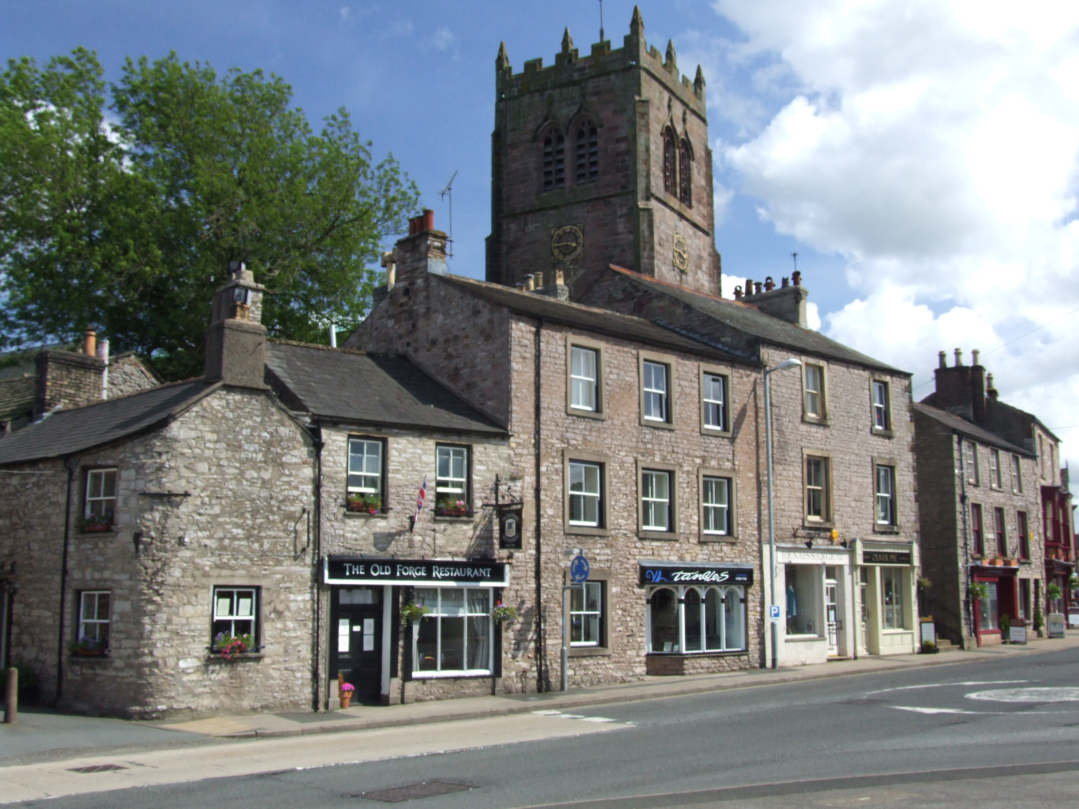
Kirkby Stephen

Kirkby Stephen () is a market town and civil parish in Westmorland and Furness, Cumbria, England. Historically part of Westmorland, it lies on the A685...

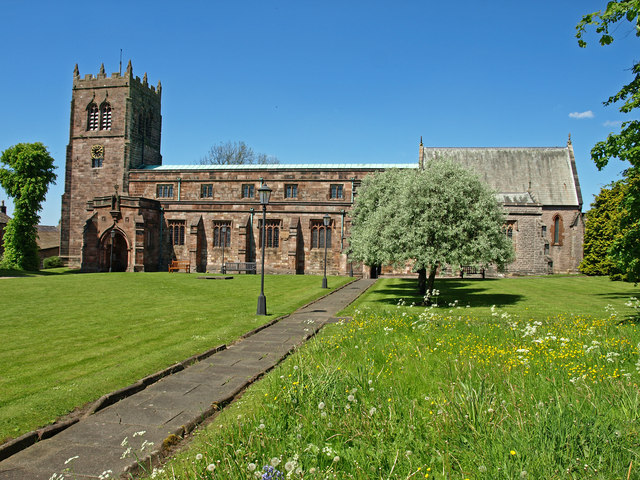
St Stephen's Church, Kirkby Stephen

The Parish Church, Kirkby Stephen is an Anglican parish church in Kirkby Stephen, Cumbria. == History == Kirkby Stephen Parish Church is often called the...

Devil's Grinding Mill

The Devil's Grinding Mill, sometimes known as the Devil's Hole, is part of The Angel's Drainpipe, a partially collapsed cave system on the River Eden in...

Kirkby Stephen Grammar School

Kirkby Stephen Grammar School is a coeducational secondary school. It is an Academy and has a sixth form. It is located in Kirkby Stephen in the English...

Nateby, Cumbria

Nateby is a village and civil parish in the Eden district of Cumbria, England. The parish had a population of 110 in 2001, increasing to 120 at the 2011...

Nearby Amenities

Located within 500m of 54.466757,-2.3303795
Hartley Castle
Place: farm
Lat/Long: 54.468819/-2.336913
Castle Hill
Ele: 221
Natural: peak
Lat/Long: 54.4692904/-2.3366544
Park Hill
Ele: 262
Natural: peak
Lat/Long: 54.4669106/-2.3305334
Tourism: viewpoint
Lat/Long: 54.4666885/-2.3380546
Barrier: kissing_gate
Lat/Long: 54.4670386/-2.3374904
Access: yes
Barrier: entrance
Lat/Long: 54.4676694/-2.3362596
Man Made: tower
Tower Type: communication
Lat/Long: 54.4686425/-2.3311562
Northern Viaduct Trust Welcomes You
Information: board
Tourism: information
Lat/Long: 54.4705124/-2.3335902
Power: pole
Lat/Long: 54.4698585/-2.3358583
Leisure: picnic_table
Lat/Long: 54.4667197/-2.3380572
Board Type: history
Information: board
Tourism: information
Lat/Long: 54.4667448/-2.3380794
Power: pole
Lat/Long: 54.4691542/-2.3354432
The data included in this document is from www.openstreetmap.org. The data is made available under ODbL.

Have you been to Park Hill?

Leave your review of Park Hill below (or comments, questions and feedback).