Burnhope Seat

Hill, Mountain in Cumberland / Durham Eden

England

Burnhope Seat

Peat banks on north-west side of Harwood Common A hill walker following the Tees / Wear watershed on a perfect winter's day.
Harwood Common is a minor moorland hill along the watershed; other hills in the distance are High Field, Chapel Fell and Fendrith Hill.
Peat banks on north-west side of Harwood Common Credit: Trevor Littlewood

Burnhope Seat is a prominent hill located on the border of Cumberland and Durham counties in England. It forms part of the North Pennines Area of Outstanding Natural Beauty. Standing at an elevation of 747 meters (2,451 feet), it is classified as a Marilyn, which is a hill with a prominence of at least 150 meters.

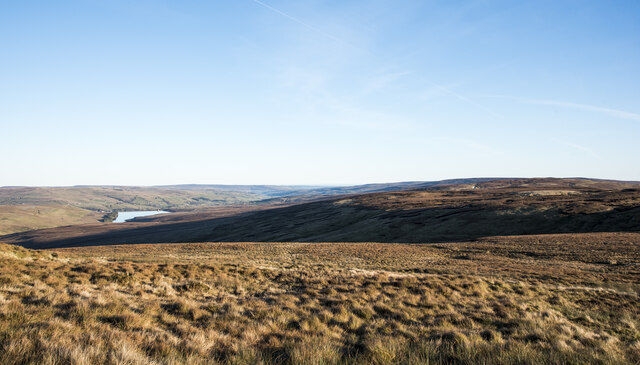
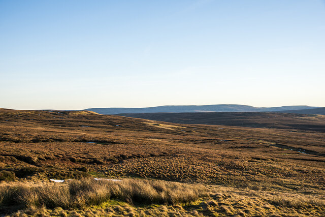
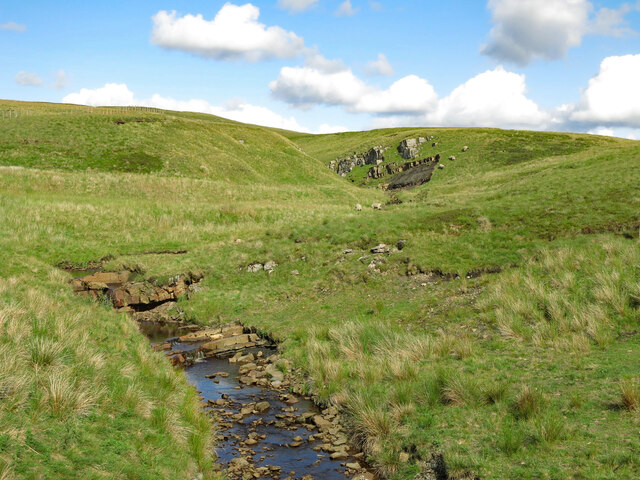
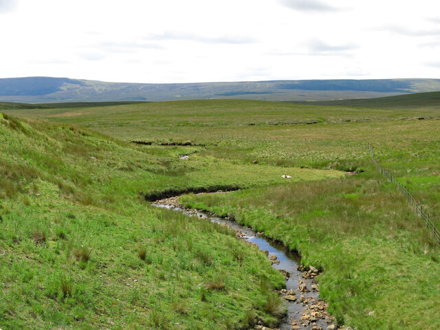
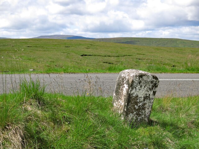
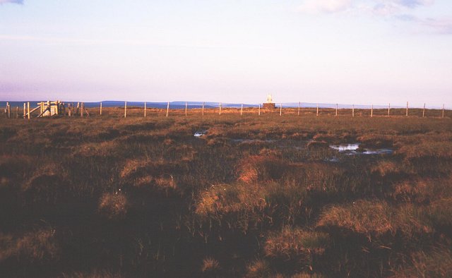
The hill is situated within the Burnhope Reservoir valley, which was dammed in the early 20th century to provide water for the surrounding areas. Burnhope Seat offers breathtaking panoramic views of the surrounding landscape, including the reservoir, moorland, and the rolling hills of the North Pennines.

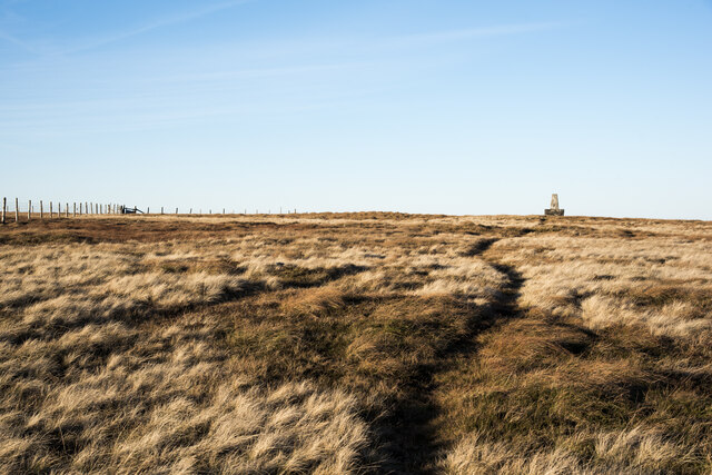
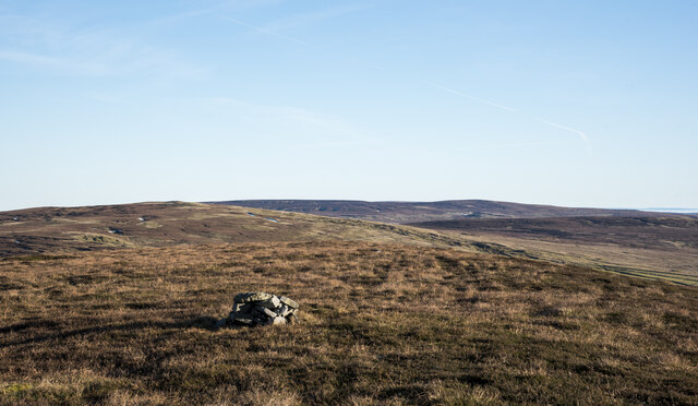
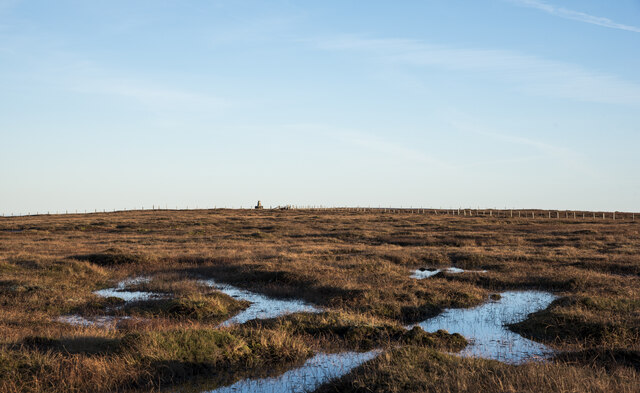
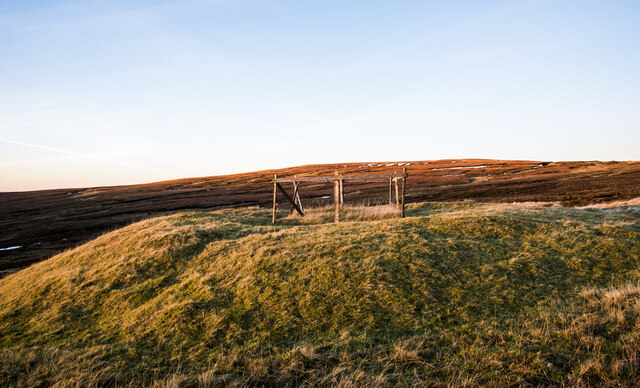
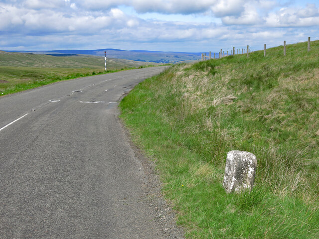
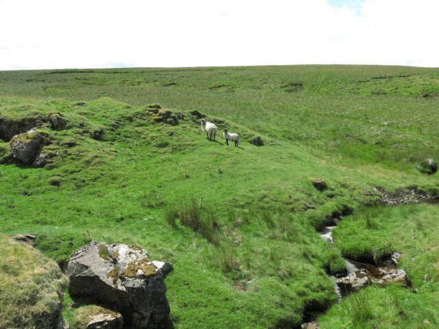
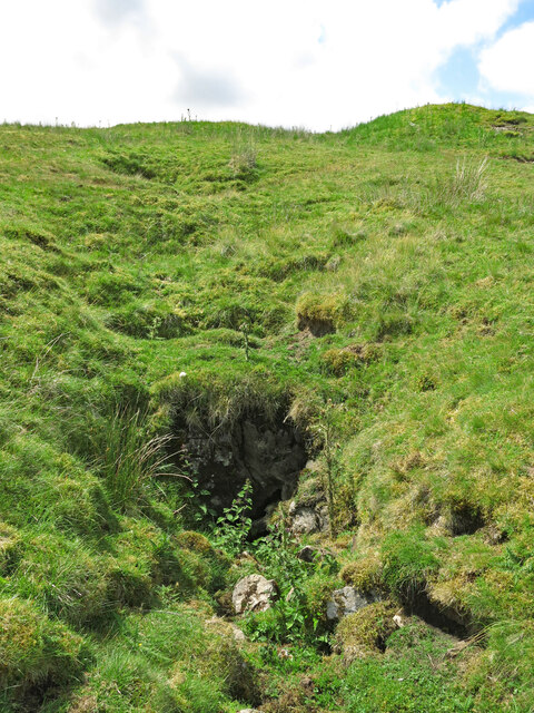
The terrain of Burnhope Seat is predominantly heather-covered moorland, with scattered boulders and rocky outcrops. The hill is relatively steep, especially on its northern side, and is often subject to strong winds and inclement weather conditions.

Due to its remote location and challenging terrain, Burnhope Seat is a popular destination for outdoor enthusiasts and hillwalkers. Several walking routes traverse the hill, providing opportunities for both experienced and novice hikers to explore the area. The nearby Burnhope Reservoir also offers fishing opportunities for those interested in angling.

Overall, Burnhope Seat is a stunning and rugged hill that showcases the natural beauty of the North Pennines. Its accessibility, coupled with its breathtaking views, make it a popular destination for outdoor enthusiasts seeking an adventure in the English countryside.

If you have any feedback on the listing, please let us know in the comments section below.

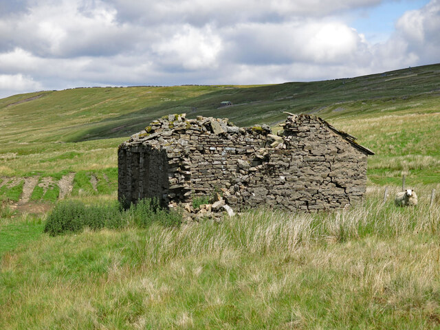
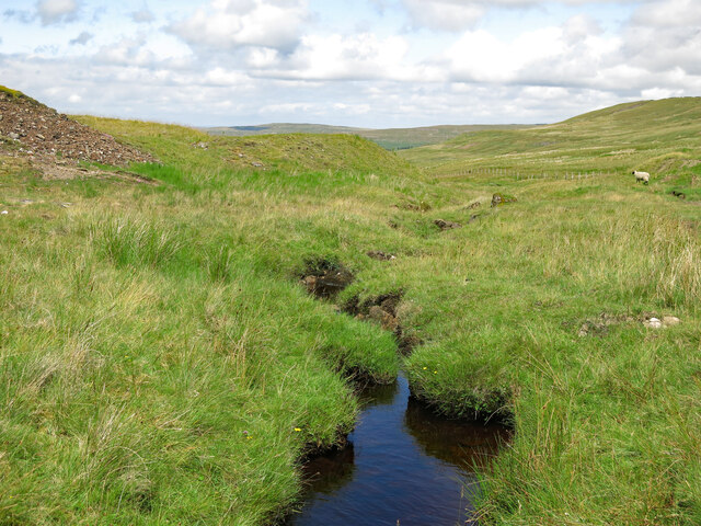
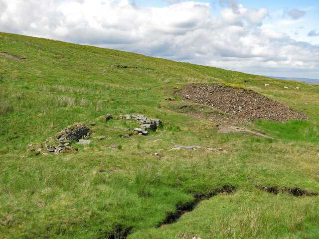
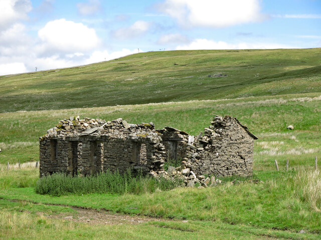
Burnhope Seat Images

Images are sourced within 2km of 54.732675/-2.3341095 or Grid Reference NY7837. Thanks to Geograph Open Source API. All images are credited.

Peat banks on north-west side of Harwood Common A hill walker following the Tees / Wear watershed on a perfect winter's day.
Harwood Common is a minor moorland hill along the watershed; other hills in the distance are High Field, Chapel Fell and Fendrith Hill.
Peat banks on north-west side of Harwood Common
A hill walker following the Tees / Wear watershed on a perfect winter's day. Harwood Common is a minor moorland hill along the watershed; other hills in the distance are High Field, Chapel Fell and Fendrith Hill.
Hill slopes beyond valley of Scraith Burn The stream groove beyond the foreground moorland is that of the Scraith Burn which drains into Burnhope Reservoir, also in the image.
High Field is beyond the shadow of the stream slot.
Hill slopes beyond valley of Scraith Burn
The stream groove beyond the foreground moorland is that of the Scraith Burn which drains into Burnhope Reservoir, also in the image. High Field is beyond the shadow of the stream slot.
Path approaching trig point of Burnhope Seat A thin path over grass created by hill walkers approaching the summit of Burnhope Seat: having climbed beside the fence to the left, they deviate as the trig point comes into view.
The trig point of course is not at the highest point of the hill!
Path approaching trig point of Burnhope Seat
A thin path over grass created by hill walkers approaching the summit of Burnhope Seat: having climbed beside the fence to the left, they deviate as the trig point comes into view. The trig point of course is not at the highest point of the hill!
Heather moorland on south side of Burnhope Seat Low-angled heather moorland descending to the south on the southern side of Burnhope Seat which is the historic high point of County Durham. County boundary reorganisation in 1972, (enacted 1974), saw that change and now the county top is Mickle Fell, which is the distant dark ridge. Previously it had been the county top of Yorkshire.
Heather moorland on south side of Burnhope Seat
Low-angled heather moorland descending to the south on the southern side of Burnhope Seat which is the historic high point of County Durham. County boundary reorganisation in 1972, (enacted 1974), saw that change and now the county top is Mickle Fell, which is the distant dark ridge. Previously it had been the county top of Yorkshire.
Small cairn at summit of Harwood Common Harwood Common is a minor moorland hill along the Tees / Wear watershed. Most of the ground in the distance is along that same watershed - High Field is to the left with Chapel Fell and Fendrith Hill in the distance. To the right is Three Pikes: only the northern end of it can be considered to be along that watershed.
Small cairn at summit of Harwood Common
Harwood Common is a minor moorland hill along the Tees / Wear watershed. Most of the ground in the distance is along that same watershed - High Field is to the left with Chapel Fell and Fendrith Hill in the distance. To the right is Three Pikes: only the northern end of it can be considered to be along that watershed.
Standing water on summit plateau of Burnhope Seat Bogs and heather dominate the summit area of this hill. In the distance, close to a fence junction is the trig point; it stands on a concrete block. The trig is not reckoned to be at the hill's highest point; that's a metre higher and somewhere behind the camera position.
Standing water on summit plateau of Burnhope Seat
Bogs and heather dominate the summit area of this hill. In the distance, close to a fence junction is the trig point; it stands on a concrete block. The trig is not reckoned to be at the hill's highest point; that's a metre higher and somewhere behind the camera position.
Fenced mine shaft north of Yad Moss OS mapping (1:25 000), indicates a number of old mine shafts in the vicinity of Yad Moss. The one in view has a prominent 'collar' of spoil about it and is fenced. The shaft isn't open and the top is grassed over with rocks protruding.
Sunset was close and sunlight was about to disappear from the vicinity of the shaft but to the north, the summit area of Burnhope Seat was still well lit.
Fenced mine shaft north of Yad Moss
OS mapping (1:25 000), indicates a number of old mine shafts in the vicinity of Yad Moss. The one in view has a prominent 'collar' of spoil about it and is fenced. The shaft isn't open and the top is grassed over with rocks protruding. Sunset was close and sunlight was about to disappear from the vicinity of the shaft but to the north, the summit area of Burnhope Seat was still well lit.
Crook Burn
Crook Burn
Crook Burn (2)
Crook Burn (2)
Old milestone by the B6277 north west of Crookburn Bridge See <a href="https://www.geograph.org.uk/photo/5622937">NY7736 : Old Milestone by the B6277, below Burnhope Seat</a> taken in 2202; since then, the milestone has lost most of its white paint, and only the horizontal top line of the benchmark is visible. 
The location of the milestone is shown in <a href="https://www.geograph.org.uk/photo/7548976">NY7736 : The B6277 north west of Crookburn Bridge and Slack's Rigg</a> and <a href="https://www.geograph.org.uk/photo/7548979">NY7736 : The B6277 north west of Crookburn Bridge</a>.
Old milestone by the B6277 north west of Crookburn Bridge
See NY7736 : Old Milestone by the B6277, below Burnhope Seat taken in 2202; since then, the milestone has lost most of its white paint, and only the horizontal top line of the benchmark is visible. The location of the milestone is shown in NY7736 : The B6277 north west of Crookburn Bridge and Slack's Rigg and NY7736 : The B6277 north west of Crookburn Bridge.
The B6277 north west of Crookburn Bridge and Slack's Rigg Shows the location of the <a href="https://www.geograph.org.uk/photo/7548967">NY7736 : Old milestone by the B6277 north west of Crookburn Bridge</a>; Cross Fell on the far horizon (half left).
The B6277 north west of Crookburn Bridge and Slack's Rigg
Shows the location of the NY7736 : Old milestone by the B6277 north west of Crookburn Bridge; Cross Fell on the far horizon (half left).
The B6277 north west of Crookburn Bridge Shows the location of the <a href="https://www.geograph.org.uk/photo/7548967">NY7736 : Old milestone by the B6277 north west of Crookburn Bridge</a>.
The B6277 north west of Crookburn Bridge
The upper valley of Clargill Burn
Old lead mine building by Clargill Burn The building had most of its stone slab roof in 2005 <a href="https://www.geograph.org.uk/photo/86968">NY7736 : Derelict hut next to Clargill Burn</a> (photographed by Andrew Smith; by 2017, much of the north end had collapsed <a href="https://www.geograph.org.uk/photo/5407950">NY7736 : Hiddenhole Lead Mine (disused)</a> (photographed by Matthew Hatton). Although there's now a 'B' road only 200 metres away, this is a desolate place, some 580 metres (1,900 ft) above sea level.
Old lead mine building by Clargill Burn
The building had most of its stone slab roof in 2005 NY7736 : Derelict hut next to Clargill Burn (photographed by Andrew Smith; by 2017, much of the north end had collapsed NY7736 : Hiddenhole Lead Mine (disused) (photographed by Matthew Hatton). Although there's now a 'B' road only 200 metres away, this is a desolate place, some 580 metres (1,900 ft) above sea level.
Clargill Burn by the former lead mine
Remains of lead mine by Clargill Burn
Old lead mine building by Clargill Burn (2)
Old mine level
Old mine level
Show me another place!

Burnhope Seat is located at Grid Ref: NY7837 (Lat: 54.732675, Lng: -2.3341095)

Administrative County: Cumbria

District: Eden

Police Authority: Cumbria

What 3 Words

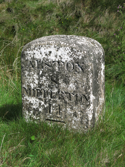
///impulse.messy.tedious. Near Alston, Cumbria

Nearby Locations

Yad Moss Burnhope Seat

Related Wikis

Burnhope Seat

Burnhope Seat is a high moorland fell in the North Pennines Area of Outstanding Natural Beauty (AONB) in northern England. It lies between the heads of...

Moorhouse and Cross Fell

Moorhouse and Cross Fell is a Site of Special Scientific Interest covering an extensive area of moorland in the Wear Valley district of west County Durham...

Ashgill Force

Ashgill Force is a waterfall near Alston, Cumbria, England. The fall is located on Ashgill Beck and is reasonably easily accessible from the B6277 (which...

Far High House Meadows

Far High House Meadows is a Site of Special Scientific Interest in Upper Weardale in west County Durham, England. It consists of three fields, located...

Nearby Amenities

Located within 500m of 54.732675,-2.3341095
Burnhope Seat
Ele: 747.4
Natural: peak
Source: OS 1:25k
Wikidata: Q1016785
Wikipedia: en:Burnhope Seat
Lat/Long: 54.7323507/-2.3345944
Burnhope Seat
Ele: 747.4
Image: https://www.geograph.org.uk/photo/5947034
Man Made: survey_point
Ref: NY86S006
Tpuk Ref: TP1783
Website: https://trigpointing.uk/trig/1783
Lat/Long: 54.7323833/-2.3309805
The data included in this document is from www.openstreetmap.org. The data is made available under ODbL.

Have you been to Burnhope Seat?

Leave your review of Burnhope Seat below (or comments, questions and feedback).