Castle Hill

Hill, Mountain in Westmorland Eden

England

Castle Hill

Little Longrigg Scar
Little Longrigg Scar Credit: David Brown

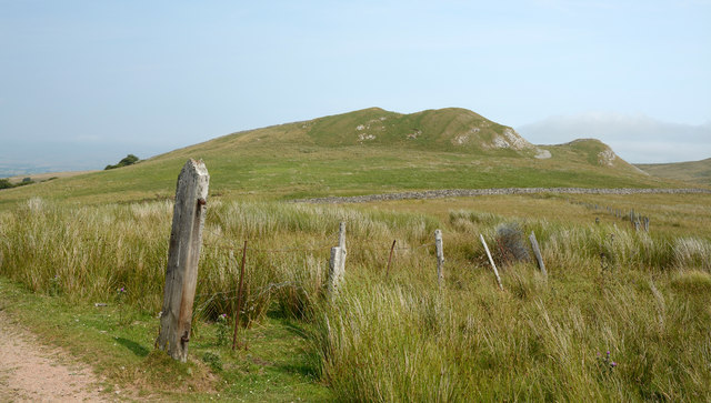
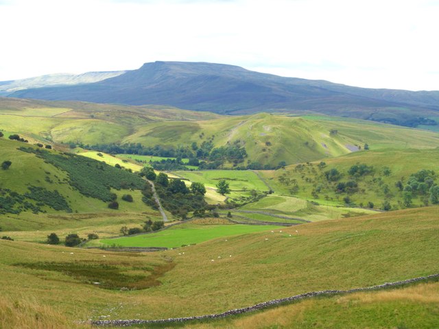
Castle Hill is a prominent hill located in the district of Westmorland, England. Rising to an elevation of 1,123 feet (342 meters), it is considered one of the notable hills in the region. Situated in the northern part of Westmorland, Castle Hill offers breathtaking panoramic views of the surrounding countryside.

The hill derives its name from the remains of a medieval motte-and-bailey castle that once stood on its summit. This historic castle, believed to have been built during the Norman period, played a significant role in the defense of the area. Unfortunately, only remnants of the castle's earthworks and ditches are visible today, serving as a reminder of its former grandeur.

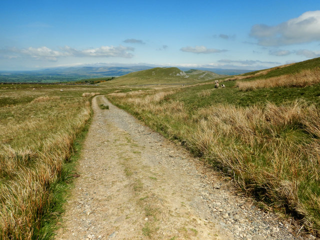
Castle Hill is a popular destination for hikers, nature enthusiasts, and history buffs alike. The hill is accessible via public footpaths and offers various walking routes for visitors to explore. The ascent to the summit can be moderately challenging, but the rewarding views make it worth the effort.

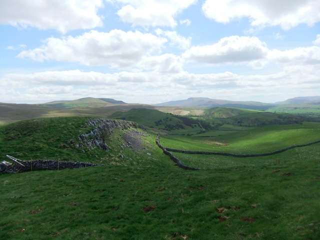
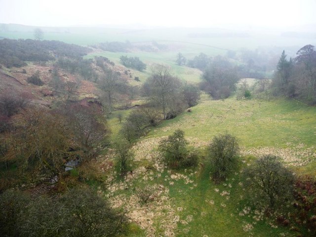
The surrounding landscape is characterized by rolling hills, green pastures, and scattered woodlands, creating a picturesque setting. Wildlife is abundant in the area, with sightings of various bird species, rabbits, and occasional deer.

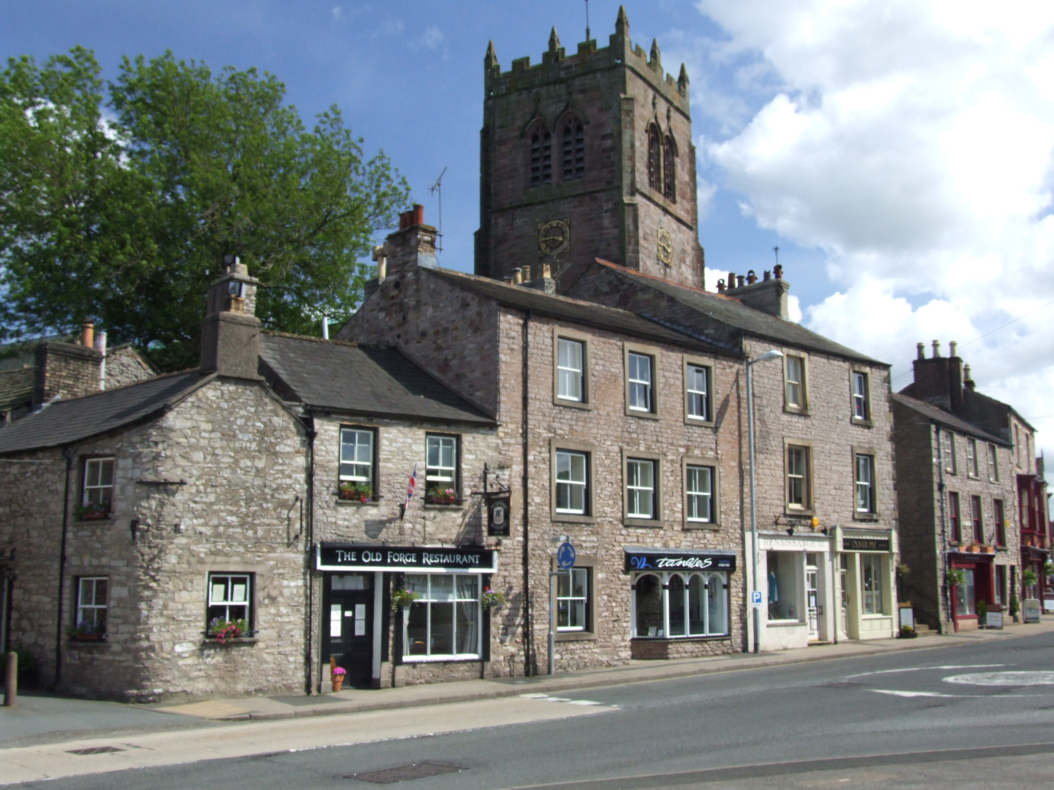
Visitors to Castle Hill can take advantage of the nearby amenities, such as parking facilities and picnic areas. The hill's location also allows for easy access to other attractions in Westmorland, including historic villages, castles, and natural landmarks.

Overall, Castle Hill in Westmorland offers a captivating blend of history, natural beauty, and outdoor activities, making it an enticing destination for locals and tourists alike.

If you have any feedback on the listing, please let us know in the comments section below.

Castle Hill Images

Images are sourced within 2km of 54.46922/-2.336818 or Grid Reference NY7808. Thanks to Geograph Open Source API. All images are credited.

Little Longrigg Scar
Limestone edge on Birkett Hill
Birkett Hill Birkett Hill as seen from the farm/estate road that is also the route of the Coast to Coast Walk.
Birkett Hill
Birkett Hill as seen from the farm/estate road that is also the route of the Coast to Coast Walk.
The view west from Long Rigg Looking west from the highest point on Long Rigg towards Kirkby Stephen and the distant High Street range in the Lake District.
The view west from Long Rigg
Looking west from the highest point on Long Rigg towards Kirkby Stephen and the distant High Street range in the Lake District.
The view SSW from Long Rigg The view from the highest point of Long Rigg, looking SSW towards Wild Boar Fell.
The view SSW from Long Rigg
The view from the highest point of Long Rigg, looking SSW towards Wild Boar Fell.
Footpath spotting southwest of Winton The trouble with footpaths which are rarely trodden is that they are far from obvious on the ground. My best guess for this one was that it headed for the gate right of centre in this view. The GPS suggested otherwise and I needed to head off to the right of the photo, where a closer approach brought a stile into view - perfectly well waymarked, but not visible from a distance. It did lead into the same field as the gate....
Footpath spotting southwest of Winton
The trouble with footpaths which are rarely trodden is that they are far from obvious on the ground. My best guess for this one was that it headed for the gate right of centre in this view. The GPS suggested otherwise and I needed to head off to the right of the photo, where a closer approach brought a stile into view - perfectly well waymarked, but not visible from a distance. It did lead into the same field as the gate....
Birkett Hill
Birkett Hill
Looking to Birkett Hill from the Hartley Fell track The voie normale from Kirkby Stephen to Nine Standards Rigg (part of the Coast-to-Coat walk) takes this track from the end of the public road through Hartley up onto Hartley Fell. This view looks back to the higher of two Birkett Hills in the vicinity - the other being a kilometre or so to its southwest. The Coast-to-Coast walk has proved so popular that at certain seasons one is asked to take alternative routes onto Nine Standards Rigg to give the ground a chance to recover. This damage is mostly on the peaty open moor above and there is little chance that walkers will wear this bit of track away! As the track climbs gently onto the fell, the views over the Eden valley get more extensive, and stretch to the Warcop army training area in the far distance. During our walk a low-flying jet circled time after time over the ranges, causing a much longer lasting disturbance of the peace of the fells than we normally expect. At least I supposed they weren't shooting the wildlife.
Looking to Birkett Hill from the Hartley Fell track
The voie normale from Kirkby Stephen to Nine Standards Rigg (part of the Coast-to-Coat walk) takes this track from the end of the public road through Hartley up onto Hartley Fell. This view looks back to the higher of two Birkett Hills in the vicinity - the other being a kilometre or so to its southwest. The Coast-to-Coast walk has proved so popular that at certain seasons one is asked to take alternative routes onto Nine Standards Rigg to give the ground a chance to recover. This damage is mostly on the peaty open moor above and there is little chance that walkers will wear this bit of track away! As the track climbs gently onto the fell, the views over the Eden valley get more extensive, and stretch to the Warcop army training area in the far distance. During our walk a low-flying jet circled time after time over the ranges, causing a much longer lasting disturbance of the peace of the fells than we normally expect. At least I supposed they weren't shooting the wildlife.
Kirkby Stephen East Kirkby Stephen East station was once at an important railway junction; closure came and the buildings were put to another use with the space between platforms being filled in and concreted over. A new company has been formed by enthusiasts which plans to have the route to Appleby functioning again.
Kirkby Stephen East
Kirkby Stephen East station was once at an important railway junction; closure came and the buildings were put to another use with the space between platforms being filled in and concreted over. A new company has been formed by enthusiasts which plans to have the route to Appleby functioning again.
From the car park to the railway path Accessible path from the walkers' car park, opened in 2009 near Skenrith bridge. The gabions are covered with mats of sedum plants.
From the car park to the railway path
Accessible path from the walkers' car park, opened in 2009 near Skenrith bridge. The gabions are covered with mats of sedum plants.
Former railway, now a path Built to take minerals between County Durham and Barrow-in-Furness, closed and restored as a footpath.
Former railway, now a path
Built to take minerals between County Durham and Barrow-in-Furness, closed and restored as a footpath.
Farm track passing under former railway The railway was built in the 1860s, looping round the south side of Kirkby Stephen.
Farm track passing under former railway
The railway was built in the 1860s, looping round the south side of Kirkby Stephen.
Bridge over former railway Carrying an old footpath over a new one, which is part of the Northern Viaduct Round. See <span class="nowrap"><a title="http://www.nvt.org.uk" rel="nofollow ugc noopener" href="http://www.nvt.org.uk">Link</a><img style="margin-left:2px;" alt="External link" title="External link - shift click to open in new window" src="https://s1.geograph.org.uk/img/external.png" width="10" height="10"/></span> for more details.
Bridge over former railway
Carrying an old footpath over a new one, which is part of the Northern Viaduct Round. See LinkExternal link for more details.
Fallen tree in the cutting Part of the Northern Viaduct Round. See <span class="nowrap"><a title="http://www.nvt.org.uk" rel="nofollow ugc noopener" href="http://www.nvt.org.uk">Link</a><img style="margin-left:2px;" alt="External link" title="External link - shift click to open in new window" src="https://s1.geograph.org.uk/img/external.png" width="10" height="10"/></span> for more details.
Fallen tree in the cutting
Part of the Northern Viaduct Round. See LinkExternal link for more details.
Valley upstream of Podgill Viaduct Ladthwaite Beck passes 84 feet below the former railway line.
Valley upstream of Podgill Viaduct
Ladthwaite Beck passes 84 feet below the former railway line.
Former signal box interpreted Built in 1926 to control the sidings to the newly-opened Hartley Quarry. Now part of the Northern Viaduct Round. See <span class="nowrap"><a title="http://www.nvt.org.uk" rel="nofollow ugc noopener" href="http://www.nvt.org.uk">Link</a><img style="margin-left:2px;" alt="External link" title="External link - shift click to open in new window" src="https://s1.geograph.org.uk/img/external.png" width="10" height="10"/></span> for more details.
Former signal box interpreted
Built in 1926 to control the sidings to the newly-opened Hartley Quarry. Now part of the Northern Viaduct Round. See LinkExternal link for more details.
Hartley Castle Long ago a fortified Peel tower, now a hill-top farmhouse.
Hartley Castle
Long ago a fortified Peel tower, now a hill-top farmhouse.
Valley downstream from Merrygill Viaduct Hartley Beck passes 78 feet below the former railway, which is part of the Northern Viaduct Round. See <span class="nowrap"><a title="http://www.nvt.org.uk" rel="nofollow ugc noopener" href="http://www.nvt.org.uk">Link</a><img style="margin-left:2px;" alt="External link" title="External link - shift click to open in new window" src="https://s1.geograph.org.uk/img/external.png" width="10" height="10"/></span> for more details.
Valley downstream from Merrygill Viaduct
Hartley Beck passes 78 feet below the former railway, which is part of the Northern Viaduct Round. See LinkExternal link for more details.
Show me another place!

Castle Hill is located at Grid Ref: NY7808 (Lat: 54.46922, Lng: -2.336818)

Administrative County: Cumbria

District: Eden

Police Authority: Cumbria

What 3 Words

///commuting.beakers.buns. Near Kirkby Stephen, Cumbria

Nearby Locations

Castle Hill Hartley

Related Wikis

Nearby Amenities

Located within 500m of 54.46922,-2.336818
Hartley
Created By: Merkaartor 0.12
Is In: UK,England,Yorkshire,North Yorkshire
Is In County: Cumbria
Is In District: Eden
Place: village
Lat/Long: 54.4735292/-2.336301
Bench
Backrest: yes
Colour: brown
Material: wood
Lat/Long: 54.4731888/-2.3366194
Telephone
Operator: British Telecom
Payment Debit Cards: no
Lat/Long: 54.4732163/-2.3366407
Grit Bin
Lat/Long: 54.4732561/-2.3365839
Post Box
Ref: CA17 101
Lat/Long: 54.4732754/-2.3364736
Hartley Castle
Place: farm
Lat/Long: 54.468819/-2.336913
Castle Hill
Ele: 221
Natural: peak
Lat/Long: 54.4692904/-2.3366544
Park Hill
Ele: 262
Natural: peak
Lat/Long: 54.4669106/-2.3305334
Tourism: viewpoint
Lat/Long: 54.4666885/-2.3380546
Barrier: kissing_gate
Lat/Long: 54.4670386/-2.3374904
Access: yes
Barrier: entrance
Lat/Long: 54.4676694/-2.3362596
Man Made: tower
Tower Type: communication
Lat/Long: 54.4686425/-2.3311562
Northern Viaduct Trust Welcomes You
Information: board
Tourism: information
Lat/Long: 54.4705124/-2.3335902
Bench
Source: survey;gps
Lat/Long: 54.4727294/-2.339652
Barrier: stile
Material: stone
Source: survey;gps
Stile: squeezer
Lat/Long: 54.4725944/-2.3395578
Generator Method: photovoltaic
Generator Output Electricity: yes
Generator Source: solar
Generator Type: solar_photovoltaic_panel
Location: roof
Power: generator
Lat/Long: 54.4722844/-2.3368844
Generator Method: photovoltaic
Generator Output Electricity: yes
Generator Source: solar
Generator Type: solar_photovoltaic_panel
Location: roof
Power: generator
Lat/Long: 54.4718815/-2.3362044
Generator Method: photovoltaic
Generator Output Electricity: yes
Generator Source: solar
Generator Type: solar_photovoltaic_panel
Location: roof
Power: generator
Lat/Long: 54.4718472/-2.3362701
Power: pole
Lat/Long: 54.4733711/-2.3378834
Power: pole
Lat/Long: 54.4729613/-2.3374141
Power: pole
Lat/Long: 54.4731139/-2.3398695
Power: pole
Lat/Long: 54.4722816/-2.3405991
Power: pole
Lat/Long: 54.4718349/-2.3409815
Power: pole
Lat/Long: 54.4721543/-2.3419946
Power: pole
Lat/Long: 54.472813/-2.3401334
Historic: tower
Ruins: yes
Lat/Long: 54.4690794/-2.3374747
Collier Dub
Place: locality
Lat/Long: 54.4689797/-2.3414816
Podgill Side
Place: locality
Lat/Long: 54.4687696/-2.3403686
Power: pole
Lat/Long: 54.4698585/-2.3358583
Power: pole
Lat/Long: 54.4705329/-2.3362642
Power: pole
Lat/Long: 54.4707219/-2.3369933
Power: pole
Lat/Long: 54.4711284/-2.3385954
Power: pole
Lat/Long: 54.471504/-2.3400595
Leisure: picnic_table
Lat/Long: 54.4667197/-2.3380572
Board Type: history
Information: board
Tourism: information
Lat/Long: 54.4667448/-2.3380794
Power: pole
Lat/Long: 54.4691542/-2.3354432
The data included in this document is from www.openstreetmap.org. The data is made available under ODbL.

Have you been to Castle Hill?

Leave your review of Castle Hill below (or comments, questions and feedback).