Bale Hill

Hill, Mountain in Westmorland Eden

England

Bale Hill

Helbeck Looking towards Mount Ida from the edge of the Warcop firing range.
Helbeck Credit: Karl and Ali

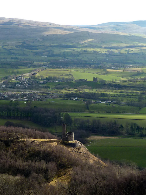
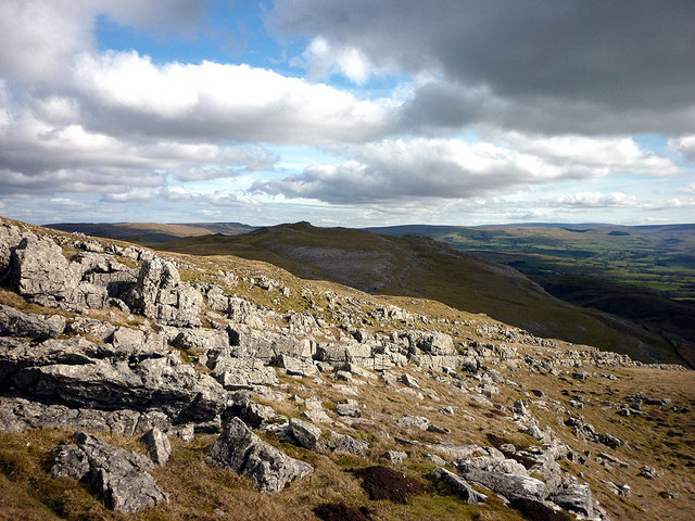
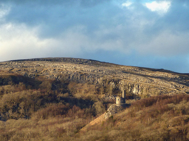
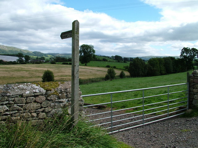
Bale Hill is a prominent hill located in the region of Westmorland, in the county of Cumbria, England. Standing at an elevation of 1,983 feet (604 meters), it is classified as a hill rather than a mountain, but its impressive presence and commanding views make it a popular destination for hikers and nature enthusiasts.

Situated in the picturesque Yorkshire Dales National Park, Bale Hill offers breathtaking panoramic views of the surrounding countryside. Its location near the village of Sedbergh makes it easily accessible for visitors, who can embark on various walking trails to reach its summit.

The hill is characterized by its gently sloping sides, covered in lush green grasses and heather, which create a stunning contrast against the vibrant blue skies. The summit of Bale Hill provides an ideal vantage point to admire the nearby Howgill Fells, a range of rolling hills and valleys that stretch across the landscape.

Wildlife is abundant in the area, with sightings of various bird species, including golden eagles and peregrine falcons. The presence of sheep grazing on the hillside further enhances the rural charm of the surroundings.

Bale Hill is not only a natural landmark but also holds historical significance. It is believed to have been used as a beacon site during medieval times, serving as a communication point to alert nearby communities of impending danger.

Overall, Bale Hill in Westmorland is a captivating destination that combines natural beauty, stunning vistas, and a touch of history. Whether for a leisurely stroll or a challenging hike, visitors are sure to be captivated by the charm and tranquility of this scenic hill.

If you have any feedback on the listing, please let us know in the comments section below.

Bale Hill Images

Images are sourced within 2km of 54.535795/-2.3463762 or Grid Reference NY7715. Thanks to Geograph Open Source API. All images are credited.

Helbeck Looking towards Mount Ida from the edge of the Warcop firing range.
Helbeck
Looking towards Mount Ida from the edge of the Warcop firing range.
Key Scar A small limestone scar that extends into the Warcop firing ranges.
Key Scar
A small limestone scar that extends into the Warcop firing ranges.
Fox Tower, Helbeck The 18th century tower seen from above Helbeck Wood. Below lies Brough Castle with the hills above Kirkby Stephen beyond.
Fox Tower, Helbeck
The 18th century tower seen from above Helbeck Wood. Below lies Brough Castle with the hills above Kirkby Stephen beyond.
Key Scar, Helbeck Looking to Mount Ida and the moors of Stainmore beyond.
Key Scar, Helbeck
Looking to Mount Ida and the moors of Stainmore beyond.
Helbeck Intake Limestone upland of outcrops and pavements.
Helbeck Intake
Limestone upland of outcrops and pavements.
Limestone pavement, Helbeck Beyond the skyline is the Warcop firing range, source of many sounds of gunfire and explosions!
Limestone pavement, Helbeck
Beyond the skyline is the Warcop firing range, source of many sounds of gunfire and explosions!
Limestone pavement, Helbeck On the west slope of Mount Ida.
Limestone pavement, Helbeck
On the west slope of Mount Ida.
Outcrops, Helbeck Intake Numerous short limestone scars are scattered over the area.
Outcrops, Helbeck Intake
Numerous short limestone scars are scattered over the area.
Trees, Helbeck Wood These are the last trees at the very eastern tip of the wood.
Trees, Helbeck Wood
These are the last trees at the very eastern tip of the wood.
Helbeck Hall Built in 1776 for John Metcalfe at the foot of Hall Fell. A grade II listed building <span class="nowrap"><a title="http://www.britishlistedbuildings.co.uk/en-73342-helbeck-hall-with-retaining-wall-to-rear-" rel="nofollow ugc noopener" href="http://www.britishlistedbuildings.co.uk/en-73342-helbeck-hall-with-retaining-wall-to-rear-">Link</a><img style="margin-left:2px;" alt="External link" title="External link - shift click to open in new window" src="https://s1.geograph.org.uk/img/external.png" width="10" height="10"/></span>
Helbeck Hall
Built in 1776 for John Metcalfe at the foot of Hall Fell. A grade II listed building LinkExternal link
Sheep pastures near Brough Evening sun on the limestone scars above Helbeck.
Sheep pastures near Brough
Evening sun on the limestone scars above Helbeck.
Fox Tower A zoom shot of the folly on its promontory in Helbeck Wood.
Fox Tower
A zoom shot of the folly on its promontory in Helbeck Wood.
Boundary stone, A66 at Bullistone Bridge On the boundary between Brough and Hilbeck townships.
Boundary stone, A66 at Bullistone Bridge
On the boundary between Brough and Hilbeck townships.
Pasture by Bullistone Bridge, Brough
Musgrave Lane bridge, A66 The A66 is a major road in northern England running from near Middlesbrough to Workington. The section between Scotch Corner and Penrith is a Trans-Pennine route between the A1 and M6, following an old Roman Road.
Wikipedia: <span class="nowrap"><a title="http://en.wikipedia.org/wiki/A66_road" rel="nofollow ugc noopener" href="http://en.wikipedia.org/wiki/A66_road">Link</a><img style="margin-left:2px;" alt="External link" title="External link - shift click to open in new window" src="https://s1.geograph.org.uk/img/external.png" width="10" height="10"/></span>
Musgrave Lane bridge, A66
The A66 is a major road in northern England running from near Middlesbrough to Workington. The section between Scotch Corner and Penrith is a Trans-Pennine route between the A1 and M6, following an old Roman Road. Wikipedia: LinkExternal link
West View Farm by the A66
A66 near Brough The A66 is a major road in northern England running from near Middlesbrough to Workington. The section between Scotch Corner and Penrith is a Trans-Pennine route between the A1 and M6, following an old Roman Road.
Wikipedia: <span class="nowrap"><a title="http://en.wikipedia.org/wiki/A66_road" rel="nofollow ugc noopener" href="http://en.wikipedia.org/wiki/A66_road">Link</a><img style="margin-left:2px;" alt="External link" title="External link - shift click to open in new window" src="https://s1.geograph.org.uk/img/external.png" width="10" height="10"/></span>
A66 near Brough
The A66 is a major road in northern England running from near Middlesbrough to Workington. The section between Scotch Corner and Penrith is a Trans-Pennine route between the A1 and M6, following an old Roman Road. Wikipedia: LinkExternal link
West View Farm
West View Farm
Show me another place!

Bale Hill is located at Grid Ref: NY7715 (Lat: 54.535795, Lng: -2.3463762)

Administrative County: Cumbria

District: Eden

Police Authority: Cumbria

What 3 Words

///instructs.sisters.regrowth. Near Kirkby Stephen, Cumbria

Nearby Locations

Brackenber Hill Bale Hill

Related Wikis

Fox Tower, Cumbria

Fox Tower is a tower built by John Metcalf Carleton, an industrial entrepreneur, as a folly in 1775 on his large estate next to Brough, a village in Cumbria...

Flitholme

Flitholme is a hamlet in the parish of Musgrave, in the Eden District, in the English county of Cumbria. == Location == It is located on an unclassified...

Helbeck

Helbeck is a settlement and civil parish near the village of Brough, in the Eden district, in the county of Cumbria, England. There is a wood called Helbeck...
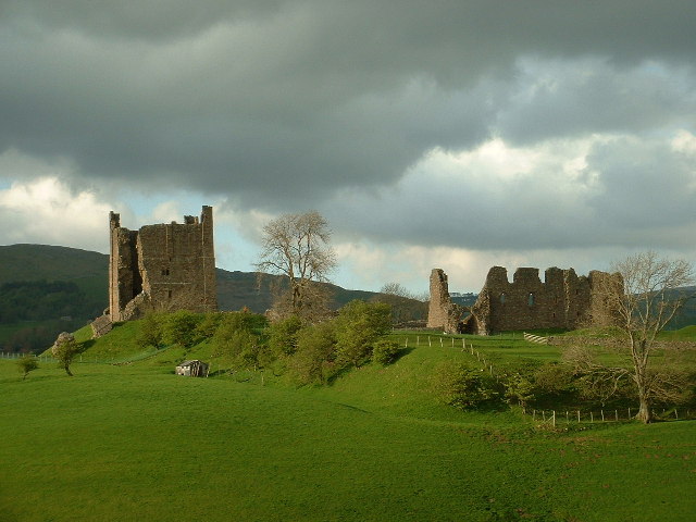
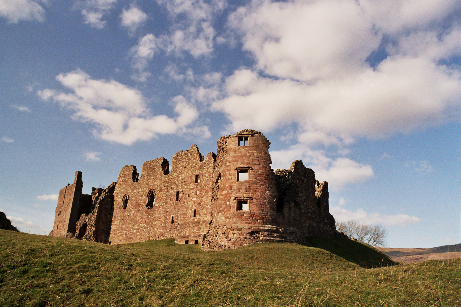
Brough Castle

Brough Castle is a ruined castle in the village of Brough, Cumbria, England. The castle was built by William Rufus around 1092 within the old Roman fort...

Verterae

Verterae was a Roman fort in the modern-day village of Brough, Cumbria, England. Occupied between the 1st and 5th centuries AD, it protected a key Roman...

Brough, Cumbria

Brough (), sometimes known as Brough under Stainmore, is a village and civil parish in the Westmorland and Furness unitary authority of Cumbria, England...

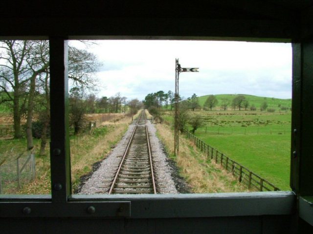
Eden Valley Railway (heritage railway)

The Eden Valley Railway (EVR) is a standard gauge heritage railway in Cumbria, England. It runs over a 2.2 miles (3.5 km) section of the original Eden...

Warcop railway station

Warcop railway station was situated on the Eden Valley Railway between Penrith and Kirkby Stephen East. It served the village of Warcop. The station opened...

Nearby Amenities

Located within 500m of 54.535795,-2.3463762
Turks Head
Place: locality
Lat/Long: 54.5323285/-2.3445552
Bale Hill
Place: locality
Lat/Long: 54.5358271/-2.3457599
Power: pole
Lat/Long: 54.531451/-2.3465777
Power: pole
Lat/Long: 54.5318974/-2.3453181
The data included in this document is from www.openstreetmap.org. The data is made available under ODbL.

Have you been to Bale Hill?

Leave your review of Bale Hill below (or comments, questions and feedback).