Brackenber Hill

Hill, Mountain in Westmorland Eden

England

Brackenber Hill

Fox Tower A zoom shot of the folly on its promontory in Helbeck Wood.
Fox Tower Credit: Karl and Ali

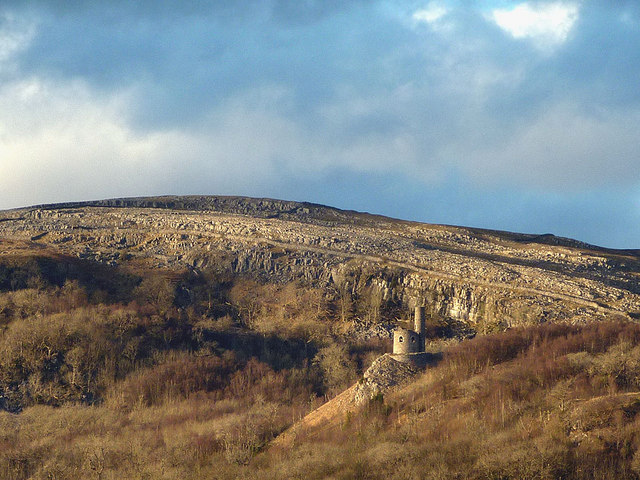
Brackenber Hill is a prominent hill located in the county of Westmorland, England. Situated in the northern part of the county, it forms part of the Pennines, a range of hills and mountains that stretches across northern England. Standing at an elevation of 207 meters (679 feet), it offers stunning panoramic views of the surrounding countryside.

The hill is characterized by its gently sloping sides and is covered in a dense growth of bracken, giving it its name. Brackenber Hill is composed mainly of limestone, which contributes to its unique geological features. It is also home to a variety of flora and fauna, including wildflowers, butterflies, and various bird species.

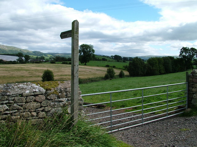
The hill is a popular destination for outdoor enthusiasts and nature lovers, offering numerous walking trails and paths that lead to its summit. Visitors can enjoy leisurely strolls or more challenging hikes, depending on their preferences. The summit provides an excellent vantage point to admire the picturesque landscapes of Westmorland, with rolling hills, lush green valleys, and scattered farmsteads.

Brackenber Hill is easily accessible, with nearby parking facilities and well-maintained footpaths. It is a perfect spot for a family outing or a peaceful retreat in nature. The hill's tranquil ambiance and breathtaking views make it a favorite spot for photographers and artists seeking inspiration.

In conclusion, Brackenber Hill is a stunning natural landmark in Westmorland, offering a delightful blend of scenic beauty, outdoor recreation opportunities, and a peaceful getaway from the hustle and bustle of daily life.

If you have any feedback on the listing, please let us know in the comments section below.

Brackenber Hill Images

Images are sourced within 2km of 54.538146/-2.3537683 or Grid Reference NY7715. Thanks to Geograph Open Source API. All images are credited.

Fox Tower A zoom shot of the folly on its promontory in Helbeck Wood.
Fox Tower
A zoom shot of the folly on its promontory in Helbeck Wood.
Boundary stone, A66 at Bullistone Bridge On the boundary between Brough and Hilbeck townships.
Boundary stone, A66 at Bullistone Bridge
On the boundary between Brough and Hilbeck townships.
Pasture by Bullistone Bridge, Brough
West View Farm by the A66
The Eden Valley Railway A steam preservation line.
The Eden Valley Railway
A steam preservation line.
Road to nowhere off the A66
The road to Warcop
The road to Warcop
Eden Valley Railway at Warcop Railway Station
West View Farm
West View Farm
A66 near Turks Head The A66 is a major road in northern England running from near Middlesbrough to Workington. The section between Scotch Corner and Penrith is a Trans-Pennine route between the A1 and M6, following an old Roman Road.
Wikipedia: <span class="nowrap"><a title="http://en.wikipedia.org/wiki/A66_road" rel="nofollow ugc noopener" href="http://en.wikipedia.org/wiki/A66_road">Link</a><img style="margin-left:2px;" alt="External link" title="External link - shift click to open in new window" src="https://s1.geograph.org.uk/img/external.png" width="10" height="10"/></span>
A66 near Turks Head
The A66 is a major road in northern England running from near Middlesbrough to Workington. The section between Scotch Corner and Penrith is a Trans-Pennine route between the A1 and M6, following an old Roman Road. Wikipedia: LinkExternal link
A66, Flitholme Bridge The A66 is a major road in northern England running from near Middlesbrough to Workington. The section between Scotch Corner and Penrith is a Trans-Pennine route between the A1 and M6, following an old Roman Road.
Wikipedia: <span class="nowrap"><a title="http://en.wikipedia.org/wiki/A66_road" rel="nofollow ugc noopener" href="http://en.wikipedia.org/wiki/A66_road">Link</a><img style="margin-left:2px;" alt="External link" title="External link - shift click to open in new window" src="https://s1.geograph.org.uk/img/external.png" width="10" height="10"/></span>
A66, Flitholme Bridge
The A66 is a major road in northern England running from near Middlesbrough to Workington. The section between Scotch Corner and Penrith is a Trans-Pennine route between the A1 and M6, following an old Roman Road. Wikipedia: LinkExternal link
A66 near Flitholme The A66 is a major road in northern England running from near Middlesbrough to Workington. The section between Scotch Corner and Penrith is a Trans-Pennine route between the A1 and M6, following an old Roman Road.
Wikipedia: <span class="nowrap"><a title="http://en.wikipedia.org/wiki/A66_road" rel="nofollow ugc noopener" href="http://en.wikipedia.org/wiki/A66_road">Link</a><img style="margin-left:2px;" alt="External link" title="External link - shift click to open in new window" src="https://s1.geograph.org.uk/img/external.png" width="10" height="10"/></span>
A66 near Flitholme
The A66 is a major road in northern England running from near Middlesbrough to Workington. The section between Scotch Corner and Penrith is a Trans-Pennine route between the A1 and M6, following an old Roman Road. Wikipedia: LinkExternal link
A66, Toddygill Bridge The A66 is a major road in northern England running from near Middlesbrough to Workington. The section between Scotch Corner and Penrith is a Trans-Pennine route between the A1 and M6, following an old Roman Road.
Wikipedia: <span class="nowrap"><a title="http://en.wikipedia.org/wiki/A66_road" rel="nofollow ugc noopener" href="http://en.wikipedia.org/wiki/A66_road">Link</a><img style="margin-left:2px;" alt="External link" title="External link - shift click to open in new window" src="https://s1.geograph.org.uk/img/external.png" width="10" height="10"/></span>
A66, Toddygill Bridge
The A66 is a major road in northern England running from near Middlesbrough to Workington. The section between Scotch Corner and Penrith is a Trans-Pennine route between the A1 and M6, following an old Roman Road. Wikipedia: LinkExternal link
A66, Warcop turning The A66 is a major road in northern England running from near Middlesbrough to Workington. The section between Scotch Corner and Penrith is a Trans-Pennine route between the A1 and M6, following an old Roman Road.
Wikipedia: <span class="nowrap"><a title="http://en.wikipedia.org/wiki/A66_road" rel="nofollow ugc noopener" href="http://en.wikipedia.org/wiki/A66_road">Link</a><img style="margin-left:2px;" alt="External link" title="External link - shift click to open in new window" src="https://s1.geograph.org.uk/img/external.png" width="10" height="10"/></span>
A66, Warcop turning
The A66 is a major road in northern England running from near Middlesbrough to Workington. The section between Scotch Corner and Penrith is a Trans-Pennine route between the A1 and M6, following an old Roman Road. Wikipedia: LinkExternal link
Fox Tower, Brough From Brough castle.
Fox Tower, Brough
From Brough castle.
Lowgill Farm
Lowgill Farm
Barn at Langrigg Roman Fell forms the backcloth.
Barn at Langrigg
Roman Fell forms the backcloth.
Fox Tower, Helbeck Wood, Brough, Cumbria A folly built in 1775 on the estate of John Metcalf Carleton who lived in Helbeck Hall.
Fox Tower, Helbeck Wood, Brough, Cumbria
A folly built in 1775 on the estate of John Metcalf Carleton who lived in Helbeck Hall.
Show me another place!

Brackenber Hill is located at Grid Ref: NY7715 (Lat: 54.538146, Lng: -2.3537683)

Administrative County: Cumbria

District: Eden

Police Authority: Cumbria

What 3 Words

///system.overlaid.opts. Near Kirkby Stephen, Cumbria

Nearby Locations

Brackenber Hill Bale Hill

Related Wikis

Flitholme

Flitholme is a hamlet in the parish of Musgrave, in the Eden District, in the English county of Cumbria. == Location == It is located on an unclassified...

Fox Tower, Cumbria

Fox Tower is a tower built by John Metcalf Carleton, an industrial entrepreneur, as a folly in 1775 on his large estate next to Brough, a village in Cumbria...

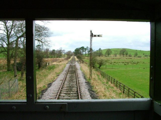
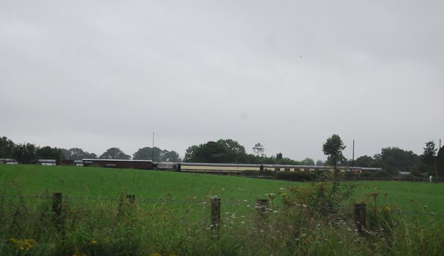
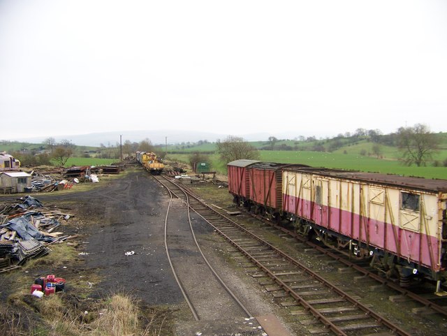
Eden Valley Railway (heritage railway)

The Eden Valley Railway (EVR) is a standard gauge heritage railway in Cumbria, England. It runs over a 2.2 miles (3.5 km) section of the original Eden...

Warcop railway station

Warcop railway station was situated on the Eden Valley Railway between Penrith and Kirkby Stephen East. It served the village of Warcop. The station opened...

Nearby Amenities

Located within 500m of 54.538146,-2.3537683
Brackenber Hill
Place: locality
Lat/Long: 54.5379821/-2.3561395
The data included in this document is from www.openstreetmap.org. The data is made available under ODbL.

Have you been to Brackenber Hill?

Leave your review of Brackenber Hill below (or comments, questions and feedback).