Goodham Gill Rigg
Hill, Mountain in Yorkshire Richmondshire
England
Goodham Gill Rigg

Goodham Gill Rigg is a picturesque hill located in the county of Yorkshire, England. Situated in the Yorkshire Dales National Park, it offers breathtaking views and is a popular destination for hikers and nature enthusiasts.
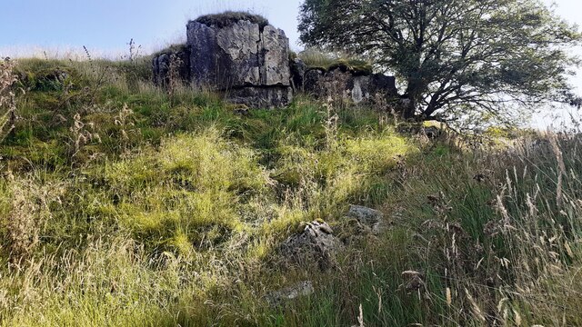
Rising to an elevation of approximately 500 meters, Goodham Gill Rigg is characterized by its rolling green slopes and craggy cliffs. The hill is covered in lush vegetation, with patches of heather and bracken dotting the landscape. The rugged terrain is a testament to the region's geological history, displaying evidence of ancient rock formations and geological processes.
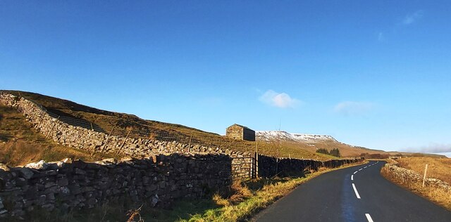
The hill is crisscrossed by several footpaths, including the famous Pennine Way, which passes through the area. These trails provide visitors with opportunities to explore the surroundings and enjoy the stunning vistas that stretch as far as the eye can see. On a clear day, one can spot the distant peaks of the Yorkshire Dales and even catch a glimpse of the nearby Lake District.
Wildlife is abundant on Goodham Gill Rigg, with various bird species, including peregrine falcons and curlews, making their homes in the area. Small mammals like rabbits and hares can also be spotted, as well as occasional sightings of larger animals such as deer.
Whether it's a leisurely walk, a challenging hike, or simply soaking in the beauty of the natural surroundings, Goodham Gill Rigg is a must-visit destination for outdoor enthusiasts. Its stunning landscapes and diverse wildlife make it an ideal spot for those seeking a connection with nature in the heart of Yorkshire.
If you have any feedback on the listing, please let us know in the comments section below.
Goodham Gill Rigg Images
Images are sourced within 2km of 54.352085/-2.3515825 or Grid Reference SD7795. Thanks to Geograph Open Source API. All images are credited.


Goodham Gill Rigg is located at Grid Ref: SD7795 (Lat: 54.352085, Lng: -2.3515825)
Division: North Riding
Administrative County: North Yorkshire
District: Richmondshire
Police Authority: North Yorkshire
What 3 Words
///guarding.comply.witty. Near Sedbergh, Cumbria
Nearby Locations
Related Wikis

Aisgill
Aisgill is the southernmost of the hamlets that form the parish of Mallerstang in the English county of Cumbria. It is on the B6259 road, at the head of...

1913 Ais Gill rail accident
The Ais Gill rail accident occurred on the Settle–Carlisle line in Northwest England on 2 September 1913. Two long trains were both ascending a steep gradient...

Eden Sike Cave
Eden Sike Cave is a small cave in Mallerstang in the Eden valley in Cumbria, England 400 metres (440 yd) north of Hell Gill. The entrance is 391 metres...

Grisedale
Grisedale (sometimes Grisdale, or Grizedale [archaic]) is a south east facing Dale in Cumbria, England, 8 miles (13 km) east of Sedbergh, and 7 miles...
Nearby Amenities
Located within 500m of 54.352085,-2.3515825Have you been to Goodham Gill Rigg?
Leave your review of Goodham Gill Rigg below (or comments, questions and feedback).