Jubilee Hill

Hill, Mountain in Herefordshire

England

Jubilee Hill

Walkers on Pinnacle Hill Walkers on Pinnacle Hill viewed from Black Hill.
Walkers on Pinnacle Hill Credit: Philip Halling

Jubilee Hill is a prominent hill located in the beautiful county of Herefordshire, England. It is situated near the village of Much Marcle, approximately 8 miles southwest of the city of Hereford. Rising to an elevation of 256 meters (840 feet), Jubilee Hill is classified as a hill rather than a mountain due to its height.

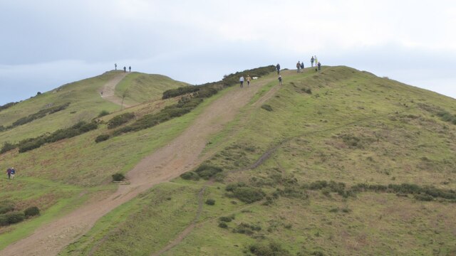
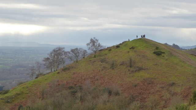
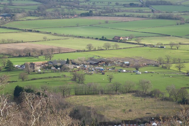
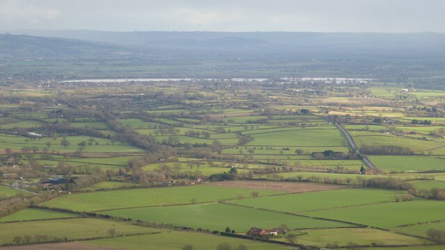
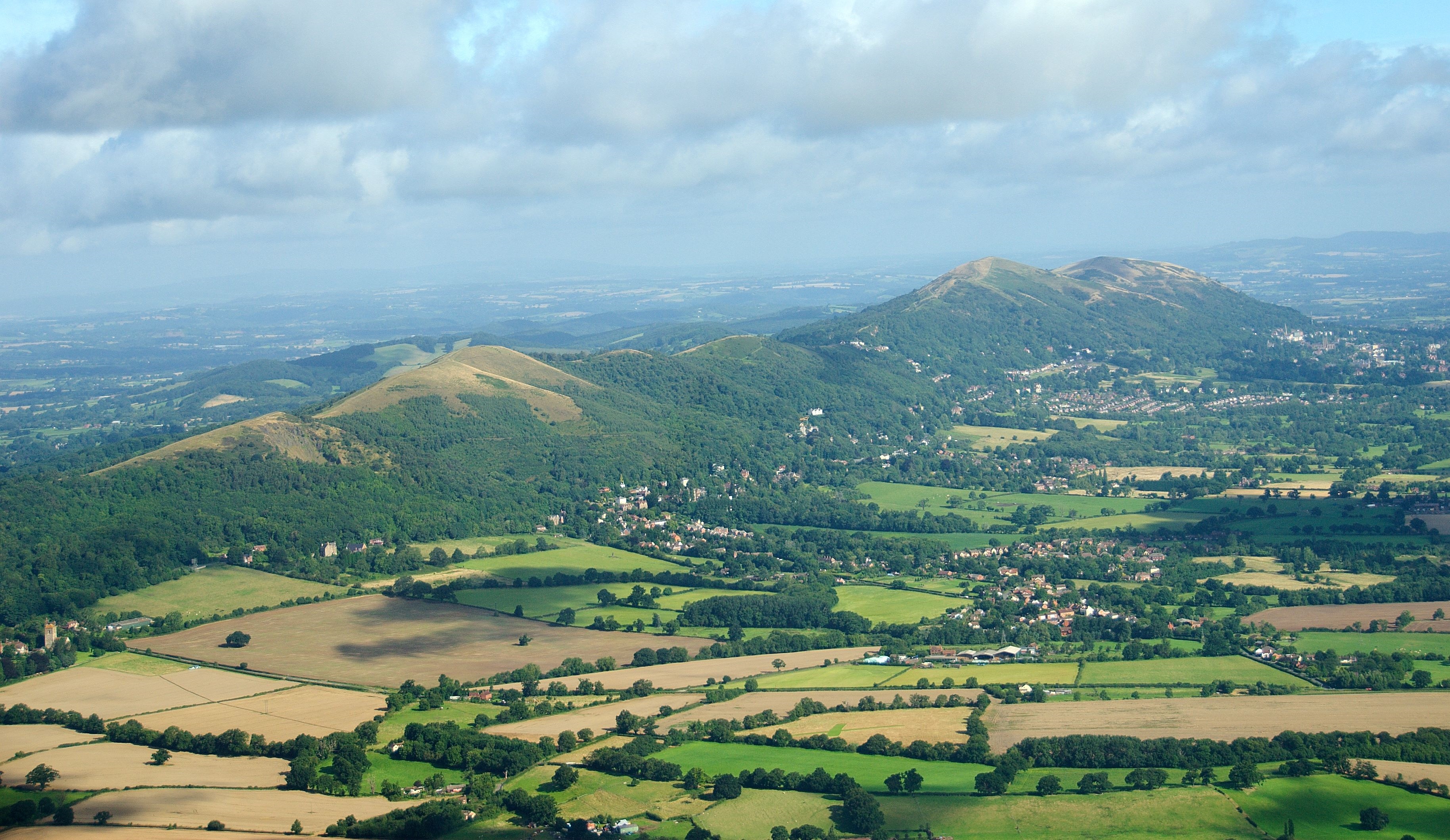
The hill is renowned for its breathtaking panoramic views of the surrounding countryside, offering visitors a stunning vista of rolling green hills, picturesque farmland, and charming rural villages. On a clear day, one can even catch a glimpse of the majestic Malvern Hills in the distance.

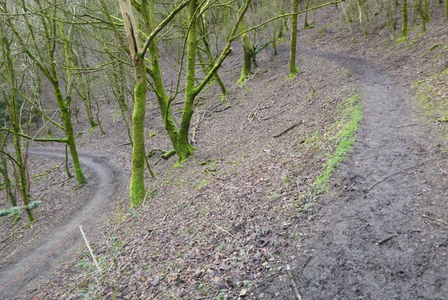
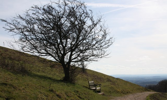
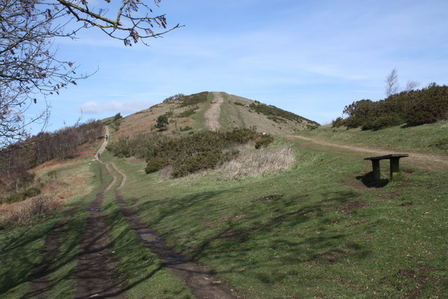
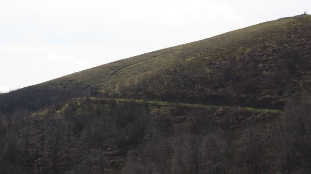
Jubilee Hill is a popular destination for outdoor enthusiasts, offering a range of activities such as hiking, walking, and nature exploration. Several well-maintained footpaths and trails traverse the hill, allowing visitors to immerse themselves in the tranquility of the Herefordshire countryside. The hill is also home to a diverse array of flora and fauna, making it an ideal spot for wildlife enthusiasts and nature photographers.

At the summit of Jubilee Hill, there is a small stone monument that commemorates Queen Victoria's Golden Jubilee in 1887. The monument serves as a reminder of the hill's historical significance and adds an additional point of interest for visitors.

Overall, Jubilee Hill is a hidden gem in Herefordshire, offering visitors a chance to escape the hustle and bustle of everyday life and immerse themselves in the natural beauty of the English countryside.

If you have any feedback on the listing, please let us know in the comments section below.
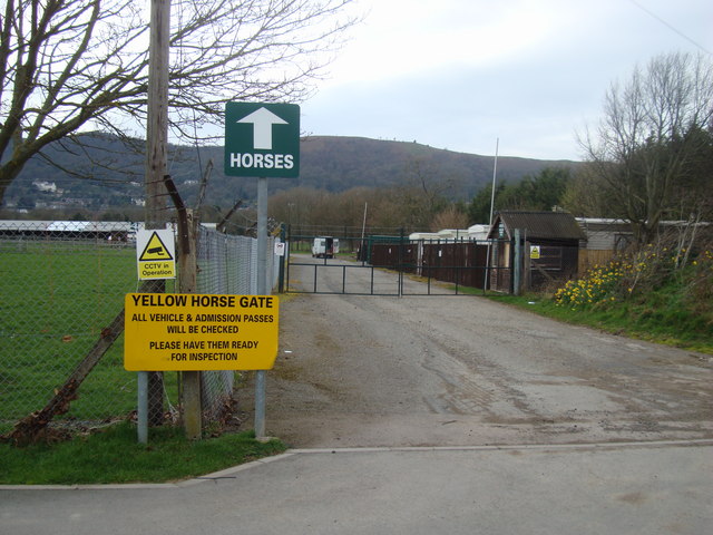
Jubilee Hill Images

Images are sourced within 2km of 52.080325/-2.3385966 or Grid Reference SO7642. Thanks to Geograph Open Source API. All images are credited.

Walkers on Pinnacle Hill Walkers on Pinnacle Hill viewed from Black Hill.
Walkers on Pinnacle Hill
Walkers on Pinnacle Hill viewed from Black Hill.
Black Hill Walkers on Black Hill in the Malvern Hills.
Black Hill
Walkers on Black Hill in the Malvern Hills.
Path on Perseverance Hill  Path in woodland on the eastern slopes of Perseverance Hill.
Path on Perseverance Hill
Path in woodland on the eastern slopes of Perseverance Hill.
Brickbarns Farm Brickbarns Farm viewed from the Malvern Hills.
Brickbarns Farm
Brickbarns Farm viewed from the Malvern Hills.
View to the flooded River Severn View to the flooded River Severn to the south of Upton upon Severn.  Viewed here from Pinnacle Hill in the Malvern Hills, to the right the road to Upper Hook and Upton can be seen, while to the left the line of trees indicate the route of the former Malvern to Ashchurch railway line.
View to the flooded River Severn
View to the flooded River Severn to the south of Upton upon Severn. Viewed here from Pinnacle Hill in the Malvern Hills, to the right the road to Upper Hook and Upton can be seen, while to the left the line of trees indicate the route of the former Malvern to Ashchurch railway line.
Harper bench on Black Hill The seat is inscribed:
"In memory of Roy William Harper 1912-1973"
Just one of the many memorial seats paid for by friends and relatives, but installed by the Malvern Hills Conservators who maintain the hills for us all.
This seat provides wonderful views of Herefordshire Beacon, Herefordshire and the distant, blue hills of Wales.
Harper bench on Black Hill
The seat is inscribed: "In memory of Roy William Harper 1912-1973" Just one of the many memorial seats paid for by friends and relatives, but installed by the Malvern Hills Conservators who maintain the hills for us all. This seat provides wonderful views of Herefordshire Beacon, Herefordshire and the distant, blue hills of Wales.
Pinnacle Hill from the south A choice of paths.
The left hand path takes one around the west side of the hill to "Thirds Land" and Jubilee Hill.
The alternative is to follow the ridge path to the two peaks of Pinnacle Hill and see the bronze-age tumuli.
In the foreground is one of the simple bench seats installed by the Malvern Hills Conservators.
Pinnacle Hill from the south
A choice of paths. The left hand path takes one around the west side of the hill to "Thirds Land" and Jubilee Hill. The alternative is to follow the ridge path to the two peaks of Pinnacle Hill and see the bronze-age tumuli. In the foreground is one of the simple bench seats installed by the Malvern Hills Conservators.
Path around Pinnacle Hill This fairly level path climbs gently to the ridge path.
Path around Pinnacle Hill
This fairly level path climbs gently to the ridge path.
Jubilee Hill A small, but distinct peak on the Malvern ridge.
It was one of the un-named peaks until Queen Elizabeth's golden jubilee in 2002.
Her son Prince Andrew walked to the top of the hill (which was adorned with a flagpole flying the union flag for the one day only) to name it.
Jubilee Hill
A small, but distinct peak on the Malvern ridge. It was one of the un-named peaks until Queen Elizabeth's golden jubilee in 2002. Her son Prince Andrew walked to the top of the hill (which was adorned with a flagpole flying the union flag for the one day only) to name it.
Pinnacle Hill Taken from the larch trees of Thirds Land by Jubilee Hill.
Pinnacle Hill
Taken from the larch trees of Thirds Land by Jubilee Hill.
Larch buds at Thirds Land Close to Jubilee Hill. 
The flowering buds will form into cones as the seasons pass.
The land got the name "Thirds Land" as it was part of the Malvern Chase common handed to King Charles II as compensation for the disafforestation of the Chase.
Larch buds at Thirds Land
Close to Jubilee Hill. The flowering buds will form into cones as the seasons pass. The land got the name "Thirds Land" as it was part of the Malvern Chase common handed to King Charles II as compensation for the disafforestation of the Chase.
Severn Hall, End Elevation The southern elevation of the Severn Hall at the Three Counties Showground with cafe and cash machine room
Severn Hall, End Elevation
The southern elevation of the Severn Hall at the Three Counties Showground with cafe and cash machine room
Yellow Horse Gate, Three Counties Showground The approach road and gate known as the 'Yellow Horse Gate' at the Three Counties Showground, Malvern. The colour refers to the shade of ticket rather than an equestrian breed!
Yellow Horse Gate, Three Counties Showground
The approach road and gate known as the 'Yellow Horse Gate' at the Three Counties Showground, Malvern. The colour refers to the shade of ticket rather than an equestrian breed!
Equestrian Paddock and Associated Buildings, Three Counties Showground The paddock areas used for horse events and other animal showing activities at the Three Counties Showground. The Malvern Hills are to be seen behind the buildings which accompany the paddocks
Equestrian Paddock and Associated Buildings, Three Counties Showground
The paddock areas used for horse events and other animal showing activities at the Three Counties Showground. The Malvern Hills are to be seen behind the buildings which accompany the paddocks
Vehicular Admission Gate, Three Counties Showground An approach road and admission gate for vehicles at the Three Counties Showground. The field car parks are to the left and the equestrian paddocks are to the right.
Vehicular Admission Gate, Three Counties Showground
An approach road and admission gate for vehicles at the Three Counties Showground. The field car parks are to the left and the equestrian paddocks are to the right.
The Wells Road near Ashdown Villa Looking in a southerly direction towards Little Malvern.
This stretch of the road is still lit by gas lamps.
On the right is the "Gothic Well" - not open to the public.
<span class="nowrap"><a title="http://www.malvern-hills.co.uk/malvernspa/well-info/gothic.html" rel="nofollow ugc noopener" href="http://www.malvern-hills.co.uk/malvernspa/well-info/gothic.html">Link</a><img style="margin-left:2px;" alt="External link" title="External link - shift click to open in new window" src="https://s1.geograph.org.uk/img/external.png" width="10" height="10"/></span>
The Wells Road near Ashdown Villa
Looking in a southerly direction towards Little Malvern. This stretch of the road is still lit by gas lamps. On the right is the "Gothic Well" - not open to the public. LinkExternal link
The Wells Road below Hanley Terrace Looking in a northerly direction towards Great Malvern.
The houses are on Hanley Terrace high above the main road.
On the left, built into the hillside, is the "Gothic Well".
<span class="nowrap"><a title="http://www.malvern-hills.co.uk/malvernspa/well-info/gothic.html" rel="nofollow ugc noopener" href="http://www.malvern-hills.co.uk/malvernspa/well-info/gothic.html">Link</a><img style="margin-left:2px;" alt="External link" title="External link - shift click to open in new window" src="https://s1.geograph.org.uk/img/external.png" width="10" height="10"/></span>
The Wells Road below Hanley Terrace
Looking in a northerly direction towards Great Malvern. The houses are on Hanley Terrace high above the main road. On the left, built into the hillside, is the "Gothic Well". LinkExternal link
The Gothic Well on Wells Road, Malvern An old wooden green door stood under the central arch until recently, but this has now been bricked up.
This gave access to a chamber going 30 feet into the hillside to the well which supplied 30,000 gallons of water per day. 
During the war the chamber was used as an air raid shelter. 
<span class="nowrap"><a title="http://www.malvern-hills.co.uk/malvernspa/well-info/gothic.html" rel="nofollow ugc noopener" href="http://www.malvern-hills.co.uk/malvernspa/well-info/gothic.html">Link</a><img style="margin-left:2px;" alt="External link" title="External link - shift click to open in new window" src="https://s1.geograph.org.uk/img/external.png" width="10" height="10"/></span>
The Gothic Well on Wells Road, Malvern
An old wooden green door stood under the central arch until recently, but this has now been bricked up. This gave access to a chamber going 30 feet into the hillside to the well which supplied 30,000 gallons of water per day. During the war the chamber was used as an air raid shelter. LinkExternal link
Show me another place!

Jubilee Hill is located at Grid Ref: SO7642 (Lat: 52.080325, Lng: -2.3385966)

Unitary Authority: County of Herefordshire

Police Authority: West Mercia

What 3 Words

///placidly.direction.rationed. Near Great Malvern, Worcestershire

Related Wikis

Jubilee Hill

Jubilee Hill is situated in the range of Malvern Hills that runs about 13 kilometres (8 mi) north-south along the Herefordshire-Worcestershire border....

Holy Well, Malvern

The Holy Well is set on the slopes of the Malvern Hills above Malvern Wells. The well is believed to be the site of the oldest bottling plant in the...

Pinnacle Hill

Pinnacle Hill is situated in the range of Malvern Hills in England, running about 13 kilometres (8 mi) north-south along the Herefordshire-Worcestershire...

Malvern Wells

Malvern Wells is a village and civil parish south of Great Malvern in the Malvern Hills district of Worcestershire, England. The parish, once known as...

Malvern Hills

The Malvern Hills are in the English counties of Worcestershire, Herefordshire and a small area of northern Gloucestershire, dominating the surrounding...

Colwall Tunnels

The Colwall Tunnels are a pair of railway tunnels that connect Colwall and Malvern Wells on the Cotswold Line, passing under the Malvern Hills in the Welsh...

Abbey College, Malvern

Abbey College in Malvern, Worcestershire, England, is a small boarding school providing secondary education to a diverse and international student body...

The Downs Malvern

The Downs Malvern is a private prep school in the United Kingdom, founded in 1900. It is located on a 55-acre (22 ha) site in Colwall in the County of...

Nearby Amenities

Located within 500m of 52.080325,-2.3385966
Jubilee Hill
Natural: peak
Wikidata: Q6301863
Wikipedia: en:Jubilee Hill
Lat/Long: 52.080385/-2.3386584
Barrier: cattle_grid
Lat/Long: 52.0800338/-2.3343159
Barrier: stile
Lat/Long: 52.0789718/-2.3333462
Turning Circle
Lat/Long: 52.0787864/-2.331753
Bus Stop
Hanley Road
Bus: yes
Naptan AtcoCode: 2000G500829
Naptan Bearing: N
Naptan CommonName: Hanley Road
Naptan Crossing: Hanley Road
Naptan Indicator: opp
Naptan NaptanCode: wocdmjmd
Naptan PlusbusZoneRef: GTMLVRN
Naptan Street: Wells Road
Naptan Verified: no
Public Transport: platform
Source: naptan_import
Lat/Long: 52.0817276/-2.332475
Bus Stop
Hanley Road
Bus: yes
Naptan AtcoCode: 2000G500830
Naptan Bearing: S
Naptan CommonName: Hanley Road
Naptan Crossing: Hanley Road
Naptan Indicator: adj
Naptan NaptanCode: wocdmjmg
Naptan PlusbusZoneRef: GTMLVRN
Naptan Street: Wells Road
Naptan Verified: no
Public Transport: platform
Source: naptan_import
Lat/Long: 52.0813238/-2.3322239
Bus Stop
Green Lane
Bus: yes
Naptan AtcoCode: 2000G500832
Naptan Bearing: N
Naptan CommonName: Green Lane
Naptan Indicator: Opp
Naptan Landmark: Green Lane
Naptan NaptanCode: wocdmjmj
Naptan PlusbusZoneRef: GTMLVRN
Naptan Street: Wells Road
Naptan Verified: no
Public Transport: platform
Source: naptan_import
Lat/Long: 52.0778616/-2.3324755
Post Box
Collection Plate: nocode
Collection Times: Mo-Fr 11:30,17:30; Sa 01:30
Description: At North end of terrace of houses/shops
Fixme: Collection Plate says Saturday 1.30 _A_ M ! This is probably not right
Historic Operator: Post Office
Old Ref: M069 Malvern Wells P.O.
Post Box Type: lamp
Ref: WR14 69
Royal Cypher: EIIR
Royal Cypher Wikidata: Q33102113
Lat/Long: 52.0792216/-2.3322885
Fixme: Very approx location.
Fixme2: There seems to be an other War Memorial just up the hill.
Historic: memorial
Memorial: war_memorial
Lat/Long: 52.0793407/-2.3324628
Drinking Water
Holy Well
Wikidata: Q15224742
Wikipedia: en:Holy Well, Malvern
Lat/Long: 52.0789014/-2.3365707
Eye Well
Natural: spring
Lat/Long: 52.0789312/-2.3382698
Pinnacle Hill
Ele: 358
Natural: peak
Wikidata: Q7196300
Wikipedia: en:Pinnacle Hill
Lat/Long: 52.0768438/-2.3401286
Jubllee Fountain
Inscription: Victoria/Laus Deo/1887/Fiftieth Year of Her majesty's Reign
Man Made: water_tap
Lat/Long: 52.0786122/-2.3322534
Inscription: This plaque unveiled by Prince Andrew in 2002 to commemorate the naming of the hill in honour of the golden jubilee of Queen Elizabeth II
Memorial: plaque
Lat/Long: 52.0803971/-2.3387536
Bench
Backrest: no
Capacity: 2
Material: wood
Lat/Long: 52.0821009/-2.3388062
Bench
Lat/Long: 52.0770923/-2.3429302
Bench
Lat/Long: 52.0777574/-2.3427341
Bench
Lat/Long: 52.0785252/-2.3422459
The data included in this document is from www.openstreetmap.org. The data is made available under ODbL.

Have you been to Jubilee Hill?

Leave your review of Jubilee Hill below (or comments, questions and feedback).