Thirds Land

Wood, Forest in Herefordshire

England

Thirds Land

Walkers on Pinnacle Hill Walkers on Pinnacle Hill viewed from Black Hill.
Walkers on Pinnacle Hill Credit: Philip Halling

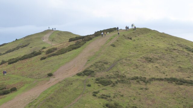
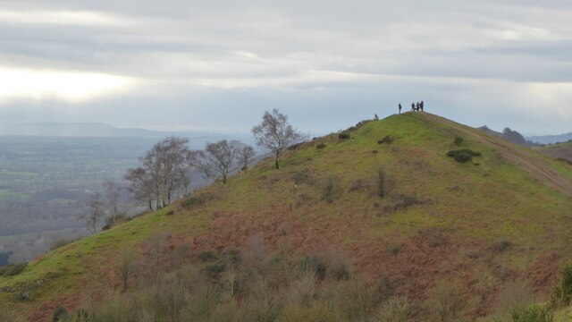
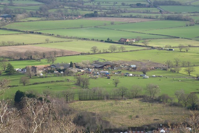
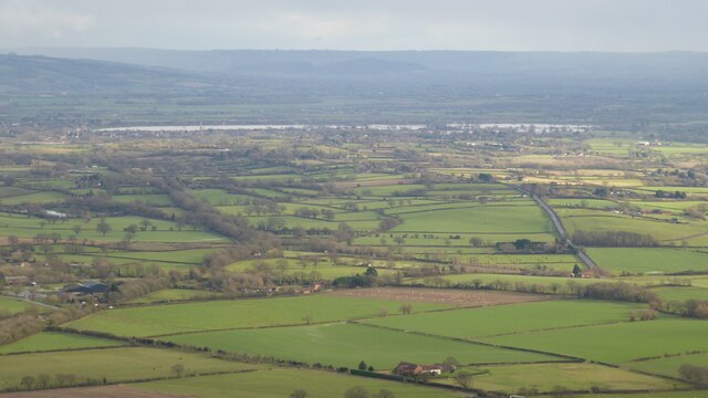
Thirds Land is a picturesque woodland area located in Herefordshire, England. Situated in the heart of the county, it is a natural haven that offers visitors a tranquil escape from urban life. This enchanting forest covers an area of approximately 100 acres, providing ample space for nature enthusiasts to explore and immerse themselves in the beauty of the surrounding landscape.

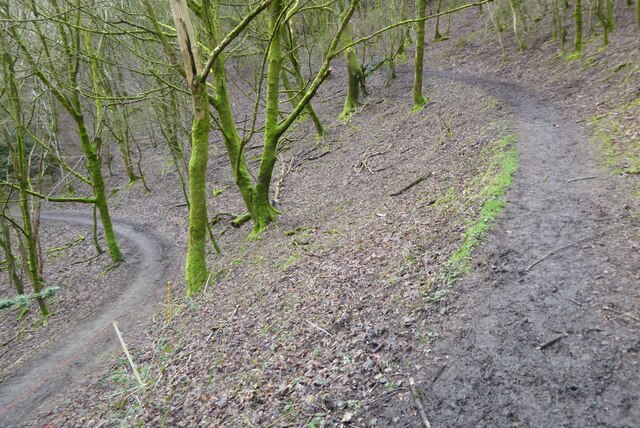
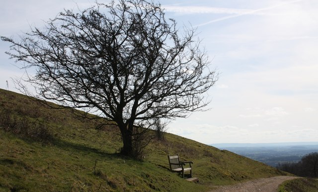
The dense woodland of Thirds Land boasts a diverse range of tree species, including oak, beech, and birch, creating a rich and vibrant tapestry of colors throughout the seasons. The forest floor is adorned with a myriad of wildflowers, adding to the area's natural charm. The wood is crisscrossed by meandering footpaths, allowing visitors to navigate easily and discover hidden gems within the forest.

Thirds Land is a haven for wildlife, providing a sanctuary for various species. Birdwatchers will delight in the opportunity to spot a wide array of birdlife, including woodpeckers, owls, and various songbirds. The forest is also home to mammals such as deer, foxes, and badgers, which can occasionally be spotted during dawn or dusk.

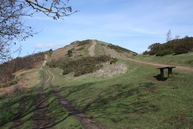
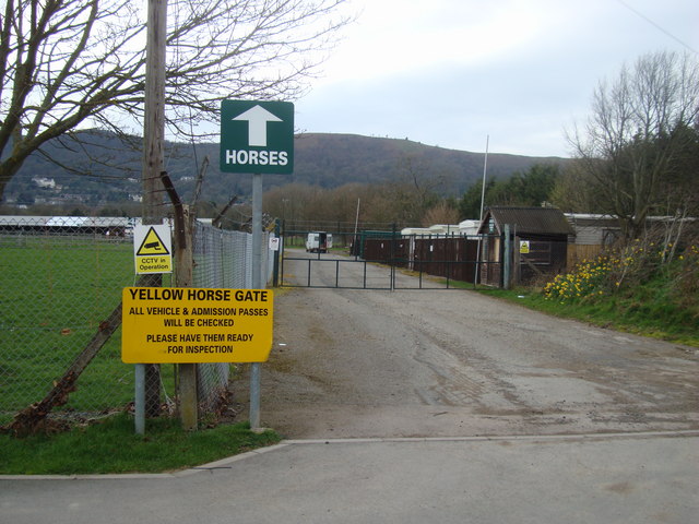
In addition to its natural beauty, Thirds Land also offers recreational activities for visitors. The forest is a popular destination for hiking, cycling, and horseback riding, with designated trails catering to different skill levels. There are also picnic areas scattered throughout the wood, providing the perfect opportunity for visitors to relax and enjoy a meal amidst the serene surroundings.

Overall, Thirds Land in Herefordshire is a true gem, offering a captivating blend of natural beauty, wildlife, and recreational opportunities. It is a place that invites visitors to reconnect with nature and experience the tranquility of a woodland retreat.

If you have any feedback on the listing, please let us know in the comments section below.

Thirds Land Images

Images are sourced within 2km of 52.079843/-2.3405921 or Grid Reference SO7642. Thanks to Geograph Open Source API. All images are credited.

Walkers on Pinnacle Hill Walkers on Pinnacle Hill viewed from Black Hill.
Walkers on Pinnacle Hill
Walkers on Pinnacle Hill viewed from Black Hill.
Black Hill Walkers on Black Hill in the Malvern Hills.
Black Hill
Walkers on Black Hill in the Malvern Hills.
Path on Perseverance Hill  Path in woodland on the eastern slopes of Perseverance Hill.
Path on Perseverance Hill
Path in woodland on the eastern slopes of Perseverance Hill.
Brickbarns Farm Brickbarns Farm viewed from the Malvern Hills.
Brickbarns Farm
Brickbarns Farm viewed from the Malvern Hills.
View to the flooded River Severn View to the flooded River Severn to the south of Upton upon Severn.  Viewed here from Pinnacle Hill in the Malvern Hills, to the right the road to Upper Hook and Upton can be seen, while to the left the line of trees indicate the route of the former Malvern to Ashchurch railway line.
View to the flooded River Severn
View to the flooded River Severn to the south of Upton upon Severn. Viewed here from Pinnacle Hill in the Malvern Hills, to the right the road to Upper Hook and Upton can be seen, while to the left the line of trees indicate the route of the former Malvern to Ashchurch railway line.
Harper bench on Black Hill The seat is inscribed:
"In memory of Roy William Harper 1912-1973"
Just one of the many memorial seats paid for by friends and relatives, but installed by the Malvern Hills Conservators who maintain the hills for us all.
This seat provides wonderful views of Herefordshire Beacon, Herefordshire and the distant, blue hills of Wales.
Harper bench on Black Hill
The seat is inscribed: "In memory of Roy William Harper 1912-1973" Just one of the many memorial seats paid for by friends and relatives, but installed by the Malvern Hills Conservators who maintain the hills for us all. This seat provides wonderful views of Herefordshire Beacon, Herefordshire and the distant, blue hills of Wales.
Pinnacle Hill from the south A choice of paths.
The left hand path takes one around the west side of the hill to "Thirds Land" and Jubilee Hill.
The alternative is to follow the ridge path to the two peaks of Pinnacle Hill and see the bronze-age tumuli.
In the foreground is one of the simple bench seats installed by the Malvern Hills Conservators.
Pinnacle Hill from the south
A choice of paths. The left hand path takes one around the west side of the hill to "Thirds Land" and Jubilee Hill. The alternative is to follow the ridge path to the two peaks of Pinnacle Hill and see the bronze-age tumuli. In the foreground is one of the simple bench seats installed by the Malvern Hills Conservators.
Path around Pinnacle Hill This fairly level path climbs gently to the ridge path.
Path around Pinnacle Hill
This fairly level path climbs gently to the ridge path.
Jubilee Hill A small, but distinct peak on the Malvern ridge.
It was one of the un-named peaks until Queen Elizabeth's golden jubilee in 2002.
Her son Prince Andrew walked to the top of the hill (which was adorned with a flagpole flying the union flag for the one day only) to name it.
Jubilee Hill
A small, but distinct peak on the Malvern ridge. It was one of the un-named peaks until Queen Elizabeth's golden jubilee in 2002. Her son Prince Andrew walked to the top of the hill (which was adorned with a flagpole flying the union flag for the one day only) to name it.
Pinnacle Hill Taken from the larch trees of Thirds Land by Jubilee Hill.
Pinnacle Hill
Taken from the larch trees of Thirds Land by Jubilee Hill.
Larch buds at Thirds Land Close to Jubilee Hill. 
The flowering buds will form into cones as the seasons pass.
The land got the name "Thirds Land" as it was part of the Malvern Chase common handed to King Charles II as compensation for the disafforestation of the Chase.
Larch buds at Thirds Land
Close to Jubilee Hill. The flowering buds will form into cones as the seasons pass. The land got the name "Thirds Land" as it was part of the Malvern Chase common handed to King Charles II as compensation for the disafforestation of the Chase.
Severn Hall, End Elevation The southern elevation of the Severn Hall at the Three Counties Showground with cafe and cash machine room
Severn Hall, End Elevation
The southern elevation of the Severn Hall at the Three Counties Showground with cafe and cash machine room
Yellow Horse Gate, Three Counties Showground The approach road and gate known as the 'Yellow Horse Gate' at the Three Counties Showground, Malvern. The colour refers to the shade of ticket rather than an equestrian breed!
Yellow Horse Gate, Three Counties Showground
The approach road and gate known as the 'Yellow Horse Gate' at the Three Counties Showground, Malvern. The colour refers to the shade of ticket rather than an equestrian breed!
Equestrian Paddock and Associated Buildings, Three Counties Showground The paddock areas used for horse events and other animal showing activities at the Three Counties Showground. The Malvern Hills are to be seen behind the buildings which accompany the paddocks
Equestrian Paddock and Associated Buildings, Three Counties Showground
The paddock areas used for horse events and other animal showing activities at the Three Counties Showground. The Malvern Hills are to be seen behind the buildings which accompany the paddocks
Vehicular Admission Gate, Three Counties Showground An approach road and admission gate for vehicles at the Three Counties Showground. The field car parks are to the left and the equestrian paddocks are to the right.
Vehicular Admission Gate, Three Counties Showground
An approach road and admission gate for vehicles at the Three Counties Showground. The field car parks are to the left and the equestrian paddocks are to the right.
The Wells Road near Ashdown Villa Looking in a southerly direction towards Little Malvern.
This stretch of the road is still lit by gas lamps.
On the right is the "Gothic Well" - not open to the public.
<span class="nowrap"><a title="http://www.malvern-hills.co.uk/malvernspa/well-info/gothic.html" rel="nofollow ugc noopener" href="http://www.malvern-hills.co.uk/malvernspa/well-info/gothic.html">Link</a><img style="margin-left:2px;" alt="External link" title="External link - shift click to open in new window" src="https://s1.geograph.org.uk/img/external.png" width="10" height="10"/></span>
The Wells Road near Ashdown Villa
Looking in a southerly direction towards Little Malvern. This stretch of the road is still lit by gas lamps. On the right is the "Gothic Well" - not open to the public. LinkExternal link
The Wells Road below Hanley Terrace Looking in a northerly direction towards Great Malvern.
The houses are on Hanley Terrace high above the main road.
On the left, built into the hillside, is the "Gothic Well".
<span class="nowrap"><a title="http://www.malvern-hills.co.uk/malvernspa/well-info/gothic.html" rel="nofollow ugc noopener" href="http://www.malvern-hills.co.uk/malvernspa/well-info/gothic.html">Link</a><img style="margin-left:2px;" alt="External link" title="External link - shift click to open in new window" src="https://s1.geograph.org.uk/img/external.png" width="10" height="10"/></span>
The Wells Road below Hanley Terrace
Looking in a northerly direction towards Great Malvern. The houses are on Hanley Terrace high above the main road. On the left, built into the hillside, is the "Gothic Well". LinkExternal link
The Gothic Well on Wells Road, Malvern An old wooden green door stood under the central arch until recently, but this has now been bricked up.
This gave access to a chamber going 30 feet into the hillside to the well which supplied 30,000 gallons of water per day. 
During the war the chamber was used as an air raid shelter. 
<span class="nowrap"><a title="http://www.malvern-hills.co.uk/malvernspa/well-info/gothic.html" rel="nofollow ugc noopener" href="http://www.malvern-hills.co.uk/malvernspa/well-info/gothic.html">Link</a><img style="margin-left:2px;" alt="External link" title="External link - shift click to open in new window" src="https://s1.geograph.org.uk/img/external.png" width="10" height="10"/></span>
The Gothic Well on Wells Road, Malvern
An old wooden green door stood under the central arch until recently, but this has now been bricked up. This gave access to a chamber going 30 feet into the hillside to the well which supplied 30,000 gallons of water per day. During the war the chamber was used as an air raid shelter. LinkExternal link
Show me another place!

Thirds Land is located at Grid Ref: SO7642 (Lat: 52.079843, Lng: -2.3405921)

Unitary Authority: County of Herefordshire

Police Authority: West Mercia

What 3 Words

///toasted.retain.powering. Near Great Malvern, Worcestershire

Related Wikis

Jubilee Hill

Jubilee Hill is situated in the range of Malvern Hills that runs about 13 kilometres (8 mi) north-south along the Herefordshire-Worcestershire border....

Holy Well, Malvern

The Holy Well is set on the slopes of the Malvern Hills above Malvern Wells. The well is believed to be the site of the oldest bottling plant in the...

Pinnacle Hill

Pinnacle Hill is situated in the range of Malvern Hills in England, running about 13 kilometres (8 mi) north-south along the Herefordshire-Worcestershire...

Malvern Wells

Malvern Wells is a village and civil parish south of Great Malvern in the Malvern Hills district of Worcestershire, England. The parish, once known as...
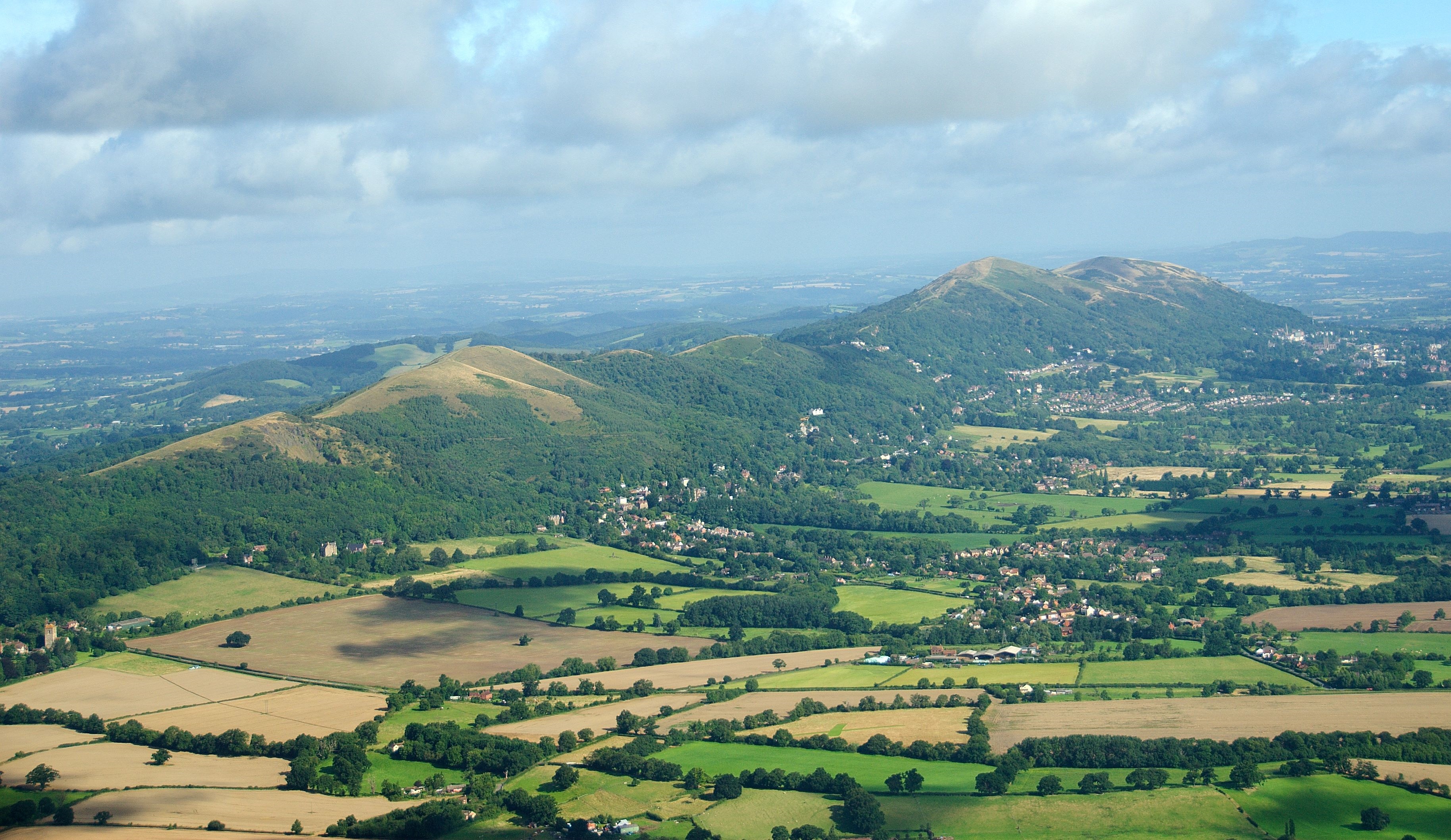
Malvern Hills

The Malvern Hills are in the English counties of Worcestershire, Herefordshire and a small area of northern Gloucestershire, dominating the surrounding...

Colwall Tunnels

The Colwall Tunnels are a pair of railway tunnels that connect Colwall and Malvern Wells on the Cotswold Line, passing under the Malvern Hills in the Welsh...

Abbey College, Malvern

Abbey College in Malvern, Worcestershire, England, is a small boarding school providing secondary education to a diverse and international student body...

Colwall railway station

Colwall railway station is a railway station on the Cotswold Line serving the village of Colwall in Herefordshire, England. The station has one platform...

Nearby Amenities

Located within 500m of 52.079843,-2.3405921
Jubilee Hill
Natural: peak
Wikidata: Q6301863
Wikipedia: en:Jubilee Hill
Lat/Long: 52.080385/-2.3386584
Barrier: cattle_grid
Lat/Long: 52.0800338/-2.3343159
Drinking Water
Holy Well
Wikidata: Q15224742
Wikipedia: en:Holy Well, Malvern
Lat/Long: 52.0789014/-2.3365707
Cafe
Kettle Sings
Lat/Long: 52.0767851/-2.3447842
Eye Well
Natural: spring
Lat/Long: 52.0789312/-2.3382698
Barrier: stile
Foot: yes
Lat/Long: 52.0804974/-2.3475708
Barrier: stile
Foot: yes
Lat/Long: 52.0839635/-2.3430575
Bench
Lat/Long: 52.0756175/-2.3415519
Bench
Lat/Long: 52.0759208/-2.3425416
Pinnacle Hill
Ele: 358
Natural: peak
Wikidata: Q7196300
Wikipedia: en:Pinnacle Hill
Lat/Long: 52.0768438/-2.3401286
Inscription: This plaque unveiled by Prince Andrew in 2002 to commemorate the naming of the hill in honour of the golden jubilee of Queen Elizabeth II
Memorial: plaque
Lat/Long: 52.0803971/-2.3387536
Bench
Backrest: no
Capacity: 2
Material: wood
Lat/Long: 52.0821009/-2.3388062
Bench
Lat/Long: 52.0770923/-2.3429302
Bench
Lat/Long: 52.0777574/-2.3427341
Bench
Lat/Long: 52.0785252/-2.3422459
The data included in this document is from www.openstreetmap.org. The data is made available under ODbL.

Have you been to Thirds Land?

Leave your review of Thirds Land below (or comments, questions and feedback).