Gillie Hill

Hill, Mountain in Northumberland

England

Gillie Hill

Forest track and bridge near Poplin Knowe
Forest track and bridge near Poplin Knowe Credit: Sandy Gerrard

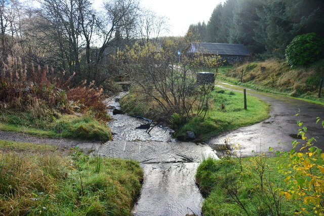
Gillie Hill is a prominent hill located in the county of Northumberland, England. Situated in the northeastern part of the country, it forms part of the beautiful Northumberland National Park. Rising to an elevation of approximately 345 meters (1,132 feet) above sea level, Gillie Hill offers breathtaking panoramic views of the surrounding countryside.

The hill is characterized by its verdant slopes, covered in lush grasses and scattered with wildflowers during the warmer months. It is home to a diverse range of flora and fauna, including various species of birds, small mammals, and insects. The hill's rich biodiversity attracts nature enthusiasts and birdwatchers, who can often spot rare and elusive species in the area.

Gillie Hill is a popular destination for outdoor activities such as hiking and walking. Its well-defined trails and footpaths allow visitors to explore the hill and its surroundings, providing opportunities for both challenging hikes and leisurely strolls. The hill's summit offers the most stunning views, with vast expanses of rolling countryside, distant valleys, and the occasional glimpse of neighboring hills in the distance.

The hill is easily accessible, with nearby parking facilities and public transportation options available. It is a place of tranquility and natural beauty, providing visitors with a peaceful retreat away from the hustle and bustle of urban life. Gillie Hill is a must-visit location for those seeking to experience the natural wonders of Northumberland and take in the awe-inspiring landscapes it has to offer.

If you have any feedback on the listing, please let us know in the comments section below.

Gillie Hill Images

Images are sourced within 2km of 55.212783/-2.3655615 or Grid Reference NY7691. Thanks to Geograph Open Source API. All images are credited.

Forest track and bridge near Poplin Knowe
Shilla Hill Bastle Now somewhat overgrown <span class="nowrap"><a title="https://historicengland.org.uk/listing/the-list/list-entry/1008991" rel="nofollow ugc noopener" href="https://historicengland.org.uk/listing/the-list/list-entry/1008991">Link</a><img style="margin-left:2px;" alt="External link" title="External link - shift click to open in new window" src="https://s1.geograph.org.uk/img/external.png" width="10" height="10"/></span>
Shilla Hill Bastle
Now somewhat overgrown LinkExternal link
Post-medieval farmstead at Boghead
Boghead Bastle
Boghead Bastle
Northern Bastle at Black Middens Only the lower courses of this bastle survive.
Northern Bastle at Black Middens
Only the lower courses of this bastle survive.
Ford at Waterhead This ford on the Tarset Burn is found at Waterhead just beyond the ford at Shipley Shiels. The ford can also be seen at:
<a title="https://www.geograph.org.uk/photo/3608601" href="https://www.geograph.org.uk/photo/3608601">Link</a>
Ford at Waterhead
This ford on the Tarset Burn is found at Waterhead just beyond the ford at Shipley Shiels. The ford can also be seen at: Link
Moorland behind Black Middens Bastle House Land suitable only for sheep farming.
Moorland behind Black Middens Bastle House
Land suitable only for sheep farming.
Comb Hill from the air The wooded Comb Hill is in the foreground.
Comb Hill from the air
The wooded Comb Hill is in the foreground.
Remains of Bastle In Kielder Forest.
Remains of Bastle
In Kielder Forest.
Near Highfield Cleared area of Kileder Forest near Highfield.
Near Highfield
Cleared area of Kileder Forest near Highfield.
Highfield Burn Looking SW.
Highfield Burn
Looking SW.
Ford and Footbridge, Tarset Burn
Ford on the Tarset Burn
Cottage near Tarset Burn
Ruined Sheepfolds near Tarset Burn
Corbie Castle These are the remains of a 16th or 17th century bastle standing at the foot of a steep slope in the valley of the Tarset Burn. It is rectangular in shape and has thick stone walls. Above the doorway there is a narrow channel cut through the wall. This may have been to pour water through to put out fires lit against the door. The basement shows the remains of a vaulted roof. There are traces of two buildings to the west of the bastle. This is a Grade II Listed Building and a Scheduled Monument protected by law.
<span class="nowrap"><a title="http://www.keystothepast.info/Pages/pgDetail.aspx?PRN=N7066" rel="nofollow ugc noopener" href="http://www.keystothepast.info/Pages/pgDetail.aspx?PRN=N7066">Link</a><img style="margin-left:2px;" alt="External link" title="External link - shift click to open in new window" src="https://s1.geograph.org.uk/img/external.png" width="10" height="10"/></span>
This Bastle is referred to as Boghead Bastle in a leaflet about The Tarset Bastle Trail. I'm not certain where this reference comes from.
Corbie Castle
These are the remains of a 16th or 17th century bastle standing at the foot of a steep slope in the valley of the Tarset Burn. It is rectangular in shape and has thick stone walls. Above the doorway there is a narrow channel cut through the wall. This may have been to pour water through to put out fires lit against the door. The basement shows the remains of a vaulted roof. There are traces of two buildings to the west of the bastle. This is a Grade II Listed Building and a Scheduled Monument protected by law. LinkExternal link This Bastle is referred to as Boghead Bastle in a leaflet about The Tarset Bastle Trail. I'm not certain where this reference comes from.
Shilla Hill Bastle These are the remains of a 16th or 17th century bastle standing on the summit of Shilla Hill, overlooking the valley of the Tarset Burn. The remains of the thick walls of the bastle can still be seen. Traces of other buildings can be seen nearby. This is a Scheduled Monument protected by law.
<span class="nowrap"><a title="http://www.keystothepast.info/Pages/pgDetail.aspx?PRN=N7067" rel="nofollow ugc noopener" href="http://www.keystothepast.info/Pages/pgDetail.aspx?PRN=N7067">Link</a><img style="margin-left:2px;" alt="External link" title="External link - shift click to open in new window" src="https://s1.geograph.org.uk/img/external.png" width="10" height="10"/></span>
Shilla Hill Bastle
These are the remains of a 16th or 17th century bastle standing on the summit of Shilla Hill, overlooking the valley of the Tarset Burn. The remains of the thick walls of the bastle can still be seen. Traces of other buildings can be seen nearby. This is a Scheduled Monument protected by law. LinkExternal link
Show me another place!

Gillie Hill is located at Grid Ref: NY7691 (Lat: 55.212783, Lng: -2.3655615)

Unitary Authority: Northumberland

Police Authority: Northumbria

What 3 Words

///regard.blunders.switch. Near Rochester, Northumberland

Nearby Locations

Gillie Hill

Related Wikis

Black Middens Bastle House

Black Middens Bastle House lies about 7 miles (11 km) northwest of Bellingham, Northumberland. It is a two-storey fortified stone farmhouse from the 16th...

Thorneyburn

Thorneyburn is a village and former civil parish, now in the parish of Tarset, in Northumberland, England, to the northwest of Bellingham. In 1951 the...

Border Moors and Forests

Border Moors and Forests NCA is an upland plateau region in Northern England between the North East and North West regions, and touching the Anglo-Scottish...

Thorneyburn railway station

Thorneyburn railway station served the village of Thorneyburn, Northumberland, England from 1861 to 1956 on the Border Counties Railway. == History... ==

Have you been to Gillie Hill?

Leave your review of Gillie Hill below (or comments, questions and feedback).