Simon Fell

Hill, Mountain in Yorkshire Craven

England

Simon Fell

Looking towards Whernside from Southerscales, Ingleborough
Looking towards Whernside from Southerscales, Ingleborough Credit: habiloid

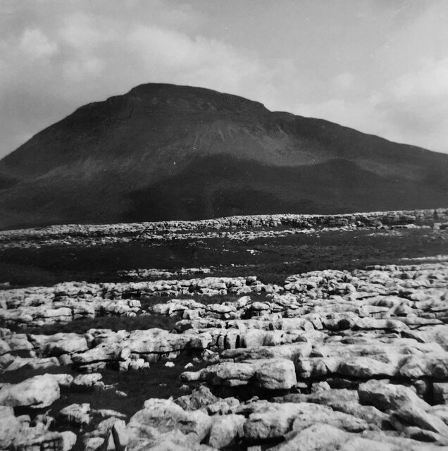
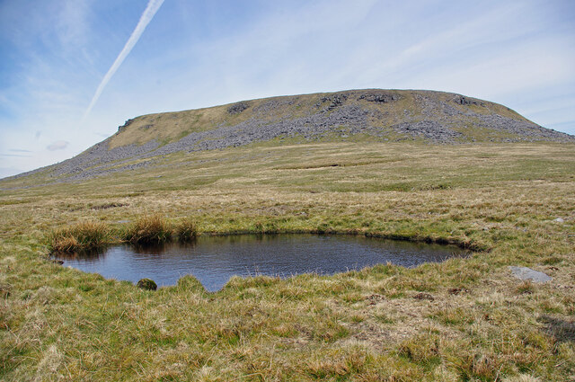
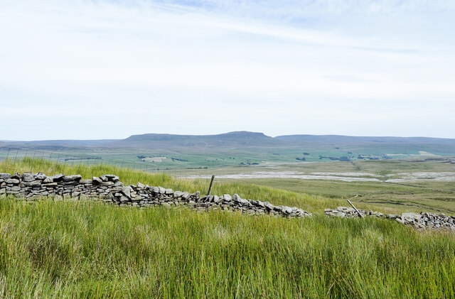
Simon Fell is a prominent hill located in the Yorkshire Dales National Park, in the county of North Yorkshire, England. Standing at an elevation of 650 meters (2,133 feet), it is often considered a mountain due to its impressive height and rugged terrain. It is situated in the southern part of the park, near the village of Ingleton.

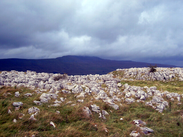
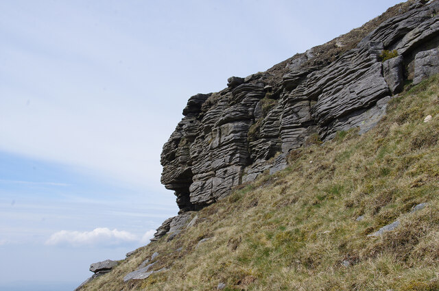
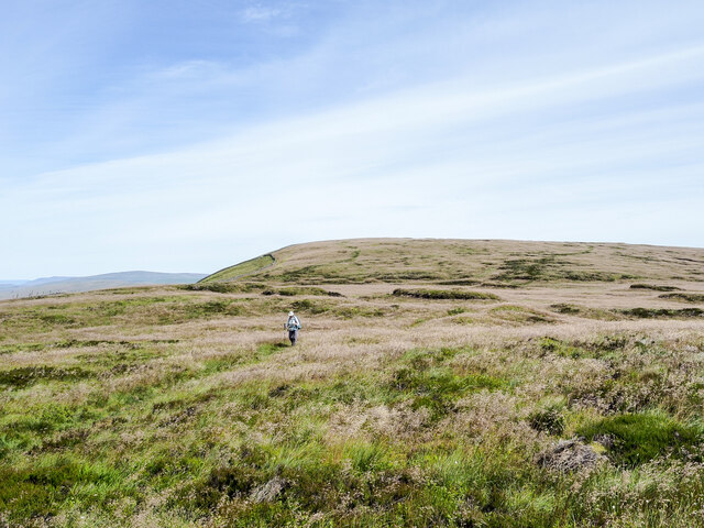
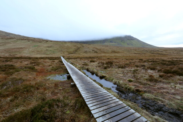
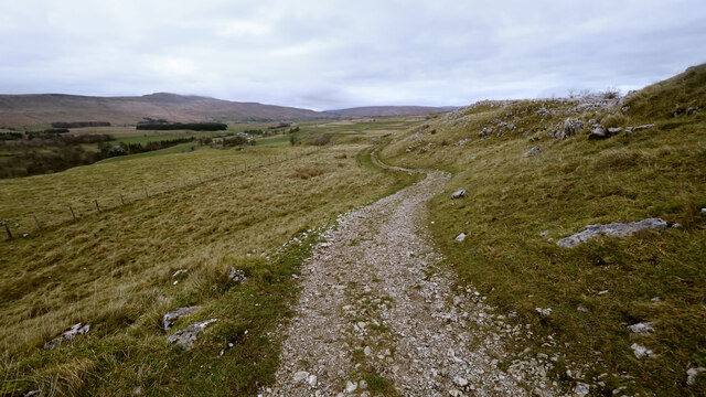
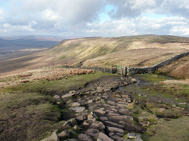
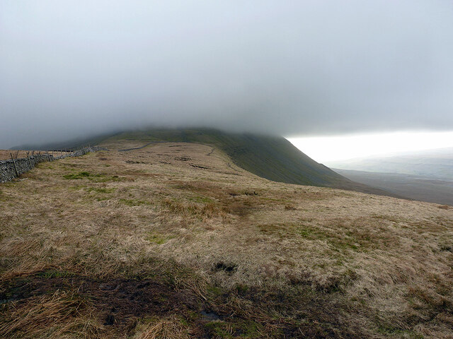
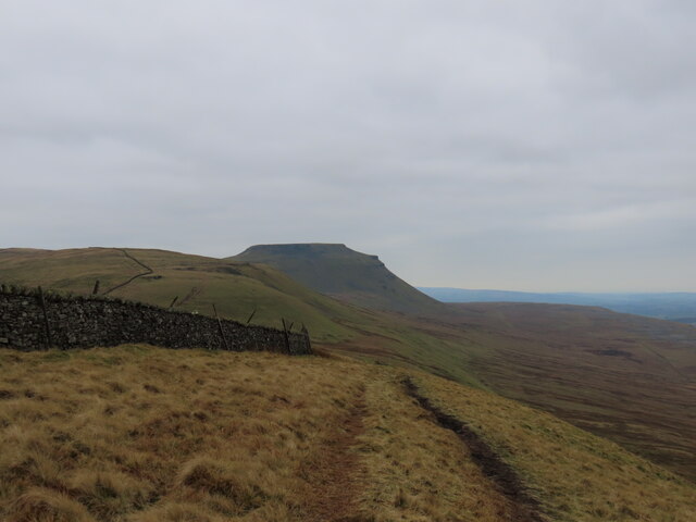
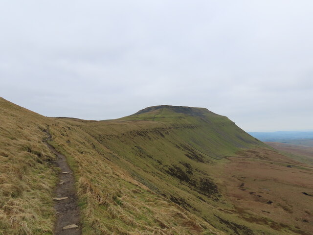
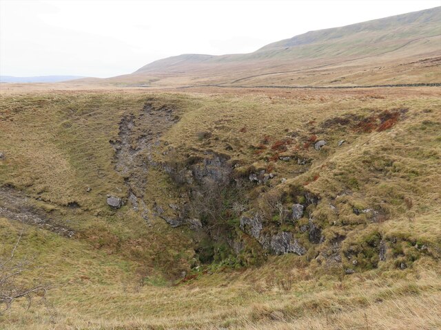
Simon Fell is known for its distinctive shape, with a long ridge stretching from west to east. It is composed mainly of limestone, creating steep slopes and rocky outcrops. As a result, it offers a challenging yet rewarding climb for hikers and mountaineers.

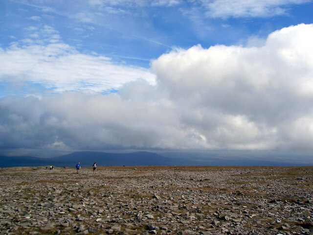
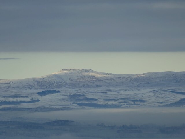
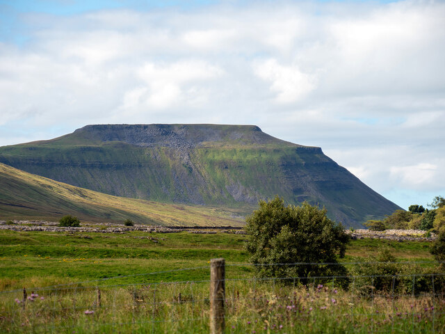
The hill provides breathtaking panoramic views of the surrounding countryside, including the Three Peaks of Yorkshire: Ingleborough, Pen-y-ghent, and Whernside. On a clear day, visitors can also enjoy vistas of the Lake District and the Forest of Bowland.

The area surrounding Simon Fell is rich in biodiversity, with a variety of plant and animal species. Rare upland birds such as the peregrine falcon and the ring ouzel can be spotted here, along with diverse flora including heather, bilberry, and limestone grassland species.

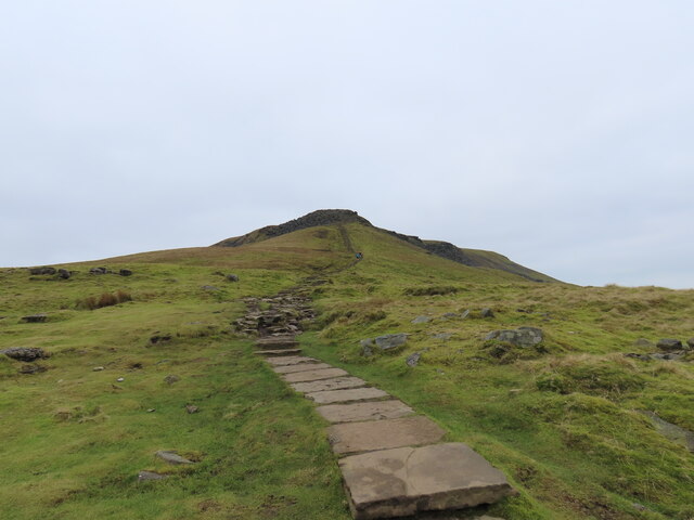
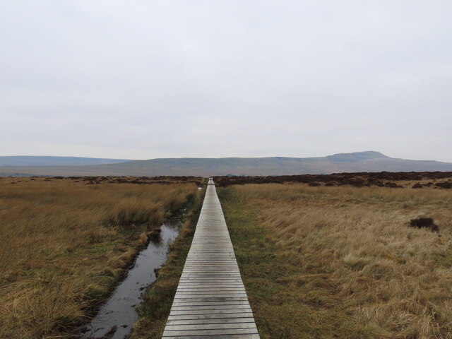
Simon Fell is a popular destination for outdoor enthusiasts, offering numerous walking routes and trails. It is part of the Yorkshire Three Peaks Challenge, a 39-kilometer (24-mile) circular hike that also includes the neighboring peaks. On a visit to Simon Fell, visitors can experience the natural beauty and rugged charm of the Yorkshire Dales while enjoying a challenging and rewarding climb.

If you have any feedback on the listing, please let us know in the comments section below.

Simon Fell Images

Images are sourced within 2km of 54.171767/-2.3772407 or Grid Reference SD7575. Thanks to Geograph Open Source API. All images are credited.

Looking towards Whernside from Southerscales, Ingleborough
Ingleborough Summit
Ingleborough Summit
Ingleborough across the limestone pavement
Gritstone outcrop on Ingleborough On the SW side of the summit plateau, near the southern point.
Gritstone outcrop on Ingleborough
On the SW side of the summit plateau, near the southern point.
Flooded shake hole on Ingleborough South of the summit plateau, on the Little Ingleborough spur.
Flooded shake hole on Ingleborough
South of the summit plateau, on the Little Ingleborough spur.
Wall immersed in area of rushes Lying to the north side of the path between Horton in Ribblesdale and Ingleborough; it's below Simon Fell,  part of the main mountain.
Pen-y-ghent is the peak in the distance.
Wall immersed in area of rushes
Lying to the north side of the path between Horton in Ribblesdale and Ingleborough; it's below Simon Fell, part of the main mountain. Pen-y-ghent is the peak in the distance.
Grass flowers gone to seed The hill walker is on a path connecting Park Fell in the distance, with Ingleborough. The pale buff-coloured grass heads covering most of the ground in view have finished flowering and are now seeded.
Grass flowers gone to seed
The hill walker is on a path connecting Park Fell in the distance, with Ingleborough. The pale buff-coloured grass heads covering most of the ground in view have finished flowering and are now seeded.
Causeway to the Arks across Humphrey Bottom Humphrey Bottom is pretty boggy for a lot of the year, so repeated use by hikers heading up or down Ingleborough via the Arks (an unpleasantly steep section heading into the cloud in this view) was causing too much damage to the fragile vegetation and peat, so, whilst ugly, this long causeway was an inevitable response (adding stone to make a solid path would have been vastly expensive and done nothing to help the drainage).
Causeway to the Arks across Humphrey Bottom
Humphrey Bottom is pretty boggy for a lot of the year, so repeated use by hikers heading up or down Ingleborough via the Arks (an unpleasantly steep section heading into the cloud in this view) was causing too much damage to the fragile vegetation and peat, so, whilst ugly, this long causeway was an inevitable response (adding stone to make a solid path would have been vastly expensive and done nothing to help the drainage).
Heading down the Southerscales track Familiar to many cavers as the route to and from Meregill Hole, Black Shiver Pot, Roaring Hole and several other potholes, the track gives easy going for walkers, and somewhat more challenging progress for a Cave Rescue Landrover (usually in the dark with heavy rain - and after the pub). By the time you are here on the way down, the difficulties are largely behind you.
Heading down the Southerscales track
Familiar to many cavers as the route to and from Meregill Hole, Black Shiver Pot, Roaring Hole and several other potholes, the track gives easy going for walkers, and somewhat more challenging progress for a Cave Rescue Landrover (usually in the dark with heavy rain - and after the pub). By the time you are here on the way down, the difficulties are largely behind you.
Ingleborough from Weets Hill Ingleborough is 32km (20 miles) north-north-west from Weets Hill, and seen here rising above low cloud that filled Ribblesdale on this cold day.
Ingleborough from Weets Hill
Ingleborough is 32km (20 miles) north-north-west from Weets Hill, and seen here rising above low cloud that filled Ribblesdale on this cold day.
Souther Scales Fell The escarpment of Simon Fell, viewed from Swine Tail beneath Ingleborough summit.
Souther Scales Fell
The escarpment of Simon Fell, viewed from Swine Tail beneath Ingleborough summit.
Ingleborough top hidden in cloud Viewed from Simon Fell.
Ingleborough top hidden in cloud
Viewed from Simon Fell.
Path to Ingleborough
Summiting Ingleborough
Path across the bog
Path across the bog
Braithwaite Wife Hole
The distinctive flat top of Ingleborough Viewed from Ribblehead station.
The distinctive flat top of Ingleborough
Viewed from Ribblehead station.
Show me another place!

Simon Fell is located at Grid Ref: SD7575 (Lat: 54.171767, Lng: -2.3772407)

Division: West Riding

Administrative County: North Yorkshire

District: Craven

Police Authority: North Yorkshire

What 3 Words

///rave.glee.hack. Near Ingleton, North Yorkshire

Related Wikis

Simon Fell (Yorkshire Dales)

Simon Fell is a subsidiary summit on the north east ridge of Ingleborough, a mountain in the Yorkshire Dales in Northern England. With a height of 650...

Ingleborough

Ingleborough (723 m or 2,372 ft) is the second-highest mountain in the Yorkshire Dales, England. It is one of the Yorkshire Three Peaks (the other two...

Yorkshire Three Peaks

The mountains of Whernside (736 m or 2,415 ft), Ingleborough (723 m or 2,372 ft) and Pen-y-ghent (694 m or 2,277 ft) are collectively known as the Three...
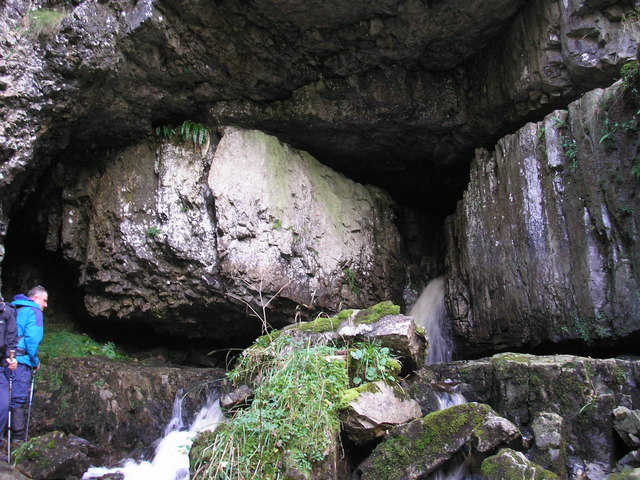
Great Douk Cave

Great Douk Cave is a shallow cave system lying beneath the limestone bench of Ingleborough in Chapel-le-Dale, North Yorkshire, England. It is popular with...

Nearby Amenities

Located within 500m of 54.171767,-2.3772407
Simon Fell
Description: A sub-peak of Ingleborough.
Ele: 650
Natural: peak
Source: npe
Lat/Long: 54.1718498/-2.3773587
Barrier: stile
Lat/Long: 54.1727992/-2.3756269
Green Hill
Natural: peak
Lat/Long: 54.1687644/-2.3825541
Lord's Seat
Ele: 633.7
Natural: peak
Lat/Long: 54.1698539/-2.3712227
Rawnsley's Leap
Barrier: stile
Bicycle: no
Foot: yes
Horse: no
Motor Vehicle: no
Lat/Long: 54.1698509/-2.3720358
Natural: spring
Source: NLS-OS-1st_Series
Lat/Long: 54.1745289/-2.371443
Natural: spring
Source: NLS-OS-1st_Series
Lat/Long: 54.1725074/-2.3713786
Natural: spring
Source: NLS-OS-1st_Series
Lat/Long: 54.1729219/-2.3736961
Natural: spring
Source: NLS-OS-1st_Series
Lat/Long: 54.1717161/-2.3704989
The data included in this document is from www.openstreetmap.org. The data is made available under ODbL.

Have you been to Simon Fell?

Leave your review of Simon Fell below (or comments, questions and feedback).