Peat Hillock

Hill, Mountain in Kincardineshire

Scotland

Peat Hillock

An interesting sign in the Burn of Guinea at the Bridge of Bogincaber
An interesting sign in the Burn of Guinea at the Bridge of Bogincaber Credit: Mike Dunn

The requested URL returned error: 429 Too Many Requests

If you have any feedback on the listing, please let us know in the comments section below.
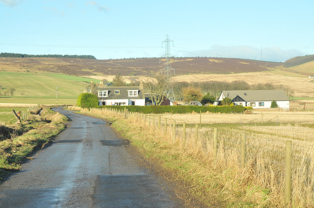
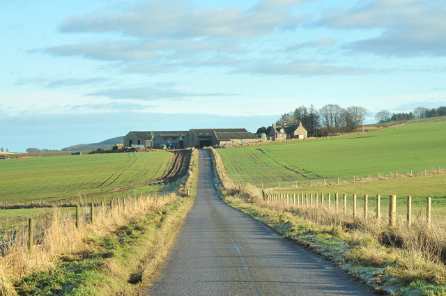
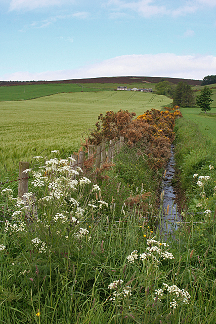
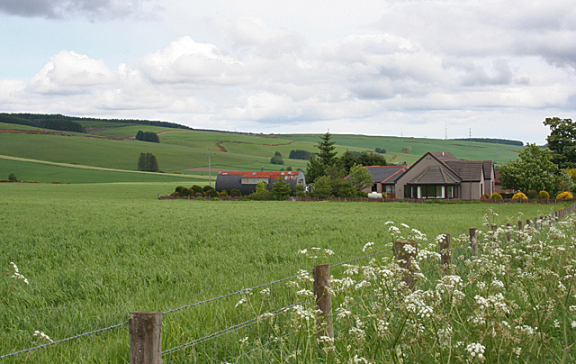
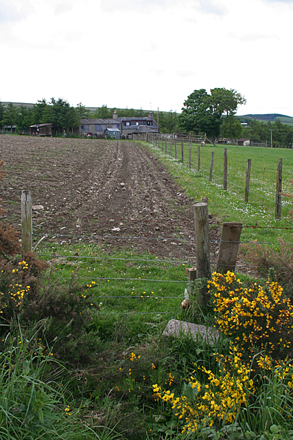
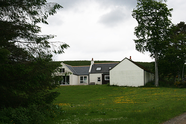
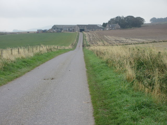
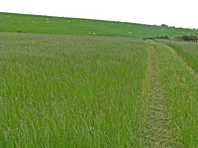
Peat Hillock Images

Images are sourced within 2km of 56.943781/-2.4089489 or Grid Reference NO7583. Thanks to Geograph Open Source API. All images are credited.

An interesting sign in the Burn of Guinea at the Bridge of Bogincaber
Farm road to Inches
Farm road to Inches
Farm road to Cot Bank
Minor road near Goosecruives
Minor road near Jacksbank
Cleuchhead Cleuchhead stands well above the road on the Brae of Glenbervie, with the Hill of Bogjurgan sheltering it from the north.
Cleuchhead
Cleuchhead stands well above the road on the Brae of Glenbervie, with the Hill of Bogjurgan sheltering it from the north.
New Bungalow near Peathillock This is one of three new houses by the roadside. The Brae of Glenbervie is to the left.
New Bungalow near Peathillock
This is one of three new houses by the roadside. The Brae of Glenbervie is to the left.
Mains of Inchbreck The steadings here have all been renovated and converted to housing.
Mains of Inchbreck
The steadings here have all been renovated and converted to housing.
Bridge of Bogincaber The bridge carries the road across the Burn of Guinea. Compare with <a href="https://www.geograph.org.uk/photo/2564787">NO7483 : An interesting sign in the Burn of Guinea at the Bridge of Bogincaber</a>. Presumably the ban on ball games has been lifted.
Bridge of Bogincaber
The bridge carries the road across the Burn of Guinea. Compare with NO7483 : An interesting sign in the Burn of Guinea at the Bridge of Bogincaber. Presumably the ban on ball games has been lifted.
White Hill It's not obvious why this modest hill should be so named; there's nothing obviously white about it.
White Hill
It's not obvious why this modest hill should be so named; there's nothing obviously white about it.
West Bogton The house almost merges into the similarly coloured earth of the recently seeded field.
West Bogton
The house almost merges into the similarly coloured earth of the recently seeded field.
Chapelton Croft The croft stands beside the signposted path from Bervie Braes to the Slug Road.
Chapelton Croft
The croft stands beside the signposted path from Bervie Braes to the Slug Road.
Combine near Inches Combine harvester viewed from the Inches Farm access track.
Combine near Inches
Combine harvester viewed from the Inches Farm access track.
Backfield Farm Backfield viewed from the roadside to the south-east.
Backfield Farm
Backfield viewed from the roadside to the south-east.
Road to Jacksbank Minor road running eastwards towards Jacksbank Farm.
Road to Jacksbank
Minor road running eastwards towards Jacksbank Farm.
Cleuchhead Kennels A distant view of Cleuchhead, looking up the Braes of Glenbervie from the south.
Cleuchhead Kennels
A distant view of Cleuchhead, looking up the Braes of Glenbervie from the south.
Bogjurgan sign The sign at the entrance to Bogjurgan, incorporating bagpipes and an old bus stop sign, in front of a pile of bales.
Bogjurgan sign
The sign at the entrance to Bogjurgan, incorporating bagpipes and an old bus stop sign, in front of a pile of bales.
Mains of Inchbreck Mains of Inchbreck viewed from the road to the east.
Mains of Inchbreck
Mains of Inchbreck viewed from the road to the east.
Show me another place!

Peat Hillock is located at Grid Ref: NO7583 (Lat: 56.943781, Lng: -2.4089489)

Unitary Authority: Aberdeenshire

Police Authority: North East

What 3 Words

///breathed.jumped.published. Near Stonehaven, Aberdeenshire

Related Wikis

Bogjurgan Hill

Bogjurgan Hill is an elevated landform at the southern verge of the Fetteresso Forest in Aberdeenshire, Scotland. Its top is at an elevation of 299 metres...

Droop Hill

Droop Hill is a mountain landform in the Kincardine and Mearns region of Aberdeenshire, Scotland. The locale had been featured in a windfarm proposal...

Craiginour

Craiginour is a hill located near Cowie Water in Stonehaven, Aberdeenshire, Scotland. Its summit is at 355 metres (1,165 ft). == References ==

Glenbervie

Glenbervie (Scottish Gaelic: Gleann Biorbhaidh) is located in the north east of Scotland in the Howe o' the Mearns, one mile from the village of Drumlithie...

Nearby Amenities

Located within 500m of 56.943781,-2.4089489
Building: yes
Lat/Long: 56.9441251/-2.4030557
Mains of Inchbreck
Place: isolated_dwelling
Lat/Long: 56.9415099/-2.413785
Power: pole
Lat/Long: 56.9447218/-2.4021423
Power: pole
Lat/Long: 56.9446588/-2.4031737
Power: pole
Lat/Long: 56.9445875/-2.4046487
Power: pole
Lat/Long: 56.9445076/-2.4061436
Power: pole
Lat/Long: 56.9444254/-2.4083073
Power: pole
Lat/Long: 56.9409385/-2.4141827
Power: pole
Lat/Long: 56.9415991/-2.4046032
Power: pole
Lat/Long: 56.941051/-2.4040044
Lawgavin
Place: hamlet
Lat/Long: 56.9438643/-2.4011455
Mosshead
Place: isolated_dwelling
Lat/Long: 56.9417574/-2.4051581
The data included in this document is from www.openstreetmap.org. The data is made available under ODbL.

Have you been to Peat Hillock?

Leave your review of Peat Hillock below (or comments, questions and feedback).