Jamestown

Settlement in Dunbartonshire

Scotland

Jamestown

Arable field
Arable field Credit: N Chadwick

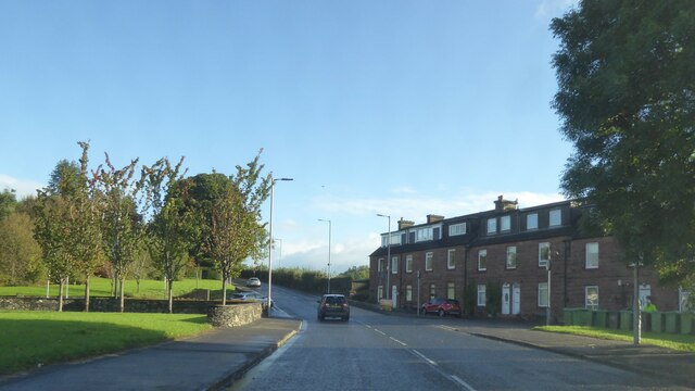
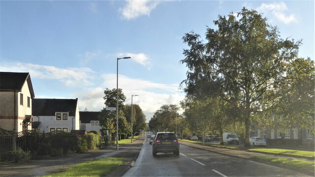
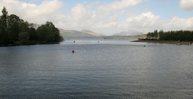
Jamestown is a picturesque village located in Dunbartonshire, Scotland. Situated on the banks of the River Leven, it occupies a prime location within the stunning Loch Lomond and The Trossachs National Park. With a population of around 2,000 residents, the village offers a tranquil and close-knit community.

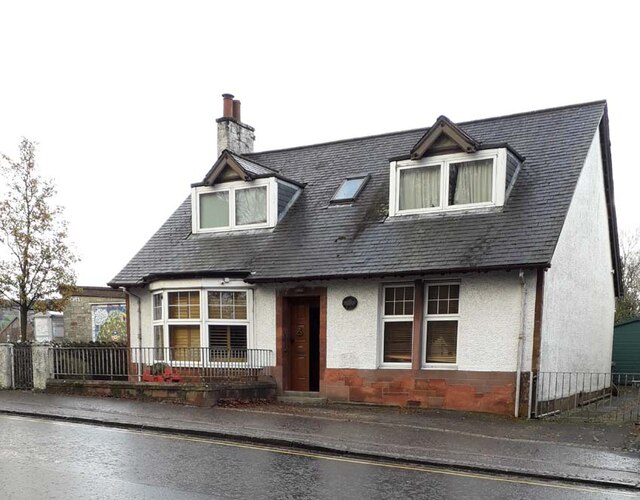
Jamestown boasts a rich history, dating back to the 18th century when it was established as a cotton mill village. The remnants of its industrial past can still be seen today, with several old mill buildings and warehouses that have been repurposed into residential properties and businesses. The village's architecture is a mix of traditional Scottish stone cottages and more modern developments.

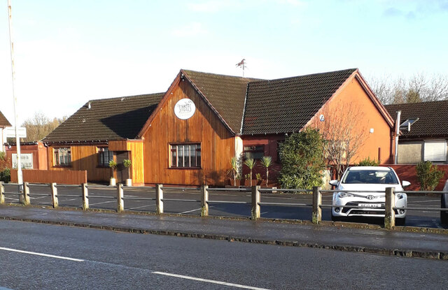
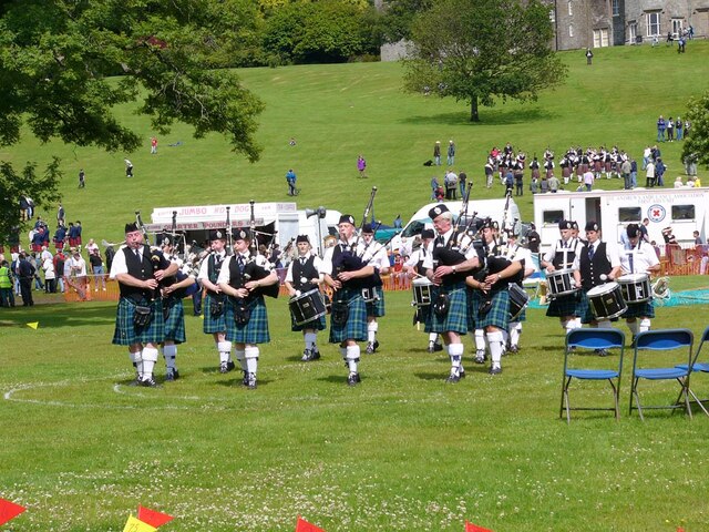
The village is well-served by amenities, including a primary school, a medical center, and a community center that hosts various events and activities throughout the year. It also has a range of local shops, cafes, and restaurants, providing residents with all the essentials within walking distance.

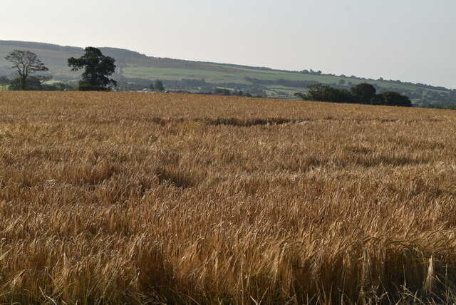
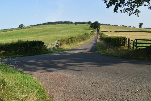
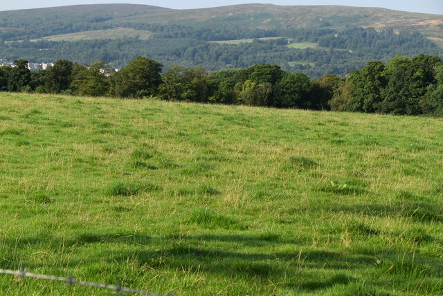
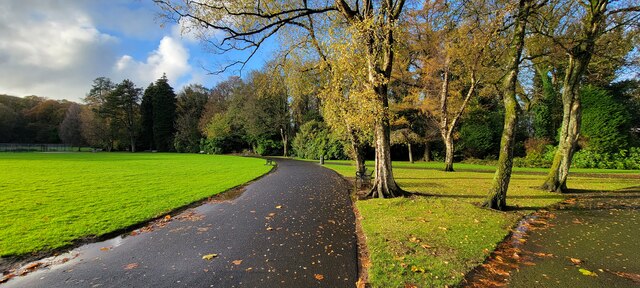
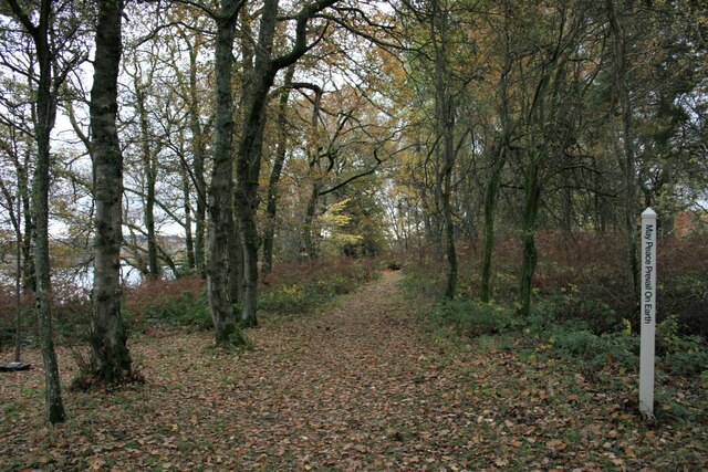
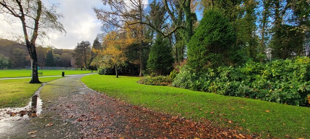
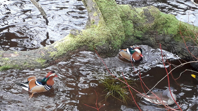
Nature enthusiasts are drawn to Jamestown due to its proximity to the stunning Loch Lomond, offering opportunities for boating, fishing, and scenic walks along its shores. The surrounding national park also provides ample opportunities for outdoor activities, including hiking, cycling, and wildlife spotting.

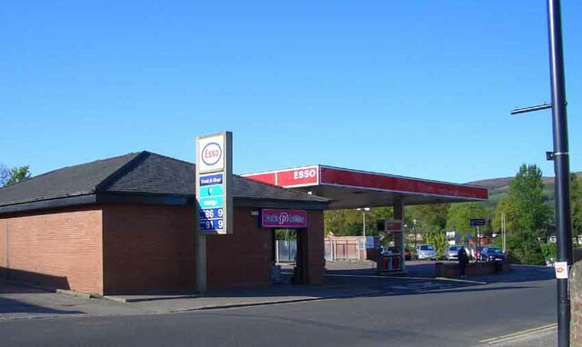
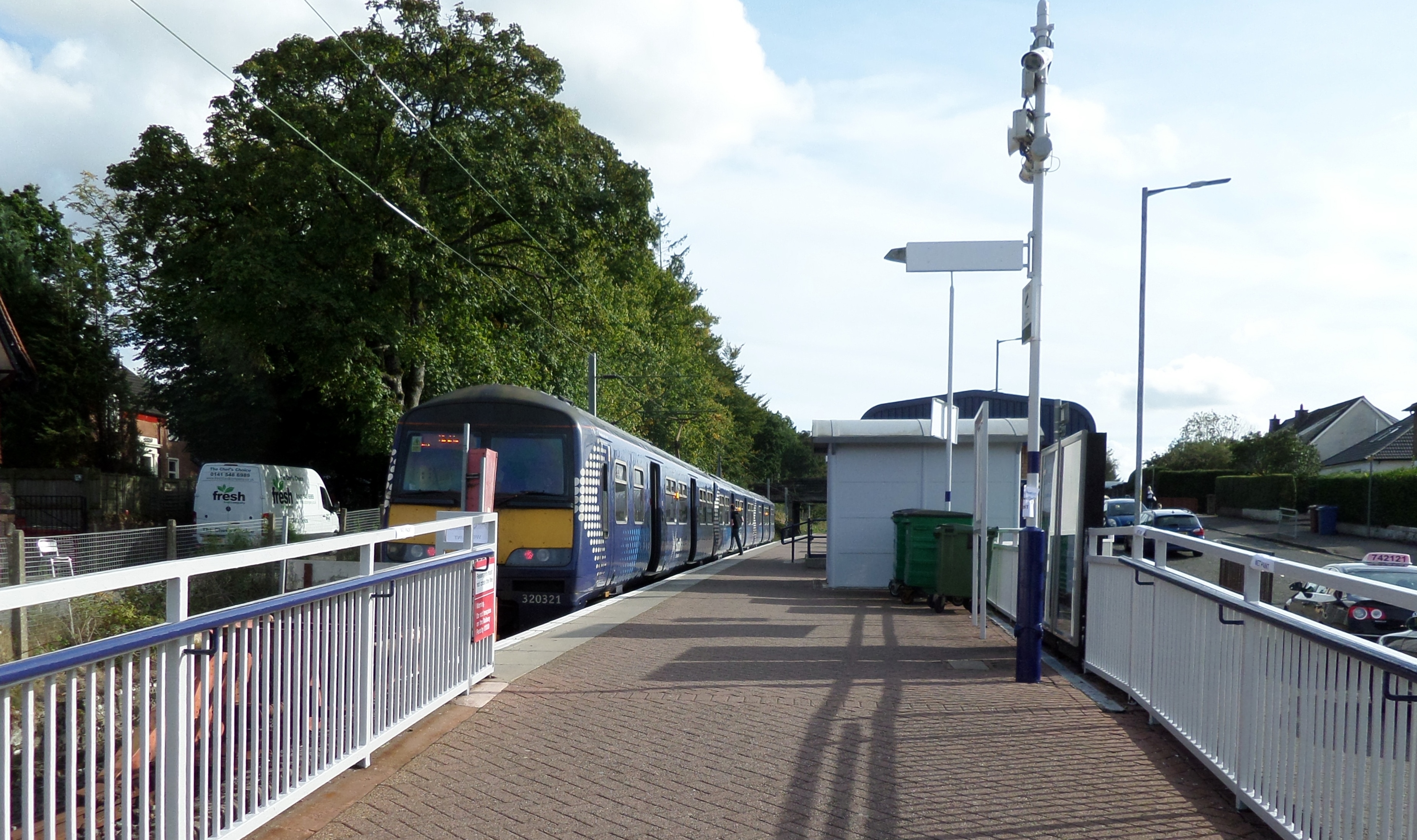
Jamestown benefits from excellent transport links, with a nearby train station connecting it to Glasgow and other major cities in Scotland. Additionally, the village is conveniently located near the A82 road, which provides easy access to surrounding areas.

Overall, Jamestown is a charming village that seamlessly blends its industrial heritage with its natural surroundings, making it an attractive place to live or visit in Dunbartonshire.

If you have any feedback on the listing, please let us know in the comments section below.

Jamestown Images

Images are sourced within 2km of 55.997937/-4.571582 or Grid Reference NS3981. Thanks to Geograph Open Source API. All images are credited.

Arable field
Arable field
John Muir Way The John Muir Way is a 215-kilometre continuous long-distance route in southern Scotland, running from Helensburgh, Argyll and Bute in the west to Dunbar, East Lothian in the east. It is named in honour of the Scottish conservationist John Muir, who was born in Dunbar in 1838 and became a founder of the United States National Park Service. The route provides a coast-to-coast route across Scotland, linking Muir's birthplace with Scotland's first national park, Loch Lomond and The Trossachs, and Helensburgh, from where he left Scotland for the United States.
Wikipedia: <span class="nowrap"><a title="https://en.wikipedia.org/wiki/John_Muir_Way" rel="nofollow ugc noopener" href="https://en.wikipedia.org/wiki/John_Muir_Way">Link</a><img style="margin-left:2px;" alt="External link" title="External link - shift click to open in new window" src="https://s1.geograph.org.uk/img/external.png" width="10" height="10"/></span>
John Muir Way
The John Muir Way is a 215-kilometre continuous long-distance route in southern Scotland, running from Helensburgh, Argyll and Bute in the west to Dunbar, East Lothian in the east. It is named in honour of the Scottish conservationist John Muir, who was born in Dunbar in 1838 and became a founder of the United States National Park Service. The route provides a coast-to-coast route across Scotland, linking Muir's birthplace with Scotland's first national park, Loch Lomond and The Trossachs, and Helensburgh, from where he left Scotland for the United States. Wikipedia: LinkExternal link
Pastureland
Pastureland
A811 Stirling Road, Balloch
Balloch Road, Alexandria
Yet ANOTHER photo of Christie Park, Alexandria! Christie Park, Alexandria
Yet ANOTHER photo of Christie Park, Alexandria!
Christie Park, Alexandria
Peace pole, Loch Lomond The peace pole is one of over 200,000 similar poles found in 200 countries around the world. They all display the message "May Peace Prevail On Earth". See <span class="nowrap"><a title="https://en.wikipedia.org/wiki/Peace_pole" rel="nofollow ugc noopener" href="https://en.wikipedia.org/wiki/Peace_pole">Link</a><img style="margin-left:2px;" alt="External link" title="External link - shift click to open in new window" src="https://s1.geograph.org.uk/img/external.png" width="10" height="10"/></span> for more information.

This example is beside a woodland path on the edge of Loch Lomond, close to Loch Lomond Shores.
Peace pole, Loch Lomond
The peace pole is one of over 200,000 similar poles found in 200 countries around the world. They all display the message "May Peace Prevail On Earth". See LinkExternal link for more information. This example is beside a woodland path on the edge of Loch Lomond, close to Loch Lomond Shores.
View up Loch Lomond Looking from Loch Lomond Shores. The Maid of the Loch can be seen on the right.
View up Loch Lomond
Looking from Loch Lomond Shores. The Maid of the Loch can be seen on the right.
Christie Park, Alexandria An Autumn day in the park.
Christie Park, Alexandria
An Autumn day in the park.
The Stables Restaurant & Bar This family-run restaurant is situated on the northeast side of Carrochan Road, Balloch (A813), half way between Balloch and Jamestown. It was originally known as the "Roundabout Inn". It closed indefinitely in autumn 2022.
The Stables Restaurant & Bar
This family-run restaurant is situated on the northeast side of Carrochan Road, Balloch (A813), half way between Balloch and Jamestown. It was originally known as the "Roundabout Inn". It closed indefinitely in autumn 2022.
Postbox Dalvait Rd, Balloch This Postbox was on the pavement outside the Well Pharmacy on Dalvait Rd, Balloch. It was removed (2020) after the Post Office was moved from Dalvait Rd to the Co-op Store, Carrochan Rd, Balloch.
Postbox Dalvait Rd, Balloch
This Postbox was on the pavement outside the Well Pharmacy on Dalvait Rd, Balloch. It was removed (2020) after the Post Office was moved from Dalvait Rd to the Co-op Store, Carrochan Rd, Balloch.
Esso Filling Station This Filling Station was at the east end of Balloch Bridge opposite the then “Balloch Hotel”. The Filling Station was demolished in 2007 and the Riverside Apartments <a href="https://www.geograph.org.uk/photo/7357218">NS3981 : Riverside Apartments, Balloch</a> were built on the same site. Locally the filling station was often referred to as “Lynn’s Garage” acknowledging its previous ownership and usage.
Esso Filling Station
This Filling Station was at the east end of Balloch Bridge opposite the then “Balloch Hotel”. The Filling Station was demolished in 2007 and the Riverside Apartments NS3981 : Riverside Apartments, Balloch were built on the same site. Locally the filling station was often referred to as “Lynn’s Garage” acknowledging its previous ownership and usage.
Riverside Apartments, Balloch These apartments with commercial space at ground level are at the east end of Balloch Bridge opposite the “Balloch House Hotel”. The site was formerly occupied by an Esso filling station <a href="https://www.geograph.org.uk/photo/7357213">NS3981 : Esso Filling Station</a>.
Riverside Apartments, Balloch
These apartments with commercial space at ground level are at the east end of Balloch Bridge opposite the “Balloch House Hotel”. The site was formerly occupied by an Esso filling station NS3981 : Esso Filling Station.
Beechwood, Balloch Road, Balloch This cottage is adjacent to the Balloch Bus Stance. Up until the late 1990s it was used by the Royal Bank of Scotland, opening mornings only. For many years, in front of the bay window, there has been a stone blade-sharpener, mounted on its wooden trestle.
Beechwood, Balloch Road, Balloch
This cottage is adjacent to the Balloch Bus Stance. Up until the late 1990s it was used by the Royal Bank of Scotland, opening mornings only. For many years, in front of the bay window, there has been a stone blade-sharpener, mounted on its wooden trestle.
Balloch Highland Games in front of the Castle This shows Balloch Castle Country Park, which was the old venue for the Balloch Highland Games before they moved into the smaller Moss 'o Balloch Park. Whilst the band in the foreground performed, other groups tuned up their instruments and practised on the wide grass slope in front of Balloch Castle. (Entrance was free!)

Run Rig (1991) and Oasis (1996) both held sell-out concerts at this same glorious venue beside the banks of Loch Lomond.
Balloch Highland Games in front of the Castle
This shows Balloch Castle Country Park, which was the old venue for the Balloch Highland Games before they moved into the smaller Moss 'o Balloch Park. Whilst the band in the foreground performed, other groups tuned up their instruments and practised on the wide grass slope in front of Balloch Castle. (Entrance was free!) Run Rig (1991) and Oasis (1996) both held sell-out concerts at this same glorious venue beside the banks of Loch Lomond.
Mandarins on the River Leven at Balloch A mandarin duck and two drakes. They are sheltering at their normal spot under branches near the jetty on the east side of the River Leven about 100 metres upstream from the Balloch House Hotel.

They are not permanent residents but for several years have been occasional visitors. Unlike the lone Black Swan which appeared in 2004 and the Muscovy Duck in 2013/14 and haven’t been seen since.

The mandarins often attract an army of ‘twitchers’ with long lenses.
Mandarins on the River Leven at Balloch
A mandarin duck and two drakes. They are sheltering at their normal spot under branches near the jetty on the east side of the River Leven about 100 metres upstream from the Balloch House Hotel. They are not permanent residents but for several years have been occasional visitors. Unlike the lone Black Swan which appeared in 2004 and the Muscovy Duck in 2013/14 and haven’t been seen since. The mandarins often attract an army of ‘twitchers’ with long lenses.
Spontaneous Ice Crystals 1 This is one of two photos taken at Drumkinnon Bay a couple of days before Christmas 2010. The other image is <a href="https://www.geograph.org.uk/photo/7370686">NS3882 : Spontaneous Ice Crystals 2</a>
It was cold, but probably no more than minus 6 degrees centigrade; nothing to write home about.
However some form of meteorological phenomena caused ice crystals to build on top of the iced-up bay. Almost like some cold version of spontaneous combustion. There was no snow that day.
I thought it might be freezing fog, hoar frost or rime. I have been told it is rime and is not unusual at higher altitudes. I had never seen anything quite like it before or since.
Spontaneous Ice Crystals 1
This is one of two photos taken at Drumkinnon Bay a couple of days before Christmas 2010. The other image is NS3882 : Spontaneous Ice Crystals 2 It was cold, but probably no more than minus 6 degrees centigrade; nothing to write home about. However some form of meteorological phenomena caused ice crystals to build on top of the iced-up bay. Almost like some cold version of spontaneous combustion. There was no snow that day. I thought it might be freezing fog, hoar frost or rime. I have been told it is rime and is not unusual at higher altitudes. I had never seen anything quite like it before or since.
Spontaneous Ice Crystals 2 This is one of two photos taken at Drumkinnon Bay a couple of days before Christmas 2010. The other image is <a href="https://www.geograph.org.uk/photo/7370685">NS3882 : Spontaneous Ice Crystals 1</a>
It was cold, but probably no more than minus 6 degrees centigrade; nothing to write home about.
However some form of meteorological phenomena caused ice crystals to build on top of the iced-up bay. Almost like some cold version of spontaneous combustion. There was no snow that day.
I thought it might be freezing fog, hoar frost or rime. I have been told it is rime and is not unusual at higher altitudes. I had never seen anything quite like it before or since.
Spontaneous Ice Crystals 2
This is one of two photos taken at Drumkinnon Bay a couple of days before Christmas 2010. The other image is NS3882 : Spontaneous Ice Crystals 1 It was cold, but probably no more than minus 6 degrees centigrade; nothing to write home about. However some form of meteorological phenomena caused ice crystals to build on top of the iced-up bay. Almost like some cold version of spontaneous combustion. There was no snow that day. I thought it might be freezing fog, hoar frost or rime. I have been told it is rime and is not unusual at higher altitudes. I had never seen anything quite like it before or since.
Show me another place!

Jamestown is located at Grid Ref: NS3981 (Lat: 55.997937, Lng: -4.571582)

Unitary Authority: West Dunbartonshire

Police Authority: Argyll and West Dunbartonshire

What 3 Words

///dares.nobody.refers. Near Balloch, West Dunbartonshire

Related Wikis

Jamestown railway station

Jamestown railway station served the village of Jamestown, in the historical county of Dunbartonshire, Scotland, from 1856 to 1964 on the Forth and Clyde...

Jamestown, West Dunbartonshire

Jamestown (Scottish Gaelic: Baile Sheumais (IPA:[ˈpaləˈheːməʃ]), Scots: Jeamstoun) is a village in the Vale of Leven conurbation in West Dunbartonshire...

Loch Lomond distillery

Loch Lomond distillery is a Highland Single Malt Scotch whisky distillery in Alexandria, Scotland, near Loch Lomond. == History == The first site of the...

Loch Lomond Rowing Club

Loch Lomond Rowing Club is a rowing club on the River Leven, based at Heather Avenue, Balloch, Alexandria, West Dunbartonshire. The club is affiliated...

Balloch, West Dunbartonshire

Balloch (; Scots pronunciation: /ˈbɑləx/; Gaelic: Am Bealach) is a village in West Dunbartonshire, Scotland, at the foot of Loch Lomond. == Etymology... ==

Loch Lomond Radium Works

Loch Lomond Radium Works was a company founded by John Stewart MacArthur in 1911 as the Radium Works in Halton, Cheshire, England. The company moved to...

Balloch railway station

Balloch railway station is a railway station serving the town of Balloch in Scotland. The station is a western terminus of the North Clyde Line, sited...

Balloch Central railway station

Balloch Central railway station was the main railway station serving the town of Balloch in Scotland. It was opened on 15 July 1850 by the Caledonian and...

Nearby Amenities

Located within 500m of 55.997937,-4.571582
Crossing
Button Operated: yes
Crossing: traffic_signals
Crossing Island: no
Tactile Paving: yes
Traffic Signals Sound: yes
Lat/Long: 55.9997169/-4.5711269
Fuel
BP
Brand: BP
Brand Wikidata: Q152057
Source: survey
Website: https://map.bp.com/en-GB/GB/petrol-station/alexandria/lomond-service-station/4201
Lat/Long: 55.9992824/-4.5715409
Turning Circle
Lat/Long: 55.9987553/-4.5764576
Post Box
Lat/Long: 56.0001206/-4.5652107
Telephone
Booth: KX100
Covered: booth
Source: survey
Lat/Long: 56.0017477/-4.5731382
Jamestown
Place: village
Wikidata: Q15059302
Wikipedia: en:Jamestown, West Dunbartonshire
Lat/Long: 55.9981176/-4.5714427
Restaurant
Stables
Addr Postcode: G83 8BW
Addr Street: Carrochan Road
Fhrs Id: 94208
Source Addr: FHRS Open Data
Lat/Long: 56.001401/-4.5718891
Generator Method: photovoltaic
Generator Output Electricity: yes
Generator Source: solar
Generator Type: solar_photovoltaic_panel
Location: roof
Power: generator
Lat/Long: 55.9990163/-4.5639452
Generator Method: photovoltaic
Generator Output Electricity: yes
Generator Source: solar
Generator Type: solar_photovoltaic_panel
Location: roof
Power: generator
Lat/Long: 56.0007981/-4.5769177
Generator Method: photovoltaic
Generator Output Electricity: yes
Generator Source: solar
Generator Type: solar_photovoltaic_panel
Location: roof
Power: generator
Lat/Long: 56.0003842/-4.57559
Generator Method: photovoltaic
Generator Output Electricity: yes
Generator Source: solar
Generator Type: solar_photovoltaic_panel
Location: roof
Power: generator
Lat/Long: 56.0007307/-4.5755095
Crossing
Crossing: traffic_signals
Tactile Paving: yes
Lat/Long: 56.0009635/-4.5717134
Noexit: yes
Lat/Long: 56.0010881/-4.5697855
Barrier: yes
Lat/Long: 55.9990496/-4.5789617
Jamestown
Historic Railway: station
Railway: site
Wikidata: Q107394785
Wikipedia: en:Jamestown railway station
Lat/Long: 55.997357/-4.5710594
Jamestown Junction
Alt Name: Dalmonach Branch Junction
Lat/Long: 55.9974924/-4.5694886
Noexit: yes
Lat/Long: 56.0011173/-4.5669145
The data included in this document is from www.openstreetmap.org. The data is made available under ODbL.

Have you been to Jamestown?

Leave your review of Jamestown below (or comments, questions and feedback).