Ingleborough

Hill, Mountain in Yorkshire Craven

England

Ingleborough

Ingleborough Summit
Ingleborough Summit Credit: habiloid

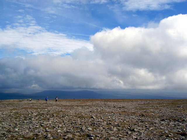
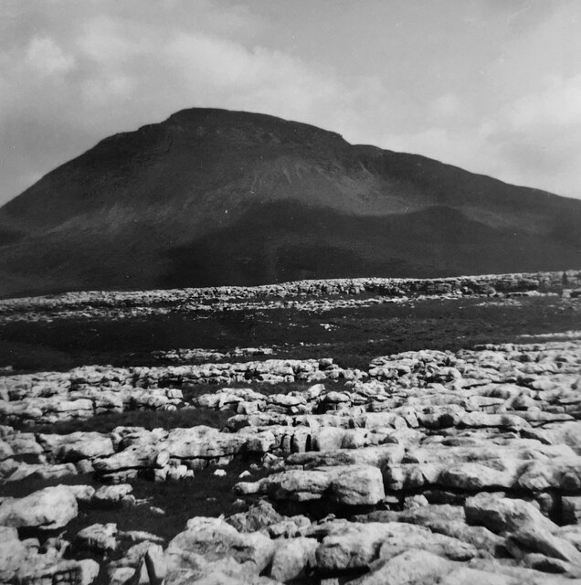
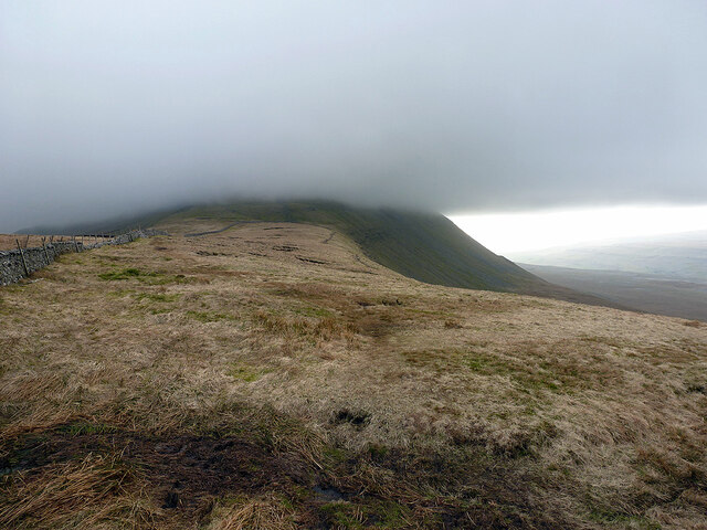
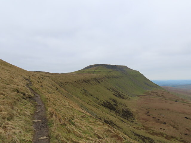
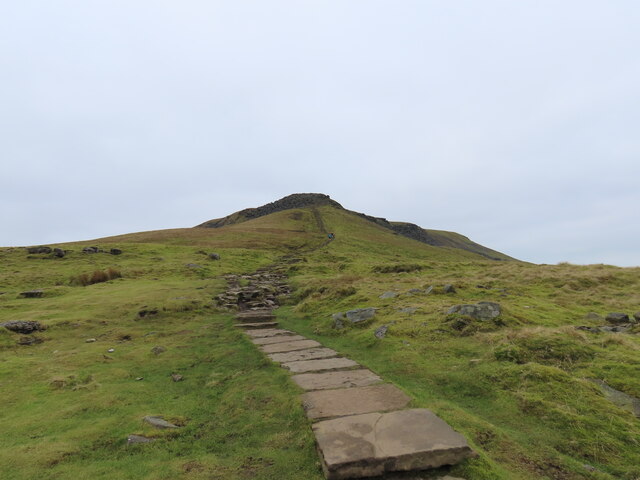
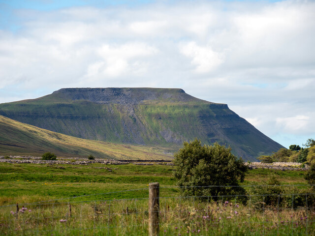
Ingleborough is a prominent hill and mountain located in the Yorkshire Dales National Park, in the county of Yorkshire, England. Standing at a height of 723 meters (2,372 feet), it is the second highest peak in the park, attracting hikers, climbers, and nature enthusiasts from all over the world.

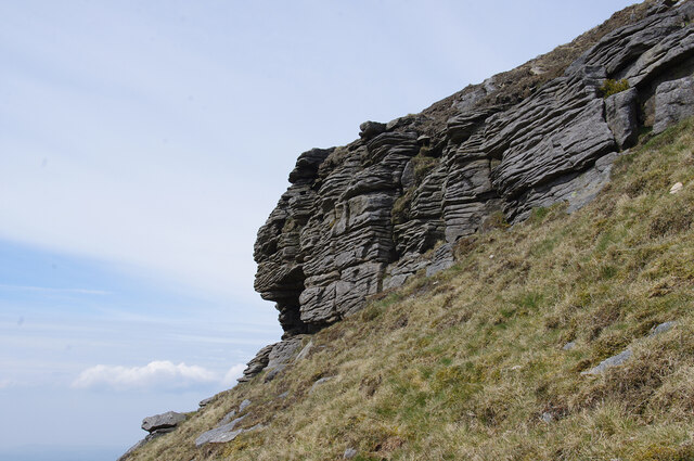
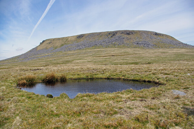
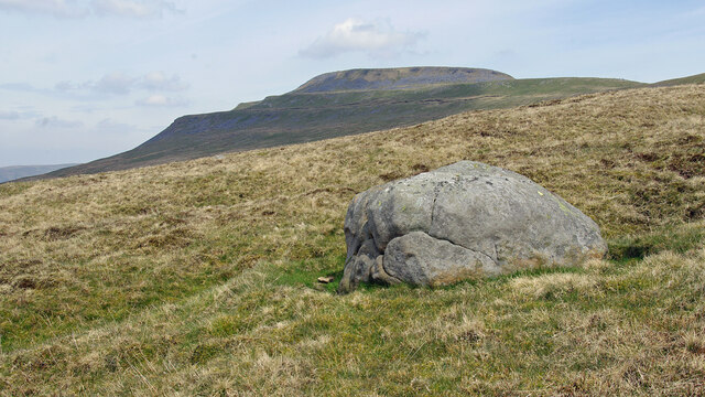
The mountain is formed from limestone and boasts a distinctive shape, with its flat summit plateau and steep sides. It is part of the Three Peaks, a famous collection of three mountains that also includes Pen-y-ghent and Whernside. Ingleborough is often considered the most challenging of the three, offering a rewarding and exhilarating climb to those who undertake its ascent.

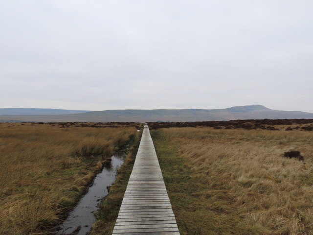
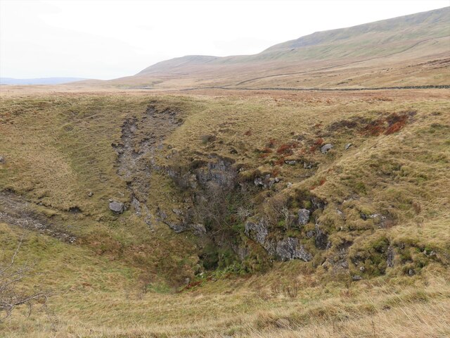
The area surrounding Ingleborough is characterized by its stunning natural beauty, with rolling hills, lush valleys, and picturesque villages. The mountain itself is home to a variety of plant and animal species, including rare alpine plants, birds of prey, and mammals such as hares and foxes.

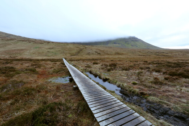
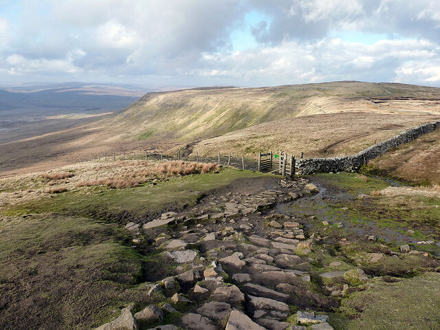
The ascent to the summit can be reached by various paths, with the most popular starting from the village of Ingleton. The climb is moderately challenging, with some steep sections that require a good level of fitness and proper hiking gear. However, the breathtaking panoramic views of the surrounding countryside from the top make it all worth it.

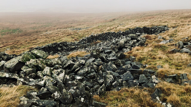
In addition to its natural beauty, Ingleborough also holds historical significance. The mountain is dotted with ancient remains, including a prehistoric hill fort and several limestone pavements. These remnants of the past add an extra layer of intrigue and fascination to the area.

Overall, Ingleborough is a must-visit destination for outdoor enthusiasts and those seeking a true taste of Yorkshire's rugged beauty.

If you have any feedback on the listing, please let us know in the comments section below.

Ingleborough Images

Images are sourced within 2km of 54.166164/-2.3978974 or Grid Reference SD7474. Thanks to Geograph Open Source API. All images are credited.

Ingleborough Summit
Ingleborough Summit
Ingleborough across the limestone pavement
Gritstone outcrop on Ingleborough On the SW side of the summit plateau, near the southern point.
Gritstone outcrop on Ingleborough
On the SW side of the summit plateau, near the southern point.
Flooded shake hole on Ingleborough South of the summit plateau, on the Little Ingleborough spur.
Flooded shake hole on Ingleborough
South of the summit plateau, on the Little Ingleborough spur.
Cloven Stone, Ingleborough Common Ingleborough is in the background. See <a href="https://www.geograph.org.uk/photo/2509839">SD7373 : Cloven Stone</a> & <a href="https://www.geograph.org.uk/photo/157297">SD7373 : Boulder on Ingleborough Common</a> for other views.
Cloven Stone, Ingleborough Common
Ingleborough is in the background. See SD7373 : Cloven Stone & SD7373 : Boulder on Ingleborough Common for other views.
Causeway to the Arks across Humphrey Bottom Humphrey Bottom is pretty boggy for a lot of the year, so repeated use by hikers heading up or down Ingleborough via the Arks (an unpleasantly steep section heading into the cloud in this view) was causing too much damage to the fragile vegetation and peat, so, whilst ugly, this long causeway was an inevitable response (adding stone to make a solid path would have been vastly expensive and done nothing to help the drainage).
Causeway to the Arks across Humphrey Bottom
Humphrey Bottom is pretty boggy for a lot of the year, so repeated use by hikers heading up or down Ingleborough via the Arks (an unpleasantly steep section heading into the cloud in this view) was causing too much damage to the fragile vegetation and peat, so, whilst ugly, this long causeway was an inevitable response (adding stone to make a solid path would have been vastly expensive and done nothing to help the drainage).
Ingleborough from Weets Hill Ingleborough is 32km (20 miles) north-north-west from Weets Hill, and seen here rising above low cloud that filled Ribblesdale on this cold day.
Ingleborough from Weets Hill
Ingleborough is 32km (20 miles) north-north-west from Weets Hill, and seen here rising above low cloud that filled Ribblesdale on this cold day.
Souther Scales Fell The escarpment of Simon Fell, viewed from Swine Tail beneath Ingleborough summit.
Souther Scales Fell
The escarpment of Simon Fell, viewed from Swine Tail beneath Ingleborough summit.
Ingleborough top hidden in cloud Viewed from Simon Fell.
Ingleborough top hidden in cloud
Viewed from Simon Fell.
Re-entrant, Nook
Re-entrant, Nook
Ruined sheepfold, Dowlass Moss
Cloven Stone
Cloven Stone
Tatham Wife Hole
Tatham Wife Hole
Path to Ingleborough
Summiting Ingleborough
Path across the bog
Path across the bog
Braithwaite Wife Hole
The distinctive flat top of Ingleborough Viewed from Ribblehead station.
The distinctive flat top of Ingleborough
Viewed from Ribblehead station.
Show me another place!

Ingleborough is located at Grid Ref: SD7474 (Lat: 54.166164, Lng: -2.3978974)

Division: West Riding

Administrative County: North Yorkshire

District: Craven

Police Authority: North Yorkshire

What 3 Words

///riding.riverbank.actors. Near Ingleton, North Yorkshire

Nearby Locations

Ingleborough

Related Wikis

Ingleborough

Ingleborough (723 m or 2,372 ft) is the second-highest mountain in the Yorkshire Dales, England. It is one of the Yorkshire Three Peaks (the other two...

Yorkshire Three Peaks

The mountains of Whernside (736 m or 2,415 ft), Ingleborough (723 m or 2,372 ft) and Pen-y-ghent (694 m or 2,277 ft) are collectively known as the Three...

Simon Fell (Yorkshire Dales)

Simon Fell is a subsidiary summit on the north east ridge of Ingleborough, a mountain in the Yorkshire Dales in Northern England. With a height of 650...

Rat Hole, Gaping Gill

Rat Hole is one of the entrances to the Gaping Gill cave system, located in the north bank of Fell Beck 30 metres (33 yd) upstream of Gaping Gill Main...

Jib Tunnel

Jib Tunnel, also known as Lateral Passage is one of the entrances into the Gaping Gill cave system, located behind a large boulder in the north bank of...

Gaping Gill

Gaping Gill (also known as Gaping Ghyll) is a natural cave in North Yorkshire, England. It is one of the unmistakable landmarks on the southern slopes...

Fell Beck

Fell Beck is a stream near the foot of Ingleborough, in the Yorkshire Dales National Park. It is notable for running into Gaping Gill, the second-largest...

Stream Passage Pot

Stream Passage Pot is one of the entrances to the Gaping Gill system being located about 320 metres (350 yd) ESE of Gaping Gill Main Shaft. It is a popular...

Nearby Amenities

Located within 500m of 54.166164,-2.3978974
Seat
Description: Semi-sheltered stone seating sheltered by a high cross-shaped wall. The only shelter around!
Source: Bing;survey;GPS
Lat/Long: 54.1665482/-2.3978078
Ingleborough Camp
Description: Brigantian (Celtic) hill fort
Historic: archaeological_site
Lat/Long: 54.1656565/-2.3960982
Ingleborough
Description: Distinctive flat top hill with Brigantian (Celtic) hill fort on top. The hut circles are clearly visible. One of Yorkshire's three highest peaks.
Ele: 723
Name Ru: Инглборо
Natural: peak
Wikidata: Q1164985
Wikipedia: en:Ingleborough
Lat/Long: 54.1662868/-2.3978702
Coronation of Queen Elizabeth II
Historic: memorial
Lat/Long: 54.166562/-2.3977957
Natural: rock
Lat/Long: 54.1657439/-2.3987581
Ele: 723
Man Made: survey_point
Survey Point Ref: S. 5619
Lat/Long: 54.1663121/-2.397875
Man Made: cairn
Lat/Long: 54.1649848/-2.4013622
Man Made: cairn
Lat/Long: 54.1650869/-2.4010225
Man Made: cairn
Lat/Long: 54.1661774/-2.3979119
The data included in this document is from www.openstreetmap.org. The data is made available under ODbL.

Have you been to Ingleborough?

Leave your review of Ingleborough below (or comments, questions and feedback).