Flint Howe

Hill, Mountain in Westmorland Eden

England

Flint Howe

Converted Wesleyan Chapel
Converted Wesleyan Chapel Credit: Roger Cornfoot

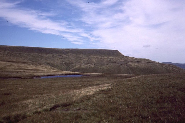
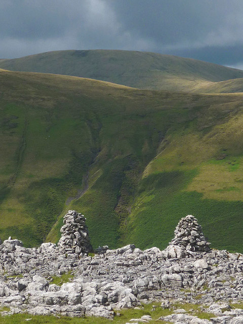
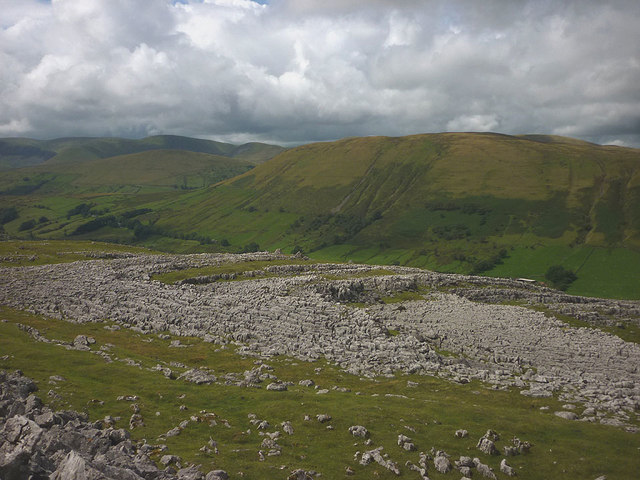
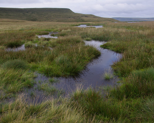
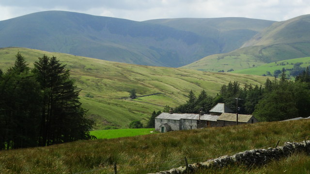
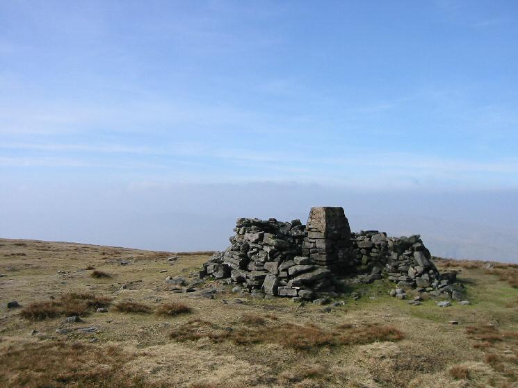
Flint Howe, located in Westmorland, is a prominent hill or mountain that offers a breathtaking panoramic view of the surrounding landscape. Situated in the northwestern region of England, this natural landmark stands tall at an elevation of approximately 500 meters (1,640 feet) above sea level.

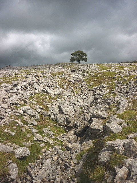
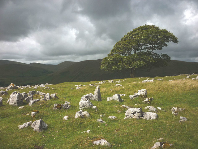
With its distinctively rugged terrain, Flint Howe is renowned for its unique geological formations, particularly its abundance of flint rocks. These flints, which have weathered over time, give the hill its name. The presence of these ancient stones adds to the area's rich history and geological significance.

Flint Howe is a popular destination for outdoor enthusiasts and nature lovers alike. Its challenging slopes and trails attract hikers, mountaineers, and trail runners who seek adventure and a physical challenge. The hill offers stunning views of the surrounding countryside, including rolling hills, lush green valleys, and distant peaks.

The flora and fauna of Flint Howe are diverse and thriving. The hill is home to a variety of plant species, including heather, gorse, and wildflowers, which add vibrant colors to the landscape. Wildlife such as rabbits, hares, and various bird species can also be spotted, making it an ideal location for birdwatching and nature photography.

Flint Howe holds historical significance as well. It has been a site of interest for archaeologists, who have discovered ancient artifacts and evidence of early human settlements in the area. These findings contribute to our understanding of the region's past and its cultural heritage.

Overall, Flint Howe in Westmorland is a captivating natural landmark that combines stunning landscapes, geological wonders, and historical significance, making it a must-visit location for those seeking an immersive outdoor experience.

If you have any feedback on the listing, please let us know in the comments section below.

Flint Howe Images

Images are sourced within 2km of 54.376544/-2.4070734 or Grid Reference SD7397. Thanks to Geograph Open Source API. All images are credited.

Converted Wesleyan Chapel
Wesleyan Chapel Conversion
Ruined barn off the A683 Near Foggy Hill.
Ruined barn off the A683
Near Foggy Hill.
A683 near Foggy Hill
Tarn beneath Wild Boar Fell The boggy col with Swarth Fell.
Tarn beneath Wild Boar Fell
The boggy col with Swarth Fell.
Twin cairns, Fell End Clouds The shattered limestone of the Clouds contrasts sharply with the grassy flanks of the Howgill Fells beyond. Since 2016 everything in this area has been incorporated into the Yorkshire Dales National Park.
Twin cairns, Fell End Clouds
The shattered limestone of the Clouds contrasts sharply with the grassy flanks of the Howgill Fells beyond. Since 2016 everything in this area has been incorporated into the Yorkshire Dales National Park.
Old workings, Fell End Clouds On the southern slope of the Clouds are a series of open, parallel grooves which were probably worked for lead. One magnificent, solitary sycamore stands in the midst of them.
Old workings, Fell End Clouds
On the southern slope of the Clouds are a series of open, parallel grooves which were probably worked for lead. One magnificent, solitary sycamore stands in the midst of them.
The big tree on Fell End Clouds The solitary sycamore that is the only large tree growing on the limestone uplands. Here it is in November 2012 <a href="https://www.geograph.org.uk/photo/3222092">SD7399 : The big tree, Fell End Clouds</a>.
The big tree on Fell End Clouds
The solitary sycamore that is the only large tree growing on the limestone uplands. Here it is in November 2012 SD7399 : The big tree, Fell End Clouds.
Limestone pavements, Fell End Clouds The Clouds contain areas of pavement that contrast greatly with the smooth, grassy slopes of the adjacent Howgill Fells.
Limestone pavements, Fell End Clouds
The Clouds contain areas of pavement that contrast greatly with the smooth, grassy slopes of the adjacent Howgill Fells.
The dip between Swarth Fell and Wild Boar Fell
Old Waymarker Stone on Black Moss, Ravenstonedale parish Black Moss Waymarker Stone, standing stone by the UC road, in parish of Ravenstonedale (Eden District), Black Moss, beside the road.

To be surveyed

Milestone Society National ID: CBED_RAV
Old Waymarker Stone on Black Moss, Ravenstonedale parish
Black Moss Waymarker Stone, standing stone by the UC road, in parish of Ravenstonedale (Eden District), Black Moss, beside the road. To be surveyed Milestone Society National ID: CBED_RAV
Old Milestone by the A683, Low Dovengill, Ravenstonedale parish Carved stone post by the A683, in parish of Ravenstonedale (Eden District), Low Dovengill, 150m Northeast of Methodist Chapel, on the verge, on West side of road. Sedbergh Kirkby stone, erected by the Sedbergh turnpike trust in the 18th century. 

Inscription reads:-
: KY STEPHEN / 7 / MILES : : SEDBERGH / 7 / MILES :

Grade II listed.  
List Entry Number: 1248962 <span class="nowrap"><a title="https://historicengland.org.uk/listing/the-list/list-entry/1248962" rel="nofollow ugc noopener" href="https://historicengland.org.uk/listing/the-list/list-entry/1248962">Link</a><img style="margin-left:2px;" alt="External link" title="External link - shift click to open in new window" src="https://s1.geograph.org.uk/img/external.png" width="10" height="10"/></span>

Milestone Society National ID: WE_SBKS07
Old Milestone by the A683, Low Dovengill, Ravenstonedale parish
Carved stone post by the A683, in parish of Ravenstonedale (Eden District), Low Dovengill, 150m Northeast of Methodist Chapel, on the verge, on West side of road. Sedbergh Kirkby stone, erected by the Sedbergh turnpike trust in the 18th century. Inscription reads:- : KY STEPHEN / 7 / MILES : : SEDBERGH / 7 / MILES : Grade II listed. List Entry Number: 1248962 LinkExternal link Milestone Society National ID: WE_SBKS07
Tarn below Wild Boar Fell On the boggy col between Wild Boar Fell (in background) and Swarth Fell
Tarn below Wild Boar Fell
On the boggy col between Wild Boar Fell (in background) and Swarth Fell
Ridge south from Wild Boar Fell towards Swarth Fell Even after some exceptional wet weather the route between Wild Boar Fell and Swarth Fell wasn't too wet underfoot. A path runs the whole way.
Ridge south from Wild Boar Fell towards Swarth Fell
Even after some exceptional wet weather the route between Wild Boar Fell and Swarth Fell wasn't too wet underfoot. A path runs the whole way.
New House Farm, & view towards Howgill Fells
White Green on Black Moss, W of Wild Boar Fell
Tunstall Tractors, Foggy Hill, Cautley, Cumbria
Show me another place!

Flint Howe is located at Grid Ref: SD7397 (Lat: 54.376544, Lng: -2.4070734)

Administrative County: Cumbria

District: Eden

Police Authority: Cumbria

What 3 Words

///increment.courts.accompany. Near Sedbergh, Cumbria

Nearby Locations

Flint Howe

Related Wikis

Wild Boar Fell

Wild Boar Fell is a mountain in the Yorkshire Dales National Park, on the eastern edge of Cumbria, England. At 2,323 feet (708 m), it is either the 4th...

Swarth Fell

Swarth Fell is an approximately 1 mile (1.5 km) stretch of high ground (consisting mainly of limestone capped with millstone grit) situated to the south...

1913 Ais Gill rail accident

The Ais Gill rail accident occurred on the Settle–Carlisle line in Northwest England on 2 September 1913. Two long trains were both ascending a steep gradient...

1995 Ais Gill rail accident

The 1995 Ais Gill rail accident occurred near Aisgill, Cumbria, UK, at about 18:55 on 31 January 1995, when a class 156 Super-Sprinter was derailed by...

Aisgill

Aisgill is the southernmost of the hamlets that form the parish of Mallerstang in the English county of Cumbria. It is on the B6259 road, at the head of...

Eden Sike Cave

Eden Sike Cave is a small cave in Mallerstang in the Eden valley in Cumbria, England 400 metres (440 yd) north of Hell Gill. The entrance is 391 metres...

Yarlside

Yarlside is a hill in the Howgill Fells, Cumbria (historically Westmorland), England. This fell is not to be confused with the Yarlside area near Barrow...

Randygill Top

Randygill Top is a mountain located in the Howgill Fells, Cumbria (historically Westmorland), England. == References ==

Nearby Amenities

Located within 500m of 54.376544,-2.4070734
Natural: sinkhole
Lat/Long: 54.378254/-2.4014616
Natural: sinkhole
Lat/Long: 54.3790102/-2.4047066
Natural: sinkhole
Lat/Long: 54.3779859/-2.4055645
Natural: sinkhole
Lat/Long: 54.3764757/-2.4069945
Natural: sinkhole
Lat/Long: 54.3774543/-2.4059131
Natural: sinkhole
Lat/Long: 54.3749121/-2.4079987
Natural: sinkhole
Lat/Long: 54.3756883/-2.4074773
Natural: sinkhole
Lat/Long: 54.3785341/-2.4094665
Natural: sinkhole
Lat/Long: 54.3781742/-2.4097175
Natural: sinkhole
Lat/Long: 54.3779942/-2.4098913
Natural: sinkhole
Lat/Long: 54.3738772/-2.4089837
Natural: sinkhole
Lat/Long: 54.3795511/-2.4079917
Natural: sinkhole
Lat/Long: 54.3792828/-2.4082508
Natural: sinkhole
Lat/Long: 54.3807248/-2.406322
Natural: sinkhole
Lat/Long: 54.3797775/-2.4041485
Natural: sinkhole
Lat/Long: 54.3804062/-2.4036159
Natural: sinkhole
Lat/Long: 54.3792912/-2.4032992
Natural: sinkhole
Lat/Long: 54.3789307/-2.4036015
Natural: sinkhole
Lat/Long: 54.3783523/-2.4040477
Natural: sinkhole
Lat/Long: 54.3785619/-2.4050265
Flint Howe
Place: locality
Lat/Long: 54.3770255/-2.4015462
The data included in this document is from www.openstreetmap.org. The data is made available under ODbL.

Have you been to Flint Howe?

Leave your review of Flint Howe below (or comments, questions and feedback).