Corse Law

Hill, Mountain in Berwickshire

Scotland

Corse Law

Eye Water viewed from the road bridge near to Paitshill Looking south-westward.
Eye Water viewed from the road bridge near to Paitshill Credit: Peter Wood

Corse Law is a prominent hill located in the Scottish Borders region of Berwickshire. Rising to an elevation of approximately 488 meters (1,601 feet), it is classified as a Marilyn, which denotes a hill with a prominence of at least 150 meters (492 feet). Situated just north of the village of Cranshaws, Corse Law offers breathtaking views of the surrounding landscape.

The hill is characterized by its rugged and rocky terrain, covered in heather and grasses. It is a popular destination for hiking and hillwalking enthusiasts, who are drawn to its challenging slopes and scenic vistas. The ascent to the summit can be achieved via various routes, with the most common starting point being the small car park near Cranshaws.

As climbers make their way up Corse Law, they are treated to panoramic views of the Berwickshire countryside, with rolling hills, farmland, and distant mountains visible in the distance. On clear days, it is even possible to catch a glimpse of the North Sea to the east.

Corse Law is also home to a number of ancient archaeological sites, including a cairn and a burial chamber. These remnants of the past add an extra layer of historical significance to the hill, attracting history enthusiasts and archaeology buffs.

Overall, Corse Law in Berwickshire is a captivating natural landmark, offering outdoor enthusiasts a chance to immerse themselves in the stunning Scottish countryside while enjoying a challenging hike and discovering the area's rich historical heritage.

If you have any feedback on the listing, please let us know in the comments section below.
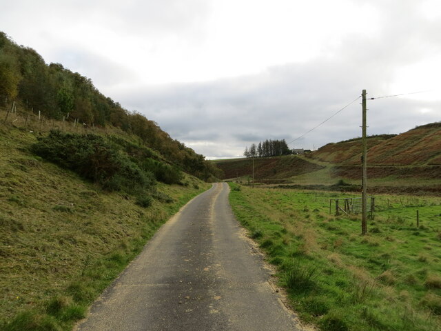
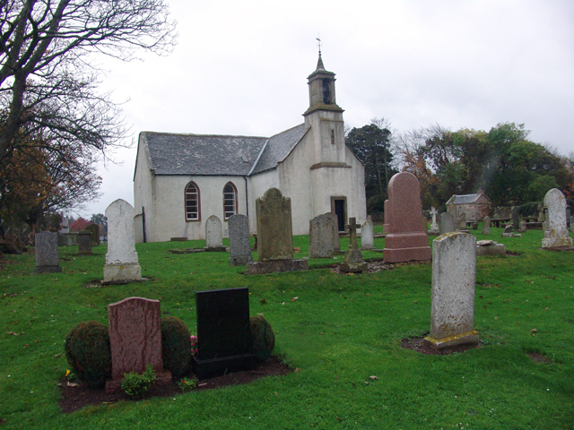
Corse Law Images

Images are sourced within 2km of 55.887385/-2.4281876 or Grid Reference NT7366. Thanks to Geograph Open Source API. All images are credited.

Eye Water viewed from the road bridge near to Paitshill Looking south-westward.
Eye Water viewed from the road bridge near to Paitshill
Looking south-westward.
Sheep pasture and woodland near Corse Law Looking south-eastward.
Sheep pasture and woodland near Corse Law
Looking south-eastward.
Sheep pens and woodland near Corse Law Looking southward.
Sheep pens and woodland near Corse Law
Looking southward.
Track for access to Middle Monynut Looking north-westward in the direction of some of the Aikengall II Community Wind Farm turbines.
Track for access to Middle Monynut
Looking north-westward in the direction of some of the Aikengall II Community Wind Farm turbines.
Minor road and buildings at Nether Monynut Looking southward.
Minor road and buildings at Nether Monynut
Looking southward.
Minor road following the course of Monynut Water down the valley Looking southward.
Minor road following the course of Monynut Water down the valley
Looking southward.
Ordnance Survey Cut Mark This mark can be found on the wall of a building at Nether Monynut.
The recorded details give a height of 235.1105 metres above sea level.
For more detail see : <span class="nowrap"><a title="https://www.bench-marks.org.uk/bm208282" rel="nofollow ugc noopener" href="https://www.bench-marks.org.uk/bm208282">Link</a><img style="margin-left:2px;" alt="External link" title="External link - shift click to open in new window" src="https://s1.geograph.org.uk/img/external.png" width="10" height="10"/></span>
Ordnance Survey Cut Mark
This mark can be found on the wall of a building at Nether Monynut. The recorded details give a height of 235.1105 metres above sea level. For more detail see : LinkExternal link
Cattle Grid and long view towards Ecclaw looking towards the North Sea at Pease Bay
Cattle Grid and long view towards Ecclaw
looking towards the North Sea at Pease Bay
Flocks, looking to Fannanside I centred this on the foreground rather but Fannanside is in the same square so the exact location can be amended if required.
Flocks, looking to Fannanside
I centred this on the foreground rather but Fannanside is in the same square so the exact location can be amended if required.
Lammermuir Road Road from Ecclaw to Nether Monynut. Whareburn runs through the valley.
Lammermuir Road
Road from Ecclaw to Nether Monynut. Whareburn runs through the valley.
Middle Monynut, Lammermuirs View over Skinner Burn.
Middle Monynut, Lammermuirs
View over Skinner Burn.
Forest behind Dunglass Common
Gate on Paits Hill Possibly former moorland, now fertile grazing land on a Lammermuir hilltop (c. 250m asl)
Gate on Paits Hill
Possibly former moorland, now fertile grazing land on a Lammermuir hilltop (c. 250m asl)
Foul Rig Farmland won from Lammermuir moorland. Grazed by sheep.
Foul Rig
Farmland won from Lammermuir moorland. Grazed by sheep.
Zzzzap! 400 kV powerline. One of two from Torness power station, this runs to the substation at Eccles and links up with the English grid.
Zzzzap!
400 kV powerline. One of two from Torness power station, this runs to the substation at Eccles and links up with the English grid.
Strip wood Small protective plantation along a damp reentrant. Surrounding fields are all grazed by sheep.  The OS show a path to Lucky Shiel here, no sign of it  on the ground, but there are helpful stiles.
Strip wood
Small protective plantation along a damp reentrant. Surrounding fields are all grazed by sheep. The OS show a path to Lucky Shiel here, no sign of it on the ground, but there are helpful stiles.
Sheep pasture and disk harrow This field is left open to the sheep in neighbouring fields as it has a spring for watering. Dykes are common in this area. The old disk harrow looks as if it has been there a while.
Sheep pasture and disk harrow
This field is left open to the sheep in neighbouring fields as it has a spring for watering. Dykes are common in this area. The old disk harrow looks as if it has been there a while.
Sheep pastures, Fannanside, Berwickshire South of the wooded top of Fannanside, grassland currently occupied by sheep.
Sheep pastures, Fannanside, Berwickshire
South of the wooded top of Fannanside, grassland currently occupied by sheep.
Show me another place!

Corse Law is located at Grid Ref: NT7366 (Lat: 55.887385, Lng: -2.4281876)

Unitary Authority: The Scottish Borders

Police Authority: The Lothians and Scottish Borders

What 3 Words

///landlady.entitle.witty. Near Duns, Scottish Borders

Nearby Locations

Corse Law

Related Wikis

Oldhamstocks

Oldhamstocks or Aldhamstocks ("old dwelling place") is a civil parish and small village in the east of East Lothian, Scotland, adjacent to the Scottish...

Crystal Rig Wind Farm

Crystal Rig Wind Farm is an operational onshore wind farm located on the Lammermuir Hills in the Scottish Borders region of Scotland. When phase 1 was...

Abbey St Bathans

Abbey St Bathans (Scottish Gaelic: Abaid Bhaoithin) is a parish in the Lammermuir district of Berwickshire, in the eastern part of the Scottish Borders...

Bothwell Water

The Bothwell Water is a river in the Scottish Borders area of Scotland. It rises in the Lammermuir Hills near Caldercleugh and continues past the Upper...

Nearby Amenities

Located within 500m of 55.887385,-2.4281876
Corse Law
Ele: 318
Natural: peak
Lat/Long: 55.8875603/-2.4288585
Power: pole
Lat/Long: 55.8832514/-2.4271099
Power: pole
Lat/Long: 55.8836638/-2.4260974
Power: pole
Lat/Long: 55.8840737/-2.4250913
Power: pole
Lat/Long: 55.8845958/-2.4242528
Power: pole
Lat/Long: 55.8851227/-2.4234316
Power: pole
Lat/Long: 55.8856412/-2.4225889
Power: pole
Lat/Long: 55.8861174/-2.4218816
Power: pole
Lat/Long: 55.8865997/-2.4211743
The data included in this document is from www.openstreetmap.org. The data is made available under ODbL.

Have you been to Corse Law?

Leave your review of Corse Law below (or comments, questions and feedback).