Coleridge Hill

Hill, Mountain in Gloucestershire Forest of Dean

England

Coleridge Hill

Durbridge Mill buildings Buildings alongside the track through Durbridge Mill Farm.
Durbridge Mill buildings Credit: Pebble

Coleridge Hill is a prominent geographical feature located in the county of Gloucestershire, England. It is classified as a hill and is situated in the southern part of the county, near the town of Stroud. Rising to an elevation of approximately 252 meters (827 feet), Coleridge Hill offers stunning panoramic views of the surrounding countryside.

The hill is named after the famous English poet Samuel Taylor Coleridge, who was believed to have spent time in the area during the early 19th century. It is said that the natural beauty of the hill and its surroundings inspired Coleridge's poetry, particularly his renowned work, "The Rime of the Ancient Mariner."

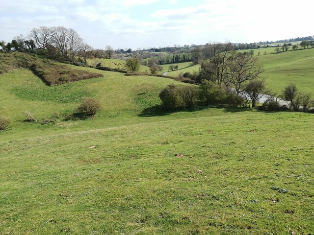
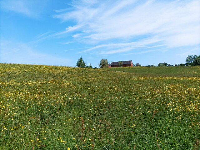
Coleridge Hill is characterized by its rolling green slopes and is predominantly covered in grassland and scattered trees. It is a popular destination for hikers and nature enthusiasts, offering various walking trails that lead to the summit. The hill's terrain is relatively gentle, making it accessible for people of all ages and fitness levels.

In addition to its natural beauty, Coleridge Hill is also home to a diverse range of flora and fauna. The hill's grassy slopes support a variety of wildflowers, while its woodland areas provide habitat for numerous bird species and small mammals.

Overall, Coleridge Hill is a picturesque and historically significant landmark in Gloucestershire. Its association with the renowned poet and its breathtaking views make it a must-visit destination for those seeking a tranquil escape in the English countryside.

If you have any feedback on the listing, please let us know in the comments section below.

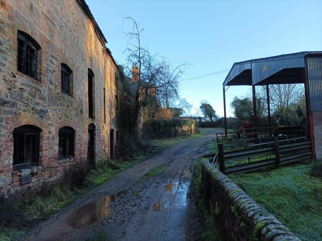
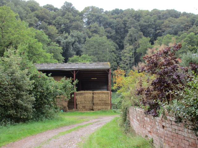
Coleridge Hill Images

Images are sourced within 2km of 51.977606/-2.3910484 or Grid Reference SO7331. Thanks to Geograph Open Source API. All images are credited.

Durbridge Mill buildings Buildings alongside the track through Durbridge Mill Farm.
Durbridge Mill buildings
Buildings alongside the track through Durbridge Mill Farm.
Fields near Welsh House Lane Grassy fields and rolling hills near Welsh House Lane.
Fields near Welsh House Lane
Grassy fields and rolling hills near Welsh House Lane.
Field of buttercups A large field of buttercups and other wildflowers.
Field of buttercups
A large field of buttercups and other wildflowers.
Footbridge over the River Leadon There are a number of footpaths in the area, this footbridge enables walkers to cross the River Leadon near Durbridge Farm.
Footbridge over the River Leadon
There are a number of footpaths in the area, this footbridge enables walkers to cross the River Leadon near Durbridge Farm.
River Leadon near Durbridge Mill Trees reflected in the River Leadon which is flowing at a very low level after a prolong period of low rainfall. Note the exposed tree roots on the riverbank.
River Leadon near Durbridge Mill
Trees reflected in the River Leadon which is flowing at a very low level after a prolong period of low rainfall. Note the exposed tree roots on the riverbank.
Bridge reflected in the River Leadon Bridge reflected in the River Leadon near Durbridge Mill.
Bridge reflected in the River Leadon
Bridge reflected in the River Leadon near Durbridge Mill.
Building at Durbridge Mill The remains of a round building at Durbridge Mill near Poolhill, not sure what its original purpose was.
Building at Durbridge Mill
The remains of a round building at Durbridge Mill near Poolhill, not sure what its original purpose was.
Former mill buildings Former mill buildings at Durbridge Mill beside the River Leadon.
Former mill buildings
Former mill buildings at Durbridge Mill beside the River Leadon.
Old millwheel, Durbridge Mill
Traditional farm buildings, Durbridge Mill Traditional red-brick farm buildings at Durbridge Mill.
Traditional farm buildings, Durbridge Mill
Traditional red-brick farm buildings at Durbridge Mill.
Road to Durbridge Mill Road to Durbridge Mill which appears now to be a farm.
Road to Durbridge Mill
Road to Durbridge Mill which appears now to be a farm.
The River Leadon at Payford Bridge Looking upstream. It is marginal as to whether the river here is in SO7429 or SO7430, but I am relying on my GPS reading.

The Explorer map has this as 'Playford Bridge', but the Landranger has 'Payford'. As the Explorer has 'Payford Mill' nearby, I have assumed this to be the correct name.
The River Leadon at Payford Bridge
Looking upstream. It is marginal as to whether the river here is in SO7429 or SO7430, but I am relying on my GPS reading. The Explorer map has this as 'Playford Bridge', but the Landranger has 'Payford'. As the Explorer has 'Payford Mill' nearby, I have assumed this to be the correct name.
Farmland at Poolhill
Farmland at Hayes Farm
Weir on the River Leadon I guess it's all relative. At this point the River Leadon barely counts as a river being little more than a metre wide so a weir that's maybe 15cm high is just right proportionately (though the water has found a way round it).
Weir on the River Leadon
I guess it's all relative. At this point the River Leadon barely counts as a river being little more than a metre wide so a weir that's maybe 15cm high is just right proportionately (though the water has found a way round it).
Barn at Durbridge Mill
Restoration work at Durbridge Farm
View down to Durbridge Mill Farm
Show me another place!

Coleridge Hill is located at Grid Ref: SO7331 (Lat: 51.977606, Lng: -2.3910484)

Administrative County: Gloucestershire

District: Forest of Dean

Police Authority: Gloucestershire

What 3 Words

///ranking.shaky.trickling. Near Donnington, Herefordshire

Related Wikis

Ketford Bank

Ketford Bank (grid reference SO723308) is a 0.69-hectare (1.7-acre) nature reserve in Gloucestershire.The site is owned and managed by the Gloucestershire...

Redmarley D'Abitot

Redmarley D'Abitot is a civil parish and village in the Forest of Dean district, Gloucestershire, South West England. In addition to the village of Redmarley...

Vell Mill Daffodil Meadow

Vell Mill Daffodil Meadow (grid reference SO710314) is a 2.1-hectare (5.2-acre) nature reserve in Gloucestershire.The site is owned and managed by the...

Three Counties (Gloucestershire, Herefordshire and Worcestershire)

The Three Counties of England are traditionally the three agrarian counties of Gloucestershire, Herefordshire and Worcestershire.Including towns and cities...

Nearby Amenities

Located within 500m of 51.977606,-2.3910484
Ketford
Place: hamlet
Source: OS 1:25k
Lat/Long: 51.9748337/-2.3945245
Coleridge Hill
Natural: peak
Source: OS 1:25k
Lat/Long: 51.9774376/-2.3910269
Barrier: cattle_grid
Bicycle: yes
Foot: yes
Lat/Long: 51.9752237/-2.3945511
Barrier: kissing_gate
Foot: yes
Lat/Long: 51.9756904/-2.3883013
Ryton Nurseries
Power: pole
Transformer: distribution
Voltage Primary: 11000
Lat/Long: 51.9794128/-2.3971608
Great Ketford Farm
Power: pole
Transformer: distribution
Voltage Primary: 11000
Lat/Long: 51.9760979/-2.3911087
Power: pole
Lat/Long: 51.9756558/-2.3916317
Power: pole
Lat/Long: 51.9749329/-2.3925128
Power: pole
Lat/Long: 51.9740981/-2.3934961
Power: pole
Lat/Long: 51.9736441/-2.3937463
Ketford Mill Cottage
Power: pole
Transformer: distribution
Voltage Primary: 11000
Lat/Long: 51.9765938/-2.3980343
The data included in this document is from www.openstreetmap.org. The data is made available under ODbL.

Have you been to Coleridge Hill?

Leave your review of Coleridge Hill below (or comments, questions and feedback).