Colvin's Hill
Hill, Mountain in Roxburghshire
Scotland
Colvin's Hill

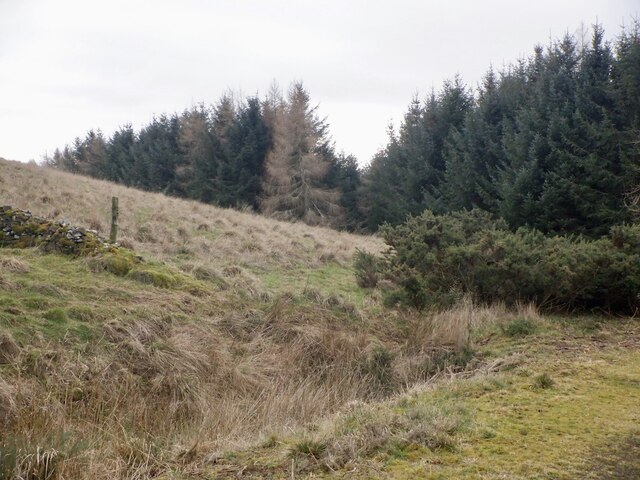
Colvin's Hill, located in Roxburghshire, Scotland, is a prominent hill that offers breathtaking views of the surrounding landscape. Rising to an elevation of approximately 280 meters (918 feet), it is not classified as a mountain but rather a hill. Despite its modest height, Colvin's Hill is a popular destination for hikers, nature enthusiasts, and photographers.
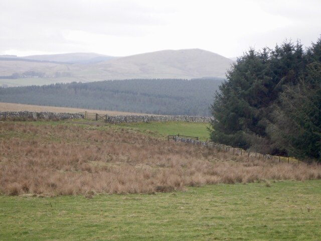
Situated near the village of Denholm, Colvin's Hill provides a stunning panoramic view of the picturesque Teviot Valley and the rolling countryside of Roxburghshire. On clear days, visitors can see as far as the Cheviot Hills, the Eildon Hills, and the distant Lammermuir Hills. The hill's strategic location makes it an ideal spot for capturing beautiful sunrise or sunset photographs.
The ascent to Colvin's Hill is relatively easy, with a well-marked trail leading to the summit. It is a favorite destination for local walkers who appreciate the tranquility and natural beauty the hill offers. The vegetation on the hillside is diverse, ranging from heather and bracken to scattered trees, adding to the visual appeal of the landscape.
Colvin's Hill also holds historical significance. It is said to have been named after Sir Robert Colville, a Scottish soldier who fought in the Battle of Waterloo. Ruins of an ancient fort can still be found on the hill, reminding visitors of its rich past.
Overall, Colvin's Hill in Roxburghshire is a captivating destination for those seeking a peaceful and scenic escape. Whether one is a keen hiker, a nature lover, or simply someone looking to enjoy the beauty of the Scottish countryside, Colvin's Hill is a must-visit location.
If you have any feedback on the listing, please let us know in the comments section below.
Colvin's Hill Images
Images are sourced within 2km of 55.43711/-2.4346765 or Grid Reference NT7216. Thanks to Geograph Open Source API. All images are credited.


Colvin's Hill is located at Grid Ref: NT7216 (Lat: 55.43711, Lng: -2.4346765)
Unitary Authority: The Scottish Borders
Police Authority: The Lothians and Scottish Borders
What 3 Words
///diagram.witless.paradise. Near Jedburgh, Scottish Borders
Nearby Locations
Related Wikis

Oxnam
Oxnam (Scots: Owsenam) is a village near Jedburgh, in Roxburghshire in the Scottish Borders area of Scotland. It is a primarily residential village. The...

Pennymuir Roman camps
The Pennymuir Roman camps are situated southeast of Jedburgh in the Scottish Borders area of Scotland, near the Anglo-Scottish border, in the former Roxburghshire...

Camptown, Scottish Borders
Camptown is a small settlement on the A68, in the Scottish Borders area of Scotland, 5m (8 km) south of Jedburgh, and the same distance south to Carter...

Edgerston
Edgerston is a village and an estate about 4 miles (6.4 km) north of the Anglo-Scottish border, and 8 miles (13 km) south of Jedburgh in the Scottish Borders...

Hownam
Hownam or Hounam is a small village and parish situated 8 miles east of Jedburgh in the Scottish Borders area of Scotland, near the Anglo-Scottish border...

Crailinghall
Crailinghall is a village near Oxnam in the Scottish Borders area of Scotland, in the former Roxburghshire. Crailinghall is on the route of the St. Cuthbert...

Bairnkine
Bairnkine is a hamlet on the Jed Water in the Scottish Borders area of Scotland, on the A68, south of Jedburgh. Other places nearby include Abbotrule,...

Ferniehirst Castle
Ferniehirst Castle (sometimes spelled Ferniehurst) is an L-shaped construction on the east bank of the Jed Water, about a mile and a half south of Jedburgh...
Nearby Amenities
Located within 500m of 55.43711,-2.4346765Have you been to Colvin's Hill?
Leave your review of Colvin's Hill below (or comments, questions and feedback).