High Scald Fell

Hill, Mountain in Westmorland Eden

England

High Scald Fell

The Pennine Way near Swindale Beck
The Pennine Way near Swindale Beck Credit: Dave Kelly

High Scald Fell, located in Westmorland, is a prominent hill/mountain that stands at an elevation of 621 meters (2,037 feet) above sea level. Situated in the Lake District National Park, it forms part of the majestic Cumbrian landscape in the county of Cumbria, England.

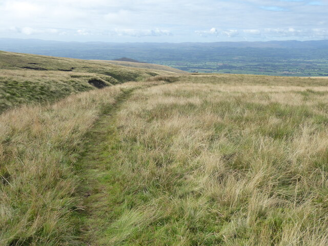
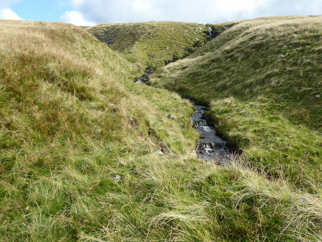
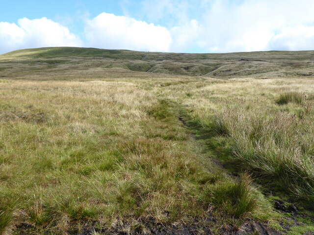
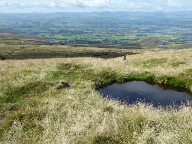
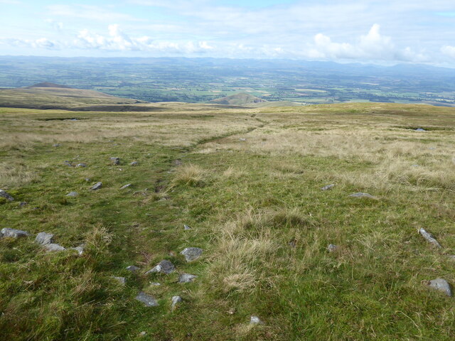
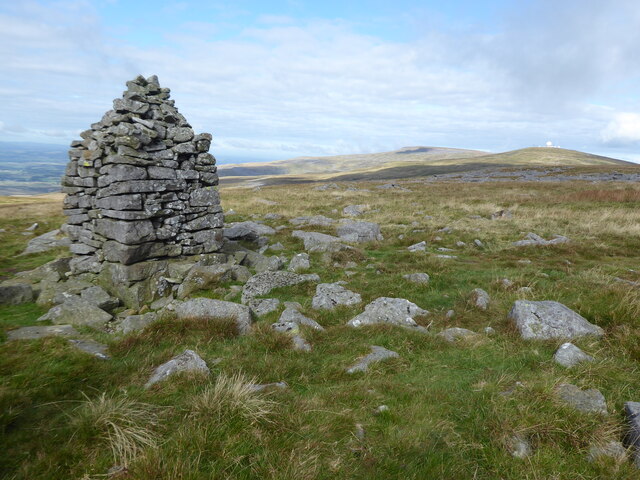
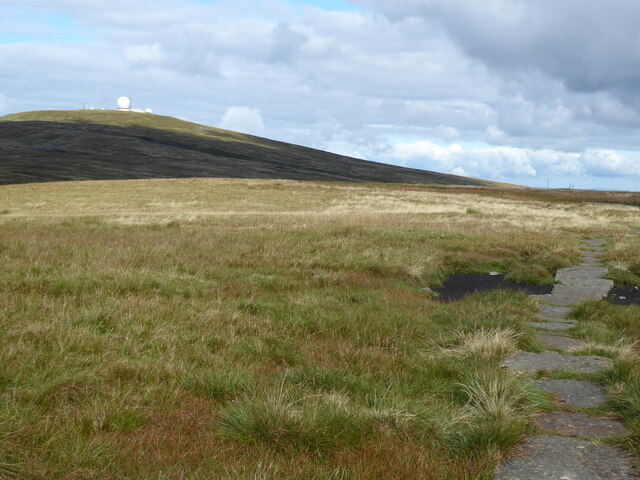
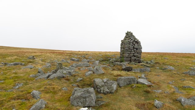
The summit of High Scald Fell offers breathtaking panoramic views of the surrounding area, including the nearby fells of Carrock Fell, Knott, and Great Calva. On a clear day, visitors can also enjoy vistas of the Solway Firth and the Scottish mountains to the north. The hill/mountain is characterized by its rugged terrain, with rocky outcrops and heathland dominating the landscape.

The ascent to High Scald Fell can be done from various starting points, with the most popular route beginning from the hamlet of Mosedale. The hike is of moderate difficulty, with a well-defined path leading walkers through moorland and grassy slopes. As one nears the summit, the terrain becomes more challenging, requiring some scrambling over boulders.

High Scald Fell is a haven for outdoor enthusiasts, attracting hikers, mountain bikers, and nature lovers alike. The area is home to an array of wildlife, including red deer, birds of prey, and various species of moorland birds. The hill/mountain provides an opportunity for visitors to immerse themselves in the tranquility of the Lake District, offering a peaceful retreat from the hustle and bustle of everyday life.

Overall, High Scald Fell is a captivating destination for those seeking adventure, natural beauty, and a chance to connect with the stunning landscapes of Westmorland.

If you have any feedback on the listing, please let us know in the comments section below.

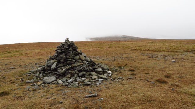
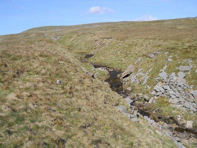
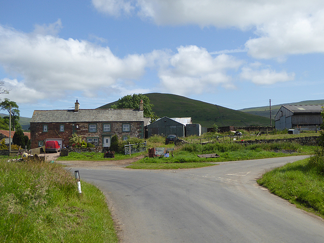
High Scald Fell Images

Images are sourced within 2km of 54.6539/-2.4352768 or Grid Reference NY7228. Thanks to Geograph Open Source API. All images are credited.

The Pennine Way near Swindale Beck
The Pennine Way near Knock Hush
The Pennine Way near Green Fell Spring
Ordnance Survey Pivot This OS pivot can be found on a boulder. It marks a point 1319.4ft above mean sea level.
Ordnance Survey Pivot
This OS pivot can be found on a boulder. It marks a point 1319.4ft above mean sea level.
The Pennine Way near Knock Old Man
The Pennine Way at Knock Old Man
The Pennine Way near Knock Fell
Knock Old Man (Currick) Knock Fell
Cairn on summit of Knock Fell - view towards Great Dun Fell
Knock Hush
Knock Hush
Bridleway to Threlkeld Side The bridleway was used by the mines in the Great Rundale valley. The scar in the hillside on the right  is a hush - a man-made gorge formed by releasing the water from dammed streams, washing away the upper layers of earth to expose seams of ore.
Bridleway to Threlkeld Side
The bridleway was used by the mines in the Great Rundale valley. The scar in the hillside on the right is a hush - a man-made gorge formed by releasing the water from dammed streams, washing away the upper layers of earth to expose seams of ore.
Great Rundale Great Rundale is a significant slice into the western flank of the north Pennines. Historically it's seen much mineral mining and the valley is scarred both in the stretch visible here and in its upper reaches with the extensive remains of it. The view is from a mine and estate road on the valley's south side; it's line can be seen entering the right edge of the image. The black dot a short way along the road is a fine old lime kiln: <a title="https://www.geograph.org.uk/photo/1921590" href="https://www.geograph.org.uk/photo/1921590">Link</a>.
Great Rundale
Great Rundale is a significant slice into the western flank of the north Pennines. Historically it's seen much mineral mining and the valley is scarred both in the stretch visible here and in its upper reaches with the extensive remains of it. The view is from a mine and estate road on the valley's south side; it's line can be seen entering the right edge of the image. The black dot a short way along the road is a fine old lime kiln: Link.
Great Rundale, eroding hill slope Great Rundale has seen much mining activity in the past and some of the evidence is seen here, viewed from a track on the south side of the valley, above the main estate road through it. The steep eroded slope may or may not be mined and discarded material but a terrace below the upper rocks suggests that it is mine spoil dumped below from there. There are a number of remaining fragments of masonry which surely will soon be lost to the on-going erosion of the slope.
Great Rundale, eroding hill slope
Great Rundale has seen much mining activity in the past and some of the evidence is seen here, viewed from a track on the south side of the valley, above the main estate road through it. The steep eroded slope may or may not be mined and discarded material but a terrace below the upper rocks suggests that it is mine spoil dumped below from there. There are a number of remaining fragments of masonry which surely will soon be lost to the on-going erosion of the slope.
Peat banks, pools and Great Rundale Tarn Great Rundale is a steep cleft of a valley into the western flank of the northern Pennines and a walk through it is very much 'Lake District' in character. Above 650m however the steepness ends and the nature of the landscape becomes moorland in appearance. The view here is to the west end of Great Rundale Tarn over peat banks and pools; Meldon Hill is the distant mountain.
Peat banks, pools and Great Rundale Tarn
Great Rundale is a steep cleft of a valley into the western flank of the northern Pennines and a walk through it is very much 'Lake District' in character. Above 650m however the steepness ends and the nature of the landscape becomes moorland in appearance. The view here is to the west end of Great Rundale Tarn over peat banks and pools; Meldon Hill is the distant mountain.
Great Rundale Tarn Great Rundale Tarn lies amid undulating moorland to the east of the head of Great Rundale. The eastern end of the lake is seen here with Mickle Fell and Little Fell the distant peaks; both lie within the MOD Warcop firing range.
Great Rundale Tarn
Great Rundale Tarn lies amid undulating moorland to the east of the head of Great Rundale. The eastern end of the lake is seen here with Mickle Fell and Little Fell the distant peaks; both lie within the MOD Warcop firing range.
Trig point above Backstone Edge The trig point seen here (known to the OS as 'Dufton'), is not at  the local high point but perhaps 250m to the south-west of it; the trig point location is given as 692m - 7m lower. The view is generally to the north where Cross Fell, the Dun Fells and Knock Fell are seen.
Note: Listings of two thousand foot hills generally name the 'peak' here as Backstone Edge but that name actually refers to an horizon of the western slope of the mountain to the south of both the trig and the true summit; in all probability, this hill is effectively nameless.
Further Note: The trig point has been robbed of its bronze flush bracket; the cavity can be seen.
Trig point above Backstone Edge
The trig point seen here (known to the OS as 'Dufton'), is not at the local high point but perhaps 250m to the south-west of it; the trig point location is given as 692m - 7m lower. The view is generally to the north where Cross Fell, the Dun Fells and Knock Fell are seen. Note: Listings of two thousand foot hills generally name the 'peak' here as Backstone Edge but that name actually refers to an horizon of the western slope of the mountain to the south of both the trig and the true summit; in all probability, this hill is effectively nameless. Further Note: The trig point has been robbed of its bronze flush bracket; the cavity can be seen.
Show me another place!

High Scald Fell is located at Grid Ref: NY7228 (Lat: 54.6539, Lng: -2.4352768)

Administrative County: Cumbria

District: Eden

Police Authority: Cumbria

What 3 Words

///diary.flaunting.recur. Near Appleby-in-Westmorland, Cumbria

Related Wikis

Dufton Pike

Dufton Pike is a hill in the northern Pennines, in Cumbria, England. It is classed as a Marilyn (a hill with topographic prominence of at least 150m)....

High Cup Gill

High Cup Gill (or High Cup Nick or just High Cup), almost a geometrically perfect U-shaped chasm, is a valley deeply incised into the Pennine scarp to...

Knock, Cumbria

Knock is a small village in the Eden district of Cumbria, England, and 1.9 km northwest of the larger village of Dufton and 3.1 km south of the village...

St Cuthbert's Church, Dufton

St Cuthbert's Church is situated 3⁄4 mile (1.2 km) north of the village of Dufton, Cumbria, England. It should not be confused with the nearby St Cuthbert...

Dufton

Dufton is a village and civil parish in Cumbria, England. Historically part of Westmorland, it lies in the Eden Valley and below Great Dun Fell. It is...

Keisley

Keisley is a small hamlet in the English county of Cumbria. It is located in the Dufton civil parish and the Eden district. == Location and geography... ==

Warcop Training Area

The Warcop Training Area (WTA) is a UK Ministry of Defence military training area near the village of Warcop in Cumbria. Part of the Defence Training...

Murton Fell

Murton Fell is a hill of 675 metres (2,215 ft) above the village of Murton, Cumbria in Eden district, in the North Pennines. It lies east of the dramatic...

Nearby Amenities

Located within 500m of 54.6539,-2.4352768
High Scald Fell
Ele: 687.6
Place: locality
Razed Man Made: survey_point
Source: NPE
Lat/Long: 54.6516644/-2.4389634
Ele: 715
Natural: peak
Lat/Long: 54.6548834/-2.4280053
Man Made: cairn
Lat/Long: 54.6532998/-2.4276428
Natural: sinkhole
Lat/Long: 54.6495241/-2.4354736
Natural: sinkhole
Lat/Long: 54.6494265/-2.4355165
Natural: sinkhole
Lat/Long: 54.6501937/-2.4308735
Natural: sinkhole
Lat/Long: 54.6501904/-2.4310467
Natural: sinkhole
Lat/Long: 54.6501269/-2.4314566
Natural: sinkhole
Lat/Long: 54.6501837/-2.4316471
Natural: sinkhole
Lat/Long: 54.650698/-2.4406507
Natural: sinkhole
Lat/Long: 54.6508811/-2.440935
Natural: sinkhole
Lat/Long: 54.6509867/-2.4410852
Natural: sinkhole
Lat/Long: 54.651297/-2.4415144
Natural: sinkhole
Lat/Long: 54.651415/-2.4416378
Natural: sinkhole
Lat/Long: 54.6515888/-2.4417665
Natural: sinkhole
Lat/Long: 54.6516384/-2.4418094
Natural: sinkhole
Lat/Long: 54.6520791/-2.4423888
Natural: sinkhole
Lat/Long: 54.652315/-2.4424263
Natural: sinkhole
Lat/Long: 54.6524578/-2.4425658
Natural: sinkhole
Lat/Long: 54.6524112/-2.442539
Natural: sinkhole
Lat/Long: 54.6517812/-2.4419006
The data included in this document is from www.openstreetmap.org. The data is made available under ODbL.

Have you been to High Scald Fell?

Leave your review of High Scald Fell below (or comments, questions and feedback).