Kiln Knowes

Hill, Mountain in Northumberland

England

Kiln Knowes

Young trees near Brown Rigg Rather than being deliberately replanted the trees in this area appear to have grown naturally from dormant seed following the felling of the previous crop covering this area.
Young trees near Brown Rigg Credit: Graham Robson

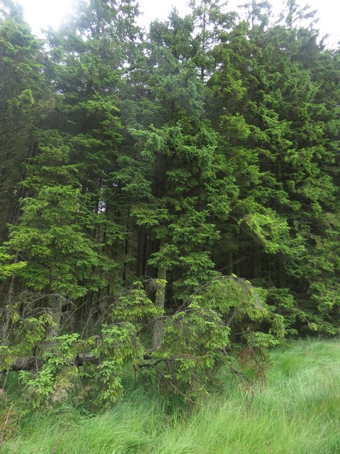
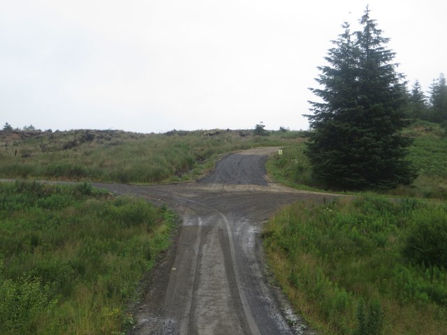
Kiln Knowes is a small hill located in the county of Northumberland, in the northeast of England. Situated near the village of Otterburn, this hill is part of the scenic Northumberland National Park. Kiln Knowes is known for its picturesque beauty and is a popular destination for outdoor enthusiasts and nature lovers.

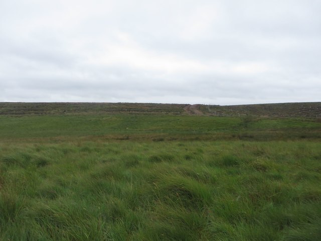
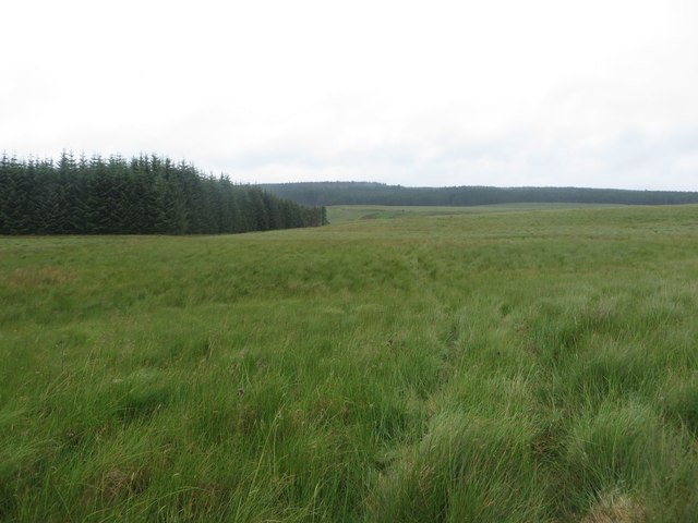
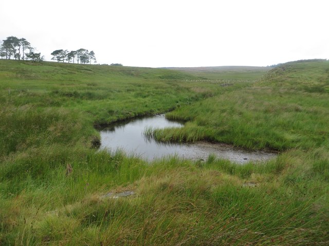
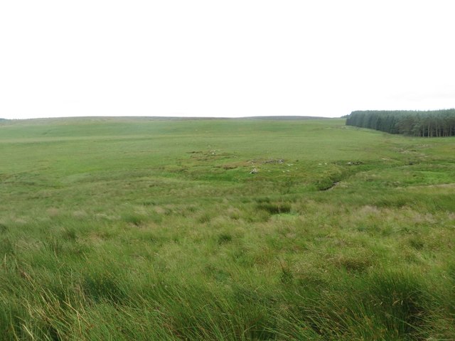
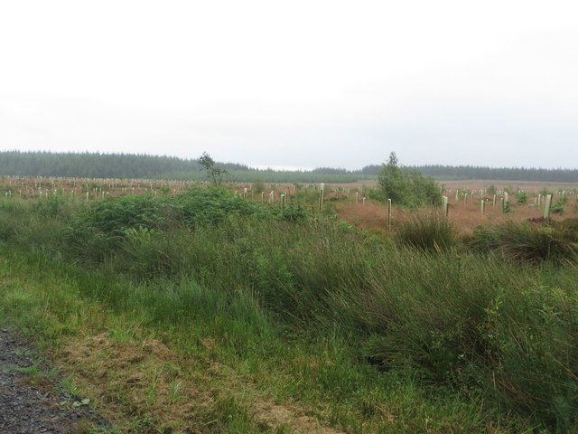
With an elevation of approximately 290 meters (950 feet), Kiln Knowes offers stunning panoramic views of the surrounding countryside. The hill is covered in lush greenery, with a mix of heather, grasses, and wildflowers. It is also home to a variety of wildlife, including birds, rabbits, and occasional deer, making it an ideal spot for birdwatching and wildlife observation.

Kiln Knowes is easily accessible by foot, and there are several well-marked walking trails that lead visitors to the summit. These trails offer a range of difficulty levels, catering to both casual walkers and more experienced hikers. The ascent to the top is moderately steep but manageable, providing an enjoyable challenge for those seeking a rewarding hike.

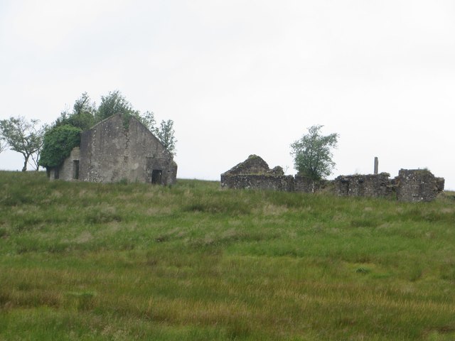
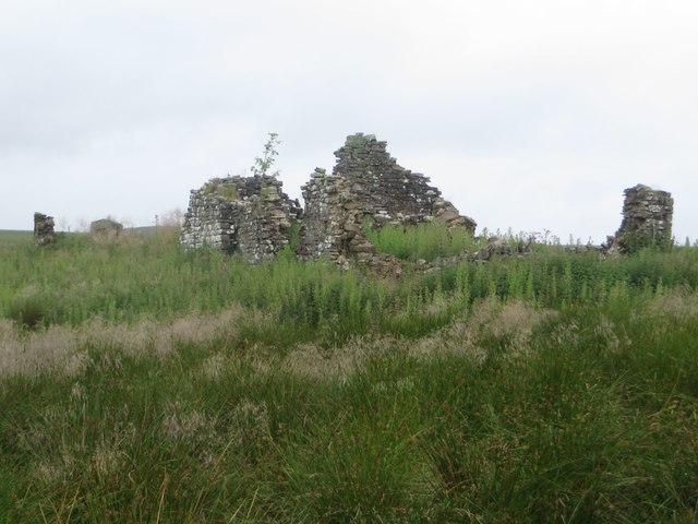
At the summit, there are the remains of an old lime kiln, which gives the hill its name. This historic feature adds an interesting element to the landscape and serves as a reminder of the area's industrial past.

Whether it's for a leisurely stroll, a challenging hike, or simply to enjoy the tranquility of nature, Kiln Knowes offers a delightful experience for visitors of all ages. Its natural beauty and captivating views make it a must-visit attraction in Northumberland.

If you have any feedback on the listing, please let us know in the comments section below.
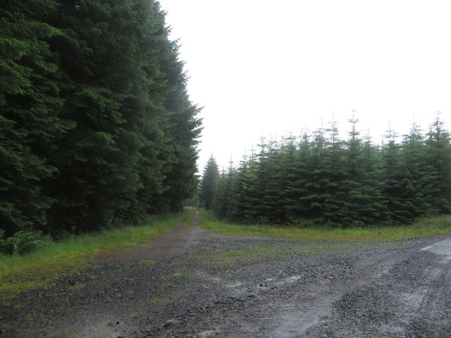
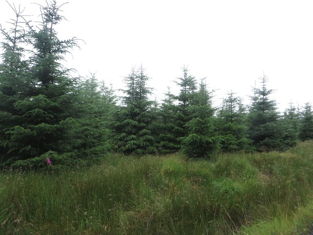
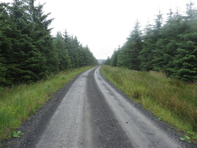
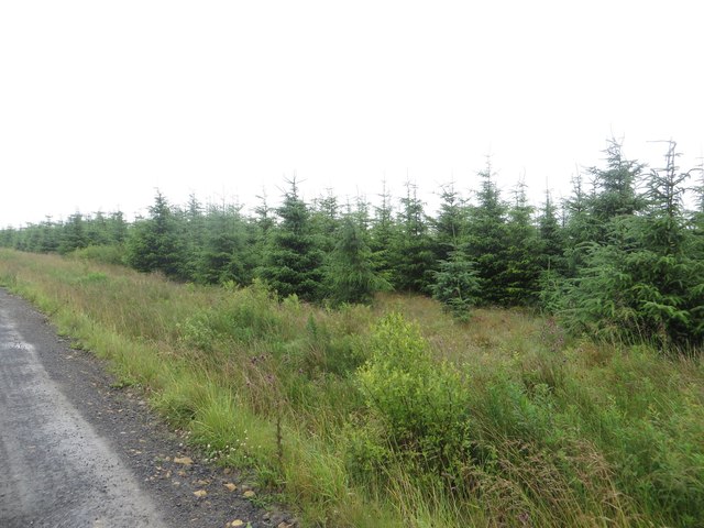
Kiln Knowes Images

Images are sourced within 2km of 55.075879/-2.4421667 or Grid Reference NY7175. Thanks to Geograph Open Source API. All images are credited.

Young trees near Brown Rigg Rather than being deliberately replanted the trees in this area appear to have grown naturally from dormant seed following the felling of the previous crop covering this area.
Young trees near Brown Rigg
Rather than being deliberately replanted the trees in this area appear to have grown naturally from dormant seed following the felling of the previous crop covering this area.
Empty plantation, Brown Rigg An area of Wark Forest which has been felled and not currently replanted. it looks like a large drainage channel has been fairly recently created in the foreground to carry water off the unplanted ground.
Empty plantation, Brown Rigg
An area of Wark Forest which has been felled and not currently replanted. it looks like a large drainage channel has been fairly recently created in the foreground to carry water off the unplanted ground.
Grassland in Wark Forest A large area in the middle of Wark Forest which has been left free of trees. Instead the rough ground is grazed by sheep. A public bridleway crosses the field.
Grassland in Wark Forest
A large area in the middle of Wark Forest which has been left free of trees. Instead the rough ground is grazed by sheep. A public bridleway crosses the field.
Grassland north of Brock's Hill Extensive grassland in the middle of Wark Forest grazed by a small number of sheep.
Grassland north of Brock's Hill
Extensive grassland in the middle of Wark Forest grazed by a small number of sheep.
Public bridleway crossing rough grassland Looking along the route of a bridleway which crosses the large expanse of rough grassland which is completely surrounded by parts of Kielder Forest.
Public bridleway crossing rough grassland
Looking along the route of a bridleway which crosses the large expanse of rough grassland which is completely surrounded by parts of Kielder Forest.
Derelict buildings west of Haining Head A ruined house and outbuildings in a large expanse of grassland to the west of Haining Head.
Derelict buildings west of Haining Head
A ruined house and outbuildings in a large expanse of grassland to the west of Haining Head.
West Sike, Haining Head A stream flowing through the extensive grassland around the ruined farm of Haining Head.
West Sike, Haining Head
A stream flowing through the extensive grassland around the ruined farm of Haining Head.
Ruined building at Haining Head A ruined house in the large expanse of grassland around Haining Head.
Ruined building at Haining Head
A ruined house in the large expanse of grassland around Haining Head.
Grassland in Wark Forest An extensive area of rough grassland in Wark Forest.
Grassland in Wark Forest
An extensive area of rough grassland in Wark Forest.
Trees in Wark Forest A wall of trees on the edge of Wark Forest. A public bridleway is meant to follow a route through the almost impenetrable tangle of trees.
Trees in Wark Forest
A wall of trees on the edge of Wark Forest. A public bridleway is meant to follow a route through the almost impenetrable tangle of trees.
Fallen trees near Preaching Heights Clear felling of the adjacent area of plantation has led to a large number of trees being blown over in the still standing area of trees to the east. These have made a bridleway through the plantation virtually impassable.
Fallen trees near Preaching Heights
Clear felling of the adjacent area of plantation has led to a large number of trees being blown over in the still standing area of trees to the east. These have made a bridleway through the plantation virtually impassable.
Junction of forest tracks near Preaching Heights A junction of forest tracks near Preaching Heights in Wark Forest.
Junction of forest tracks near Preaching Heights
A junction of forest tracks near Preaching Heights in Wark Forest.
Young trees near Hawthorne Rigg A reasonably young area of plantation beside the forest track passing Hawthorne Rigg.
Young trees near Hawthorne Rigg
A reasonably young area of plantation beside the forest track passing Hawthorne Rigg.
Forest Track in Wark Forest A forest track in Wark Forest, passing between dense areas of coniferous plantation.
Forest Track in Wark Forest
A forest track in Wark Forest, passing between dense areas of coniferous plantation.
Young plantation in Wark Forest A large area of young conifers in Wark Forest.
Young plantation in Wark Forest
A large area of young conifers in Wark Forest.
Track junction in Wark Forest A junction of forest tracks in Wark Forest.
Track junction in Wark Forest
A junction of forest tracks in Wark Forest.
Freshly replanted plantation near Felecia Crags A large area of freshly replanted plantation beside a forest track near Felecia Crags. The young trees are protected from being eaten by marauding wildlife by biodegradable sleeves.
Freshly replanted plantation near Felecia Crags
A large area of freshly replanted plantation beside a forest track near Felecia Crags. The young trees are protected from being eaten by marauding wildlife by biodegradable sleeves.
Footpath Gate North of Brock's Hill, Wark Forest Looking back towards the northern end of the forest path from Grindon Green.
Footpath Gate North of Brock's Hill, Wark Forest
Looking back towards the northern end of the forest path from Grindon Green.
Show me another place!

Kiln Knowes is located at Grid Ref: NY7175 (Lat: 55.075879, Lng: -2.4421667)

Unitary Authority: Northumberland

Police Authority: Northumbria

What 3 Words

///waistcoat.cattle.survey. Near Haltwhistle, Northumberland

Nearby Locations

Kiln Knowes Long Rigg

Related Wikis

Wark Forest

Wark Forest is the southern part of Kielder Forest in Northumberland, England. Wark Forest is found within the south-west tip of Northumberland National...

Churnsike Lodge

Churnsike Lodge is an early Victorian hunting lodge situated in the parish of Greystead, West Northumberland, England. Constructed in 1850 by the Charlton...

Stonehaugh

Stonehaugh is a small settlement in Northumberland about 5 miles (8 km) west of Wark on Tyne and 4 Roman miles (6 km) north of Hadrian's Wall. It was purpose...

Milecastle 40

Milecastle 40 (Winshields) was a milecastle on Hadrian's Wall (grid reference NY74566758). == Description == Milecastle 40 is located northwest of Twice...

Nearby Amenities

Located within 500m of 55.075879,-2.4421667
Corn Field
Place: locality
Lat/Long: 55.0740397/-2.4386454
Kiln Knowes
Place: locality
Lat/Long: 55.0751554/-2.4433529
Preaching Heights
Place: locality
Lat/Long: 55.0784909/-2.4361624
Natural: peak
Lat/Long: 55.0736592/-2.4470958
The data included in this document is from www.openstreetmap.org. The data is made available under ODbL.

Have you been to Kiln Knowes?

Leave your review of Kiln Knowes below (or comments, questions and feedback).