Stallion Hill

Hill, Mountain in Gloucestershire Forest of Dean

England

Stallion Hill

Newent Community School, 1 Main block photographed during the summer holidays, 2021.
Newent Community School, 1 Credit: Jonathan Billinger

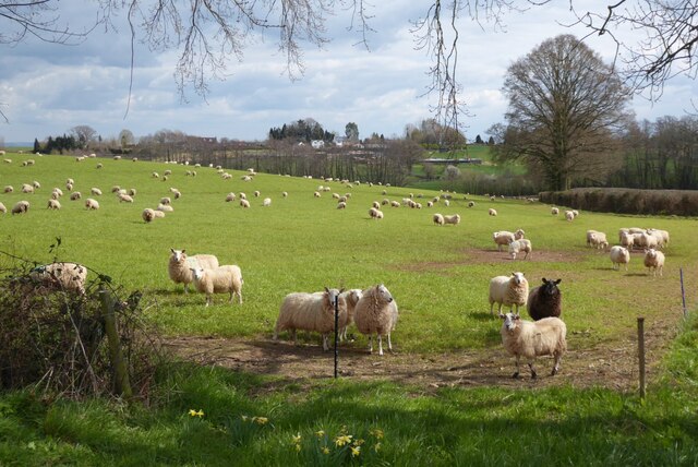
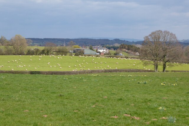
Stallion Hill is a prominent geological feature located in the county of Gloucestershire, England. Situated in the heart of the Cotswolds, it is part of a range of hills that stretches across the region. Rising to an elevation of approximately 307 meters (1,007 feet) above sea level, Stallion Hill offers breathtaking panoramic views of the surrounding landscape.

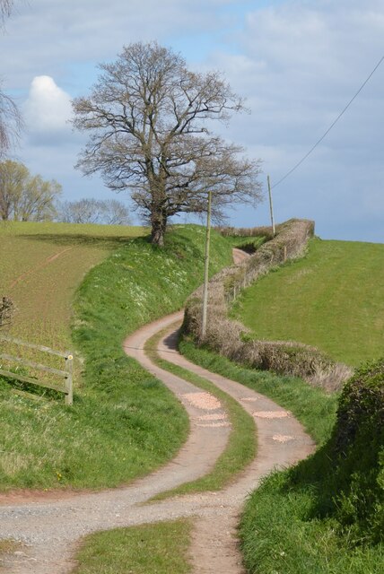
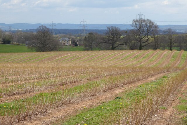
The hill is characterized by its steep slopes and rugged terrain, with a mixture of grassy patches and rocky outcrops. It is predominantly composed of limestone, which is a common geological formation in the Cotswolds. The limestone gives the hill a distinctive pale coloration, especially in sunlight when it appears to gleam.

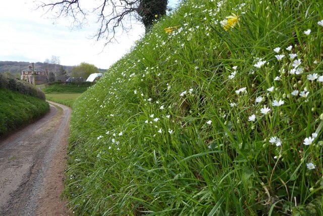
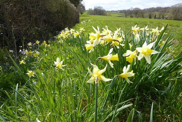
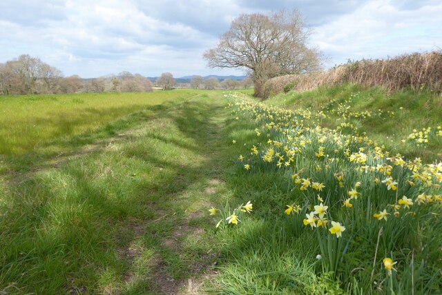
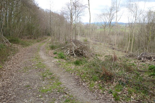
Stallion Hill is a popular destination for outdoor enthusiasts, attracting hikers, walkers, and nature lovers. There are various footpaths and trails that wind their way up the hill, providing opportunities for exploration and adventure. The hill is also home to a diverse range of flora and fauna, including wildflowers, birds, and small mammals.

In addition to its natural beauty, Stallion Hill has historical significance. It is believed to have been used as a lookout point during ancient times, with evidence of prehistoric settlements in the surrounding area. The hill has also been featured in local folklore and legends, adding to its mystique and allure.

Overall, Stallion Hill is a remarkable landmark in Gloucestershire, offering both natural beauty and cultural significance. It provides a stunning vantage point to appreciate the Cotswolds' picturesque countryside and serves as a gateway to explore the region's rich history and heritage.

If you have any feedback on the listing, please let us know in the comments section below.

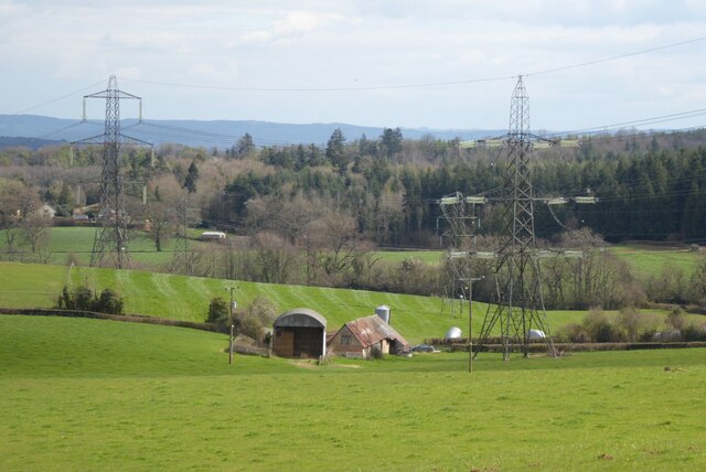
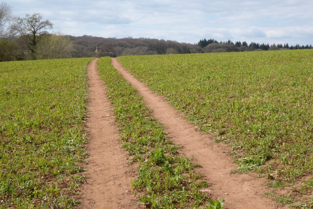
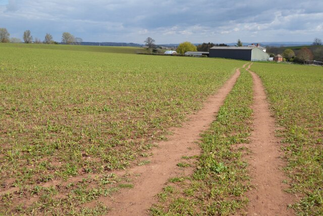
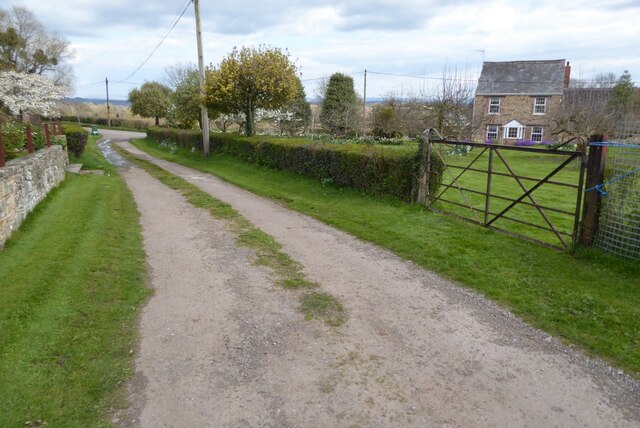
Stallion Hill Images

Images are sourced within 2km of 51.913472/-2.4179388 or Grid Reference SO7123. Thanks to Geograph Open Source API. All images are credited.

Newent Community School, 1 Main block photographed during the summer holidays, 2021.
Newent Community School, 1
Main block photographed during the summer holidays, 2021.
Newent Community School, 2 Main block photographed during the summer holidays, 2021.
Newent Community School, 2
Main block photographed during the summer holidays, 2021.
The start of the 2022 Snowdrops Galanthus nivalis emerging in late January.
The start of the 2022 Snowdrops
Galanthus nivalis emerging in late January.
A fine display of Snowdrops This spot always has a great show of Galanthus nivalis, see <a href="https://www.geograph.org.uk/photo/6758671">SO7222 : Snowdrops by Cugley Cottage, 2</a> from 2021.
A fine display of Snowdrops
This spot always has a great show of Galanthus nivalis, see SO7222 : Snowdrops by Cugley Cottage, 2 from 2021.
A fine display of wild daffodils This spot near Ploddy House was the scene of an equally fine carpet of snowdrops six weeks earlier. See <a href="https://www.geograph.org.uk/photo/7097861">SO7222 : A fine display of Snowdrops</a>.
A fine display of wild daffodils
This spot near Ploddy House was the scene of an equally fine carpet of snowdrops six weeks earlier. See SO7222 : A fine display of Snowdrops.
Farm drive to Knappers Farm The winding farm drive leading to Knappers Farm near Newent.  A public footpath follows this drive.
Farm drive to Knappers Farm
The winding farm drive leading to Knappers Farm near Newent. A public footpath follows this drive.
Spring blooms on the roadside The farm drive to Knappers Farm has become sunken, no doubt from centuries of use.  Spring bloom as colour to the grass bank.  The farmhouse can be seen in the background.
Spring blooms on the roadside
The farm drive to Knappers Farm has become sunken, no doubt from centuries of use. Spring bloom as colour to the grass bank. The farmhouse can be seen in the background.
Wild daffodils Wild daffodils beside a field hedgerow near Knappers Farm.
Wild daffodils
Wild daffodils beside a field hedgerow near Knappers Farm.
Daffodils and a footpath This footpath near Knappers Farm is the route of the Geopark Way.  Wild daffodils are a feature of this corner of Gloucestershire.
Daffodils and a footpath
This footpath near Knappers Farm is the route of the Geopark Way. Wild daffodils are a feature of this corner of Gloucestershire.
Sheep near Knappers Farm Sheep in a field beside the Geopark Way to the south-west of Knappers Farm.
Sheep near Knappers Farm
Sheep in a field beside the Geopark Way to the south-west of Knappers Farm.
Farmland around Knappers Farm View to the north-east from the Geopark Way where it enters Acorn Wood.  Sheep graze a field in the middle distance with Knappers Farm beyond.  The spire of Newent Church can be seen to the left of centre.
Farmland around Knappers Farm
View to the north-east from the Geopark Way where it enters Acorn Wood. Sheep graze a field in the middle distance with Knappers Farm beyond. The spire of Newent Church can be seen to the left of centre.
Bradfords Cottage An early 17th century timber-framed thatched cottage just outside Newent.  The cottage is Grade II listed, see: <span class="nowrap"><a title="https://historicengland.org.uk/listing/the-list/list-entry/1172282?section=official-list-entry" rel="nofollow ugc noopener" href="https://historicengland.org.uk/listing/the-list/list-entry/1172282?section=official-list-entry">Link</a><img style="margin-left:2px;" alt="External link" title="External link - shift click to open in new window" src="https://s1.geograph.org.uk/img/external.png" width="10" height="10"/></span>
Bradfords Cottage
An early 17th century timber-framed thatched cottage just outside Newent. The cottage is Grade II listed, see: LinkExternal link
Footpath through Acorn Word The Geopark Way follows this footpath through Acorn Wood to the south of Newent.  Here the wood is partially felled.
Footpath through Acorn Word
The Geopark Way follows this footpath through Acorn Wood to the south of Newent. Here the wood is partially felled.
Farm buildings Farm buildings and electricity pylons near Clifford Mesne.
Farm buildings
Farm buildings and electricity pylons near Clifford Mesne.
Footpath crossing an arable field The Geopark Way follows this footpath across this field near Knappers Farm.
Footpath crossing an arable field
The Geopark Way follows this footpath across this field near Knappers Farm.
Footpath approaching Knappers Farm The Geopark Way follows this footpath approaching Knappers Farm.
Footpath approaching Knappers Farm
The Geopark Way follows this footpath approaching Knappers Farm.
Footpath and track Footpath and track near Clifford's Mesne.
Footpath and track
Footpath and track near Clifford's Mesne.
Farmland near Clifford's Mesne I am not sure what the bushes are in this field, possibly currents.
Farmland near Clifford's Mesne
I am not sure what the bushes are in this field, possibly currents.
Show me another place!

Stallion Hill is located at Grid Ref: SO7123 (Lat: 51.913472, Lng: -2.4179388)

Administrative County: Gloucestershire

District: Forest of Dean

Police Authority: Gloucestershire

What 3 Words

///flips.century.princely. Near Newent, Gloucestershire

Related Wikis

Boulsdon

Boulsdon is a village in Gloucestershire, England. It is the location of the International Centre for Birds of Prey.A low mound in the village may have...

Anthony's Cross

Anthony's Cross is a hamlet in Gloucestershire, England. == External links == Media related to Anthony's Cross at Wikimedia Commons

Newent Community School

Newent Community School is a secondary school in Newent, Gloucestershire, England. It is an Academy of 1,340 students, serving the town and the rural...

Cliffords Mesne

Cliffords Mesne is an English village in Gloucestershire, two miles (3.2 km) south-west of the town of Newent. It became the home of the autobiographical...

Newent

Newent (; originally called "Noent") is a market town and civil parish in the Forest of Dean in Gloucestershire, England. The town is 11 miles (18 km)...

Aston Ingham

Aston Ingham is a village in south-eastern Herefordshire, England, near Newent and about 7 miles (11 km) east of Ross-on-Wye. The population of the village...

Newent railway station

Newent railway station served the town of Newent in Gloucestershire, England. It opened on 27 July 1885 when the Newent Railway and the Ross and Ledbury...

Taynton, Gloucestershire

Taynton is a village and civil parish in the Forest of Dean district of Gloucestershire, England. It lies about 2.5 miles (4.0 km) south-east of Newent...

Nearby Amenities

Located within 500m of 51.913472,-2.4179388
Barrier: cattle_grid
Lat/Long: 51.9114778/-2.4147955
Power: pole
Lat/Long: 51.9169906/-2.4154419
Power: pole
Lat/Long: 51.9164347/-2.4150328
Power: pole
Lat/Long: 51.915801/-2.4145688
Power: pole
Lat/Long: 51.915222/-2.4141517
Stallion Hill
Power: pole
Transformer: distribution
Voltage Primary: 11000
Lat/Long: 51.9146206/-2.4137065
Power: pole
Lat/Long: 51.913881/-2.4131419
Power: pole
Lat/Long: 51.9132461/-2.4126624
Power: pole
Lat/Long: 51.9129272/-2.4111678
Power: pole
Lat/Long: 51.912617/-2.4121897
Power: pole
Lat/Long: 51.9121686/-2.4118571
Power: pole
Lat/Long: 51.911714/-2.4115165
Green Farm Newent
Power: pole
Transformer: distribution
Voltage Primary: 11000
Lat/Long: 51.9101913/-2.4211409
The data included in this document is from www.openstreetmap.org. The data is made available under ODbL.

Have you been to Stallion Hill?

Leave your review of Stallion Hill below (or comments, questions and feedback).