Bluecaster

Hill, Mountain in Yorkshire South Lakeland

England

Bluecaster

The A368 to Sedbergh
The A368 to Sedbergh Credit: Roger Cornfoot

Bluecaster is a picturesque hill located in the county of Yorkshire, England. Situated in the northern region of the county, Bluecaster is known for its stunning natural beauty and breathtaking views. The hill stands at an elevation of approximately 500 meters above sea level, making it a notable landmark in the area.

The name Bluecaster is derived from the Old English words "blaw" and "ceaster," which mean "blue hill." This name perfectly encapsulates the unique characteristic of the hill, as it often appears blue in color due to the presence of heather plants that cover its slopes.

The hill is a popular destination for outdoor enthusiasts, offering a range of activities such as hiking, mountain biking, and birdwatching. Its extensive network of trails attracts both locals and tourists alike, providing ample opportunities to explore the surrounding countryside.

The summit of Bluecaster offers panoramic views of the surrounding landscape, including rolling hills, lush valleys, and distant peaks. On a clear day, one can even catch a glimpse of the nearby Yorkshire Dales National Park.

The area surrounding Bluecaster is rich in flora and fauna, with various species of birds, mammals, and plant life calling it home. It is a designated Area of Outstanding Natural Beauty, ensuring its preservation and protection for future generations to enjoy.

Bluecaster, Yorkshire is a hidden gem, offering visitors a tranquil escape from the hustle and bustle of city life. With its natural splendor and peaceful ambiance, it is no wonder that Bluecaster has become a cherished destination for nature lovers and outdoor enthusiasts.

If you have any feedback on the listing, please let us know in the comments section below.
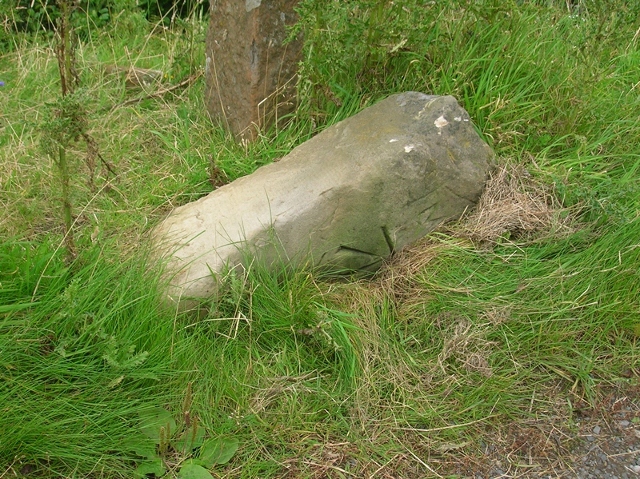
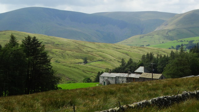
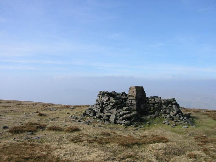
Bluecaster Images

Images are sourced within 2km of 54.366793/-2.4451464 or Grid Reference SD7196. Thanks to Geograph Open Source API. All images are credited.

The A368 to Sedbergh
View of moorland through field gate at High House
Moorland on north side of barn at High House
Humps of ground beside minor road and bushes The road, (not in view), is descending to meet the A683 near Rawthey Bridge. The bushes at the left side of the image are beside a minor stream which will soon join the River Rawthey.
The hill range is the Howgills with Great Dummacks at the left side of the image; Cautley Crag shows as a dark band below a declining ridge. The highest of the Howgill peaks, The Calf, is most probably seen to the right of the crag.
Humps of ground beside minor road and bushes
The road, (not in view), is descending to meet the A683 near Rawthey Bridge. The bushes at the left side of the image are beside a minor stream which will soon join the River Rawthey. The hill range is the Howgills with Great Dummacks at the left side of the image; Cautley Crag shows as a dark band below a declining ridge. The highest of the Howgill peaks, The Calf, is most probably seen to the right of the crag.
Rawthey Bridge Ford This ford on the River  Rawthey just below Rawthey Bridge.
Rawthey Bridge Ford
This ford on the River Rawthey just below Rawthey Bridge.
Wandale Beck Ford This ford is found on the Wandale Beck just above its confluence with the River Rawthey.
Wandale Beck Ford
This ford is found on the Wandale Beck just above its confluence with the River Rawthey.
Ruined barn off the A683 Near Foggy Hill.
Ruined barn off the A683
Near Foggy Hill.
A683 near Foggy Hill
A683 near Rawthey Bridge
A683 near Narthwaite
Ruined farm, Wandale A sad ruin miles above the road and so abandoned before the second/holiday home market could ride to the rescue. The farm has/had a superb view over Wandale directly into the upper reaches of the River Rawthey.
Ruined farm, Wandale
A sad ruin miles above the road and so abandoned before the second/holiday home market could ride to the rescue. The farm has/had a superb view over Wandale directly into the upper reaches of the River Rawthey.
Old Milestone by the A683, Cautley Road, Narthwaite Metal plate attached to stone post by the A683, in parish of Sedbergh (South Lakeland District), Cautley Road, ⅔ mile South of bridge over River Rawthey, in south end of retaining wall, on East side of road. WR iron casting, erected by the County Council in the 19th century. 

Inscription reads:-
: SEDBERGH / 5 MILES : : SEDBERGH & KIRKBY STEPHEN / ROAD / CAUTLEY : : KIRKBY STEPHEN / 9 MILES :
Maker:-
: WILLIAM TOWLER / GLOBE FOUNDRY / - LEEDS - :

Grade II listed. List Entry Number: 1384110
<span class="nowrap"><a title="https://historicengland.org.uk/listing/the-list/list-entry/1384110" rel="nofollow ugc noopener" href="https://historicengland.org.uk/listing/the-list/list-entry/1384110">Link</a><img style="margin-left:2px;" alt="External link" title="External link - shift click to open in new window" src="https://s1.geograph.org.uk/img/external.png" width="10" height="10"/></span>

Milestone Society National ID: YW_SBKS05.
Old Milestone by the A683, Cautley Road, Narthwaite
Metal plate attached to stone post by the A683, in parish of Sedbergh (South Lakeland District), Cautley Road, ⅔ mile South of bridge over River Rawthey, in south end of retaining wall, on East side of road. WR iron casting, erected by the County Council in the 19th century. Inscription reads:- : SEDBERGH / 5 MILES : : SEDBERGH & KIRKBY STEPHEN / ROAD / CAUTLEY : : KIRKBY STEPHEN / 9 MILES : Maker:- : WILLIAM TOWLER / GLOBE FOUNDRY / - LEEDS - : Grade II listed. List Entry Number: 1384110 LinkExternal link Milestone Society National ID: YW_SBKS05.
Stream near Handley's bridge
Old Bridge Marker by the A683, Rawthey Bridge, Sedbergh Parish Bridge Marker by the A683, in parish of Sedbergh (South Lakeland District), Sedbergh Road, 80m West of Rawthey Bridge, on grass verge, North side of road.

Surveyed

Milestone Society National ID: YW_SEDB01br
Old Bridge Marker by the A683, Rawthey Bridge, Sedbergh Parish
Bridge Marker by the A683, in parish of Sedbergh (South Lakeland District), Sedbergh Road, 80m West of Rawthey Bridge, on grass verge, North side of road. Surveyed Milestone Society National ID: YW_SEDB01br
Old Milestone by the A683, north of Rawthey Bridge Carved stone post by the A683, in parish of RAVENSTONEDALE (EDEN District), 250m West of Brigg Cottage, ⅓ mile North of bridge over River Rawthey, on narrow verge, South of finger post, in woods, on West side of road. Sedbergh Kirkby stone, erected by the Sedbergh turnpike trust in the 18th century. 

Inscription reads:-
: KY STEPHEN / 8 / MILES : : SEDBERGH / 6 / MILES :

Grade II listed.  
List Entry Number: 1248963 <span class="nowrap"><a title="https://historicengland.org.uk/listing/the-list/list-entry/1248963" rel="nofollow ugc noopener" href="https://historicengland.org.uk/listing/the-list/list-entry/1248963">Link</a><img style="margin-left:2px;" alt="External link" title="External link - shift click to open in new window" src="https://s1.geograph.org.uk/img/external.png" width="10" height="10"/></span>

Milestone Society National ID: WE_SBKS06.
Old Milestone by the A683, north of Rawthey Bridge
Carved stone post by the A683, in parish of RAVENSTONEDALE (EDEN District), 250m West of Brigg Cottage, ⅓ mile North of bridge over River Rawthey, on narrow verge, South of finger post, in woods, on West side of road. Sedbergh Kirkby stone, erected by the Sedbergh turnpike trust in the 18th century. Inscription reads:- : KY STEPHEN / 8 / MILES : : SEDBERGH / 6 / MILES : Grade II listed. List Entry Number: 1248963 LinkExternal link Milestone Society National ID: WE_SBKS06.
Old Milestone by the A683, east of Narthwaite Carved stone post by the A683, in parish of SEDBERGH (SOUTH LAKELAND District), ½ mile South of bridge over River Rawthey, Narthwaite, South end of post and metal bars fence near "Beware Debris in Road sign", on West side of road. Old Sedbergh stone, erected by the Sedbergh turnpike trust in the 19th century. Now re-erected.

Inscription reads:-
: 9 MILE :
Carved benchmark on base front.

Milestone Society National ID: YW_SBKS04a.
Old Milestone by the A683, east of Narthwaite
Carved stone post by the A683, in parish of SEDBERGH (SOUTH LAKELAND District), ½ mile South of bridge over River Rawthey, Narthwaite, South end of post and metal bars fence near "Beware Debris in Road sign", on West side of road. Old Sedbergh stone, erected by the Sedbergh turnpike trust in the 19th century. Now re-erected. Inscription reads:- : 9 MILE : Carved benchmark on base front. Milestone Society National ID: YW_SBKS04a.
Old Waymarker Stone on Black Moss, Ravenstonedale parish Black Moss Waymarker Stone, standing stone by the UC road, in parish of Ravenstonedale (Eden District), Black Moss, beside the road.

To be surveyed

Milestone Society National ID: CBED_RAV
Old Waymarker Stone on Black Moss, Ravenstonedale parish
Black Moss Waymarker Stone, standing stone by the UC road, in parish of Ravenstonedale (Eden District), Black Moss, beside the road. To be surveyed Milestone Society National ID: CBED_RAV
New House Farm, & view towards Howgill Fells
Show me another place!

Bluecaster is located at Grid Ref: SD7196 (Lat: 54.366793, Lng: -2.4451464)

Division: West Riding

Administrative County: Cumbria

District: South Lakeland

Police Authority: Cumbria

What 3 Words

///carrots.they.crumb. Near Sedbergh, Cumbria

Nearby Locations

Bluecaster

Related Wikis

Yarlside

Yarlside is a hill in the Howgill Fells, Cumbria (historically Westmorland), England. This fell is not to be confused with the Yarlside area near Barrow...

Randygill Top

Randygill Top is a mountain located in the Howgill Fells, Cumbria (historically Westmorland), England. == References ==

Calders (Yorkshire Dales)

Calders is a summit of 2,211 feet (674 m) in the Howgill Fells, Cumbria, England. It lies about 2⁄3 mile (1 km) south east of the summit of The Calf and...

Swarth Fell

Swarth Fell is an approximately 1 mile (1.5 km) stretch of high ground (consisting mainly of limestone capped with millstone grit) situated to the south...

The Calf

The Calf, at 676 m, is the highest top in the Howgill Fells, an area of high ground in the north-west of the Yorkshire Dales in the county of Cumbria...

Wild Boar Fell

Wild Boar Fell is a mountain in the Yorkshire Dales National Park, on the eastern edge of Cumbria, England. At 2,323 feet (708 m), it is either the 4th...

Howgill Fells

The Howgill Fells are uplands in Northern England between the Lake District and the Yorkshire Dales, lying roughly within a triangle formed by the town...

Clough River

The Clough River is a river in Cumbria, England. A tributary of the River Rawthey, it flows for 21.8 kilometres (13.5 mi) primarily through the Garsdale...

Nearby Amenities

Located within 500m of 54.366793,-2.4451464
Bluecaster
Ele: 345
Natural: peak
Source: NPE
Lat/Long: 54.3668881/-2.4453296
Natural: sinkhole
Lat/Long: 54.3641399/-2.4407877
Natural: sinkhole
Lat/Long: 54.3639714/-2.440917
The data included in this document is from www.openstreetmap.org. The data is made available under ODbL.

Have you been to Bluecaster?

Leave your review of Bluecaster below (or comments, questions and feedback).