Duncorn Hill

Hill, Mountain in Somerset

England

Duncorn Hill

Cam Brook Small bridge over the brook.
Cam Brook Credit: Wayland Smith

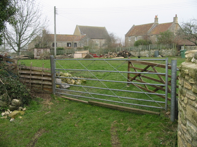
Duncorn Hill is an impressive hill located in the county of Somerset, England. Rising to a height of approximately 180 meters (590 feet), it is considered one of the prominent landmarks in the region. Situated near the village of Duncorn, the hill offers stunning panoramic views of the surrounding countryside and is a popular destination for outdoor enthusiasts and nature lovers alike.

The hill is characterized by its gentle slopes and rolling green fields, which make it an ideal spot for leisurely walks and hikes. The rich biodiversity of the area is evident in the diverse range of flora and fauna found on the hill, including various species of wildflowers, birds, and small mammals. Additionally, the hill is home to several ancient archaeological sites, such as Iron Age hillforts and burial mounds, which add to its historical significance.

Visitors to Duncorn Hill can access it via well-maintained footpaths, making it easily accessible for people of all ages and abilities. The hill's location also provides opportunities for other recreational activities, including picnicking, birdwatching, and photography. Moreover, the hill offers a serene and peaceful environment, allowing visitors to escape the hustle and bustle of everyday life and immerse themselves in the beauty of nature.

Duncorn Hill is not only a natural wonder but also holds cultural importance in the area. It has been a source of inspiration for local artists and writers, who have depicted its beauty in various forms of art. With its picturesque landscape and historical significance, Duncorn Hill continues to attract both locals and tourists, providing them with an unforgettable experience in the heart of Somerset.

If you have any feedback on the listing, please let us know in the comments section below.
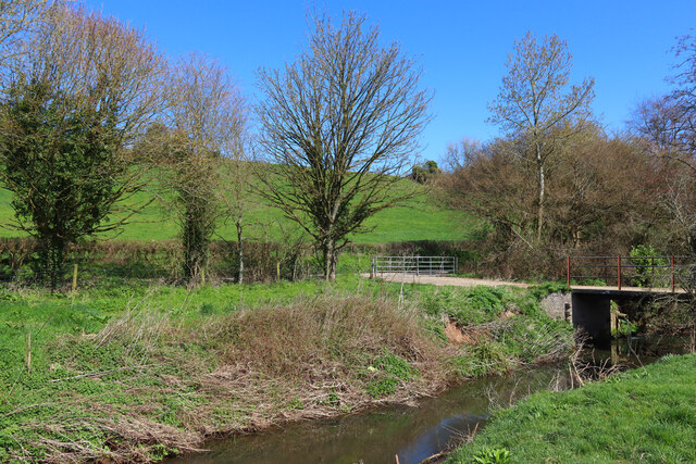
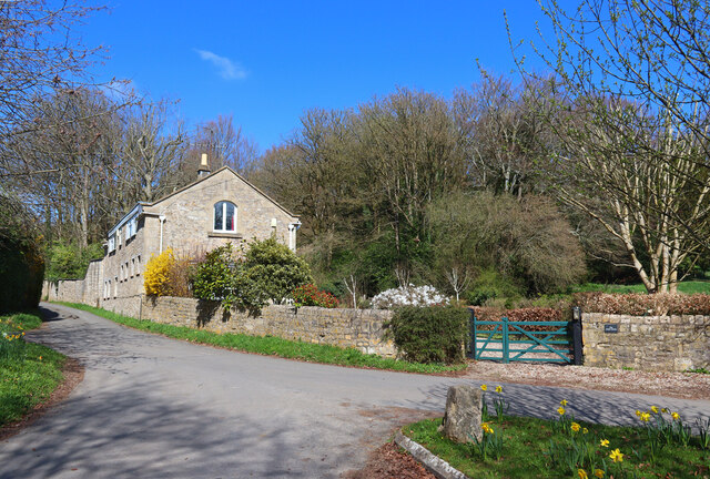
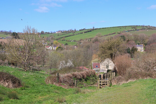
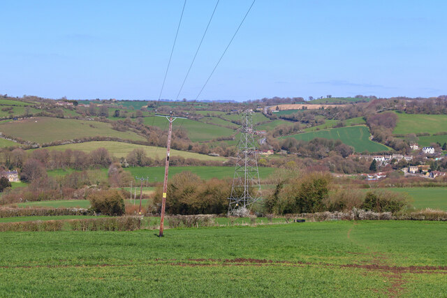
Duncorn Hill Images

Images are sourced within 2km of 51.344263/-2.4167432 or Grid Reference ST7160. Thanks to Geograph Open Source API. All images are credited.

Cam Brook Small bridge over the brook.
Cam Brook
Small bridge over the brook.
The Hollow Dwelling on the edge of Dunkerton.
The Hollow
Dwelling on the edge of Dunkerton.
Near Dunkerton Climbing away from the church at Dunkerton.
Near Dunkerton
Climbing away from the church at Dunkerton.
Intersection of Infrastructure Power lines cross in a field south of Dunkerton.
Intersection of Infrastructure
Power lines cross in a field south of Dunkerton.
A parish pavilion Dunkerton and Tunley council has a hand in the Lions' Cricket Club.
A parish pavilion
Dunkerton and Tunley council has a hand in the Lions' Cricket Club.
Signs up from Dunkerton Bridge The A367 runs across the bridge of the Cam Brook, with these signs at the junction close to the former Swan Inn.
Signs up from Dunkerton Bridge
The A367 runs across the bridge of the Cam Brook, with these signs at the junction close to the former Swan Inn.
A light to lead All Saints' church lights the way.
A light to lead
All Saints' church lights the way.
Down the valley to Dunkerton The footpath leads down the slopes south of the village, affording a fine view. The old rectory building peeps out from the hedges.
Down the valley to Dunkerton
The footpath leads down the slopes south of the village, affording a fine view. The old rectory building peeps out from the hedges.
A tree in the river It does not seem like the tree grew here, yet it has crashed into the Cam Brook. Perhaps a particularly forceful torrent carried it here.
A tree in the river
It does not seem like the tree grew here, yet it has crashed into the Cam Brook. Perhaps a particularly forceful torrent carried it here.
Losing the path through the debris A footpath marker has become somewhat disarranged. The Cam Brook lies just close by for the unwary.
Losing the path through the debris
A footpath marker has become somewhat disarranged. The Cam Brook lies just close by for the unwary.
A footbridge near Brooklands Crossing the Cam Brook is a concrete footbridge. Curiously, there appears to be a piece of old railway track holding it up.
A footbridge near Brooklands
Crossing the Cam Brook is a concrete footbridge. Curiously, there appears to be a piece of old railway track holding it up.
All Saints church, Dunkerton
Dunkerton viaduct The five arch brick viaduct at Dunkerton carried the Camerton to Limpley Stoke railway over the village. It had a total length of 77 yards, each arch having a span of 40 feet. It was demolished by explosives on 30th July 1981.
Dunkerton viaduct
The five arch brick viaduct at Dunkerton carried the Camerton to Limpley Stoke railway over the village. It had a total length of 77 yards, each arch having a span of 40 feet. It was demolished by explosives on 30th July 1981.
All Saints, Dunkerton: September 2013
Rush hour in Dunkerton
All Saints, Dunkerton: churchyard (a)
All Saints, Dunkerton: tower
All Saints, Dunkerton: churchyard (b)
Show me another place!

Duncorn Hill is located at Grid Ref: ST7160 (Lat: 51.344263, Lng: -2.4167432)

Unitary Authority: Bath and North East Somerset

Police Authority: Avon and Somerset

What 3 Words

///engage.contemplate.area. Near Priston, Somerset

Nearby Locations

Duncorn Hill

Related Wikis

Inglesbatch

Inglesbatch is a small hamlet within the civil parish of Englishcombe in the Bath and North East Somerset district of Somerset, England. Its nearest town...

Duncorn Hill

Duncorn Hill is an English, landmark, rounded hill with a flat top close to the Fosse Way. It is on a limestone plateau south of Bath in Somerset and summits...

Dunkerton, Somerset

Dunkerton is a small village in the civil parish of Dunkerton and Tunley, 4 miles (6.4 km) north east of Radstock, and 5 miles (8.0 km) south west of Bath...

Somerset Coal Canal

The Somerset Coal Canal (originally known as the Somersetshire Coal Canal) was a narrow canal in England, built around 1800. Its route began in basins...

Nearby Amenities

Located within 500m of 51.344263,-2.4167432
Barrier: stile
Lat/Long: 51.3418665/-2.4215976
Nailwell
Place: hamlet
Wikidata: Q2048134
Wikipedia: en:Englishcombe
Lat/Long: 51.3457301/-2.4225884
Duncorn Hill
Ele: 178
Natural: peak
Lat/Long: 51.3445259/-2.4163678
Power: pole
Transformer: distribution
Lat/Long: 51.3452665/-2.4231825
Power: pole
Lat/Long: 51.3451643/-2.4216026
Power: pole
Lat/Long: 51.3451107/-2.4206639
Power: pole
Lat/Long: 51.3450637/-2.4196205
Power: pole
Lat/Long: 51.3460918/-2.4139331
Power: pole
Lat/Long: 51.3457416/-2.4153443
Power: pole
Lat/Long: 51.3453451/-2.4167831
Power: pole
Lat/Long: 51.3452162/-2.4177382
Power: pole
Lat/Long: 51.3464632/-2.4125374
Power: pole
Lat/Long: 51.3468231/-2.4111109
Power: pole
Lat/Long: 51.3463497/-2.4104362
Power: pole
Lat/Long: 51.3456453/-2.4099185
Power: pole
Lat/Long: 51.340192/-2.4148248
Power: pole
Transformer: distribution
Lat/Long: 51.3401679/-2.4165039
Power: pole
Lat/Long: 51.3406377/-2.4136377
Power: pole
Lat/Long: 51.3408993/-2.412914
Post Box
Operator: Royal Mail
Operator Wikidata: Q638098
Lat/Long: 51.345577/-2.4229893
Generator Method: photovoltaic
Generator Output Electricity: yes
Generator Source: solar
Generator Type: solar_photovoltaic_panel
Location: roof
Power: generator
Lat/Long: 51.3464125/-2.4221894
Generator Method: photovoltaic
Generator Output Electricity: yes
Generator Source: solar
Generator Type: solar_photovoltaic_panel
Location: roof
Power: generator
Lat/Long: 51.3464453/-2.4220902
The data included in this document is from www.openstreetmap.org. The data is made available under ODbL.

Have you been to Duncorn Hill?

Leave your review of Duncorn Hill below (or comments, questions and feedback).