Bluethwaite Hill

Hill, Mountain in Westmorland Eden

England

Bluethwaite Hill

Ordnance Survey Pivot This OS pivot can be found on a boulder. It marks a point 1319.4ft above mean sea level.
Ordnance Survey Pivot Credit: Adrian Dust

Bluethwaite Hill, also known as Blue Thwaite Hill, is a prominent hill located in the county of Westmorland in the northwestern region of England. It is part of the larger Pennines mountain range and is situated in the Yorkshire Dales National Park.

Standing at an elevation of approximately 552 meters (1,811 feet), Bluethwaite Hill offers breathtaking panoramic views of the surrounding countryside. It is characterized by its rounded shape and green slopes, covered in heather and grasses. The hill is composed mainly of millstone grit, a durable rock that is resistant to erosion, giving it a rugged appearance.

The summit of Bluethwaite Hill is marked by a cairn, which acts as a navigational aid for hikers and serves as a focal point for those seeking to reach the top. The ascent to the summit can be challenging, with steep slopes in certain sections, making it a popular destination for experienced walkers and mountaineers.

The hill is home to a variety of wildlife, including upland birds such as curlews, lapwings, and golden plovers. The surrounding moorland provides a habitat for grouse and other small mammals.

Bluethwaite Hill is a popular destination for outdoor enthusiasts, offering opportunities for hiking, mountain biking, and birdwatching. Its remote location and unspoiled natural beauty make it an ideal spot for those seeking tranquility and a connection with nature.

Overall, Bluethwaite Hill in Westmorland is a picturesque and challenging hill, providing visitors with stunning views and a chance to explore the rugged beauty of the Yorkshire Dales National Park.

If you have any feedback on the listing, please let us know in the comments section below.

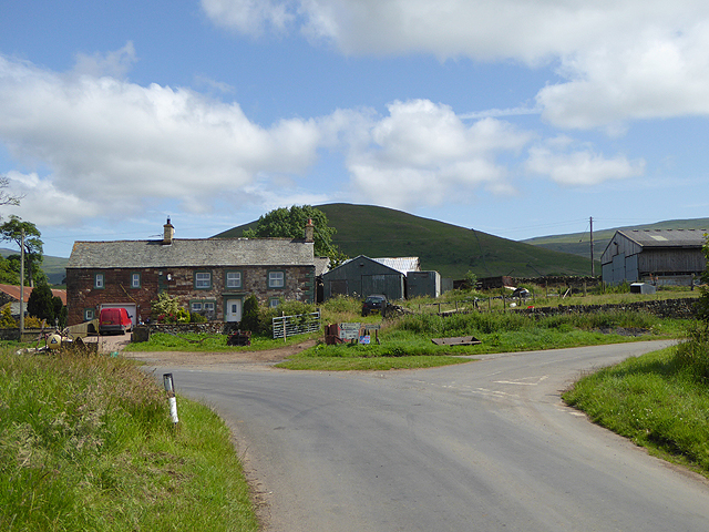
Bluethwaite Hill Images

Images are sourced within 2km of 54.635651/-2.451643 or Grid Reference NY7026. Thanks to Geograph Open Source API. All images are credited.

Ordnance Survey Pivot This OS pivot can be found on a boulder. It marks a point 1319.4ft above mean sea level.
Ordnance Survey Pivot
This OS pivot can be found on a boulder. It marks a point 1319.4ft above mean sea level.
Ordnance Survey Cut Mark This OS cut mark can be found on the gatepost north side of the track. It marks a point 953.5ft above mean sea level.
Ordnance Survey Cut Mark
This OS cut mark can be found on the gatepost north side of the track. It marks a point 953.5ft above mean sea level.
Ordnance Survey Pivot This OS pivot can be found on the large boulder. It marks a point 1080.7ft above mean sea level.
Ordnance Survey Pivot
This OS pivot can be found on the large boulder. It marks a point 1080.7ft above mean sea level.
Ordnance Survey Pivot This OS pivot can be found on a boulder east of the track. It marks a point 1044.0ft above mean sea level.
Ordnance Survey Pivot
This OS pivot can be found on a boulder east of the track. It marks a point 1044.0ft above mean sea level.
Ordnance Survey Cut Mark This OS cut mark can be found on the gatepost SE side of the track. It marks a point 1273.0ft above mean sea level.
Ordnance Survey Cut Mark
This OS cut mark can be found on the gatepost SE side of the track. It marks a point 1273.0ft above mean sea level.
Ordnance Survey Pivot This OS pivot can be found on the north angle of the sheep fold. It marks a point 1444.6ft above mean sea level.
Ordnance Survey Pivot
This OS pivot can be found on the north angle of the sheep fold. It marks a point 1444.6ft above mean sea level.
Ordnance Survey Pivot This OS pivot can be found on the east face of the wall. It marks a point 1456.7ft above mean sea level.
Ordnance Survey Pivot
This OS pivot can be found on the east face of the wall. It marks a point 1456.7ft above mean sea level.
Ordnance Survey Pivot This OS pivot can be found on the boulder next to the wall. It marks a point 1451.4ft above mean sea level.
Ordnance Survey Pivot
This OS pivot can be found on the boulder next to the wall. It marks a point 1451.4ft above mean sea level.
Ordnance Survey Cut Mark This OS cut mark can be found on the gatepost at the track/wall junction. It marks a point 1465.5ft above mean sea level.
Ordnance Survey Cut Mark
This OS cut mark can be found on the gatepost at the track/wall junction. It marks a point 1465.5ft above mean sea level.
Ordnance Survey Cut Mark This OS cut mark can be found on the gatepost at the track junction. It marks a point 1028.0ft above mean sea level.
Ordnance Survey Cut Mark
This OS cut mark can be found on the gatepost at the track junction. It marks a point 1028.0ft above mean sea level.
Ordnance Survey Cut Mark This OS cut mark can be found on the gatepost south side of the track. It marks a point 293m above mean sea level.
Ordnance Survey Cut Mark
This OS cut mark can be found on the gatepost south side of the track. It marks a point 293m above mean sea level.
Ordnance Survey Cut Mark This OS cut mark can be found on the gatepost south side of the track. It marks a point 853.5ft above mean sea level.
Ordnance Survey Cut Mark
This OS cut mark can be found on the gatepost south side of the track. It marks a point 853.5ft above mean sea level.
Milestone - Birkdale 6 Stone with the inscription 'Birkdale 6m'
Milestone - Birkdale 6
Stone with the inscription 'Birkdale 6m'
Bridleway to Threlkeld Side The bridleway was used by the mines in the Great Rundale valley. The scar in the hillside on the right  is a hush - a man-made gorge formed by releasing the water from dammed streams, washing away the upper layers of earth to expose seams of ore.
Bridleway to Threlkeld Side
The bridleway was used by the mines in the Great Rundale valley. The scar in the hillside on the right is a hush - a man-made gorge formed by releasing the water from dammed streams, washing away the upper layers of earth to expose seams of ore.
Sheepfold below Dufton Pike At the east side of Dufton Pike beside a farm road two dry stone walls come together, meeting at an acute angle; by the addition of a little more walling this narrow sheepfold has been created.
Sheepfold below Dufton Pike
At the east side of Dufton Pike beside a farm road two dry stone walls come together, meeting at an acute angle; by the addition of a little more walling this narrow sheepfold has been created.
Brownber Hill Steep-sided Brownber Hill is seen across the valley of Great Rundale from the estate/mine road above the south side of the dale.
Brownber Hill
Steep-sided Brownber Hill is seen across the valley of Great Rundale from the estate/mine road above the south side of the dale.
Great Rundale Great Rundale is a significant slice into the western flank of the north Pennines. Historically it's seen much mineral mining and the valley is scarred both in the stretch visible here and in its upper reaches with the extensive remains of it. The view is from a mine and estate road on the valley's south side; it's line can be seen entering the right edge of the image. The black dot a short way along the road is a fine old lime kiln: <a title="https://www.geograph.org.uk/photo/1921590" href="https://www.geograph.org.uk/photo/1921590">Link</a>.
Great Rundale
Great Rundale is a significant slice into the western flank of the north Pennines. Historically it's seen much mineral mining and the valley is scarred both in the stretch visible here and in its upper reaches with the extensive remains of it. The view is from a mine and estate road on the valley's south side; it's line can be seen entering the right edge of the image. The black dot a short way along the road is a fine old lime kiln: Link.
Great Rundale, eroding hill slope Great Rundale has seen much mining activity in the past and some of the evidence is seen here, viewed from a track on the south side of the valley, above the main estate road through it. The steep eroded slope may or may not be mined and discarded material but a terrace below the upper rocks suggests that it is mine spoil dumped below from there. There are a number of remaining fragments of masonry which surely will soon be lost to the on-going erosion of the slope.
Great Rundale, eroding hill slope
Great Rundale has seen much mining activity in the past and some of the evidence is seen here, viewed from a track on the south side of the valley, above the main estate road through it. The steep eroded slope may or may not be mined and discarded material but a terrace below the upper rocks suggests that it is mine spoil dumped below from there. There are a number of remaining fragments of masonry which surely will soon be lost to the on-going erosion of the slope.
Show me another place!

Bluethwaite Hill is located at Grid Ref: NY7026 (Lat: 54.635651, Lng: -2.451643)

Administrative County: Cumbria

District: Eden

Police Authority: Cumbria

What 3 Words

///guards.tapers.mystified. Near Appleby-in-Westmorland, Cumbria

Nearby Locations

Bluethwaite Hill

Related Wikis

Nearby Amenities

Located within 500m of 54.635651,-2.451643
BluethwaiteHill
Ele: 406.6
Natural: peak
Razed Man Made: survey_point
Source: NPE
Lat/Long: 54.6349774/-2.4525246
Natural: sinkhole
Lat/Long: 54.6364462/-2.4450166
Natural: sinkhole
Lat/Long: 54.6362893/-2.4448057
Natural: sinkhole
Lat/Long: 54.6367849/-2.4449822
The data included in this document is from www.openstreetmap.org. The data is made available under ODbL.

Have you been to Bluethwaite Hill?

Leave your review of Bluethwaite Hill below (or comments, questions and feedback).