Gorstyhill

Hill, Mountain in Shropshire

England

Gorstyhill

Footpath at the edge of Thrift Coppice Thrift Coppice runs into Birch Wood as you walk east; both lie on the steep southern bank of the Dean Brook valley.
Footpath at the edge of Thrift Coppice Credit: Richard Law

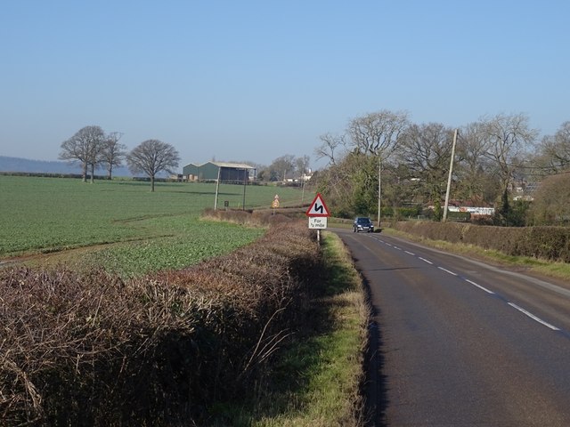
Gorstyhill is a picturesque hill located in the county of Shropshire, England. It is situated in the western part of the county, near the small village of Gorsty. Rising to an elevation of approximately 400 meters (1,312 feet), it is considered one of the prominent hills in the region.

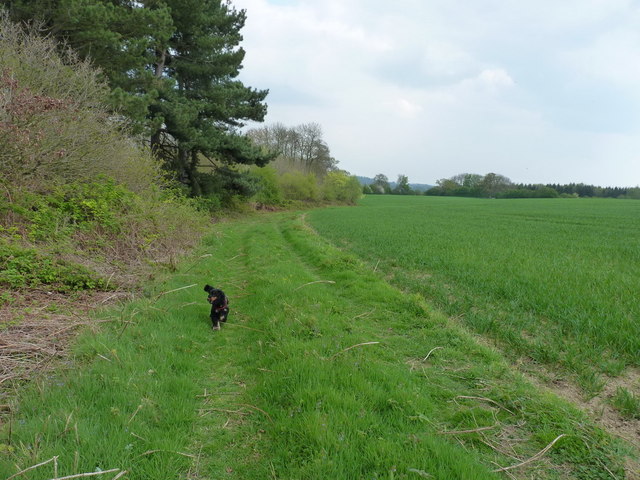
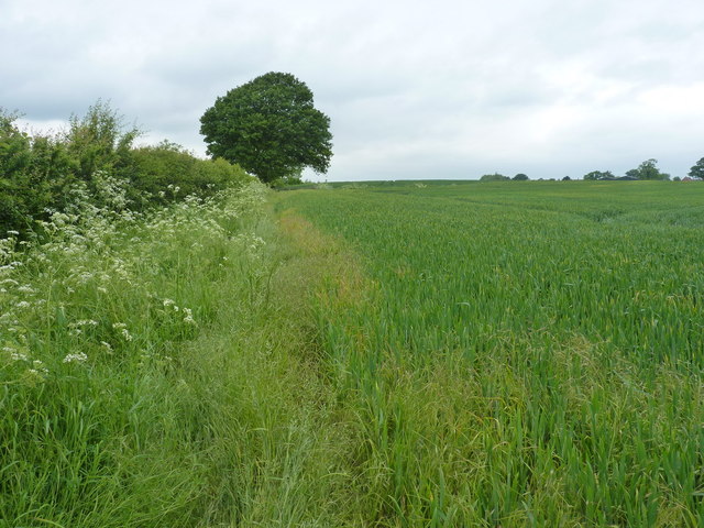
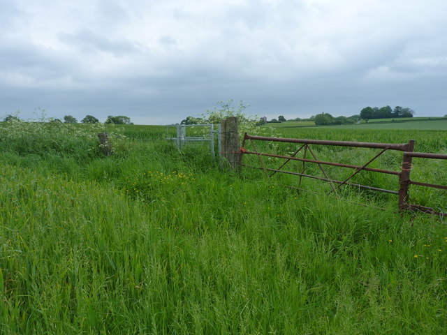
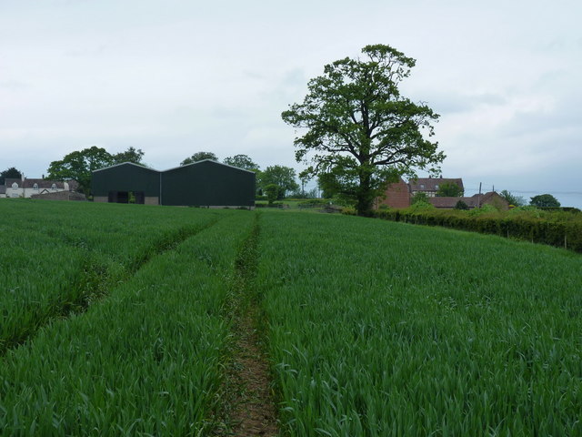
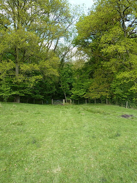
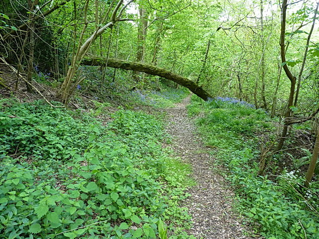
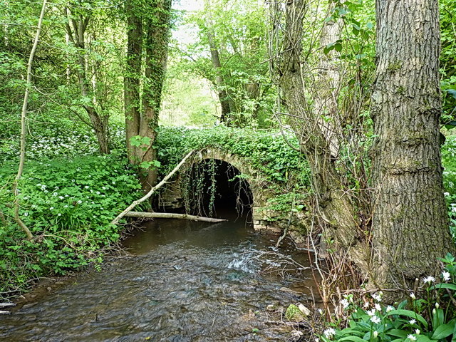
The hill is characterized by its gently sloping terrain, covered mainly in lush green grass and scattered with a variety of flora and fauna. The surrounding landscape is dotted with trees, offering a beautiful contrast against the hill's verdant slopes. The hill's summit provides breathtaking panoramic views of the surrounding countryside, making it a popular destination for nature enthusiasts and hikers.

Gorstyhill is known for its rich historical and cultural significance. It is believed to have been inhabited since prehistoric times, with archaeological evidence suggesting human activity in the area dating back thousands of years. The hill also has several ancient burial mounds, adding to its historical allure.

Due to its location, Gorstyhill offers a tranquil and serene environment, away from the hustle and bustle of urban life. It attracts visitors seeking peace and solitude, as well as those interested in outdoor activities such as walking, cycling, and birdwatching.

Overall, Gorstyhill in Shropshire is a stunning natural landmark, providing both locals and tourists with a chance to connect with nature, explore the region's rich history, and enjoy the breathtaking vistas that the hill has to offer.

If you have any feedback on the listing, please let us know in the comments section below.
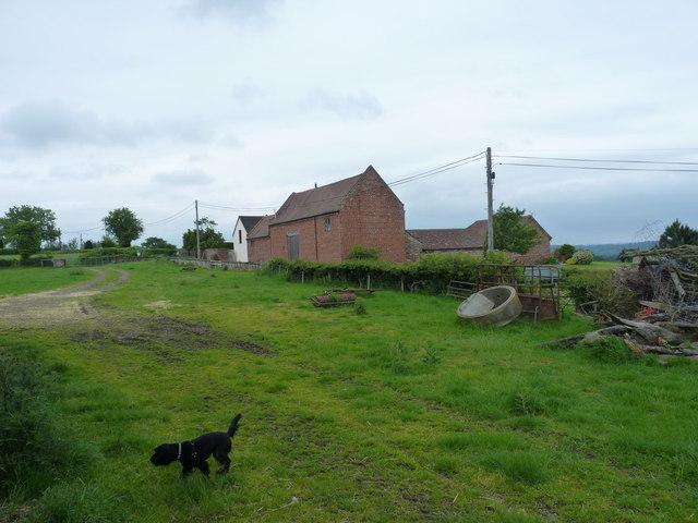
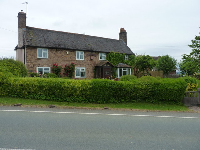
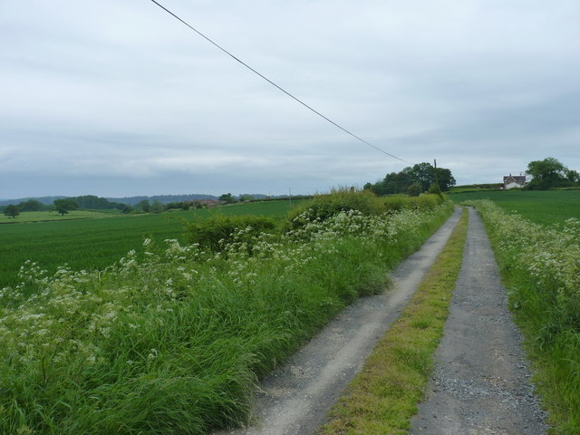
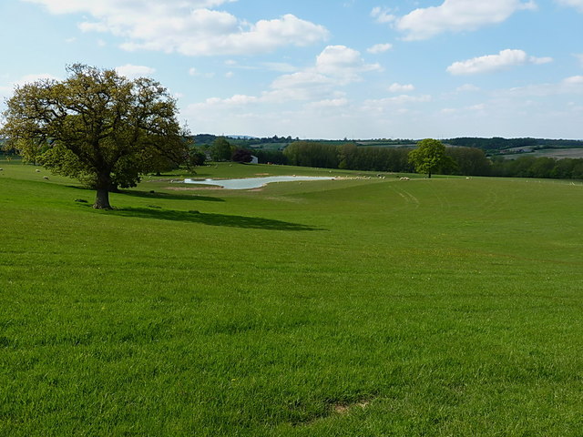
Gorstyhill Images

Images are sourced within 2km of 52.575893/-2.4302191 or Grid Reference SO7097. Thanks to Geograph Open Source API. All images are credited.

Footpath at the edge of Thrift Coppice Thrift Coppice runs into Birch Wood as you walk east; both lie on the steep southern bank of the Dean Brook valley.
Footpath at the edge of Thrift Coppice
Thrift Coppice runs into Birch Wood as you walk east; both lie on the steep southern bank of the Dean Brook valley.
Footpath to Nordley A rather overgrown (overplanted) path on the edge of a field near Nordley.
Footpath to Nordley
A rather overgrown (overplanted) path on the edge of a field near Nordley.
Best of luck with THIS stile... The stile's there, and quite new. What isn't so obvious in the photo is the 3-strand barbed wire fence that completely blocks it. Daft Dog went under the rickety gate, and I climbed it, as I didn't much fancy lacerating my legs.
Best of luck with THIS stile...
The stile's there, and quite new. What isn't so obvious in the photo is the 3-strand barbed wire fence that completely blocks it. Daft Dog went under the rickety gate, and I climbed it, as I didn't much fancy lacerating my legs.
Approaching Nordley On the footpath from the direction of Kingsley Farm, this is the view you get of the barns at Dairy Farm in Nordley.
Approaching Nordley
On the footpath from the direction of Kingsley Farm, this is the view you get of the barns at Dairy Farm in Nordley.
Farmyard clutter at Dairy Farm, Nordley Although the buildings visible on the other side of the road now appear to be residential-only, some signs of recent activity remain around the yard on this side of the road.
Farmyard clutter at Dairy Farm, Nordley
Although the buildings visible on the other side of the road now appear to be residential-only, some signs of recent activity remain around the yard on this side of the road.
Rosemary Cottage, Nordley
Bridleway down to the two Binnals The white-ish building on the right is Little Binnal, with the farm of Great Binnal just off to the left .
Bridleway down to the two Binnals
The white-ish building on the right is Little Binnal, with the farm of Great Binnal just off to the left .
The Albynes A large farmhouse and buildings just off the B4373 Broseley Road out of Bridgnorth.
The Albynes
A large farmhouse and buildings just off the B4373 Broseley Road out of Bridgnorth.
Grazing land and a new pool at The Albynes
Bridleway gate into Frogmill Covert
Good luck limboing under that one A fallen tree doing its best to block the bridleway. Easy to walk or ride a bike under - not so easy on an 'oss.
Good luck limboing under that one
A fallen tree doing its best to block the bridleway. Easy to walk or ride a bike under - not so easy on an 'oss.
Packhorse bridge over the Linley Brook One of a couple of arched brick bridges in these woods; there must have been quite a bit of trade running up and down this part of the Severn valley once upon a time to warrant the effort of building them.
Packhorse bridge over the Linley Brook
One of a couple of arched brick bridges in these woods; there must have been quite a bit of trade running up and down this part of the Severn valley once upon a time to warrant the effort of building them.
Old Milepost by the B4373, Nordley, Astley Abbotts parish Cast iron post by the B4373, in parish of ASTLEY ABBOTTS (BRIDGNORTH District), Nordley; 250m North of village, at entrance to Bullgate, on the verge, on West side of road. Erected by the Wenlock turnpike trust in the 19th century. Re-located from O.S. map position. 

Inscription reads:-
: SALOP / 18 : : IRON BRIDGE / 5 / {motif} : : B NORTH / 3 :

Shropshire HER.
HER Number (PRN): 21113 <span class="nowrap"><a title="https://www.heritagegateway.org.uk/Gateway/Results_Single.aspx?uid=MSA23686&resourceID=1015" rel="nofollow ugc noopener" href="https://www.heritagegateway.org.uk/Gateway/Results_Single.aspx?uid=MSA23686&resourceID=1015">Link</a><img style="margin-left:2px;" alt="External link" title="External link - shift click to open in new window" src="https://s1.geograph.org.uk/img/external.png" width="10" height="10"/></span>

Milestone Society National ID: SA_IRBN05
Old Milepost by the B4373, Nordley, Astley Abbotts parish
Cast iron post by the B4373, in parish of ASTLEY ABBOTTS (BRIDGNORTH District), Nordley; 250m North of village, at entrance to Bullgate, on the verge, on West side of road. Erected by the Wenlock turnpike trust in the 19th century. Re-located from O.S. map position. Inscription reads:- : SALOP / 18 : : IRON BRIDGE / 5 / {motif} : : B NORTH / 3 : Shropshire HER. HER Number (PRN): 21113 LinkExternal link Milestone Society National ID: SA_IRBN05
B4373, Nordley Bridgnorth to Broseley road.
B4373, Nordley
Bridgnorth to Broseley road.
Nordley: strange way to block off a gate The use of, and survival of cider kegs for blocking off a gate is rather unusual.
Nordley: strange way to block off a gate
The use of, and survival of cider kegs for blocking off a gate is rather unusual.
Fields, Nordley From the gate blocked off with the cider kegs - they don't work on bikes.
Fields, Nordley
From the gate blocked off with the cider kegs - they don't work on bikes.
B4373, Nordley Bridgnorth to Broseley road.
B4373, Nordley
Bridgnorth to Broseley road.
Old Milestone, Berkeley Heath Carved stone post by the B4066, in parish of BERKELEY (STROUD District), Berkeley Heath, in front of Field View on verge, on South side of road. Erected by the Berkley & Dursley (Division) turnpike trust in the 19th century. Carved benchmark front lower middle 23.1 m ASL. Note: that the destination (presumably Berkeley) is defaced. For an older image see: <a title="https://www.geograph.org.uk/photo/6098469" href="https://www.geograph.org.uk/photo/6098469">Link</a>

Inscription reads:- : TO / (BERKELEY) / 1 / MILE 

Milestone Society National ID: GL_BKDY01
Old Milestone, Berkeley Heath
Carved stone post by the B4066, in parish of BERKELEY (STROUD District), Berkeley Heath, in front of Field View on verge, on South side of road. Erected by the Berkley & Dursley (Division) turnpike trust in the 19th century. Carved benchmark front lower middle 23.1 m ASL. Note: that the destination (presumably Berkeley) is defaced. For an older image see: Link Inscription reads:- : TO / (BERKELEY) / 1 / MILE Milestone Society National ID: GL_BKDY01
Show me another place!

Gorstyhill is located at Grid Ref: SO7097 (Lat: 52.575893, Lng: -2.4302191)

Unitary Authority: Shropshire

Police Authority: West Mercia

What 3 Words

///zapped.massive.seemingly. Near Bridgnorth, Shropshire

Related Wikis

Nearby Amenities

Located within 500m of 52.575893,-2.4302191
Barrier: stile
Lat/Long: 52.5763922/-2.4248511
Barrier: stile
Lat/Long: 52.5764379/-2.4251568
Barrier: cattle_grid
Lat/Long: 52.573103/-2.433316
Barrier: stile
Lat/Long: 52.5787419/-2.4314935
Barrier: stile
Lat/Long: 52.5763347/-2.4254835
Barrier: stile
Lat/Long: 52.5743465/-2.4326688
The data included in this document is from www.openstreetmap.org. The data is made available under ODbL.

Have you been to Gorstyhill?

Leave your review of Gorstyhill below (or comments, questions and feedback).