Craig of Affrusk
Hill, Mountain in Kincardineshire
Scotland
Craig of Affrusk
Craig of Affrusk is a prominent hill located in the region of Kincardineshire, Scotland. Standing at an elevation of approximately 335 meters (1,099 feet), it is a notable landmark in the area. The hill is situated near the village of Arbuthnott, offering picturesque views of the surrounding countryside.
Covered in lush greenery, Craig of Affrusk is known for its diverse flora and fauna, making it an ideal spot for nature enthusiasts. The hill is home to a variety of plant species, including heather, gorse, and wildflowers, which add vibrant colors to the landscape. The presence of these plants also attracts a range of wildlife, such as rabbits, hares, and various bird species.
The ascent to the summit of Craig of Affrusk is relatively gentle, with well-established paths leading to the top. This makes it accessible to hikers of various skill levels, offering a rewarding outdoor experience. Once at the summit, visitors are treated to panoramic views of the surrounding countryside, including rolling hills, farmland, and glimpses of the North Sea in the distance.
Craig of Affrusk holds historical significance as well. It is believed to have been used as a defensive site during ancient times, with remnants of a fortified enclosure still visible today. The hill's strategic location offers commanding views of the surrounding area, making it an ideal vantage point for observation and protection.
Overall, Craig of Affrusk is a captivating hill in Kincardineshire that offers a blend of natural beauty, recreational opportunities, and historical intrigue.
If you have any feedback on the listing, please let us know in the comments section below.
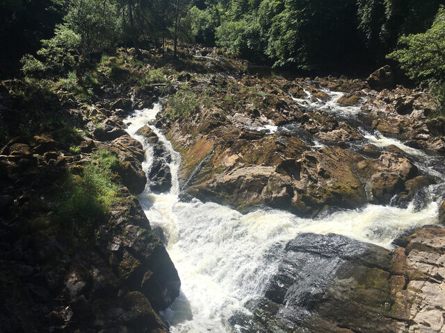
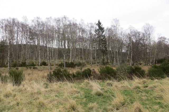
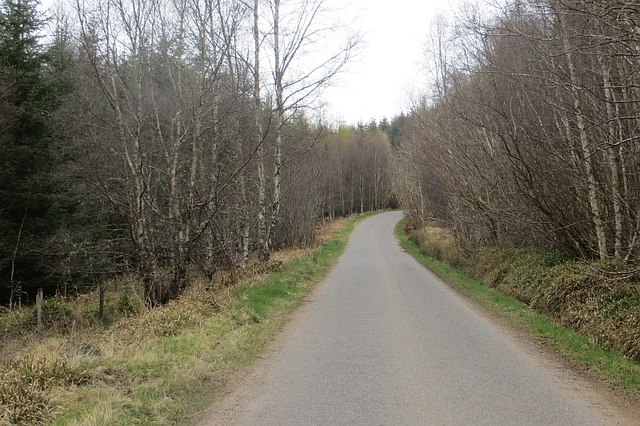
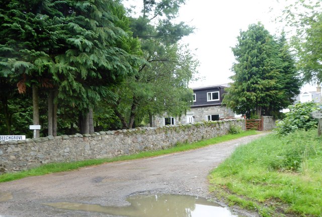
Craig of Affrusk Images
Images are sourced within 2km of 57.031554/-2.4829967 or Grid Reference NO7093. Thanks to Geograph Open Source API. All images are credited.


Craig of Affrusk is located at Grid Ref: NO7093 (Lat: 57.031554, Lng: -2.4829967)
Unitary Authority: Aberdeenshire
Police Authority: North East
What 3 Words
///piled.shatters.gladiators. Near Banchory, Aberdeenshire
Nearby Locations
Related Wikis

Tilquhillie Castle
Tilquhillie Castle is a castle near Banchory in Aberdeenshire, Scotland. A Category A listed building, the castle formally formed part of the lands of...

Braehead, Banchory
Braehead, Banchory is a proposed major housing development to the south of Banchory, Aberdeenshire, Scotland. The site is home to Braehead farm, formerly...

Water of Feugh
The Water of Feugh (pronounced:few-ikh) is a stream in Aberdeenshire that is the largest tributary to the River Dee. This stream rises in the Grampian...

Banchory railway station
Banchory railway station was situated on the Aberdeen and Ballater branch (the Deeside Line). It was situated at 16 miles 72 chains (27.2 km) from Aberdeen...

Dee Street Halt railway station
Dee Street Halt railway station was a short-lived stopping place on the Aberdeen and Ballater railway branch. It was situated at 17 miles 30 chains (28...

Banchory Ternan East Church
Banchory Ternan East Parish Church is a congregation of the Church of Scotland, a member of the Presbyterian Church. The church building is located in...

Banchory Academy
Banchory Academy is a secondary school serving Banchory, Scotland and surroundings, including the neighbouring communities of Raemoir, Crathes, Strachan...

Banchory Town Hall
Banchory Town Hall is a municipal structure in the High Street, Banchory, Aberdeenshire, Scotland. The structure is primarily used as a community events...
Nearby Amenities
Located within 500m of 57.031554,-2.4829967Have you been to Craig of Affrusk?
Leave your review of Craig of Affrusk below (or comments, questions and feedback).