Bents Hill

Hill, Mountain in Westmorland Eden

England

Bents Hill

Sheep in field near High Dubbs A farm and a field to the west of Newbiggin-on-Lune.
The northern slopes of the Howgill Fells rise in the distance.
Sheep in field near High Dubbs Credit: Trevor Littlewood

Bents Hill, located in Westmorland, is a picturesque hill/mountain situated in the northwestern part of England. With an elevation of approximately 1,200 feet (365 meters), it is a prominent feature in the surrounding landscape.

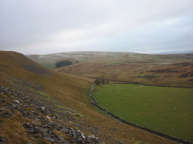
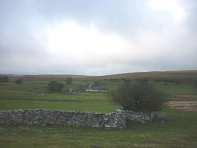
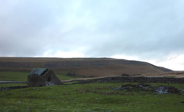
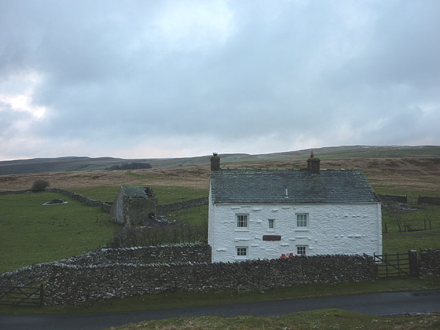
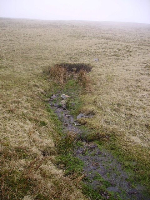
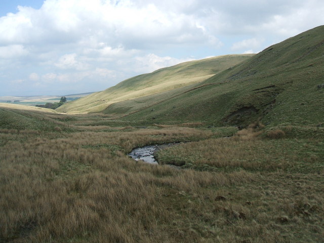
Bents Hill offers breathtaking panoramic views of the surrounding countryside, including rolling hills, lush green meadows, and picturesque villages. The hill is covered with a variety of vegetation, including heather, grasses, and occasional clusters of trees. The diverse flora on the hill attracts a range of wildlife, including birds, rabbits, and occasionally deer.

The area surrounding Bents Hill has a rich history, with evidence of human settlement dating back centuries. The hill has been the site of various archaeological discoveries, including ancient burial mounds and remnants of Bronze Age settlements. These findings indicate that the hill has been inhabited and utilized by humans for thousands of years.

For outdoor enthusiasts, Bents Hill offers a range of activities. Hiking and walking trails crisscross the hill, allowing visitors to explore its beauty at their own pace. The hill is also popular among birdwatchers, who flock to the area to observe a variety of bird species, including buzzards, kestrels, and peregrine falcons.

In summary, Bents Hill in Westmorland is a stunning hill/mountain that offers visitors a chance to immerse themselves in the natural beauty of the English countryside. With its breathtaking views, rich history, and diverse wildlife, it is a must-visit destination for nature lovers and those seeking a peaceful retreat.

If you have any feedback on the listing, please let us know in the comments section below.

Bents Hill Images

Images are sourced within 2km of 54.456493/-2.4549271 or Grid Reference NY7006. Thanks to Geograph Open Source API. All images are credited.

Sheep in field near High Dubbs A farm and a field to the west of Newbiggin-on-Lune.
The northern slopes of the Howgill Fells rise in the distance.
Sheep in field near High Dubbs
A farm and a field to the west of Newbiggin-on-Lune. The northern slopes of the Howgill Fells rise in the distance.
Sheep near Newbiggin-on-Lune Looking across upper Lunesdale to the Howgill Fells.
Sheep near Newbiggin-on-Lune
Looking across upper Lunesdale to the Howgill Fells.
Mazon Wath sheep pasture At the head of Potts Valley.
Mazon Wath sheep pasture
At the head of Potts Valley.
Wall corner at Fell Head Looking towards Mazon Wath.
Wall corner at Fell Head
Looking towards Mazon Wath.
Decrepit barn at Fell Head Looking towards Potts Valley.
Decrepit barn at Fell Head
Looking towards Potts Valley.
Fell Head No noisy neighbours here.
Fell Head
No noisy neighbours here.
Routemaster On A Road Run A view of the Clydeside Scottish AEC Routemaster whilst on a road run at the close of the first day of the 2013 rally.
Routemaster On A Road Run
A view of the Clydeside Scottish AEC Routemaster whilst on a road run at the close of the first day of the 2013 rally.
Bristol Lodekka On A Road Run The 1959 Lodekka, a convertible open/closed top double decker, is operated by Cumbria Classic Coaches.
Bristol Lodekka On A Road Run
The 1959 Lodekka, a convertible open/closed top double decker, is operated by Cumbria Classic Coaches.
'Green Goddess' On A Road Run A 1957 Bedford RHLZ 'Green Goddess' Fire Engine, ex-Home Office reserve.
'Green Goddess' On A Road Run
A 1957 Bedford RHLZ 'Green Goddess' Fire Engine, ex-Home Office reserve.
Farmland, Mazon Wath Surrounded by a vast area of unenclosed grassland.
Farmland, Mazon Wath
Surrounded by a vast area of unenclosed grassland.
Fell Head Snow drifts west of a dyke after a month of east winds.
Fell Head
Snow drifts west of a dyke after a month of east winds.
Moorland, Mask Hill
Moorland, Mask Hill
Road, Mask Hill A vast area of unenclosed grassland.
Road, Mask Hill
A vast area of unenclosed grassland.
Open range Warning by a cattle grid at the edge of a vast unenclosed area of grassland. The cattle were not out at time of visit.
Open range
Warning by a cattle grid at the edge of a vast unenclosed area of grassland. The cattle were not out at time of visit.
Ravenstonedale Moor A fence runs across the moor, one of very few in the area.
Ravenstonedale Moor
A fence runs across the moor, one of very few in the area.
Ravenstonedale Moor The road has climbed out of Lunedale. There is a lot of snow on the Howgill Fells.
Ravenstonedale Moor
The road has climbed out of Lunedale. There is a lot of snow on the Howgill Fells.
High Lane Climbing out of Newbiggin. I had missed the bus by a day. <a href="https://www.geograph.org.uk/photo/3392666">NY6905 : Routemaster On A Road Run</a> 
There is a gully from a previous road alignment.
High Lane
Climbing out of Newbiggin. I had missed the bus by a day. NY6905 : Routemaster On A Road Run There is a gully from a previous road alignment.
Common, High Lane A tongue of moorland and rough grazing descends to Lunedale.
Common, High Lane
A tongue of moorland and rough grazing descends to Lunedale.
Show me another place!

Bents Hill is located at Grid Ref: NY7006 (Lat: 54.456493, Lng: -2.4549271)

Administrative County: Cumbria

District: Eden

Police Authority: Cumbria

What 3 Words

///kiosk.human.revisit. Near Kirkby Stephen, Cumbria

Nearby Locations

Bents Hill

Related Wikis

Ravenstonedale railway station

Ravenstonedale railway station was situated on the South Durham & Lancashire Union Railway (SD&LUR) between Tebay and Kirkby Stephen East. It served the...

Newbiggin-on-Lune

Newbiggin-on-Lune is a village in the Eden district of Cumbria, England. Historically in Westmorland it is about 4 miles (6.4 km) south west of Kirkby...

Brownber

Brownber is a hamlet surrounding Brownber Hall near Newbiggin-on-Lune in Cumbria, England.

Sandwath Beck

Sandwath Beck is a river running through Cumbria in England. The beck rises beneath Green Bell in Ravenstonedale as Dale Gill, changing its designation...

Weasdale Beck

Weasdale Beck is a stream in Cumbria, England. The Beck rises in Ravenstonedale and drains Leathgill Bridge on Randygill Top and Great Swindale, below...

Little Asby

Little Asby is a small village in Cumbria, England. Historically part of Westmorland, its name is said to be derived from the Norse words askr, meaning...

Ravenstonedale Priory

Ravenstonedale Priory was a Gilbertine priory in Cumbria, England. It was founded in the reign of Henry II, when Torphin, son of Robert, son of Copsus...

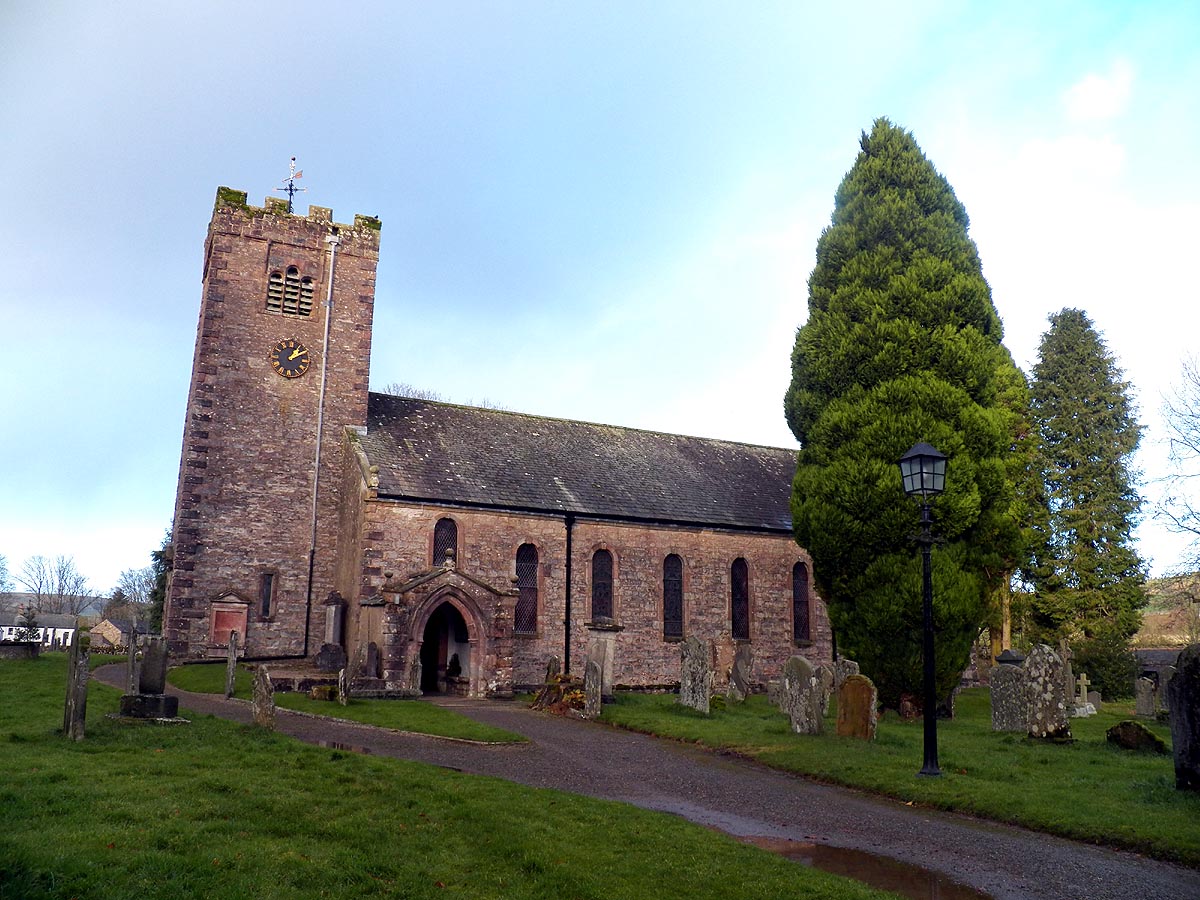
St Oswald's Church, Ravenstonedale

St Oswald's Church is in the village of Ravenstonedale, Cumbria, England. It is an active Anglican parish church in the deanery of Appleby, the archdeaconry...

Nearby Amenities

Located within 500m of 54.456493,-2.4549271
Great Ewe Fell
Ele: 365.2
Is In Country Code: GB
Is In County: Cumbria
Man Made: cairn
Natural: peak
Lat/Long: 54.4586153/-2.4609566
Bents Camping Barn
Tourism: hostel
Lat/Long: 54.4526751/-2.4510262
Bents Farm
Place: farm
Lat/Long: 54.4525267/-2.451303
Bents Hill
Natural: peak
Lat/Long: 54.4563036/-2.4543364
Power: pole
Lat/Long: 54.4521273/-2.455817
Power: pole
Lat/Long: 54.4523959/-2.4543656
Power: pole
Lat/Long: 54.4526538/-2.4530286
Power: pole
Lat/Long: 54.4526122/-2.4519042
The data included in this document is from www.openstreetmap.org. The data is made available under ODbL.

Have you been to Bents Hill?

Leave your review of Bents Hill below (or comments, questions and feedback).