Great Harlow

Hill, Mountain in Yorkshire Ribble Valley

England

Great Harlow

Cross of Greet (woz 'ere) Pendle Hill still visible (just).
Cross of Greet (woz 'ere) Credit: Peter Turner

Great Harlow is a prominent hill located in the picturesque region of Yorkshire, England. Standing at an elevation of approximately 1,500 feet, it is considered one of the highest points in the area, offering breathtaking views of the surrounding countryside.

The hill is characterized by its rolling slopes and rocky terrain, with patches of lush greenery dotting its landscape. Great Harlow is part of the larger Harlow Moor, which spans over a vast area and is known for its diverse flora and fauna.

The summit of Great Harlow provides visitors with a panoramic vista, offering a sweeping view of the Yorkshire Dales and the nearby towns and villages. On a clear day, one can even catch glimpses of the distant Pennines and the North Sea.

Hikers and nature enthusiasts are drawn to Great Harlow due to its abundant walking trails and opportunities for outdoor activities. The hill is a popular destination for both casual strollers and serious trekkers, with paths varying in difficulty and length. It is also a favored spot for birdwatchers, as the area is home to various species of birds, including kestrels, peregrine falcons, and buzzards.

Great Harlow, Yorkshire, serves as a serene retreat for those seeking solace in nature's beauty. Its tranquil surroundings, coupled with its stunning vistas, make it a must-visit destination for anyone exploring the Yorkshire region.

If you have any feedback on the listing, please let us know in the comments section below.
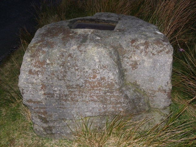
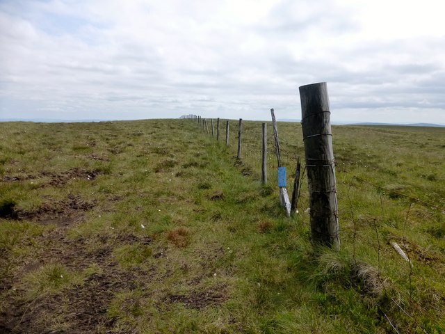
Great Harlow Images

Images are sourced within 2km of 54.042379/-2.4630346 or Grid Reference SD6960. Thanks to Geograph Open Source API. All images are credited.

Cross of Greet (woz 'ere) Pendle Hill still visible (just).
Cross of Greet (woz 'ere)
Pendle Hill still visible (just).
To Little Clough head
The road to Bentham With access point for a less speedy route to other places.
The road to Bentham
With access point for a less speedy route to other places.
At the Cross of Greet On the road from Slaidburn to Bentham. The cross is now gone, leaving only the base stone. The cross probably once marked the boundary between the Civil Parishes of Tatham and Slaidburn.
At the Cross of Greet
On the road from Slaidburn to Bentham. The cross is now gone, leaving only the base stone. The cross probably once marked the boundary between the Civil Parishes of Tatham and Slaidburn.
Cross of Greet The lonely Cross of Greet at dusk.
Cross of Greet
The lonely Cross of Greet at dusk.
The Cross 'O' Greet at Watter Shed Wurs't cross gone then? Musta gone long a go, wur't med a wood or stone, long long ago ?
The Cross 'O' Greet at Watter Shed
Wurs't cross gone then? Musta gone long a go, wur't med a wood or stone, long long ago ?
Remains of Cross of Greet - Tatham fell - Bowland
Moon from Cross of Greet
Night falling at Cross of Greet
On Reflection at Cross of Greet
Hailshowers Fell Parked after cattle grid at 427 metres at SD6823860865 then Great Harlow, Hailshowers Fell, Bowlands Knotts, return to Hailshowers Fell, Great Harlow, Thistle Hill, Burn Moor and then to road below Moor Cock Farm and then up road back to my car. Very hot sunny day with drier than average moorland underfoot. 486 metre point next to fence didn't seem to be the highest point walking either way over this hill today. A quad track seemed to stop at the highest point before a lower cairn, buried stake and grit point.
Name: Hailshowers Fell
Hill number: 108526
Height: 486m / 1594ft
Area: 36: Lancashire, Cheshire & the Southern Pennines
Class: 4
Grid ref: SD698608 (est)
Drop: 64m
Col: 422m
Hailshowers Fell
Parked after cattle grid at 427 metres at SD6823860865 then Great Harlow, Hailshowers Fell, Bowlands Knotts, return to Hailshowers Fell, Great Harlow, Thistle Hill, Burn Moor and then to road below Moor Cock Farm and then up road back to my car. Very hot sunny day with drier than average moorland underfoot. 486 metre point next to fence didn't seem to be the highest point walking either way over this hill today. A quad track seemed to stop at the highest point before a lower cairn, buried stake and grit point. Name: Hailshowers Fell Hill number: 108526 Height: 486m / 1594ft Area: 36: Lancashire, Cheshire & the Southern Pennines Class: 4 Grid ref: SD698608 (est) Drop: 64m Col: 422m
Hailshowers Fell Alternative Summit This spot above the cairn appeared to be as high or higher than the summit of Hailshowers Fell beside the fence on this hot sunny Sunday.  This hill high point is also called Great Harlow.
Hailshowers Fell Alternative Summit
This spot above the cairn appeared to be as high or higher than the summit of Hailshowers Fell beside the fence on this hot sunny Sunday. This hill high point is also called Great Harlow.
Raven's Castle The stile and wall junction at Raven's Castle.
Raven's Castle
The stile and wall junction at Raven's Castle.
Start Of Route Towards Hailshowers Fell The start of the route towards Hailshowers Fell is a little boggy.
Start Of Route Towards Hailshowers Fell
The start of the route towards Hailshowers Fell is a little boggy.
Heading Towards Hailshowers Fell The moorland has plenty of Cottongrass this year as I walk up towards Raven's Castle and then Hailshowers Fell.
Heading Towards Hailshowers Fell
The moorland has plenty of Cottongrass this year as I walk up towards Raven's Castle and then Hailshowers Fell.
Road descends to Slaidburn
Wooden structure on moor There are several of these. I think they are hides for shooters.
Wooden structure on moor
There are several of these. I think they are hides for shooters.
Valley of the River Hodder Looking south down the valley of the River Hodder with the Cross of Greet moorland road on the left
Valley of the River Hodder
Looking south down the valley of the River Hodder with the Cross of Greet moorland road on the left
Show me another place!

Great Harlow is located at Grid Ref: SD6960 (Lat: 54.042379, Lng: -2.4630346)

Division: West Riding

Administrative County: Lancashire

District: Ribble Valley

Police Authority: Lancashire

What 3 Words

///sheds.shining.nagging. Near High Bentham, North Yorkshire

Related Wikis

White Hill (Forest of Bowland)

White Hill is a hill in the Forest of Bowland, north-western England. It lies between Slaidburn and High Bentham. The summit houses a tower and a trig...

Geography of the United Kingdom

The United Kingdom is a sovereign state located off the north-western coast of continental Europe. With a total area of approximately 248,532 square kilometres...

Stocks Reservoir

Stocks Reservoir is a reservoir situated at the head of the Hodder valley in the Forest of Bowland, Lancashire, England (historically in the West Riding...

Easington, Lancashire

Easington () is a civil parish within the Ribble Valley district of Lancashire, England, with a population in 2001 of 52. The Census 2011 population details...

Great Stone of Fourstones

The Great Stone of Fourstones, or the Big Stone as it is known locally, is a glacial deposit on the moorlands of Tatham Fells, England, straddling the...

Keasden

Keasden is a hamlet in the civil parish of Clapham-cum-Newby, in the Craven district of the county of North Yorkshire, in the north-western England. It...

Church of the Good Shepherd, Tatham

The Church of the Good Shepherd is on Tatham Fell in Lancashire, England. It is an active Anglican parish church in the deanery of Tunstall, the archdeaconry...

Brennand Farm

Brennand Farm is often claimed to be the true centre of Great Britain. This is about seven kilometres north-west of Dunsop Bridge - which has the nearest...

Nearby Amenities

Located within 500m of 54.042379,-2.4630346
Hailshowers Fell
Is In: Craven, North Yorkshire
Place: locality
Source: OS OpenData Streetview
Lat/Long: 54.042979/-2.458436
Great Harlow
Is In: Craven, North Yorkshire
Place: locality
Source: OS OpenData Streetview
Lat/Long: 54.0460028/-2.4600668
Raven's Castle
Natural: peak
Lat/Long: 54.0423009/-2.4622756
Note: Unfinished; fence exists on the ground, but exact intersection with NW/SE fence unknown
Lat/Long: 54.0446594/-2.462397
The data included in this document is from www.openstreetmap.org. The data is made available under ODbL.

Have you been to Great Harlow?

Leave your review of Great Harlow below (or comments, questions and feedback).