West Grain

Hill, Mountain in Westmorland Eden

England

West Grain

Summit trig point on Green Bell with view towards Cross Fell
Summit trig point on Green Bell with view towards Cross Fell Credit: Colin Park

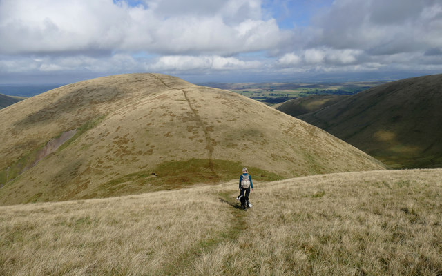
West Grain, also known as Westmorland Hill or Westmorland Mountain, is a prominent geographical feature located in the county of Westmorland in the northwestern part of England. Rising to an elevation of approximately 1,244 feet (379 meters), it is one of the highest peaks in the region and boasts breathtaking panoramic views of the surrounding countryside.

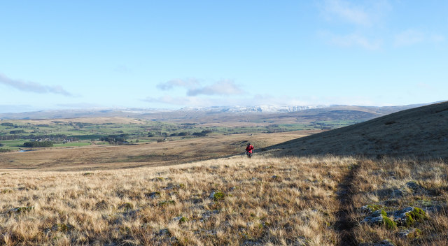
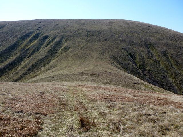
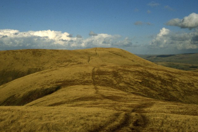
Situated within the boundaries of the Lake District National Park, West Grain is a popular destination for outdoor enthusiasts and nature lovers. Its rugged terrain and challenging hiking trails attract hikers, mountaineers, and climbers seeking an adrenaline-pumping adventure. The ascent to the summit can be demanding, but the reward is an awe-inspiring vista that stretches across the picturesque valleys, rolling hills, and shimmering lakes that define the region.

The area surrounding West Grain is rich in biodiversity, with a variety of plant and animal species thriving in its diverse ecosystems. The mountain is covered in heather moorland, interspersed with patches of woodland and rocky outcrops. It provides a sanctuary for a range of bird species, including peregrine falcons, golden eagles, and merlins, making it a bird watcher's paradise.

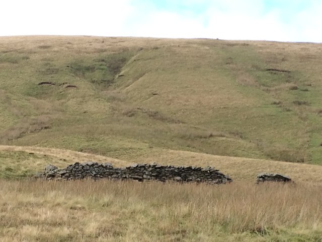
In addition to its natural beauty, West Grain holds historical significance. Its slopes are scattered with remnants of ancient settlements, stone circles, and burial mounds, evidence of human occupation dating back thousands of years. These archaeological sites provide insight into the rich cultural heritage of the area.

Whether it is conquering the summit, immersing oneself in the natural wonders, or delving into the historical past, West Grain offers a captivating experience for visitors seeking an escape into the wild beauty of Westmorland.

If you have any feedback on the listing, please let us know in the comments section below.

West Grain Images

Images are sourced within 2km of 54.405219/-2.4744015 or Grid Reference NY6901. Thanks to Geograph Open Source API. All images are credited.

Summit trig point on Green Bell with view towards Cross Fell
Sheepfold in Bowderdale
Remains of sheepfold in Bowderdale
Leathgill Bridge Appropriate name for this pass between Hooksey, in shot and Randygill Top
Leathgill Bridge
Appropriate name for this pass between Hooksey, in shot and Randygill Top
Path on Stwarth. Slowly gaining height.
Path on Stwarth.
Slowly gaining height.
Ravenstonedale Common Looking down into Great Swindale.
Ravenstonedale Common
Looking down into Great Swindale.
The path to Randygill Top Lovely Howgill scenery.
The path to Randygill Top
Lovely Howgill scenery.
Track on ridge north of Stwarth Stwarth is a location along the ridge which rises southwards ultimately to Green Bell. There's a clear path rising more or less along the length of the ridge but the one in view is different; it's a contouring route and is assumed to have been created by sheep.
The view beyond the walker is to the east where distantly, Nine Standards and the ridge of the east side of Mallerstang are seen.
Track on ridge north of Stwarth
Stwarth is a location along the ridge which rises southwards ultimately to Green Bell. There's a clear path rising more or less along the length of the ridge but the one in view is different; it's a contouring route and is assumed to have been created by sheep. The view beyond the walker is to the east where distantly, Nine Standards and the ridge of the east side of Mallerstang are seen.
Slope on north side of Great Swindale Great Swindale is the obvious, shadowed, near valley; it's a tributary to Weasdale Beck which lies beyond. The sunlit slope at the centre of the image rises to a flat area named as Turn End.
Slope on north side of Great Swindale
Great Swindale is the obvious, shadowed, near valley; it's a tributary to Weasdale Beck which lies beyond. The sunlit slope at the centre of the image rises to a flat area named as Turn End.
Debris fan at foot of stream in Bowderdale The deposit - its surface at least - is stony and so cannot, presumably, be called alluvium, which would require it to be soil or other finer material. It's clear however that the debris has collected over a period of time through the tumbling of its stones down the stream groove.
Bowderdale Beck flows through the foreground.
Debris fan at foot of stream in Bowderdale
The deposit - its surface at least - is stony and so cannot, presumably, be called alluvium, which would require it to be soil or other finer material. It's clear however that the debris has collected over a period of time through the tumbling of its stones down the stream groove. Bowderdale Beck flows through the foreground.
Sunlit eastern slope of Bowderdale Bowderdale is a deep and steep-sided valley of the Howgill Fells; its waters drain to the north. In the low-angled sunshine of early January the western side of the valley and its floor are already shadowed.
Sunlit eastern slope of Bowderdale
Bowderdale is a deep and steep-sided valley of the Howgill Fells; its waters drain to the north. In the low-angled sunshine of early January the western side of the valley and its floor are already shadowed.
Frozen pool on ridge The ice has, perhaps, the appearance of temporarily flooded piece of ground where the standing water has frozen, mapping does show however that there is a pool to be found at this location, just south of Hooksey.
The distant ground is West Fell; it's on the far side of Bowderdale.
Frozen pool on ridge
The ice has, perhaps, the appearance of temporarily flooded piece of ground where the standing water has frozen, mapping does show however that there is a pool to be found at this location, just south of Hooksey. The distant ground is West Fell; it's on the far side of Bowderdale.
Cairn at Hooksey Hooksey is a location along the ridge rising between Bowderdale and Weasdale; it's hardly a summit, just a levelling along the ridge crest. The distant hill is Green Bell.
Cairn at Hooksey
Hooksey is a location along the ridge rising between Bowderdale and Weasdale; it's hardly a summit, just a levelling along the ridge crest. The distant hill is Green Bell.
Frozen pools on Stwarth These frozen pools on Stwarth, (a location along the ridge rising to Green Bell from the north), have a scattering of snowflakes on their surfaces.
The distant hills are of the Mallerstang area with the flat-topped Wild Boar Fell to the right.
Frozen pools on Stwarth
These frozen pools on Stwarth, (a location along the ridge rising to Green Bell from the north), have a scattering of snowflakes on their surfaces. The distant hills are of the Mallerstang area with the flat-topped Wild Boar Fell to the right.
Leathgill Bridge
Leathgill Bridge
Green Bell Trig point 1985' / 605m
Path leading towards Green Bell from Randygill Top
Heading north from Randygill Top From Randygill Top, a well-defined footpath heads over the edge and descends steeply to a col with the unusual name of Leathgill Bridge - Leath Gill being the stream that drains westwards to Bowderdale Beck from the col. The path can be clearly seen as an excellent ridgewalk over the 586m unnamed top ahead. Beyond that it descends a ridge called Hooksey - it is characteristic that the name applies not to the summit, obvious from up here, but to the ridge which is the prominent part as seen from the valley below. The valley to the right is Weasdale, our walk having taken a horseshoe route around this from the hamlet of the same name.
Heading north from Randygill Top
From Randygill Top, a well-defined footpath heads over the edge and descends steeply to a col with the unusual name of Leathgill Bridge - Leath Gill being the stream that drains westwards to Bowderdale Beck from the col. The path can be clearly seen as an excellent ridgewalk over the 586m unnamed top ahead. Beyond that it descends a ridge called Hooksey - it is characteristic that the name applies not to the summit, obvious from up here, but to the ridge which is the prominent part as seen from the valley below. The valley to the right is Weasdale, our walk having taken a horseshoe route around this from the hamlet of the same name.
Show me another place!

West Grain is located at Grid Ref: NY6901 (Lat: 54.405219, Lng: -2.4744015)

Administrative County: Cumbria

District: Eden

Police Authority: Cumbria

What 3 Words

///graced.jazzy.commander. Near Sedbergh, Cumbria

Related Wikis

Randygill Top

Randygill Top is a mountain located in the Howgill Fells, Cumbria (historically Westmorland), England. == References ==

Howgill Fells

The Howgill Fells are uplands in Northern England between the Lake District and the Yorkshire Dales, lying roughly within a triangle formed by the town...

Weasdale

Weasdale is a small hamlet in Cumbria, England, 850 feet (260 m) above sea-level on the northern flanks of the Howgill Fells. It is located approximately...

Yarlside

Yarlside is a hill in the Howgill Fells, Cumbria (historically Westmorland), England. This fell is not to be confused with the Yarlside area near Barrow...

Nearby Amenities

Located within 500m of 54.405219,-2.4744015
West Grain
Is In County: Cumbria
Place: locality
Source: NPE
Lat/Long: 54.4056381/-2.474569
The data included in this document is from www.openstreetmap.org. The data is made available under ODbL.

Have you been to West Grain?

Leave your review of West Grain below (or comments, questions and feedback).