Cairn Hill

Hill, Mountain in Banffshire

Scotland

Cairn Hill

Old Milestone by the B9025, Burnside of Carnousie, Forglen Parish By the B9025, in parish of Forglen (Aberdeen District), Burnside of Carnousie, near junction sign and commercial vehicle premises, North side of road.

Inscription reads:- : 39 : (To Aberdeen)

Surveyed

Milestone Society National ID: AD_TRAC39
Old Milestone by the B9025, Burnside of Carnousie, Forglen Parish Credit: Milestone Society

Cairn Hill, located in Banffshire, Scotland, is a prominent hill and mountainous region of great natural beauty. Standing at an elevation of 817 meters (2,680 feet), it offers breathtaking panoramic views of the surrounding landscape and is a popular destination for hikers and outdoor enthusiasts.

The hill is part of the Grampian Mountains range, which stretches across the eastern Highlands of Scotland. Cairn Hill is characterized by its rugged terrain, with steep slopes and rocky outcrops that challenge adventurous climbers. The summit provides a rewarding experience, offering a spectacular vista of the surrounding valleys, forests, and neighboring peaks.

The area surrounding Cairn Hill is rich in flora and fauna, with a diverse range of plant species, including heather, moss, and wildflowers, adding vibrant colors to the landscape. The hill also hosts a variety of bird species, such as golden eagles, peregrine falcons, and ptarmigans, making it a haven for birdwatchers.

Cairn Hill is easily accessible, with several well-marked trails leading to its summit. The most popular route starts from the nearby village of Glenlivet, taking hikers through picturesque glens and alongside sparkling streams. Along the way, visitors may encounter historic landmarks, such as ancient cairns or remnants of old settlements, showcasing the hill's rich cultural history.

Whether it's for a challenging climb, stunning vistas, or an opportunity to immerse oneself in nature, Cairn Hill offers a memorable experience for all who venture to its summit. It stands as a testament to the raw beauty and grandeur of the Scottish Highlands, attracting nature enthusiasts from far and wide.

If you have any feedback on the listing, please let us know in the comments section below.
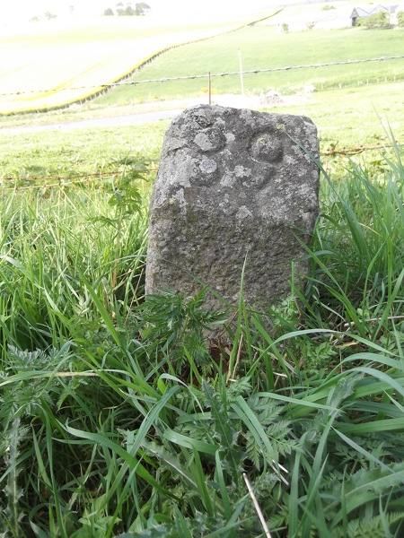
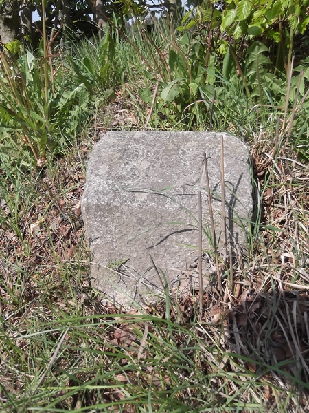
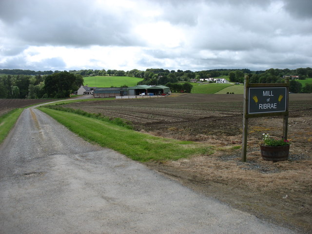
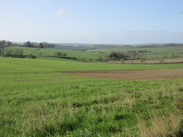
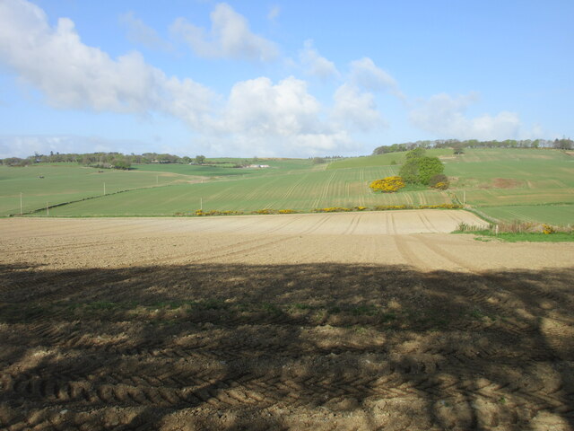
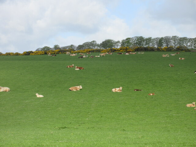
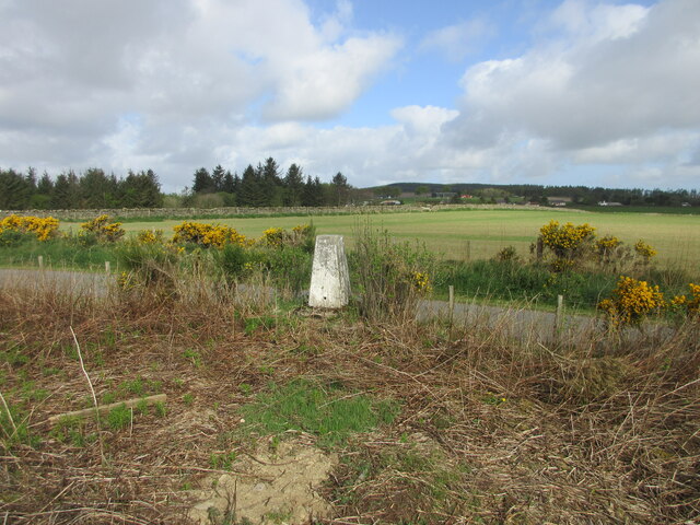
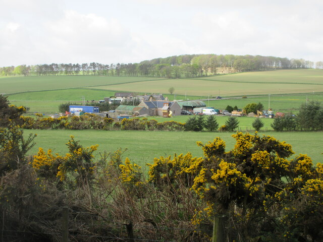
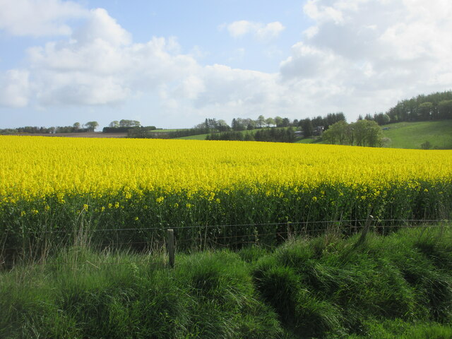
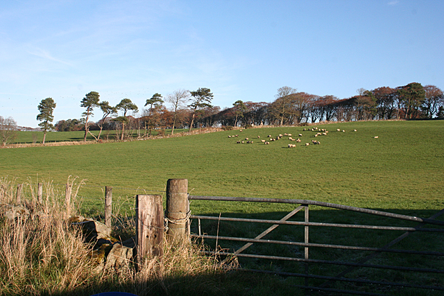
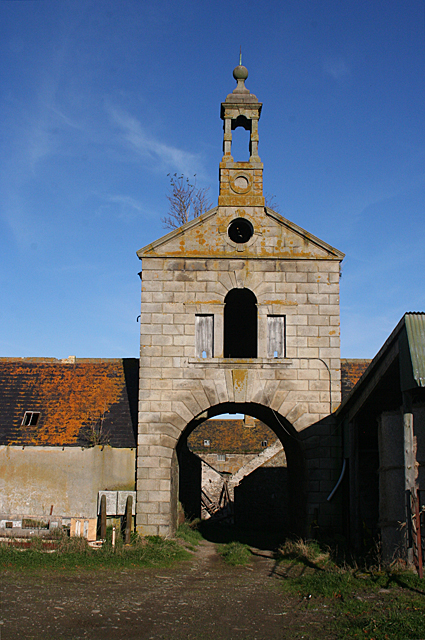
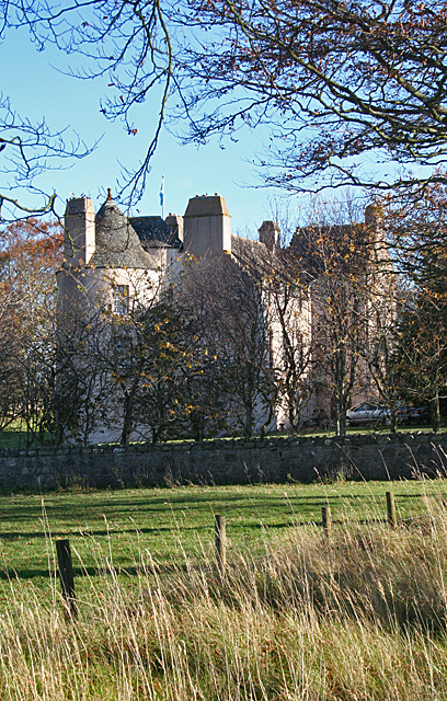
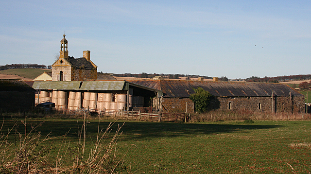
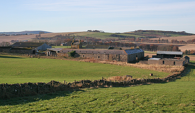
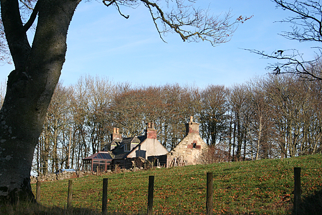
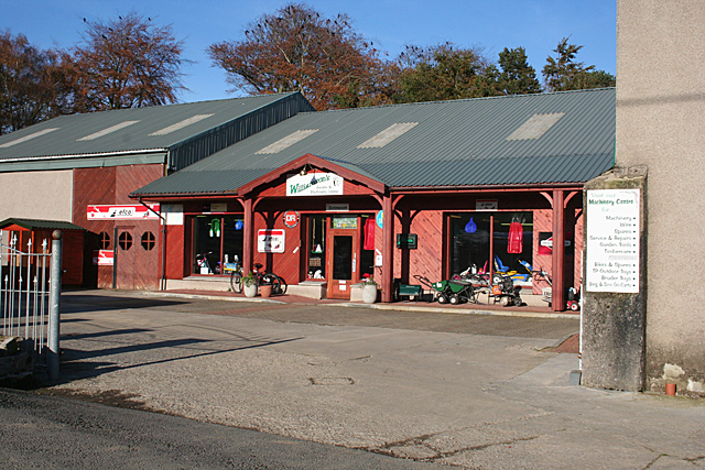
Cairn Hill Images

Images are sourced within 2km of 57.55566/-2.54132 or Grid Reference NJ6751. Thanks to Geograph Open Source API. All images are credited.

Old Milestone by the B9025, Burnside of Carnousie, Forglen Parish By the B9025, in parish of Forglen (Aberdeen District), Burnside of Carnousie, near junction sign and commercial vehicle premises, North side of road.

Inscription reads:- : 39 : (To Aberdeen)

Surveyed

Milestone Society National ID: AD_TRAC39
Old Milestone by the B9025, Burnside of Carnousie, Forglen Parish
By the B9025, in parish of Forglen (Aberdeen District), Burnside of Carnousie, near junction sign and commercial vehicle premises, North side of road. Inscription reads:- : 39 : (To Aberdeen) Surveyed Milestone Society National ID: AD_TRAC39
Old Milestone by the B9025, west of Turriff Milestone by the B9025, in parish of Forglen (Aberdeen District), opposite lane to Meikle Ribrae, near derelict wooden bus shelter.

Inscription reads:-
37
(To Aberdeen)

Surveyed

Milestone Society National ID: AD_TRAC37
Old Milestone by the B9025, west of Turriff
Milestone by the B9025, in parish of Forglen (Aberdeen District), opposite lane to Meikle Ribrae, near derelict wooden bus shelter. Inscription reads:- 37 (To Aberdeen) Surveyed Milestone Society National ID: AD_TRAC37
Mill of Ribrae farm
Mill of Ribrae farm
Fields near Carnousie Looking southwards over countryside near Carnousie.
Fields near Carnousie
Looking southwards over countryside near Carnousie.
Aberdeenshire countryside Looking west over fields near Craiglug.
Aberdeenshire countryside
Looking west over fields near Craiglug.
C29L (Aberdeenshire) Road at Bogton The C29L road heading south-west through the hamlet of Bogton.
C29L (Aberdeenshire) Road at Bogton
The C29L road heading south-west through the hamlet of Bogton.
Road to Mill of Ribrae Roadway heading to the Mill of Ribrae past a pond.
Road to Mill of Ribrae
Roadway heading to the Mill of Ribrae past a pond.
Lounging cattle Cattle on the eastern slope of the Hill of Scotston.
Lounging cattle
Cattle on the eastern slope of the Hill of Scotston.
Hillhead of Mountblairy Trig Pillar The roadside triangulation pillar near the Hillhead of Mountblairy, looking north-westwards from inside the fence.
Hillhead of Mountblairy Trig Pillar
The roadside triangulation pillar near the Hillhead of Mountblairy, looking north-westwards from inside the fence.
Bridgend from the north-east Looking south-west to Bridgend by the B9025.
Bridgend from the north-east
Looking south-west to Bridgend by the B9025.
Oil-seed rape near Brownside Looking east to a field of oil-seed rape near Brownside.
Oil-seed rape near Brownside
Looking east to a field of oil-seed rape near Brownside.
White Hill Looking towards the hill from just outside the steading at Mains of Carnousie.
White Hill
Looking towards the hill from just outside the steading at Mains of Carnousie.
Mains of Carnousie The steading here is exceptionally fine, built in a square with arches to north and south. This is the decorative tower above the south arch. Sadly, the whole steading appears to be disused.
Mains of Carnousie
The steading here is exceptionally fine, built in a square with arches to north and south. This is the decorative tower above the south arch. Sadly, the whole steading appears to be disused.
Carnousie Castle Nigel Tranter, describing Carnousie in 1970, lamented the fact that the building was abandoned and had deteriorated sadly, part of it being used as a piggery. Since then it has been fully restored as an inhabited house, though the screen of trees makes it difficult to appreciate its features. It was probably built by Walter Ogilvy of Carnousie, because he sold his newly constructed fortalice in 1583 to his brother Ogilvy of Dunlugas. It was subsequently sold to the Gordons of Park. It is a Z-plan, with a circular tower to the north-west of the main block and a square tower to the south-east.
Carnousie Castle
Nigel Tranter, describing Carnousie in 1970, lamented the fact that the building was abandoned and had deteriorated sadly, part of it being used as a piggery. Since then it has been fully restored as an inhabited house, though the screen of trees makes it difficult to appreciate its features. It was probably built by Walter Ogilvy of Carnousie, because he sold his newly constructed fortalice in 1583 to his brother Ogilvy of Dunlugas. It was subsequently sold to the Gordons of Park. It is a Z-plan, with a circular tower to the north-west of the main block and a square tower to the south-east.
Mains of Carnousie The steading here is exceptionally fine, built in a square with arches to north and south, the latter crowned with an elaborate tower. The south elevation is largely obscured by a modern lean-to for storing straw, but the east elevation gives an idea of how it originally appeared.
Mains of Carnousie
The steading here is exceptionally fine, built in a square with arches to north and south, the latter crowned with an elaborate tower. The south elevation is largely obscured by a modern lean-to for storing straw, but the east elevation gives an idea of how it originally appeared.
Mains of Carnousie From here you can see the square of the original steading, with the roofs of additional buildings inside the square and a motley collection of modern structures outside it.
Mains of Carnousie
From here you can see the square of the original steading, with the roofs of additional buildings inside the square and a motley collection of modern structures outside it.
Cottages near White Hill One cottage in good repair, the other reduced to just its walls.
Cottages near White Hill
One cottage in good repair, the other reduced to just its walls.
Williamson's Machinery Centre This is part of a family-run enterprise which also has a garden centre, a pedal go-cart track, a tearoom and a huge indoor soft play area for children. It's not exactly on the beaten track, but is well patronised by those in the know.
Williamson's Machinery Centre
This is part of a family-run enterprise which also has a garden centre, a pedal go-cart track, a tearoom and a huge indoor soft play area for children. It's not exactly on the beaten track, but is well patronised by those in the know.
Show me another place!

Cairn Hill is located at Grid Ref: NJ6751 (Lat: 57.55566, Lng: -2.54132)

Unitary Authority: Aberdeenshire

Police Authority: North East

What 3 Words

///unusually.equipping.albums. Near Aberchirder, Aberdeenshire

Nearby Locations

Cairn Hill Bogton

Related Wikis

Whitehill Wood, Aberdeenshire

Whitehill Wood is a wood and megalithic stone circle in Aberdeenshire, Scotland, located off the B9025 road between Aberchirder and Turriff and between...

Bogton

Bogton is a rural area in Aberdeenshire, Scotland. To the south is Whitehill Wood and megalithic circle. == References ==
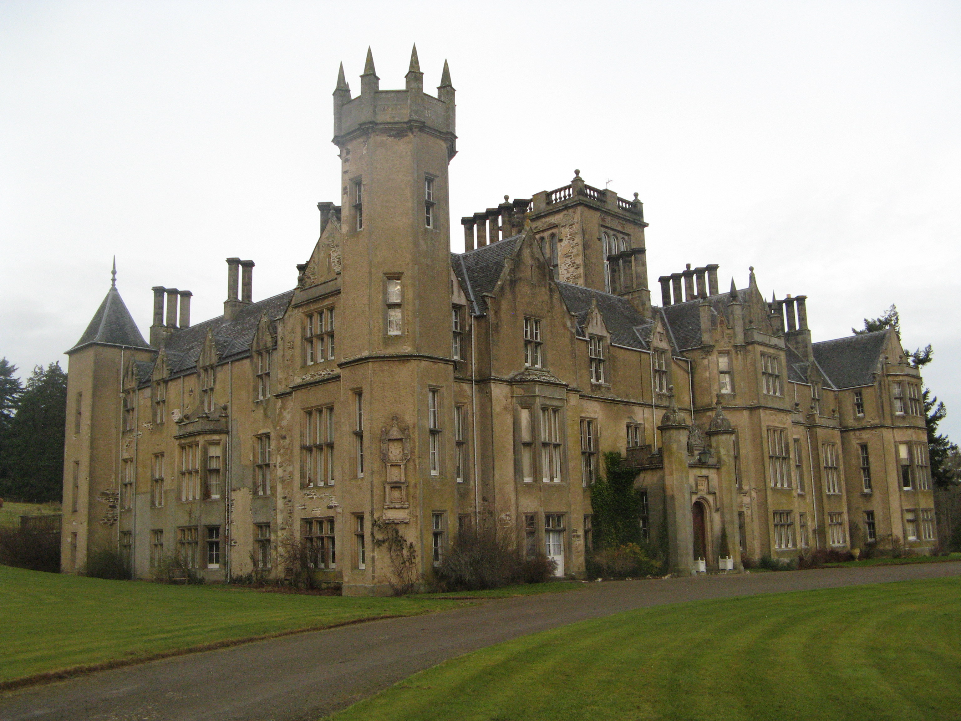
Forglen House

Forglen House is a mansion house that forms the centrepiece of the Forglen estate in the parish of Forglen, north-west of Turriff, Aberdeenshire, in the...

Turriff Castle

Turriff Castle was a tower house, on Castlegate, Turriff, north of Idoch Water, Aberdeenshire, Scotland. The castle was also called Tower of Torrey of...

Turriff United F.C.

Turriff United Football Club are a senior football club currently playing in the Highland Football League in Scotland. They play their matches at The Haughs...

Dorlaithers Castle

Dorlaithers Castle was a castle about 2.5 miles (4.0 km) south-west of Turriff, Aberdeenshire, Scotland at Dorlaithers, south of the burn of Gask. It may...

Turriff

Turriff (from Scottish Gaelic Torraibh 'place of round hills') is a town and civil parish in Aberdeenshire in Scotland. It lies on the River Deveron,...

Turriff Academy

Turriff Academy is a non denominational comprehensive co-educational secondary school located in Turriff, Aberdeenshire, Scotland. It serves a large catchment...

Nearby Amenities

Located within 500m of 57.55566,-2.54132
Bogton
Place: hamlet
Lat/Long: 57.5532573/-2.5390999
Power: pole
Lat/Long: 57.5526716/-2.5392674
Power: pole
Lat/Long: 57.5521363/-2.5387296
Power: pole
Lat/Long: 57.5515995/-2.5382146
Power: pole
Lat/Long: 57.5527517/-2.5386787
Power: pole
Lat/Long: 57.5528515/-2.5380992
Power: pole
Lat/Long: 57.5529893/-2.5375311
Power: pole
Lat/Long: 57.5531256/-2.5364069
Power: pole
Lat/Long: 57.5532694/-2.5352687
Power: pole
Lat/Long: 57.5534057/-2.5343469
Power: pole
Lat/Long: 57.5529304/-2.5396231
Power: pole
Lat/Long: 57.5532164/-2.5399909
Power: pole
Lat/Long: 57.5534467/-2.5403165
Power: pole
Lat/Long: 57.5537109/-2.5405681
Power: pole
Lat/Long: 57.5543426/-2.5411823
Power: pole
Lat/Long: 57.5551064/-2.5418887
Power: pole
Lat/Long: 57.5556969/-2.5423943
Power: pole
Lat/Long: 57.5562318/-2.5428412
Power: pole
Lat/Long: 57.5568323/-2.5432762
Power: pole
Lat/Long: 57.5573723/-2.5436595
Material: wood
Power: pole
Lat/Long: 57.5579551/-2.5440899
Material: wood
Power: pole
Lat/Long: 57.5583311/-2.5444685
Material: wood
Power: pole
Lat/Long: 57.5586881/-2.5448377
Material: wood
Power: pole
Lat/Long: 57.5593529/-2.545508
Power: pole
Lat/Long: 57.5538839/-2.5338765
Power: pole
Lat/Long: 57.5543923/-2.5333568
The data included in this document is from www.openstreetmap.org. The data is made available under ODbL.

Have you been to Cairn Hill?

Leave your review of Cairn Hill below (or comments, questions and feedback).