Ashton Hill

Hill, Mountain in Somerset

England

Ashton Hill

The Wheatsheaf
The Wheatsheaf Credit: thejackrustles

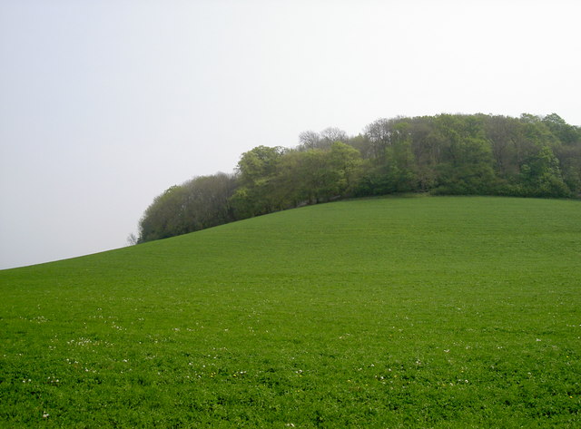
Ashton Hill is a prominent geographical feature located in Somerset, England. Rising to an elevation of 307 meters (1,007 feet), it is classified as a hill rather than a mountain. Situated near the village of Long Ashton, Ashton Hill offers picturesque views of the surrounding countryside and is a popular destination for outdoor enthusiasts and nature lovers.

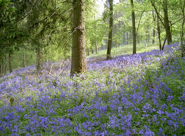
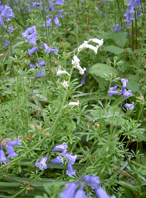
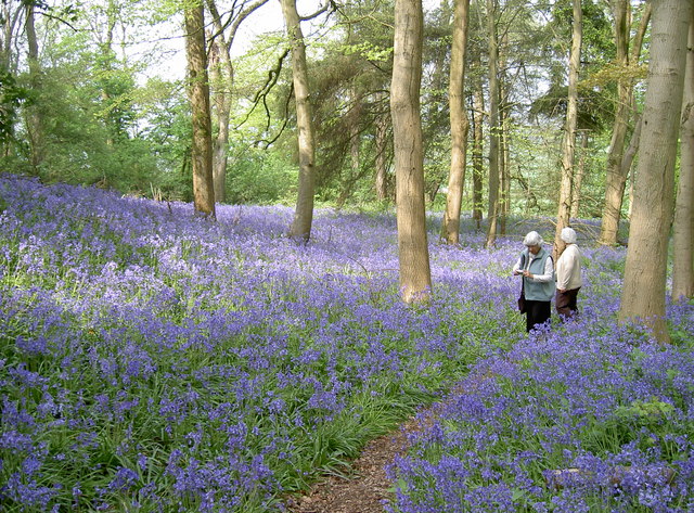
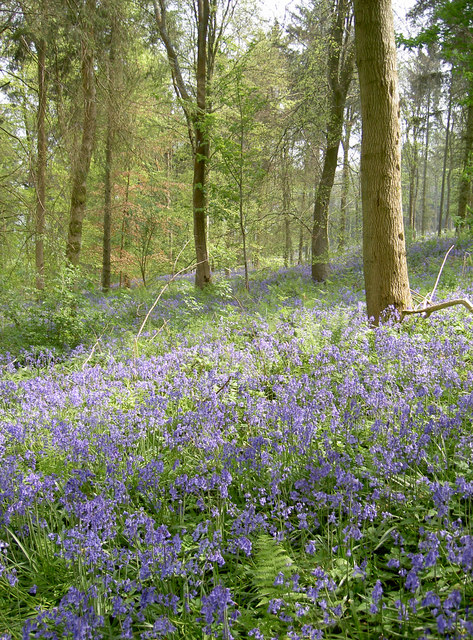
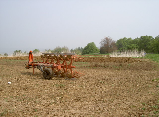
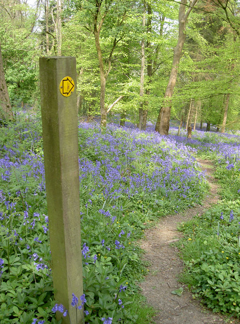
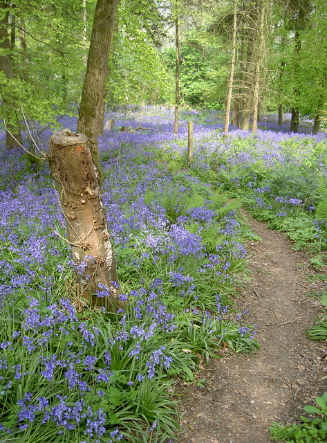
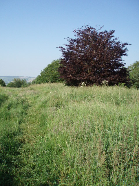
Covered in lush green vegetation, the hill is home to a diverse range of flora and fauna. The slopes are adorned with a mixture of deciduous and coniferous trees, providing a rich habitat for various bird species, small mammals, and insects. Hikers and walkers can explore the numerous footpaths and trails that crisscross the hill, offering opportunities to observe the local wildlife up close.

Additionally, Ashton Hill boasts a rich historical significance. The hill was once part of a larger estate owned by the Ashton family, who were prominent landowners in the area during the medieval period. Today, remnants of old stone walls and structures can still be found scattered across the hill, providing glimpses into its past.

Reaching the summit of Ashton Hill rewards visitors with panoramic views of the surrounding Somerset countryside. On clear days, it is possible to see as far as the Bristol Channel and even the distant coastline of Wales. This vantage point makes Ashton Hill a popular spot for photographers and those seeking a peaceful retreat to appreciate the natural beauty of the region.

Overall, Ashton Hill in Somerset offers a combination of natural beauty, wildlife, and historical charm, making it a must-visit destination for locals and tourists alike.

If you have any feedback on the listing, please let us know in the comments section below.

Ashton Hill Images

Images are sourced within 2km of 51.386618/-2.4679713 or Grid Reference ST6765. Thanks to Geograph Open Source API. All images are credited.

The Wheatsheaf
The Wheatsheaf
Saltford - The River Avon by the Riverside Inn
Saltford - The River Avon east of Saltford Marina
Ordnance Survey Cut Mark This OS cut mark can be found on the Wheatsheaf Inn. It marks a point 96.079m above mean sea level.
Ordnance Survey Cut Mark
This OS cut mark can be found on the Wheatsheaf Inn. It marks a point 96.079m above mean sea level.
Bluebells, Stantonbury Hill Perfect weather this Spring has brought out a large showing of woodland bluebells.
Bluebells, Stantonbury Hill
Perfect weather this Spring has brought out a large showing of woodland bluebells.
White bluebells Despite the obvious misnomer, there are white flowers among the traditional blue variety. Pink ones also occur. Some estimate that whites occur less than 1:10,000, and are a natural phenomenon. The introduction of the Spanish Bluebell variety has produced hybridisation, making identifying the exact species tricky.
White bluebells
Despite the obvious misnomer, there are white flowers among the traditional blue variety. Pink ones also occur. Some estimate that whites occur less than 1:10,000, and are a natural phenomenon. The introduction of the Spanish Bluebell variety has produced hybridisation, making identifying the exact species tricky.
Awash with Bluebells, Stantonbury Hill The footpath up to the top of Stantonbury Hill has been blessed this year with a fabulous showing of the traditional woodland bluebell.
Awash with Bluebells, Stantonbury Hill
The footpath up to the top of Stantonbury Hill has been blessed this year with a fabulous showing of the traditional woodland bluebell.
Bluebells, Stantonbury Hill Bluebells thriving on the slopes of the old hill-fort, along with a generous mixture of deciduous trees.
Bluebells, Stantonbury Hill
Bluebells thriving on the slopes of the old hill-fort, along with a generous mixture of deciduous trees.
Hilltop agriculture The top of Stantonbury Hill is a small plateau. After passing through the tree-lined and bluebell covered slopes (see <a href="https://www.geograph.org.uk/photo/2378780">ST6763 : Awash with Bluebells, Stantonbury Hill</a> for example), the open area is a bit of a surprise. Here there is clear evidence of cultivation, and <a href="https://www.geograph.org.uk/photo/2378822">ST6763 : Take-away for pheasants?</a> may indicate the area is kept for the benefit of pheasants.
Hilltop agriculture
The top of Stantonbury Hill is a small plateau. After passing through the tree-lined and bluebell covered slopes (see ST6763 : Awash with Bluebells, Stantonbury Hill for example), the open area is a bit of a surprise. Here there is clear evidence of cultivation, and ST6763 : Take-away for pheasants? may indicate the area is kept for the benefit of pheasants.
Take-away for pheasants? A feeder constructed from handy materials, presumably for the use by pheasants. A nearby sett may be home to a few more interested parties.

The thin hedgeline and the cultivated ground behind it may suggest the hilltop is being specifically prepared for birds, though. See <a href="https://www.geograph.org.uk/photo/2378797">ST6763 : Hilltop agriculture</a> for a better view of the machinery.
Take-away for pheasants?
A feeder constructed from handy materials, presumably for the use by pheasants. A nearby sett may be home to a few more interested parties. The thin hedgeline and the cultivated ground behind it may suggest the hilltop is being specifically prepared for birds, though. See ST6763 : Hilltop agriculture for a better view of the machinery.
Bluebells this way In fact, they are almost everywhere!
Bluebells this way
In fact, they are almost everywhere!
Footpath through the bluebells Stantonbury Hill is the site of an old hill-fort, and the footpath goes right across it. The weather this Spring has certainly brought the best out of these traditional woodland flowers.
Footpath through the bluebells
Stantonbury Hill is the site of an old hill-fort, and the footpath goes right across it. The weather this Spring has certainly brought the best out of these traditional woodland flowers.
Profile of Stantonbury Hill A view of the old hill-fort showing the outline of the land and the trees on the higher slopes. The ancient earthworks known as the Wansdyke ran across it, although little evidence remains here now.
Profile of Stantonbury Hill
A view of the old hill-fort showing the outline of the land and the trees on the higher slopes. The ancient earthworks known as the Wansdyke ran across it, although little evidence remains here now.
Bowing Bluebells The bluebell, (Hyacinthoides non-scripta), seen here in classic pose. This traditional woodland flower arrives in Spring typically in older, deciduous woodland; it is a protected species under the Wildlife and Countryside Act 1981 too.
Bowing Bluebells
The bluebell, (Hyacinthoides non-scripta), seen here in classic pose. This traditional woodland flower arrives in Spring typically in older, deciduous woodland; it is a protected species under the Wildlife and Countryside Act 1981 too.
The marina at Saltford
The River Avon by Saltford
Whoops! The notorious A39/B3116 junction is known locally as the Two-Headed Man - which is what you will need to be if you want to negotiate this hazardous area. Despite having installed traffic lights recently, someone has clearly gone straight on into the lamps and earth banking.
Whoops!
The notorious A39/B3116 junction is known locally as the Two-Headed Man - which is what you will need to be if you want to negotiate this hazardous area. Despite having installed traffic lights recently, someone has clearly gone straight on into the lamps and earth banking.
Benchmark on The Wheatsheaf A cutmark remains clearly visible on the wall of this pub, situated on the A39 Wells Road. See <span class="nowrap"><a title="http://www.bench-marks.org.uk/bm38849" rel="nofollow ugc noopener" href="http://www.bench-marks.org.uk/bm38849">Link</a><img style="margin-left:2px;" alt="External link" title="External link - shift click to open in new window" src="https://s1.geograph.org.uk/img/external.png" width="10" height="10"/></span> for the Benchmark Database, and <a href="https://www.geograph.org.uk/photo/2522128">ST6764 : The Wheatsheaf</a> for a view of the pub in early evening.
Benchmark on The Wheatsheaf
A cutmark remains clearly visible on the wall of this pub, situated on the A39 Wells Road. See LinkExternal link for the Benchmark Database, and ST6764 : The Wheatsheaf for a view of the pub in early evening.
Show me another place!

Ashton Hill is located at Grid Ref: ST6765 (Lat: 51.386618, Lng: -2.4679713)

Unitary Authority: Bath and North East Somerset

Police Authority: Avon and Somerset

What 3 Words

///rushed.axed.half. Near Saltford, Somerset

Nearby Locations

Ashton Hill

Related Wikis

Burnett, Somerset

Burnett is a small village within the civil parish of Compton Dando, approximately 500 metres (1,600 ft) from the River Chew in the Chew Valley within...

Saltford

Saltford is a large English village and civil parish in the Bath and North East Somerset unitary authority, Somerset. It lies between the cities of Bristol...

Stantonbury Camp

Stantonbury Camp is the site of an Iron Age hill fort near Stanton Prior within the parish of Marksbury in Somerset, England. It is a Scheduled Ancient...

Saltford railway station

Saltford railway station was a small station on the Great Western Main Line between Bath and Bristol in use between 1840 and 1970. It served the village...

Corston, Somerset

Corston is a small village and civil parish close to the River Avon and situated on the A39 road in the Bath and North East Somerset unitary authority...

Avon County Rowing Club

Avon County Rowing Club is a rowing club on the River Avon based at the Saltford Rowing Centre, Bath Road, Saltford, Bristol. == History == The club was...

University of Bristol Boat Club

University of Bristol Boat Club is a rowing club on the River Avon based at the Saltford Rowing Centre, Bath Road, Saltford, Bristol. == History == The...

Saltford Brass Mill

Saltford Brass Mill is a brass mill on the River Avon at Saltford, Somerset, England. It dates from the 1720s is listed as Grade II* and is also a Scheduled...

Related Videos

Hiking Britain Episode 2 - The Kelston Loop, Crazy Sheep and Amazing Views

My second Hiking Britain vlog, this time I headed towards Bath and the Kelston Loop. 7.2 miles of incredible views across to ...

A morning walk around the Bath Countryside

Join us on one of our early morning dog walks around the countryside, this time heading out from the cheese shop in Kelston, ...

SINGAPORE 2019 | Bath Business School

In February 2019 BSU took a small number of students to six international locations. We went to Singapore and had an incredible ...

2023-06-18-AM - Walking by faith and not by sight

We continue our study in the book of Exodus. This morning we turn to Exodus 15:22-26 where the bitter waters were turned sweet.

Nearby Amenities

Located within 500m of 51.386618,-2.4679713
Barrier: stile
Lat/Long: 51.3852317/-2.468808
Barrier: stile
Bicycle: no
Foot: yes
Horse: no
Motor Vehicle: no
Lat/Long: 51.3860369/-2.4707704
Power: pole
Lat/Long: 51.3893198/-2.4720606
Power: pole
Lat/Long: 51.3881381/-2.4714035
Power: pole
Lat/Long: 51.3874083/-2.4710146
Power: pole
Lat/Long: 51.3866785/-2.4706498
Power: pole
Lat/Long: 51.3856005/-2.4700382
Power: pole
Lat/Long: 51.3844505/-2.4693972
Power: pole
Lat/Long: 51.3835248/-2.4680641
Power: pole
Lat/Long: 51.3826326/-2.4667445
Ashton Hill
Ele: 116
Man Made: survey_point
Ref: ST86/T3
Survey Point Structure: pillar
Lat/Long: 51.3866227/-2.4679724
The data included in this document is from www.openstreetmap.org. The data is made available under ODbL.

Have you been to Ashton Hill?

Leave your review of Ashton Hill below (or comments, questions and feedback).