Burn Fell

Hill, Mountain in Yorkshire Ribble Valley

England

Burn Fell

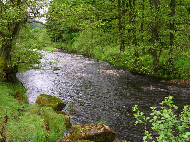
Calf Clough Bridge and Intake Farm track and access to United Utilites water intake from the Calf Clough stream near Whitendale Farm, Dunsop Bridge.
Calf Clough Bridge and Intake Credit: Robin

Burn Fell is a prominent hill located in the county of Yorkshire, England. Rising to an elevation of approximately 1,509 feet (460 meters), it is considered one of the highest points in the region. Situated in the northern part of the Yorkshire Dales National Park, Burn Fell offers breathtaking panoramic views of the surrounding landscape.

The fell is characterized by its rugged terrain, featuring steep slopes, rocky outcrops, and heather-covered moorland. The area is predominantly composed of Millstone Grit, a coarse-grained sandstone that gives the hill its distinctive appearance. The exposed nature of Burn Fell makes it susceptible to harsh weather conditions, including strong winds and heavy rainfall.

Due to its location within the national park, Burn Fell is home to a diverse range of flora and fauna. The heather moorland supports a variety of plant species, such as bilberry, crowberry, and cotton grass. The hill is also known for its rich birdlife, with species such as curlews, lapwings, and peregrine falcons frequently spotted in the area.

Burn Fell is a popular destination for outdoor enthusiasts, offering numerous hiking trails and opportunities for wildlife observation. The summit provides an excellent vantage point to admire the surrounding dales, valleys, and waterfalls. The hill's remote location and untouched natural beauty make it an ideal spot for those seeking solitude and tranquility in the heart of Yorkshire.

If you have any feedback on the listing, please let us know in the comments section below.

Burn Fell Images

Images are sourced within 2km of 53.976913/-2.4985804 or Grid Reference SD6753. Thanks to Geograph Open Source API. All images are credited.

Calf Clough Bridge and Intake Farm track and access to United Utilites water intake from the Calf Clough stream near Whitendale Farm, Dunsop Bridge.
Calf Clough Bridge and Intake
Farm track and access to United Utilites water intake from the Calf Clough stream near Whitendale Farm, Dunsop Bridge.
The track to farm at Whitendale. A very remote place to live and work.
The track to farm at Whitendale.
A very remote place to live and work.
Whitendale Secluded Bowland valley viewed from the path that descends from Dunsop Head.
Whitendale
Secluded Bowland valley viewed from the path that descends from Dunsop Head.
Inside the barn at Whitendale Looking through the wooden doors in the modern blockwork extension, the original stone barn wall and arched entrance can be seen behind it.

Inside was a bag of "lamb fattening nuts". I never knew lambs were fed on nuts. 

[technical note: due to the contrast between daylight and the barn interior I had to selectively lighten part of the photo].
Inside the barn at Whitendale
Looking through the wooden doors in the modern blockwork extension, the original stone barn wall and arched entrance can be seen behind it. Inside was a bag of "lamb fattening nuts". I never knew lambs were fed on nuts. [technical note: due to the contrast between daylight and the barn interior I had to selectively lighten part of the photo].
Looking down Whitendale At this point the road up the dale is well above the river on the far hillside.
Looking down Whitendale
At this point the road up the dale is well above the river on the far hillside.
Gabions supporting the Whitendale aqueduct The footpath on the east side of the dale follows the line of the aqueduct for some distance.  At this point there must have been movement in the hillside, and gabions have been used to stabilise it.
Gabions supporting the Whitendale aqueduct
The footpath on the east side of the dale follows the line of the aqueduct for some distance. At this point there must have been movement in the hillside, and gabions have been used to stabilise it.
Stone wall supporting the Whitendale aqueduct The footpath on the east side of the dale follows the line of the aqueduct for some distance.  At this point it crosses a slight dip, not deep enough to need a bridge, but a retaining wall was used.
Stone wall supporting the Whitendale aqueduct
The footpath on the east side of the dale follows the line of the aqueduct for some distance. At this point it crosses a slight dip, not deep enough to need a bridge, but a retaining wall was used.
Stony Clough On the east side of Whitendale, with a small cascade.
Stony Clough
On the east side of Whitendale, with a small cascade.
Cairn on the western edge of Beatrix Fell Seen from the footpath on the eastern side of Whitendale. The cairn, named as "Stone Haw Guide" on larger scale maps, is very prominent and marked on the O.S. map.
Cairn on the western edge of Beatrix Fell
Seen from the footpath on the eastern side of Whitendale. The cairn, named as "Stone Haw Guide" on larger scale maps, is very prominent and marked on the O.S. map.
Engineering support for the aqueduct There must have been a significant landslip at some time in the past, as the aqueduct pipe is carried in a concrete frame for a distance of about 90m.  The concrete frame looks several decades old, but below it is an extensive area of much fresher looking rock fill with massive gabions at the toe, suggesting a more recent movement of the hillside.  See also <a href="https://www.geograph.org.uk/photo/4301263">SD6654 : Geoengineering on the path on the east bank of the Whitendale River near Stony Clough</a> taken the previous year.
Engineering support for the aqueduct
There must have been a significant landslip at some time in the past, as the aqueduct pipe is carried in a concrete frame for a distance of about 90m. The concrete frame looks several decades old, but below it is an extensive area of much fresher looking rock fill with massive gabions at the toe, suggesting a more recent movement of the hillside. See also SD6654 : Geoengineering on the path on the east bank of the Whitendale River near Stony Clough taken the previous year.
Path along the aqueduct The public footpath runs on top of the Whitendale aqueduct for a considerable distance.
Path along the aqueduct
The public footpath runs on top of the Whitendale aqueduct for a considerable distance.
Stone wall on the eastern flank of Middle Knoll The wall actually runs for 2.7km over Middle Knoll and down into the Brennand Valley.
Stone wall on the eastern flank of Middle Knoll
The wall actually runs for 2.7km over Middle Knoll and down into the Brennand Valley.
Water board marker post BCWW is Blackburn Corporation Water Works, who laid the aqueduct (raw water main) beneath this track.
Water board marker post
BCWW is Blackburn Corporation Water Works, who laid the aqueduct (raw water main) beneath this track.
Little Costy Clough  Seen from across Costy Clough.
Little Costy Clough
Seen from across Costy Clough.
Aqueduct crossing Costy Clough  A short enough span for the spigot-and-socket pipes to need no intermediate support; the timber bridge simply takes the public footpath across the stream.
Aqueduct crossing Costy Clough
A short enough span for the spigot-and-socket pipes to need no intermediate support; the timber bridge simply takes the public footpath across the stream.
Aqueduct crossing Little Costy Clough  A short enough span for the spigot-and-socket pipes to need no intermediate support; the timber bridge simply takes the public footpath across the stream.
Aqueduct crossing Little Costy Clough
A short enough span for the spigot-and-socket pipes to need no intermediate support; the timber bridge simply takes the public footpath across the stream.
Waterfall in Costy Clough  Viewed from the taking the public footpath across the stream <a href="https://www.geograph.org.uk/photo/4907443">SD6553 : Aqueduct crossing Costy Clough </a>.
Waterfall in Costy Clough
Viewed from the taking the public footpath across the stream SD6553 : Aqueduct crossing Costy Clough .
Cascade in Little Costy Clough  Viewed from the taking the public footpath across the stream <a href="https://www.geograph.org.uk/photo/4907447">SD6553 : Aqueduct crossing Little Costy Clough </a>.
Cascade in Little Costy Clough
Viewed from the taking the public footpath across the stream SD6553 : Aqueduct crossing Little Costy Clough .
Show me another place!

Burn Fell is located at Grid Ref: SD6753 (Lat: 53.976913, Lng: -2.4985804)

Division: West Riding

Administrative County: Lancashire

District: Ribble Valley

Police Authority: Lancashire

What 3 Words

///polices.smarting.basically. Near Waddington, Lancashire

Related Wikis

Geography of the United Kingdom

The United Kingdom is a sovereign state located off the north-western coast of continental Europe. With a total area of approximately 244,376 square kilometres...

Bowland Forest High

Bowland Forest High is a civil parish in the Ribble Valley district of Lancashire, England, covering some 20,000 acres (80 km2) of the Forest of Bowland...

Dunsop Bridge

Dunsop Bridge is a village in the civil parish of Bowland Forest High, in the borough of Ribble Valley, Lancashire, England, 9 miles (14 km) north-west...

River Dunsop

The River Dunsop is a river in the Forest of Bowland in Northern England. It flows into the River Hodder at Dunsop Bridge. It begins at the confluence...

Nearby Amenities

Located within 500m of 53.976913,-2.4985804
Burn Fell
Man Made: survey_point
Natural: peak
Lat/Long: 53.9769354/-2.4985911
Description: WW2 plane crash memorial stone
Historic: memorial
Memorial: yes
Lat/Long: 53.9765894/-2.4991735
The data included in this document is from www.openstreetmap.org. The data is made available under ODbL.

Have you been to Burn Fell?

Leave your review of Burn Fell below (or comments, questions and feedback).