Burn Fell

Downs, Moorland in Yorkshire Ribble Valley

England

Burn Fell

Ordnance Survey Cut Mark This mark can be found on the roadside wall of a former farm building - now holiday accommodation - at Laythams Farm.
The benchmark has a recorded height of 204.2374 metres above sea level.
For more detail see : <span class="nowrap"><a title="https://www.bench-marks.org.uk/bm152241" rel="nofollow ugc noopener" href="https://www.bench-marks.org.uk/bm152241">Link</a><img style="margin-left:2px;" alt="External link" title="External link - shift click to open in new window" src="https://s1.geograph.org.uk/img/external.png" width="10" height="10"/></span>
Ordnance Survey Cut Mark Credit: Peter Wood

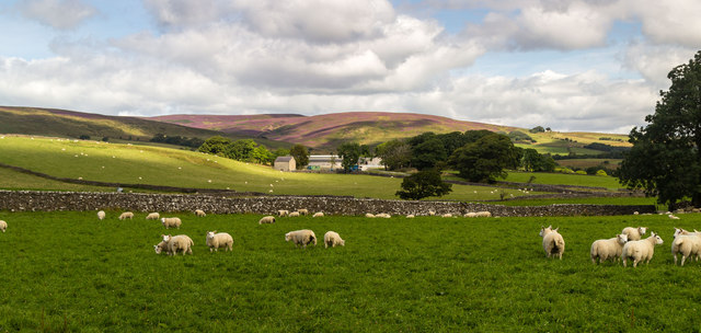
Burn Fell is a picturesque landscape located in the Yorkshire Dales National Park, in the county of Yorkshire, England. Spread over an area of approximately 10 square kilometers, Burn Fell is characterized by its rolling hills, expansive moorland, and scenic beauty. The fell is situated at an elevation of around 500 meters, providing breathtaking views of the surrounding countryside.

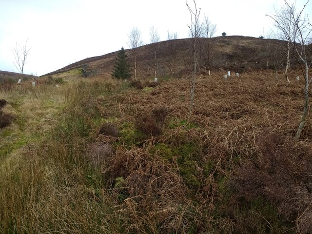
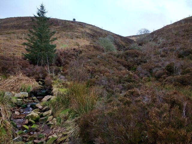
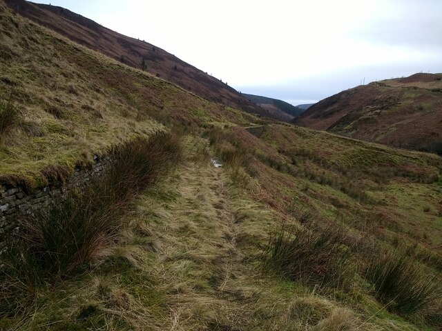
The terrain of Burn Fell is primarily composed of heather-covered moorland, interspersed with patches of marshland and rocky outcrops. The moorland is home to a diverse array of flora and fauna, including heather, cotton grass, bilberry, and various species of birds, such as curlews and lapwings.

The landscape of Burn Fell is rich in cultural heritage, with evidence of human activity dating back thousands of years. Ancient stone circles, burial mounds, and remnants of old settlements can be found scattered across the area, providing insights into the region's past.

The fell is popular among outdoor enthusiasts, offering numerous opportunities for hiking, walking, and wildlife spotting. Several well-marked trails crisscross the area, allowing visitors to explore its natural wonders at their own pace. The tranquility and solitude offered by Burn Fell make it an ideal destination for those seeking a peaceful retreat amidst nature.

Overall, Burn Fell in Yorkshire is a captivating and idyllic location, combining stunning natural landscapes with a rich cultural history. Its diverse flora and fauna, coupled with its peaceful ambiance, make it a must-visit destination for nature lovers and history enthusiasts alike.

If you have any feedback on the listing, please let us know in the comments section below.

Burn Fell Images

Images are sourced within 2km of 53.976062/-2.4936608 or Grid Reference SD6753. Thanks to Geograph Open Source API. All images are credited.

Ordnance Survey Cut Mark This mark can be found on the roadside wall of a former farm building - now holiday accommodation - at Laythams Farm.
The benchmark has a recorded height of 204.2374 metres above sea level.
For more detail see : <span class="nowrap"><a title="https://www.bench-marks.org.uk/bm152241" rel="nofollow ugc noopener" href="https://www.bench-marks.org.uk/bm152241">Link</a><img style="margin-left:2px;" alt="External link" title="External link - shift click to open in new window" src="https://s1.geograph.org.uk/img/external.png" width="10" height="10"/></span>
Ordnance Survey Cut Mark
This mark can be found on the roadside wall of a former farm building - now holiday accommodation - at Laythams Farm. The benchmark has a recorded height of 204.2374 metres above sea level. For more detail see : LinkExternal link
Looking up Beatrix Fell from the path
Stony Clough from the path
Looking south along the path The retaining wall on the left holds a water pipeline
Looking south along the path
The retaining wall on the left holds a water pipeline
Proctors Farm View of Proctors Farm.
Proctors Farm
View of Proctors Farm.
Dilworth Barn View of Dilworth Barn with Dunsop Fell in the background.
Dilworth Barn
View of Dilworth Barn with Dunsop Fell in the background.
Brunghill Moor Brunghill Moor Farm.
Brunghill Moor
Brunghill Moor Farm.
Stone wall supporting the Whitendale aqueduct The footpath on the east side of the dale follows the line of the aqueduct for some distance.  At this point it crosses a slight dip, not deep enough to need a bridge, but a retaining wall was used.
Stone wall supporting the Whitendale aqueduct
The footpath on the east side of the dale follows the line of the aqueduct for some distance. At this point it crosses a slight dip, not deep enough to need a bridge, but a retaining wall was used.
Stony Clough On the east side of Whitendale, with a small cascade.
Stony Clough
On the east side of Whitendale, with a small cascade.
Cairn on the western edge of Beatrix Fell Seen from the footpath on the eastern side of Whitendale. The cairn, named as "Stone Haw Guide" on larger scale maps, is very prominent and marked on the O.S. map.
Cairn on the western edge of Beatrix Fell
Seen from the footpath on the eastern side of Whitendale. The cairn, named as "Stone Haw Guide" on larger scale maps, is very prominent and marked on the O.S. map.
Engineering support for the aqueduct There must have been a significant landslip at some time in the past, as the aqueduct pipe is carried in a concrete frame for a distance of about 90m.  The concrete frame looks several decades old, but below it is an extensive area of much fresher looking rock fill with massive gabions at the toe, suggesting a more recent movement of the hillside.  See also <a href="https://www.geograph.org.uk/photo/4301263">SD6654 : Geoengineering on the path on the east bank of the Whitendale River near Stony Clough</a> taken the previous year.
Engineering support for the aqueduct
There must have been a significant landslip at some time in the past, as the aqueduct pipe is carried in a concrete frame for a distance of about 90m. The concrete frame looks several decades old, but below it is an extensive area of much fresher looking rock fill with massive gabions at the toe, suggesting a more recent movement of the hillside. See also SD6654 : Geoengineering on the path on the east bank of the Whitendale River near Stony Clough taken the previous year.
Path along the aqueduct The public footpath runs on top of the Whitendale aqueduct for a considerable distance.
Path along the aqueduct
The public footpath runs on top of the Whitendale aqueduct for a considerable distance.
Stone wall on the eastern flank of Middle Knoll The wall actually runs for 2.7km over Middle Knoll and down into the Brennand Valley.
Stone wall on the eastern flank of Middle Knoll
The wall actually runs for 2.7km over Middle Knoll and down into the Brennand Valley.
Water board marker post BCWW is Blackburn Corporation Water Works, who laid the aqueduct (raw water main) beneath this track.
Water board marker post
BCWW is Blackburn Corporation Water Works, who laid the aqueduct (raw water main) beneath this track.
Little Costy Clough  Seen from across Costy Clough.
Little Costy Clough
Seen from across Costy Clough.
Aqueduct crossing Costy Clough  A short enough span for the spigot-and-socket pipes to need no intermediate support; the timber bridge simply takes the public footpath across the stream.
Aqueduct crossing Costy Clough
A short enough span for the spigot-and-socket pipes to need no intermediate support; the timber bridge simply takes the public footpath across the stream.
Aqueduct crossing Little Costy Clough  A short enough span for the spigot-and-socket pipes to need no intermediate support; the timber bridge simply takes the public footpath across the stream.
Aqueduct crossing Little Costy Clough
A short enough span for the spigot-and-socket pipes to need no intermediate support; the timber bridge simply takes the public footpath across the stream.
Waterfall in Costy Clough  Viewed from the taking the public footpath across the stream <a href="https://www.geograph.org.uk/photo/4907443">SD6553 : Aqueduct crossing Costy Clough </a>.
Waterfall in Costy Clough
Viewed from the taking the public footpath across the stream SD6553 : Aqueduct crossing Costy Clough .
Show me another place!

Burn Fell is located at Grid Ref: SD6753 (Lat: 53.976062, Lng: -2.4936608)

Division: West Riding

Administrative County: Lancashire

District: Ribble Valley

Police Authority: Lancashire

What 3 Words

///crispier.carbon.snoozing. Near Waddington, Lancashire

Related Wikis

Geography of the United Kingdom

The United Kingdom is a sovereign state located off the north-western coast of continental Europe. With a total area of approximately 248,532 square kilometres...

St Andrew's Church, Slaidburn

St Andrew's Church is in Church Street, Slaidburn, Lancashire, England. It is an active Anglican parish church in the deanery of Bowland, the archdeaconry...

King's House, Slaidburn

King's House is a Grade II listed building in Slaidburn, Lancashire, England, now used as a youth hostel. It was originally built in the 18th century,...

River Dunsop

The River Dunsop is a river in the Forest of Bowland in Northern England. It flows into the River Hodder at Dunsop Bridge.It begins at the confluence of...

Nearby Amenities

Located within 500m of 53.976062,-2.4936608
Burn Fell
Man Made: survey_point
Natural: peak
Lat/Long: 53.9769354/-2.4985911
Description: WW2 plane crash memorial stone
Historic: memorial
Memorial: yes
Lat/Long: 53.9765894/-2.4991735
The data included in this document is from www.openstreetmap.org. The data is made available under ODbL.

Have you been to Burn Fell?

Leave your review of Burn Fell below (or comments, questions and feedback).