Carter Fell

Hill, Mountain in Roxburghshire

Scotland

Carter Fell

Green Cleuch A view from the Carter Bar to Bateinghope Burn head track.

This photograph was taken during the Coronavirus (COVID-19) pandemic of 2020.
Green Cleuch Credit: James T M Towill

Carter Fell is a prominent hill located in Roxburghshire, Scotland. It is part of the Southern Uplands and stands at an elevation of 818 meters (2,684 feet). The fell is situated near the border between Scotland and England, providing stunning panoramic views of both countries.

The hill is characterized by its rugged and steep terrain, with rocky outcrops and narrow ridges. It is a popular destination for hikers and hillwalkers, offering various routes of varying difficulty. The ascent to the summit can be challenging, but the rewarding views make it worth the effort.

Carter Fell is known for its rich biodiversity, with a diverse range of plant and animal species inhabiting its slopes. It is home to several rare and protected species, including the black grouse and the elusive mountain hare. The hill is also covered in heather and grasses, creating a picturesque landscape in the summer months.

The fell is steeped in history and folklore, with tales of ancient battles and legends surrounding its name. It is said to have been named after a local farmer, who lost his life while attempting to navigate the treacherous terrain in winter.

Overall, Carter Fell offers a challenging and rewarding outdoor experience for nature enthusiasts and adventure seekers alike. With its stunning views, diverse wildlife, and rich history, it is a must-visit destination for those exploring the beautiful landscape of Roxburghshire.

If you have any feedback on the listing, please let us know in the comments section below.
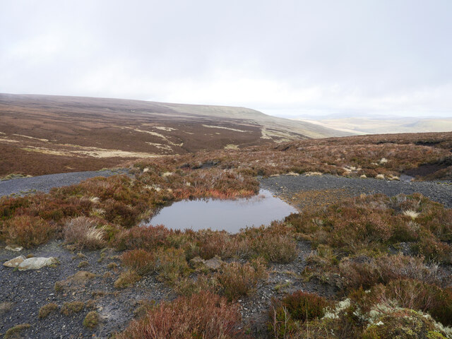
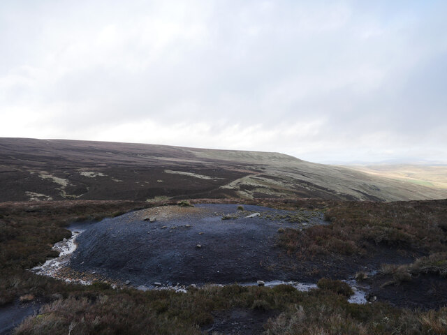
Carter Fell Images

Images are sourced within 2km of 55.324166/-2.5184943 or Grid Reference NT6703. Thanks to Geograph Open Source API. All images are credited.

Green Cleuch A view from the Carter Bar to Bateinghope Burn head track.

This photograph was taken during the Coronavirus (COVID-19) pandemic of 2020.
Green Cleuch
A view from the Carter Bar to Bateinghope Burn head track. This photograph was taken during the Coronavirus (COVID-19) pandemic of 2020.
Rock outcrops by the Bateinghope mine track There are a number of outcrops in this area, some of which appear to have been quarried, possibly for a surfacing for the mine track although there appears to be little evidence remaining of this.

This photograph was taken during the Coronavirus (COVID-19) pandemic of 2020.
Rock outcrops by the Bateinghope mine track
There are a number of outcrops in this area, some of which appear to have been quarried, possibly for a surfacing for the mine track although there appears to be little evidence remaining of this. This photograph was taken during the Coronavirus (COVID-19) pandemic of 2020.
On a firmer track The former mine track from Carter Bar to near the head of the Bateinghope Burn was rather waterlogged along most of its course, this section was somewhat firmer.  An excellent view was afforded towards the Cheviot massif in the distance.

This photograph was taken during the Coronavirus (COVID-19) pandemic of 2020.
On a firmer track
The former mine track from Carter Bar to near the head of the Bateinghope Burn was rather waterlogged along most of its course, this section was somewhat firmer. An excellent view was afforded towards the Cheviot massif in the distance. This photograph was taken during the Coronavirus (COVID-19) pandemic of 2020.
An outcrop near Buzzard Crags As shower clouds pass overhead this photograph was taken just off the former Bateinhope mine track.

This photograph was taken during the Coronavirus (COVID-19) pandemic of 2020.
An outcrop near Buzzard Crags
As shower clouds pass overhead this photograph was taken just off the former Bateinhope mine track. This photograph was taken during the Coronavirus (COVID-19) pandemic of 2020.
Coal mine spoil above the Bateinghope Burn Remains of early to mid 19th century coal mining activity above the Bateinghope Burn.

This photograph was taken during the Coronavirus (COVID-19) pandemic of 2020.
Coal mine spoil above the Bateinghope Burn
Remains of early to mid 19th century coal mining activity above the Bateinghope Burn. This photograph was taken during the Coronavirus (COVID-19) pandemic of 2020.
Remains of coal mining activity above the Bateinghope Burn The remains of coal mining activity above the Bateinghope Burn as clouds roll overhead threatening rain.  The route of the access track from Carter Bar to this site which included lime kilns and clay workings as well as coal mines can be noted in the middle distance.

This photograph was taken during the Coronavirus (COVID-19) pandemic of 2020.
Remains of coal mining activity above the Bateinghope Burn
The remains of coal mining activity above the Bateinghope Burn as clouds roll overhead threatening rain. The route of the access track from Carter Bar to this site which included lime kilns and clay workings as well as coal mines can be noted in the middle distance. This photograph was taken during the Coronavirus (COVID-19) pandemic of 2020.
Dilapidated 'Dilapidated' would be one word to describe the fence line on Carter Fell, just inside Scotland!  This is heather moorland, interspersed with boggy grassland and peat hags.  This image was taken as clouds rolled north after a beautiful start to a late November day.

This photograph was taken during the Coronavirus (COVID-19) pandemic of 2020.
Dilapidated
'Dilapidated' would be one word to describe the fence line on Carter Fell, just inside Scotland! This is heather moorland, interspersed with boggy grassland and peat hags. This image was taken as clouds rolled north after a beautiful start to a late November day. This photograph was taken during the Coronavirus (COVID-19) pandemic of 2020.
A former mine track nearing the Wauchope Forest The term 'track' is used very loosely; it is little more than slightly different vegetation from the predominantly heather moorland characteristic of the area.  The mines were in use in the first half of the 19th century and provided coal for Jedburgh.

This photograph was taken during the Coronavirus (COVID-19) pandemic of 2020.
A former mine track nearing the Wauchope Forest
The term 'track' is used very loosely; it is little more than slightly different vegetation from the predominantly heather moorland characteristic of the area. The mines were in use in the first half of the 19th century and provided coal for Jedburgh. This photograph was taken during the Coronavirus (COVID-19) pandemic of 2020.
Bateinghope Burn Bateinghope Burn is seen running downstream from a public footpath; the path can be seen rounding the hill slope at the left side of the image.
Bateinghope Burn
Bateinghope Burn is seen running downstream from a public footpath; the path can be seen rounding the hill slope at the left side of the image.
Low crag on Carter Fell
Sunrise over the eastern Cheviot Hills
Disused mine shafts, Carter Fell There is an array of disused mine shafts on the Scottish side of the Border fence. They are served by a track to the north that stops near this location and were probably dug to provide coal for use in local limekilns.

"The Carter coal where worked is said to have been about 13 ins. thick."

"The Carter Fell coal was largely worked, especially on the English side of the Border, about 40 years ago. Very much of it was carted away to Jedburgh for house coal : it is said that as many as 90 carts were sometimes there in the morning waiting to be filled. The esteem in which it, together with the upper Carter lime, was once held, may be estimated by the length of good road, made expressly to them, across the desolate fell from the Redesdale coach road."
The Geology of the Plashetts and Kielder (1889): <span class="nowrap"><a title="https://archive.org/details/cu31924004554840" rel="nofollow ugc noopener" href="https://archive.org/details/cu31924004554840">Link</a><img style="margin-left:2px;" alt="External link" title="External link - shift click to open in new window" src="https://s1.geograph.org.uk/img/external.png" width="10" height="10"/></span>
Disused mine shafts, Carter Fell
There is an array of disused mine shafts on the Scottish side of the Border fence. They are served by a track to the north that stops near this location and were probably dug to provide coal for use in local limekilns. "The Carter coal where worked is said to have been about 13 ins. thick." "The Carter Fell coal was largely worked, especially on the English side of the Border, about 40 years ago. Very much of it was carted away to Jedburgh for house coal : it is said that as many as 90 carts were sometimes there in the morning waiting to be filled. The esteem in which it, together with the upper Carter lime, was once held, may be estimated by the length of good road, made expressly to them, across the desolate fell from the Redesdale coach road." The Geology of the Plashetts and Kielder (1889): LinkExternal link
Cairn south of Carter Fell The Kielder Stone can just be seen below the summit Peel Fell on the right over the head waters of Carry Burn and a ridge of land called The Trouting.
Cairn south of Carter Fell
The Kielder Stone can just be seen below the summit Peel Fell on the right over the head waters of Carry Burn and a ridge of land called The Trouting.
Boundary stone on Carter Fell The England-Scotland Border is only marked in this section by occasional, small boundary stones and old wooden stakes. The stone is carved with a letter 'N' on the English side (Duke of Northumberland's estate) and a reversed letter 'D' on the Scottish side (Douglas estates) <a href="https://www.geograph.org.uk/photo/4110017">NT6502 : Boundary stone on Knox Knowe</a>. They were erected soon after 1769. It is thought that the letter may have been reversed by an illiterate mason or perhaps an English mason with a point to make.

In this place even the thin trod along the Border line seems to have disappeared and there is no clear ridge or geographical feature marking the Border. The old sticks and stones are essential to keep you on the line.
Boundary stone on Carter Fell
The England-Scotland Border is only marked in this section by occasional, small boundary stones and old wooden stakes. The stone is carved with a letter 'N' on the English side (Duke of Northumberland's estate) and a reversed letter 'D' on the Scottish side (Douglas estates) NT6502 : Boundary stone on Knox Knowe. They were erected soon after 1769. It is thought that the letter may have been reversed by an illiterate mason or perhaps an English mason with a point to make. In this place even the thin trod along the Border line seems to have disappeared and there is no clear ridge or geographical feature marking the Border. The old sticks and stones are essential to keep you on the line.
Bog asphodel (Narthecium ossifragum), Carter Fell
Small water course, Carter Fell Carpets of yellow-orange Bog Asphodel <a href="https://www.geograph.org.uk/photo/4109967">NT6603 : Bog asphodel (Narthecium ossifragum), Carter Fell</a> in the marshes, and the orange tips of Deergrass in the drier areas <a href="https://www.geograph.org.uk/photo/4110035">NT6502 : Deergrass (Tricophorum sp.), Duntae Edge</a> produce a bright orange glow to the moorland vegetation in early morning sunlight.
Small water course, Carter Fell
Carpets of yellow-orange Bog Asphodel NT6603 : Bog asphodel (Narthecium ossifragum), Carter Fell in the marshes, and the orange tips of Deergrass in the drier areas NT6502 : Deergrass (Tricophorum sp.), Duntae Edge produce a bright orange glow to the moorland vegetation in early morning sunlight.
Shake hole west of Carter Fell This large shake hole or swallow hole is shown on the 1:25,000 OS Map and shows that limestone rock lies close to the surface although mainly covered by a layer of peat.
Shake hole west of Carter Fell
This large shake hole or swallow hole is shown on the 1:25,000 OS Map and shows that limestone rock lies close to the surface although mainly covered by a layer of peat.
View north, east of Knox Knowe
Show me another place!

Carter Fell is located at Grid Ref: NT6703 (Lat: 55.324166, Lng: -2.5184943)

Unitary Authority: The Scottish Borders

Police Authority: The Lothians and Scottish Borders

What 3 Words

///moment.aspect.crows. Near Rochester, Northumberland

Nearby Locations

Carter Fell

Related Wikis

Whitelee Moor

Whitelee Moor is nature reserve of the Northumberland Wildlife Trust, in Northumberland, England, near Carter Bar. A large part of the moor is blanket...

Carter Bar

Carter Bar is a pass in the Cheviot Hills, on the Anglo-Scottish border. It lies east of Carter Fell at the head of Redesdale, and is crossed by the A68...

Scottish Borders

The Scottish Borders (Scots: the Mairches, lit. 'the Marches'; Scottish Gaelic: Crìochan na h-Alba) is one of 32 council areas of Scotland. It is bordered...

Raid of the Redeswire

The Raid of the Redeswire, also known as the Redeswire Fray, was a border skirmish between England and Scotland on 7 July 1575 which took place at Carter...

Nearby Amenities

Located within 500m of 55.324166,-2.5184943
Carter Fell
Place: locality
Lat/Long: 55.3243814/-2.5211486
The data included in this document is from www.openstreetmap.org. The data is made available under ODbL.

Have you been to Carter Fell?

Leave your review of Carter Fell below (or comments, questions and feedback).