Benty Hill

Hill, Mountain in Cumberland Eden

England

Benty Hill

Deserted building in upper Gilderdale The building has been considered to have had mining associations and certainly there has been mining in Gilderdale but there are sheep pens too so a farming connection is also possible. Whatever the case, the building was deserted when it was photographed in September 1989.
Deserted building in upper Gilderdale Credit: Trevor Littlewood

Benty Hill, located in the county of Cumberland in northwest England, is an impressive hill with a summit reaching an elevation of 1,575 feet (480 meters) above sea level. It is part of the Lake District National Park, renowned for its stunning landscapes and natural beauty.

Situated near the village of Ennerdale Bridge, Benty Hill is characterized by its rugged terrain, rocky slopes, and panoramic views that attract hikers and nature enthusiasts. The hill is particularly popular among walkers due to its accessibility and the variety of trails available, catering to different levels of experience and fitness.

The ascent to Benty Hill offers breathtaking vistas of the surrounding countryside, including the picturesque Ennerdale Valley, with its tranquil lake and ancient woodlands. On a clear day, visitors can even catch glimpses of the nearby peaks of Red Pike and Pillar, adding to the allure of the hike.

The hill is home to a diverse range of flora and fauna, showcasing the rich biodiversity of the area. Walkers may encounter various bird species, such as curlews and buzzards, as well as red deer and other wildlife during their exploration.

Benty Hill provides a fantastic opportunity to immerse oneself in the natural wonders of the Lake District, offering a challenging yet rewarding experience for outdoor enthusiasts seeking to connect with nature and enjoy the stunning landscapes of this region.

If you have any feedback on the listing, please let us know in the comments section below.
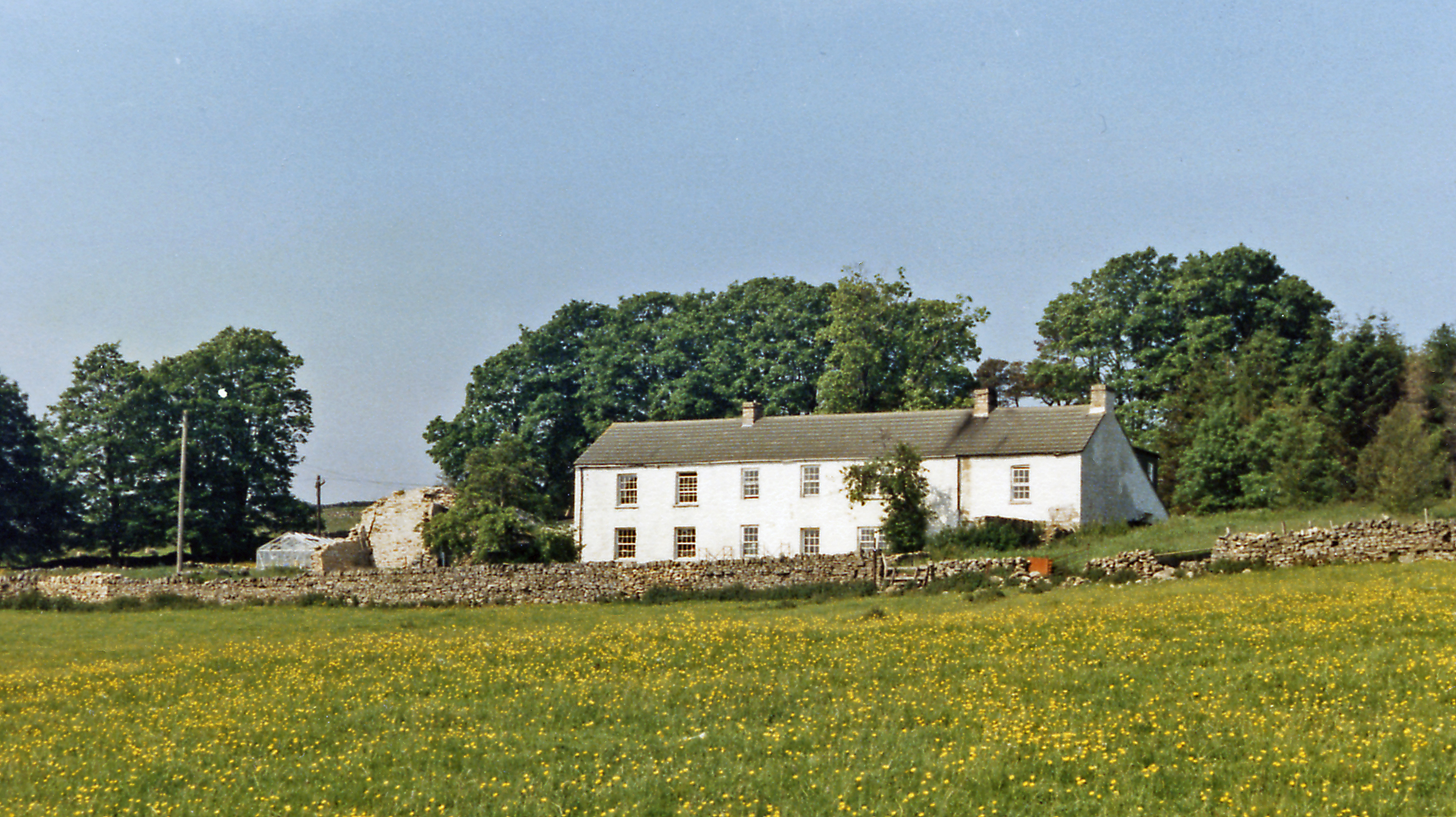
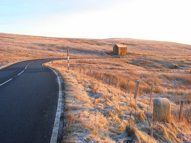
Benty Hill Images

Images are sourced within 2km of 54.781259/-2.5155343 or Grid Reference NY6643. Thanks to Geograph Open Source API. All images are credited.

Deserted building in upper Gilderdale The building has been considered to have had mining associations and certainly there has been mining in Gilderdale but there are sheep pens too so a farming connection is also possible. Whatever the case, the building was deserted when it was photographed in September 1989.
Deserted building in upper Gilderdale
The building has been considered to have had mining associations and certainly there has been mining in Gilderdale but there are sheep pens too so a farming connection is also possible. Whatever the case, the building was deserted when it was photographed in September 1989.
Old Milestone by the A686, south west of Hartside House Carved stone post by the A686, in parish of ALSTON MOOR (EDEN District), South West of Hartside House, on grass verge, near field gate, on South side of road. Alston stone, erected by the Alston turnpike trust in the 19th century. 

Inscription reads:-
ALSTON
3
PENRITH
16
Carved benchmark and rivet on top front.

Grade II Listed. List Entry Number: 1144985 <span class="nowrap"><a title="https://historicengland.org.uk/listing/the-list/list-entry/1144985" rel="nofollow ugc noopener" href="https://historicengland.org.uk/listing/the-list/list-entry/1144985">Link</a><img style="margin-left:2px;" alt="External link" title="External link - shift click to open in new window" src="https://s1.geograph.org.uk/img/external.png" width="10" height="10"/></span>

Milestone Society National ID: CU_ALPR03.
Old Milestone by the A686, south west of Hartside House
Carved stone post by the A686, in parish of ALSTON MOOR (EDEN District), South West of Hartside House, on grass verge, near field gate, on South side of road. Alston stone, erected by the Alston turnpike trust in the 19th century. Inscription reads:- ALSTON 3 PENRITH 16 Carved benchmark and rivet on top front. Grade II Listed. List Entry Number: 1144985 LinkExternal link Milestone Society National ID: CU_ALPR03.
Old Milestone by the A686, west of Rowgill Cleugh Carved stone post by the A686, in parish of GLASSONBY (EDEN District), East of Hartside Cafe, 100m above old house, opposite, on grass verge, on South side of road. Alston stone, erected by the Alston turnpike trust in the 19th century. 

Inscription reads:-
ALSTON
5
PENRITH
14 
Cancelled Carved benchmark on front top, rivet on top.

Grade II Listed. List Entry Number: 1327032
<span class="nowrap"><a title="https://historicengland.org.uk/listing/the-list/list-entry/1327032" rel="nofollow ugc noopener" href="https://historicengland.org.uk/listing/the-list/list-entry/1327032">Link</a><img style="margin-left:2px;" alt="External link" title="External link - shift click to open in new window" src="https://s1.geograph.org.uk/img/external.png" width="10" height="10"/></span>

Milestone Society National ID: CU_ALPR05.
Old Milestone by the A686, west of Rowgill Cleugh
Carved stone post by the A686, in parish of GLASSONBY (EDEN District), East of Hartside Cafe, 100m above old house, opposite, on grass verge, on South side of road. Alston stone, erected by the Alston turnpike trust in the 19th century. Inscription reads:- ALSTON 5 PENRITH 14 Cancelled Carved benchmark on front top, rivet on top. Grade II Listed. List Entry Number: 1327032 LinkExternal link Milestone Society National ID: CU_ALPR05.
Old Milestone by the A686, west of Meathaw Hill Carved stone post by the A686, in parish of GLASSONBY (EDEN District), West of Meathaw Hill, on grass verge, on bend with double white line, on South side of road. Alston stone, erected by the Alston turnpike trust in the 19th century. 

Inscription reads:-
ALSTON
4
PENRITH
15 
Carved benchmark and rivet on top.

Grade II Listed. List Entry Number: 1137257
<span class="nowrap"><a title="https://historicengland.org.uk/listing/the-list/list-entry/1137257" rel="nofollow ugc noopener" href="https://historicengland.org.uk/listing/the-list/list-entry/1137257">Link</a><img style="margin-left:2px;" alt="External link" title="External link - shift click to open in new window" src="https://s1.geograph.org.uk/img/external.png" width="10" height="10"/></span>

Milestone Society National ID: CU_ALPR04.
Old Milestone by the A686, west of Meathaw Hill
Carved stone post by the A686, in parish of GLASSONBY (EDEN District), West of Meathaw Hill, on grass verge, on bend with double white line, on South side of road. Alston stone, erected by the Alston turnpike trust in the 19th century. Inscription reads:- ALSTON 4 PENRITH 15 Carved benchmark and rivet on top. Grade II Listed. List Entry Number: 1137257 LinkExternal link Milestone Society National ID: CU_ALPR04.
Hartside House alongside the A686
Bridleway leading to Melmerby Fell
A686, cycle route 7 towards Hartside Cross
Disused building alongside the A686
A686 south of Benty Hill
A686 at disused building above Rowgill Cleugh
A686 westbound near Meathaw Hill
Quarry House above Black Burn There is another photo of this ruined farm building here <a href="https://www.geograph.org.uk/photo/2225318">NY6841 : Quarry House</a> and undergoing renovation in 2006 here <a href="https://www.geograph.org.uk/photo/3233626">NY6841 : South face of Quarry House</a>

Shield Water is a shown on maps as this section of the Black Burn which rises in the corrie of Skirwith Fell just north of Cross Fell.

The same viewpoint (from the north on the verge of the A686 between Alston and Hartside) was used by Garigill artist, Lionel Playford, for his landscape, 'Black Burn under Cross Fell with Quarry House' <span class="nowrap"><a title="http://lionel.playford.net/pages/gallery/enlarge.php?img_id=181" rel="nofollow ugc noopener" href="http://lionel.playford.net/pages/gallery/enlarge.php?img_id=181">Link</a><img style="margin-left:2px;" alt="External link" title="External link - shift click to open in new window" src="https://s1.geograph.org.uk/img/external.png" width="10" height="10"/></span>
Quarry House above Black Burn
There is another photo of this ruined farm building here NY6841 : Quarry House and undergoing renovation in 2006 here NY6841 : South face of Quarry House Shield Water is a shown on maps as this section of the Black Burn which rises in the corrie of Skirwith Fell just north of Cross Fell. The same viewpoint (from the north on the verge of the A686 between Alston and Hartside) was used by Garigill artist, Lionel Playford, for his landscape, 'Black Burn under Cross Fell with Quarry House' LinkExternal link
North Pennine National Park - Meathaw Hill
Derelict house on the A686
Grazing, Hartside Heights Mist rolling down from the hills.
Grazing, Hartside Heights
Mist rolling down from the hills.
A686 towards Alston Abandoned cottage in the distance can be seen in <a href="https://www.geograph.org.uk/photo/5510883">NY6542 : Derelict house on the A686</a>
A686 towards Alston
Abandoned cottage in the distance can be seen in NY6542 : Derelict house on the A686
Heather moorland north of the A686
National Cycle Route 7 Looking east on the A686.
National Cycle Route 7
Looking east on the A686.
Show me another place!

Benty Hill is located at Grid Ref: NY6643 (Lat: 54.781259, Lng: -2.5155343)

Administrative County: Cumbria

District: Eden

Police Authority: Cumbria

What 3 Words

///innocence.indoor.caravans. Near Alston, Cumbria

Nearby Locations

Benty Hill

Related Wikis

Black Fell (Pennines)

Black Fell is a hill in the North Pennines, England. It is located just north of the A686 road, west of Alston and is one of the most northerly parts of...

Leadgate, Cumbria

Leadgate is a small hamlet located at the foot of Hartside Fell between the town of Alston and the village of Garrigill in the parish of Alston Moor in...

Bayles, Cumbria

Bayles is a hamlet near Alston in Cumbria, England.

A686 road

The A686 is a road in Northern England. It runs from Penrith in Cumbria to Haydon Bridge in Northumberland. AA Magazine named the A686 as one of their...

Alston, Cumbria

Alston is a town in Westmorland and Furness, Cumbria, England, within the civil parish of Alston Moor on the River South Tyne. It shares the title of the...

Samuel King's School

Samuel King's School is a mixed secondary school located in Alston in the English county of Cumbria. As of 2017 it had 73 students on roll. It is a comprehensive...

Alston Moor

Alston Moor, formerly known as Alston with Garrigill, is a civil parish and electoral ward in the Westmorland and Furness district, in the ceremonial county...

Alston Town Hall

Alston Town Hall is a municipal building in Front Street, Alston, Cumbria, England. The town hall, which is currently used as a public library, is a Grade...

Nearby Amenities

Located within 500m of 54.781259,-2.5155343
Benty Hill
Ele: 609
Natural: peak
Lat/Long: 54.7810811/-2.5147357
Hunting Stand
Lat/Long: 54.7802299/-2.5121966
Hunting Stand
Lat/Long: 54.7800013/-2.5118599
Hunting Stand
Lat/Long: 54.7797942/-2.5115507
Hunting Stand
Lat/Long: 54.7795699/-2.5112565
Hunting Stand
Lat/Long: 54.7793829/-2.5109872
Hunting Stand
Lat/Long: 54.7791773/-2.5106506
Hunting Stand
Lat/Long: 54.7789558/-2.510314
Hunting Stand
Lat/Long: 54.7787315/-2.5100172
Hunting Stand
Lat/Long: 54.7784956/-2.5096432
Parkin's Stones
Man Made: cairn
Lat/Long: 54.7813224/-2.5156832
Old Anthony's Chair
Man Made: cairn
Lat/Long: 54.7811522/-2.5147335
The data included in this document is from www.openstreetmap.org. The data is made available under ODbL.

Have you been to Benty Hill?

Leave your review of Benty Hill below (or comments, questions and feedback).