Bram Rigg Top

Hill, Mountain in Yorkshire South Lakeland

England

Bram Rigg Top

South side of the Howgill Fells Slopes and ridges off Fell Head and The Calf.
South side of the Howgill Fells Credit: Richard Webb

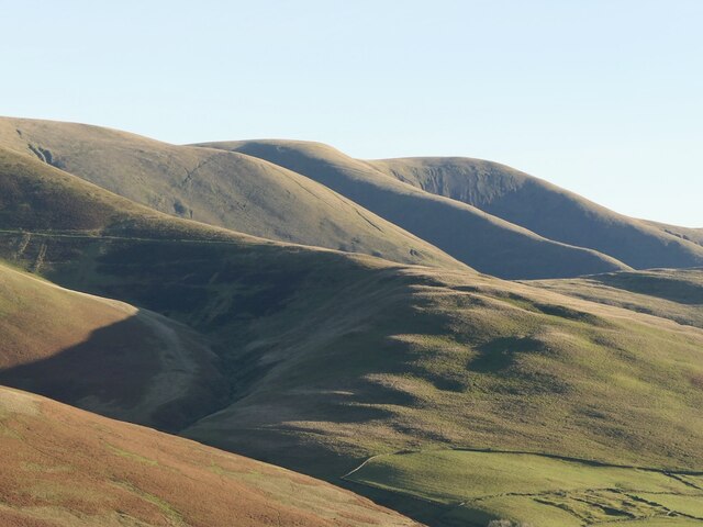
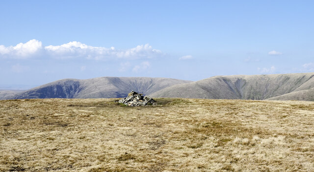
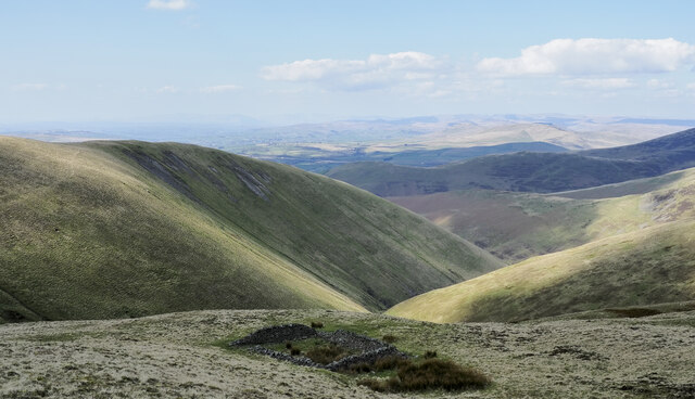
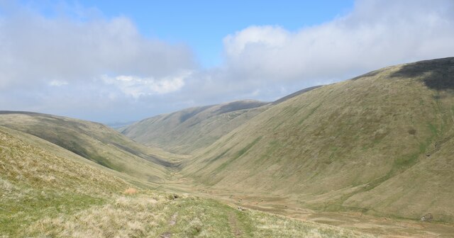
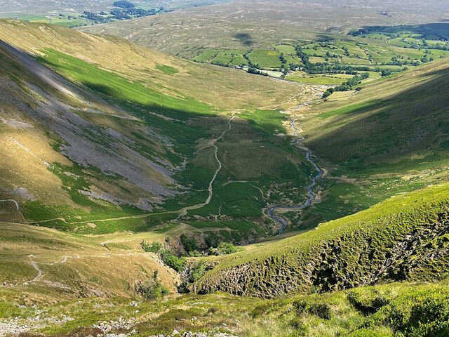
Bram Rigg Top is a prominent hill located in the Yorkshire Dales National Park, in the county of Yorkshire, England. Standing at an elevation of 672 meters (2,205 feet), it is considered one of the highest points in the region. The hill offers stunning panoramic views of the surrounding countryside, including the rolling hills, deep valleys, and picturesque villages that characterize the Yorkshire Dales.

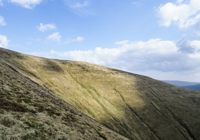
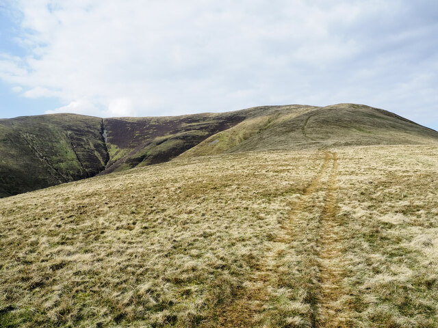
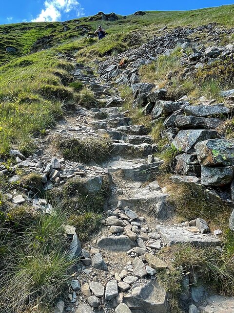
The landscape of Bram Rigg Top is typical of the area, with extensive moorland covered in heather and grasses. The hill is renowned for its rugged beauty and attracts hikers and nature enthusiasts from far and wide. There are several walking trails that lead to the summit, ranging from easy to moderate difficulty, catering to different levels of fitness and experience.

At the top of Bram Rigg Top, visitors are rewarded with breathtaking vistas in all directions. On clear days, one can see as far as the famous Three Peaks of the Yorkshire Dales: Ingleborough, Whernside, and Pen-y-ghent. The hill is also home to a variety of wildlife, including birds of prey such as kestrels and peregrine falcons, as well as sheep that graze on the moorland.

Bram Rigg Top offers a serene and tranquil escape from the hustle and bustle of daily life, making it a popular destination for those seeking peace and solitude in nature. Its accessibility and stunning views make it a must-visit location for anyone exploring the beauty of the Yorkshire Dales.

If you have any feedback on the listing, please let us know in the comments section below.

Bram Rigg Top Images

Images are sourced within 2km of 54.362575/-2.5117984 or Grid Reference SD6696. Thanks to Geograph Open Source API. All images are credited.

South side of the Howgill Fells Slopes and ridges off Fell Head and The Calf.
South side of the Howgill Fells
Slopes and ridges off Fell Head and The Calf.
Summit area of Arant Haw A flat, grassy summit with a cairn.
Fell Head is the distant hill above the cairn.
Summit area of Arant Haw
A flat, grassy summit with a cairn. Fell Head is the distant hill above the cairn.
Northern side of Arant Haw Part of the northern side of Arant Haw rises to the left above the deep valley. Rowantree Grains Fold is in the foreground: as Karl & Ali comment - <a title="https://www.geograph.org.uk/photo/4233407" href="https://www.geograph.org.uk/photo/4233407">Link</a> -  it's in an unusually exposed location.
Northern side of Arant Haw
Part of the northern side of Arant Haw rises to the left above the deep valley. Rowantree Grains Fold is in the foreground: as Karl & Ali comment - Link - it's in an unusually exposed location.
Grassy headwall of valley of Hobdale Gill The summit of Calders lies just above the steep ground; from it, the ridge at the right side of the image descends over Middle Tongue.
Grassy headwall of valley of Hobdale Gill
The summit of Calders lies just above the steep ground; from it, the ridge at the right side of the image descends over Middle Tongue.
Hills surrounding valley of Red Gill Beck The image was recorded from the ridge between Bram Rigg Top and Calders. Red Gill Beck is in the deep valley; its water soon falls as the waterfall, Cautley Spout.
Yarlside is the hill close to the centre of the image, to the left of the sunlit area.
Hills surrounding valley of Red Gill Beck
The image was recorded from the ridge between Bram Rigg Top and Calders. Red Gill Beck is in the deep valley; its water soon falls as the waterfall, Cautley Spout. Yarlside is the hill close to the centre of the image, to the left of the sunlit area.
Ridge rising to Great Dummacks Great Dummacks is an elongated rib of ground at the top of the rising ridge and across the head of the valley to the left. As with most Howgill ridges there's a quad bike track following this one which acts perfectly as a path for those on foot.
Ridge rising to Great Dummacks
Great Dummacks is an elongated rib of ground at the top of the rising ridge and across the head of the valley to the left. As with most Howgill ridges there's a quad bike track following this one which acts perfectly as a path for those on foot.
View towards Great Dummacks
View up Hollow Gill
View up Hollow Gill
View towards Cautley Spout from footpath
View along fence on north side of Cautley Holme Beck towards Cautley Spout
Footpath down into Bowderdale. Beautiful valley.
Footpath down into Bowderdale.
Beautiful valley.
Rowantree Grains Fold Below Brant Fell
Rowantree Grains Fold
Below Brant Fell
Looking over Bram Rigg Beck From the Dales High Way path below Calders
Looking over Bram Rigg Beck
From the Dales High Way path below Calders
Sheepfold beside Red Gill Beck
Red Gill Beck One of the mountain streams that feeds Cautley Spout
Red Gill Beck
One of the mountain streams that feeds Cautley Spout
Cautley Holme Beck Valley between Ben End and Cautley Crag
Cautley Holme Beck
Valley between Ben End and Cautley Crag
The steep, rough stepped path to Cautley Spout
Cautley Crag
Cautley Crag
Show me another place!

Bram Rigg Top is located at Grid Ref: SD6696 (Lat: 54.362575, Lng: -2.5117984)

Division: West Riding

Administrative County: Cumbria

District: South Lakeland

Police Authority: Cumbria

What 3 Words

///marine.fresh.earlobe. Near Sedbergh, Cumbria

Nearby Locations

Bram Rigg Top

Related Wikis

Calders (Yorkshire Dales)

Calders is a summit of 2,211 feet (674 m) in the Howgill Fells, Cumbria, England. It lies about 2⁄3 mile (1 km) south-east of the summit of The Calf and...

The Calf

The Calf, at an elevation of 676 metres (2,218 ft), is the highest point in the Howgill Fells, an area of high ground in north-west England. It is in the...

Yarlside

Yarlside is a hill in the Howgill Fells, Cumbria (historically Westmorland), England. This fell is not to be confused with the Yarlside area near Barrow...

Holy Trinity Church, Howgill

Holy Trinity Church stands in a country lane near the hamlet of Howgill, between Sedbergh and Tebay, Cumbria, England. It is an active Anglican church...

Nearby Amenities

Located within 500m of 54.362575,-2.5117984
Bram Rigg Top
Ele: 672
Natural: peak
Source: NPE
Lat/Long: 54.3629588/-2.5118571
Red Gill Head
Place: locality
Lat/Long: 54.3610725/-2.5069309
The data included in this document is from www.openstreetmap.org. The data is made available under ODbL.

Have you been to Bram Rigg Top?

Leave your review of Bram Rigg Top below (or comments, questions and feedback).