Arant Haw

Hill, Mountain in Yorkshire South Lakeland

England

Arant Haw

Conical cairn close to bridleway The cairn lies at around 370 m. on the south-eastern slope of the hill, Winder, above Sedbergh.
Baugh Fell is the distant, flat-topped hill at the left side of the image, the other obvious hill is actually a lengthy ridge rising to Aye Gill Pike; Garsdale is the valley between them.
Conical cairn close to bridleway Credit: Trevor Littlewood

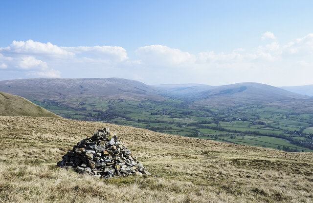
Arant Haw is a prominent hill located in the Yorkshire Dales, a picturesque region in North Yorkshire, England. With an elevation of approximately 605 meters (1,985 feet), it stands as an impressive landmark in the area.

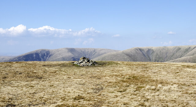
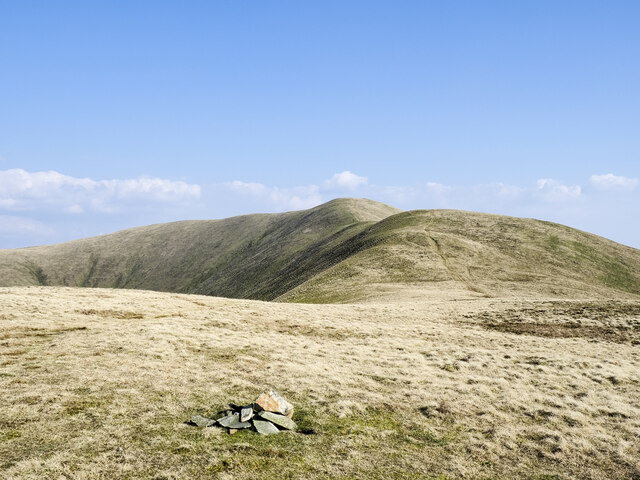
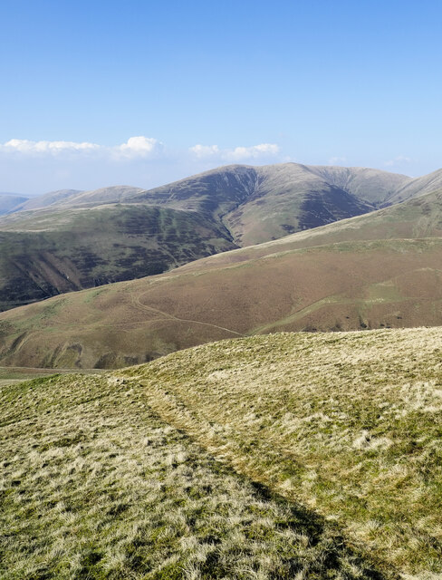
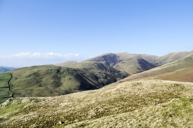
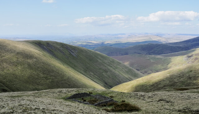
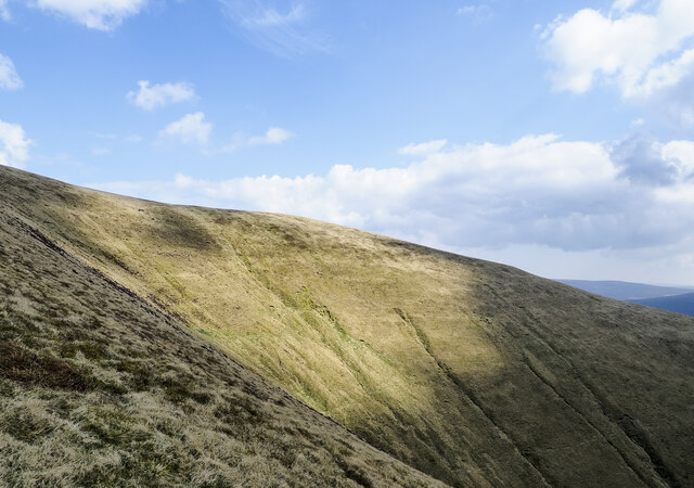
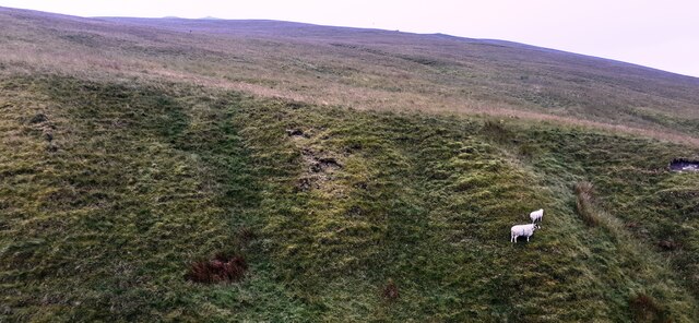
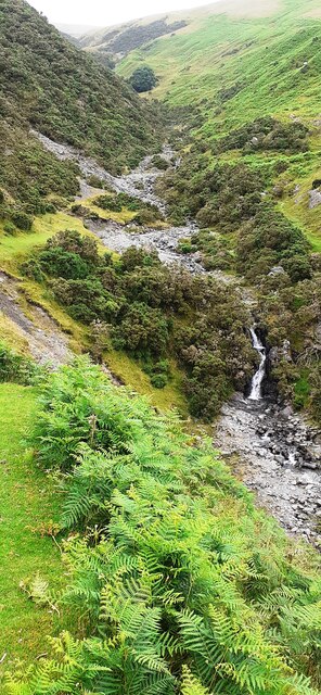
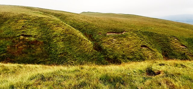
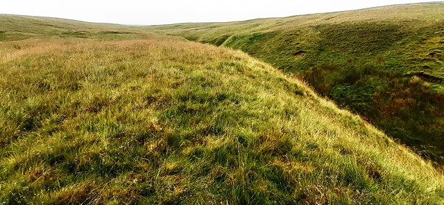
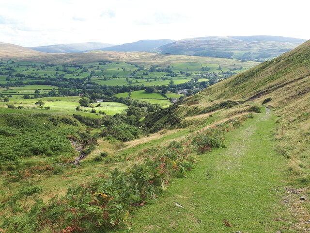
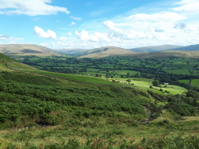
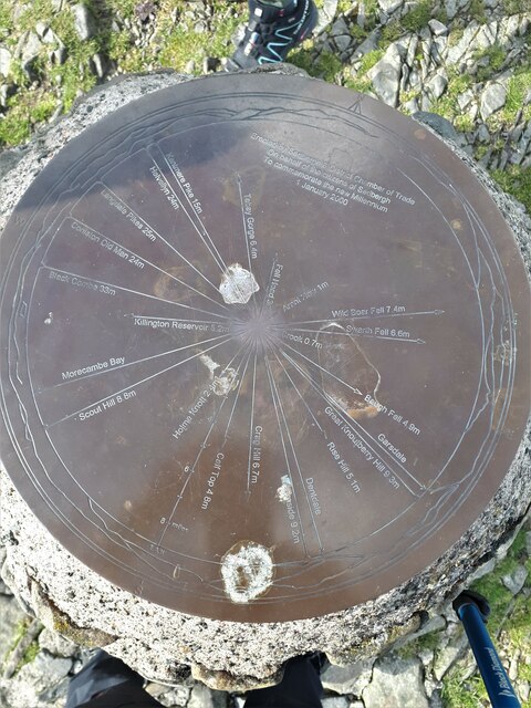
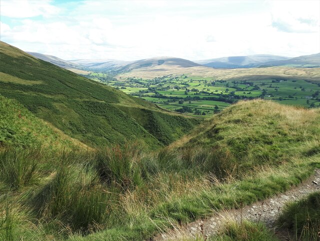
The hill is part of the Howgill Fells, a range known for its distinctive rounded and grassy appearance. Arant Haw offers breathtaking views of the surrounding countryside, making it a popular destination for hikers and nature enthusiasts. Its summit provides panoramic vistas that stretch across the Yorkshire Dales National Park, showcasing the area's rolling hills, dales, and lush greenery.

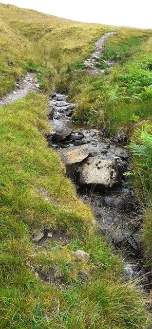
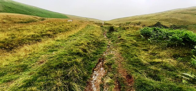
Arant Haw is characterized by its gentle slopes, covered in heather and grass, making it relatively easy to climb. The hill is often approached from the quaint village of Sedbergh, located a few miles to the east. Several well-marked paths traverse the hill, allowing visitors to explore its beauty at their own pace.

The diverse wildlife found on Arant Haw adds to its allure. The hill is home to various bird species, including curlews, lapwings, and wheatears, making it a haven for birdwatchers. Additionally, the surrounding moorlands provide habitat for grouse and other upland birds.

Arant Haw's tranquil and unspoiled environment attracts not only hikers but also those seeking a peaceful retreat amid nature. Its accessibility, stunning views, and rich biodiversity make it a must-visit destination for anyone exploring the Yorkshire Dales.

If you have any feedback on the listing, please let us know in the comments section below.

Arant Haw Images

Images are sourced within 2km of 54.346087/-2.5213464 or Grid Reference SD6694. Thanks to Geograph Open Source API. All images are credited.

Conical cairn close to bridleway The cairn lies at around 370 m. on the south-eastern slope of the hill, Winder, above Sedbergh.
Baugh Fell is the distant, flat-topped hill at the left side of the image, the other obvious hill is actually a lengthy ridge rising to Aye Gill Pike; Garsdale is the valley between them.
Conical cairn close to bridleway
The cairn lies at around 370 m. on the south-eastern slope of the hill, Winder, above Sedbergh. Baugh Fell is the distant, flat-topped hill at the left side of the image, the other obvious hill is actually a lengthy ridge rising to Aye Gill Pike; Garsdale is the valley between them.
Crook Crook is an outlying southern top of Arant Haw; there's a cairn at the summit.
Whernside, Great Coum and Calf Top are the three hills in the distance.
Crook
Crook is an outlying southern top of Arant Haw; there's a cairn at the summit. Whernside, Great Coum and Calf Top are the three hills in the distance.
Summit area of Arant Haw A flat, grassy summit with a cairn.
Fell Head is the distant hill above the cairn.
Summit area of Arant Haw
A flat, grassy summit with a cairn. Fell Head is the distant hill above the cairn.
West ridge of Arant Haw The grassy west ridge of Arant Haw with a small cairn at a minor rise to 515 metres. As with most significant ridges of the Howgill Fells there's a track along the ridge crest created either by the passage of quad bikes, walkers, or most likely, both.
West ridge of Arant Haw
The grassy west ridge of Arant Haw with a small cairn at a minor rise to 515 metres. As with most significant ridges of the Howgill Fells there's a track along the ridge crest created either by the passage of quad bikes, walkers, or most likely, both.
Path along ridge descending north The descending ground began as the west ridge of Arant Haw before splitting, this branch then turned north. It descends further then loses its identity.
Fell Head is the obvious distant hill.
Path along ridge descending north
The descending ground began as the west ridge of Arant Haw before splitting, this branch then turned north. It descends further then loses its identity. Fell Head is the obvious distant hill.
Knolls of Seat Knott Seat Knott is a feature of the declining west ridge of Arant Haw once it has gone through a few changes of direction.
Fell Head is the distant hill.
Knolls of Seat Knott
Seat Knott is a feature of the declining west ridge of Arant Haw once it has gone through a few changes of direction. Fell Head is the distant hill.
Northern side of Arant Haw Part of the northern side of Arant Haw rises to the left above the deep valley. Rowantree Grains Fold is in the foreground: as Karl & Ali comment - <a title="https://www.geograph.org.uk/photo/4233407" href="https://www.geograph.org.uk/photo/4233407">Link</a> -  it's in an unusually exposed location.
Northern side of Arant Haw
Part of the northern side of Arant Haw rises to the left above the deep valley. Rowantree Grains Fold is in the foreground: as Karl & Ali comment - Link - it's in an unusually exposed location.
Grassy headwall of valley of Hobdale Gill The summit of Calders lies just above the steep ground; from it, the ridge at the right side of the image descends over Middle Tongue.
Grassy headwall of valley of Hobdale Gill
The summit of Calders lies just above the steep ground; from it, the ridge at the right side of the image descends over Middle Tongue.
Looking north along stream and footpath on eastern flank of Winder
View over valley of Settlebeck Gill towards Crook
Looking north along Settlebeck Gill
Stream beside Dales High Way
Looking cross valley of Settlebeck Gill towards Crook
View north on west side of Settlebeck Gill valley east of Winder
Looking down Settlebeck Gill from the path up Winder A few of the buildings of Sedbergh visible.
Looking down Settlebeck Gill from the path up Winder
A few of the buildings of Sedbergh visible.
View over Settlebeck Gill From the path up Winder Fell from Sedbergh. Dentdale is fairly central and Garsdale to the left.
View over Settlebeck Gill
From the path up Winder Fell from Sedbergh. Dentdale is fairly central and Garsdale to the left.
Toposcope on Winder Looking down on the top of the pillar, with North slightly to the right of centre.
The toposcope stands a few metres east of the trig point at the summit of Winder. It was a clear September afternoon, so many of the features were visible.
Toposcope on Winder
Looking down on the top of the pillar, with North slightly to the right of centre. The toposcope stands a few metres east of the trig point at the summit of Winder. It was a clear September afternoon, so many of the features were visible.
On the way up Winder, looking back Looking down Settlebeck Gill, Dentdale in the distance left of centre.
On the way up Winder, looking back
Looking down Settlebeck Gill, Dentdale in the distance left of centre.
Show me another place!

Arant Haw is located at Grid Ref: SD6694 (Lat: 54.346087, Lng: -2.5213464)

Division: West Riding

Administrative County: Cumbria

District: South Lakeland

Police Authority: Cumbria

What 3 Words

///younger.forge.commutes. Near Sedbergh, Cumbria

Nearby Locations

Arant Haw

Related Wikis

Calders (Yorkshire Dales)

Calders is a summit of 2,211 feet (674 m) in the Howgill Fells, Cumbria, England. It lies about 2⁄3 mile (1 km) south east of the summit of The Calf and...

The Calf

The Calf, at an elevation of 676 metres (2,218 ft), is the highest point in the Howgill Fells, an area of high ground in north-west England. It is in the...

Sedbergh People's Hall

Sedbergh People's Hall is a village hall in Sedbergh, unique because it was built by the people, for the people. == Land and lease == The land on which...

The Bull Hotel, Sedbergh

The Bull Hotel, formerly The Black Bull Hotel, is a 17th-century coaching inn in Sedbergh, Cumbria. It is located in a narrow passage parallel with the...

Related Videos

English holiday in Sedbergh - 5 days near the Lake District

In this video, I'll be sharing with you our family holiday to Sedbergh, Cumbria. Join us as we explore everything this beautiful part ...

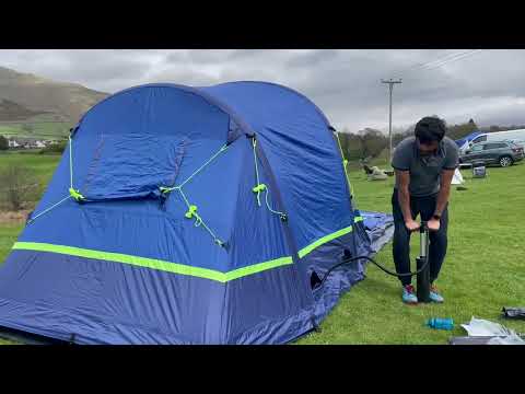
Berghaus Air 6.1 Nightfall Tent Setup in 10 mins ⛺️

We have bought Berghaus Air 6.1 Nightfall tent. Being new to camping it is fantastic one and super easy to setup and hat lot of ...

The Penthouse | Holiday Cottage in Sedbergh in the Yorkshire Dales

An open plan and contemporary apartment, The Penthouse is a convenient bolthole right in the centre of the Sedbergh.

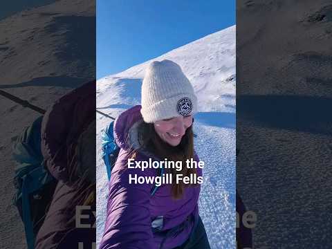
We explored the Howgill Fells after snowfall #howgillfells #hiking #ukhiking #shorts

After some snowfall in the UK my mum and I decided to head to The Howgill Fells for the day. The route started in Sedbergh and ...

Nearby Amenities

Located within 500m of 54.346087,-2.5213464
Arant Haw
Ele: 606.2
Image: https://www.geograph.org.uk/photo/3986680
Man Made: cairn
Natural: peak
Source: NPE
Lat/Long: 54.3460754/-2.5213528
Natural: spring
Lat/Long: 54.345532/-2.5180588
The data included in this document is from www.openstreetmap.org. The data is made available under ODbL.

Have you been to Arant Haw?

Leave your review of Arant Haw below (or comments, questions and feedback).