Watch Law

Hill, Mountain in East Lothian

Scotland

Watch Law

Crystal Rig grid connection Transformer and switch yard connects the Crystal Rig wind farms to the supergrid transmission line from Torness.
Crystal Rig grid connection Credit: Keith Burns

Watch Law is a prominent hill located in East Lothian, Scotland. Standing at an elevation of approximately 211 meters (692 feet), it is classified as a hill rather than a mountain. It is situated near the village of Humbie, about 20 kilometers southeast of the city of Edinburgh.

The hill is characterized by its gently sloping sides and a distinct conical shape, which makes it easily recognizable in the surrounding landscape. It offers breathtaking panoramic views of the surrounding countryside, including the rolling hills, farmland, and the Firth of Forth estuary.

Watch Law is a popular destination for outdoor enthusiasts, particularly hikers and walkers, due to its accessible location and relatively easy ascent. There are various footpaths and trails leading up to the summit, making it an ideal spot for a leisurely stroll or a more challenging hike.

At the top of Watch Law, visitors are rewarded with stunning vistas, especially on clear days when the view reaches as far as the city of Edinburgh and the nearby Pentland Hills. The hill also serves as a great vantage point for birdwatching, with various species of birds, including raptors, often seen soaring overhead.

The surrounding area of Watch Law is rich in history, with evidence of ancient settlements and archaeological sites dating back thousands of years. It is a place of natural beauty, tranquility, and a perfect escape from the hustle and bustle of city life.

If you have any feedback on the listing, please let us know in the comments section below.
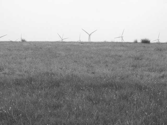
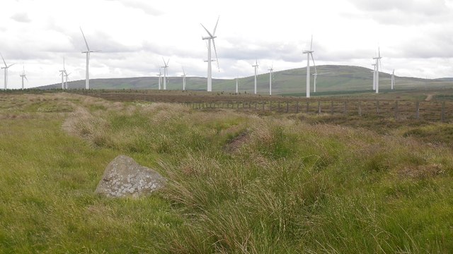
Watch Law Images

Images are sourced within 2km of 55.925131/-2.5482244 or Grid Reference NT6570. Thanks to Geograph Open Source API. All images are credited.

Crystal Rig grid connection Transformer and switch yard connects the Crystal Rig wind farms to the supergrid transmission line from Torness.
Crystal Rig grid connection
Transformer and switch yard connects the Crystal Rig wind farms to the supergrid transmission line from Torness.
Wind turbines seen from Lamb Hill The wreckage of Dunbar Common, a very much changed place since my last visit in May 2006 <a href="https://www.geograph.org.uk/photo/163428">NT6469 : Lamb Hill,  forest edge</a>
Wind turbines seen from Lamb Hill
The wreckage of Dunbar Common, a very much changed place since my last visit in May 2006 NT6469 : Lamb Hill, forest edge
The Herring Road On Dunbar Common, changed utterly. <a href="https://www.geograph.org.uk/photo/163417">NT6569 : The Herring Road</a>
The Herring Road
On Dunbar Common, changed utterly. NT6569 : The Herring Road
Path signs, Herring Road Very different here from my last visit: <a href="https://www.geograph.org.uk/photo/203362">NT6468 : Signpost, Herring Road</a>
Path signs, Herring Road
Very different here from my last visit: NT6468 : Signpost, Herring Road
Crystal Rig power station The 2009 extension with a view of Spartleton. The foreground used to be forested.
Crystal Rig power station
The 2009 extension with a view of Spartleton. The foreground used to be forested.
Turbine on Lamb Hill CR 2  - Crystal Rig 2
Turbine on Lamb Hill
CR 2 - Crystal Rig 2
Herring Road path sign The Herring Road used to go through dense conifers here, now they have been felled and replaced by turbines.
Herring Road path sign
The Herring Road used to go through dense conifers here, now they have been felled and replaced by turbines.
Gate on Bransley Hill A group near the gate just south of the top of Bransley Hill.
Gate on Bransley Hill
A group near the gate just south of the top of Bransley Hill.
The Herring Road A grassy path here, the old trade route from the coast to the interior. Herring landed at Dunbar were carried south using tracks across the Lammermuir Hills. Now waymarked as a core walking route. Almost all the square is rough grassland.
The Herring Road
A grassy path here, the old trade route from the coast to the interior. Herring landed at Dunbar were carried south using tracks across the Lammermuir Hills. Now waymarked as a core walking route. Almost all the square is rough grassland.
Mossy Burn View across dry grassland, just beginning to show green shoots, down the course of the Mossy Burn. Crystal Rig power station in the distance.
In 2009 there was a lot of construction going on here - the forest blocks had been felled for a massive extension of the wind farm, right up to the East Lothian council boundary.
Mossy Burn
View across dry grassland, just beginning to show green shoots, down the course of the Mossy Burn. Crystal Rig power station in the distance. In 2009 there was a lot of construction going on here - the forest blocks had been felled for a massive extension of the wind farm, right up to the East Lothian council boundary.
Lamb Hill,  forest edge The path, old packhorse/drove route, from Duns to lowland East Lothian, via Deuchary passes alongside modern forestry plantations. The rough grassland that makes up most of the area provides grazing for sheep and in summer, cattle.

The forest has since been felled to make way for the expanded Crystal Rig windfarm. (2009)
Lamb Hill, forest edge
The path, old packhorse/drove route, from Duns to lowland East Lothian, via Deuchary passes alongside modern forestry plantations. The rough grassland that makes up most of the area provides grazing for sheep and in summer, cattle. The forest has since been felled to make way for the expanded Crystal Rig windfarm. (2009)
Mossy Burn A shallow reentrant on the moorland plateau. Full of marshland and tussock grass, but easily crossed by the Herring Road.
Mossy Burn
A shallow reentrant on the moorland plateau. Full of marshland and tussock grass, but easily crossed by the Herring Road.
Signpost, Herring Road Crossroads of two old drove roads on the Lammermuir Hills.  These tracks are now promoted as "core paths" and have new signs and gates.
Signpost, Herring Road
Crossroads of two old drove roads on the Lammermuir Hills. These tracks are now promoted as "core paths" and have new signs and gates.
Bransley Hill Looking south towards Crystal Rigg powerstation.
Bransley Hill
Looking south towards Crystal Rigg powerstation.
Bransley Hill Dry conditions at the summit of Bransley Hill.
Bransley Hill
Dry conditions at the summit of Bransley Hill.
The electricity road Service road for the Torness powerline. This runs all the way across the Lammermuir Hills.
The electricity road
Service road for the Torness powerline. This runs all the way across the Lammermuir Hills.
View towards Spartleton And Crystal Rig II power station from the path up from Deuchrie.
View towards Spartleton
And Crystal Rig II power station from the path up from Deuchrie.
Path on Dunbar Common Very enjoyable singletrack - worth the slog up from Deuchrie.
Path on Dunbar Common
Very enjoyable singletrack - worth the slog up from Deuchrie.
Show me another place!

Watch Law is located at Grid Ref: NT6570 (Lat: 55.925131, Lng: -2.5482244)

Unitary Authority: East Lothian

Police Authority: The Lothians and Scottish Borders

What 3 Words

///purse.cheerily.forgives. Near Dunbar, East Lothian

Nearby Locations

Watch Law

Related Wikis

Crystal Rig Wind Farm

Crystal Rig Wind Farm is an operational onshore wind farm located on the Lammermuir Hills in the Scottish Borders region of Scotland. When phase 1 was...

Pressmennan Lake

Pressmennan Lake is a lake in East Lothian in Scotland. It is an artificial reservoir constructed in 1819 by a Mr Nesbit who dammed the streams flowing...

Spott, East Lothian

Spott is a small village on the eastern fringes of East Lothian in Scotland, just over 2 miles (3.2 km) south-west of Dunbar. The village straddles an...

Stenton

Stenton (Scots: Staneton) is a parish and village in East Lothian, Scotland. It is bounded on the north by parts of the parishes of Prestonkirk and Dunbar...

Nearby Amenities

Located within 500m of 55.925131,-2.5482244
Watch Law
Natural: peak
Lat/Long: 55.9262308/-2.5481617
The data included in this document is from www.openstreetmap.org. The data is made available under ODbL.

Have you been to Watch Law?

Leave your review of Watch Law below (or comments, questions and feedback).