Chivers Knoll

Hill, Mountain in Somerset

England

Chivers Knoll

Direction Sign – Signpost in Radford Located in Radford on the southwest side of a T junction opposite Radford Villa, Paulton parish. 2 arms and pyramid finial.

Milestone Society National ID: SO_ST6757B
Direction Sign – Signpost in Radford Credit: J Dowding

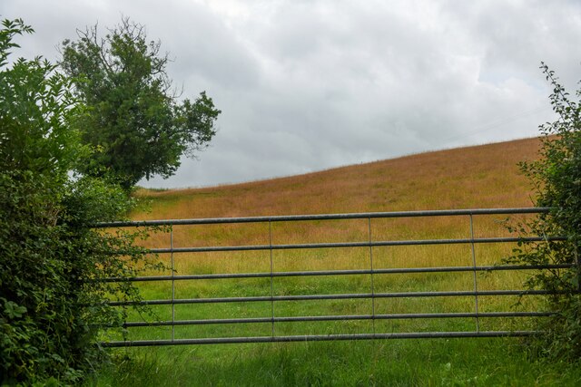
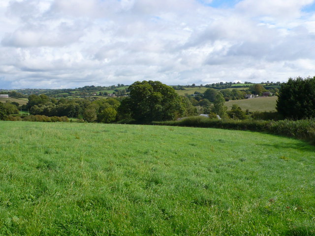
Chivers Knoll is a prominent hill located in Somerset, England. Situated in the Mendip Hills Area of Outstanding Natural Beauty, it offers breathtaking panoramic views of the surrounding countryside. With an elevation of approximately 293 meters (961 feet), Chivers Knoll stands as one of the tallest hills in the region.

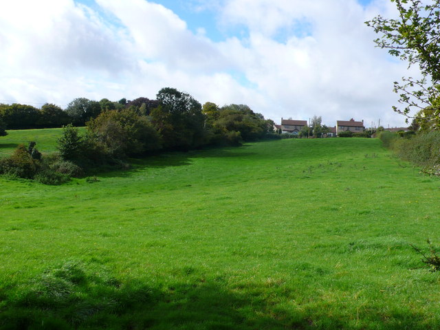
This picturesque location is popular among both locals and tourists who appreciate the beauty and tranquility it offers. The hill is covered in lush green vegetation, with a mix of grasslands, heather, and wildflowers, creating a stunning landscape that changes throughout the seasons. It is particularly captivating in the spring when colorful flowers bloom, and in the autumn when the foliage turns vibrant shades of red and gold.

Chivers Knoll is also home to a variety of wildlife, including rabbits, hares, and various bird species. Nature enthusiasts often visit the hill to observe and photograph the diverse flora and fauna that inhabit the area.

For outdoor enthusiasts, Chivers Knoll provides ample opportunities for hiking and walking. There are well-maintained trails that lead to the summit, offering a moderate challenge for those seeking a more active adventure. At the top, visitors can enjoy sweeping views of the Somerset Levels, the Bristol Channel, and even the distant Welsh mountains on clear days.

Overall, Chivers Knoll is a natural gem in Somerset, offering a captivating blend of natural beauty, wildlife, and recreational activities for all who visit.

If you have any feedback on the listing, please let us know in the comments section below.

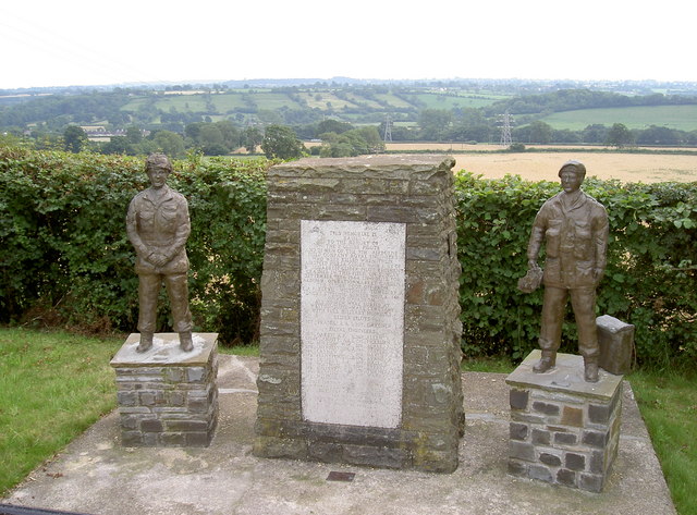
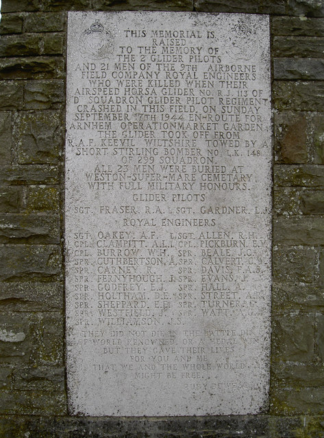
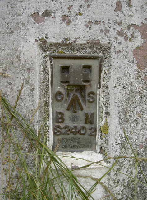
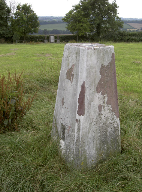
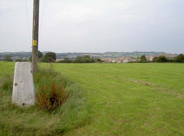
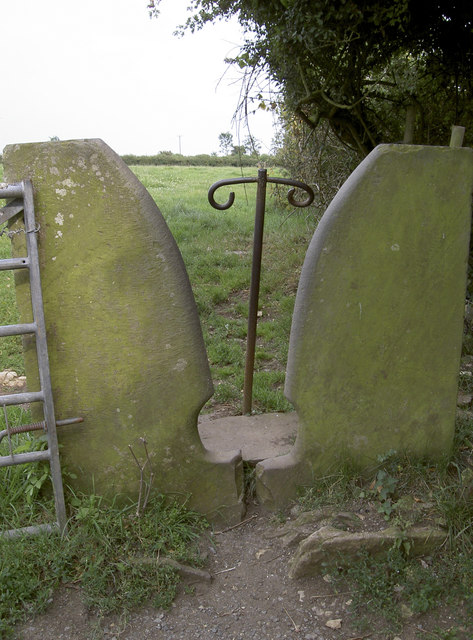
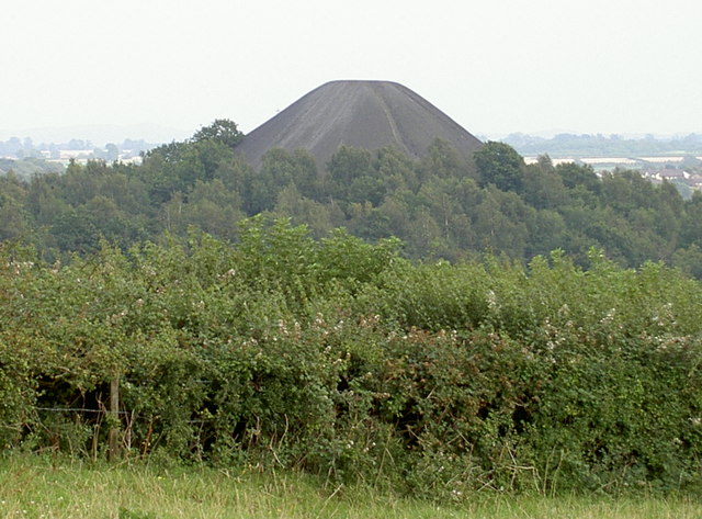
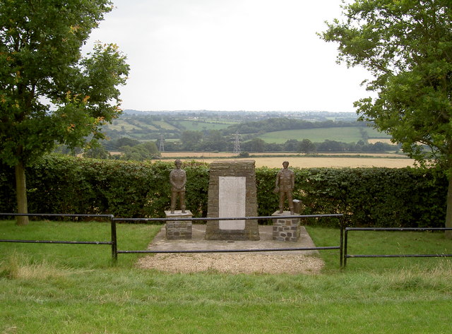
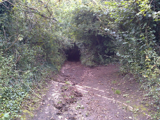
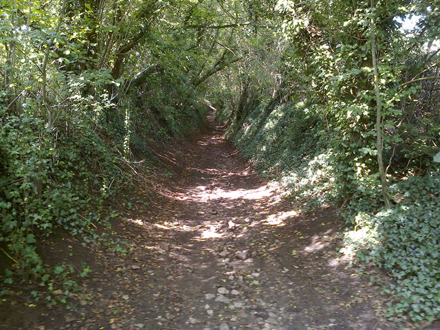
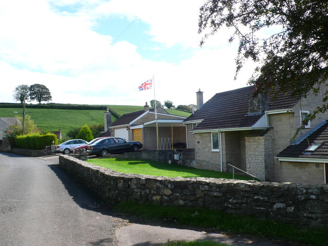
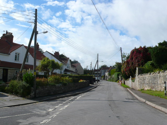
Chivers Knoll Images

Images are sourced within 2km of 51.308748/-2.4945655 or Grid Reference ST6556. Thanks to Geograph Open Source API. All images are credited.

Direction Sign – Signpost in Radford Located in Radford on the southwest side of a T junction opposite Radford Villa, Paulton parish. 2 arms and pyramid finial.

Milestone Society National ID: SO_ST6757B
Direction Sign – Signpost in Radford
Located in Radford on the southwest side of a T junction opposite Radford Villa, Paulton parish. 2 arms and pyramid finial. Milestone Society National ID: SO_ST6757B
Old Milestone, A39, High Street, High Littleton A metal plate attached to a wall behind the pavement on the east side of the road, just south of the junction with Eastover Road. Parish of High Littleton (Bath And North East Somerset District). Bath incised iron plate, erected by the Bath turnpike trust in the 18th century.

Inscription reads:
To
Bath
10

Milestone Society National ID: SO_BAGL10
Old Milestone, A39, High Street, High Littleton
A metal plate attached to a wall behind the pavement on the east side of the road, just south of the junction with Eastover Road. Parish of High Littleton (Bath And North East Somerset District). Bath incised iron plate, erected by the Bath turnpike trust in the 18th century. Inscription reads: To Bath 10 Milestone Society National ID: SO_BAGL10
Old Milestone, A39, Wells Road, Hallatrow Metal plate embedded in a stone garden wall on the north side of the junction of the road and Hart’s Lane. Parish of High Littleton (Bath and North East Somerset District). Bath incised iron plate, erected by the Bath turnpike trust in the 18th century.

Inscription reads:
To
Bath
11

Milestone Society National ID: SO_BAGL11
Old Milestone, A39, Wells Road, Hallatrow
Metal plate embedded in a stone garden wall on the north side of the junction of the road and Hart’s Lane. Parish of High Littleton (Bath and North East Somerset District). Bath incised iron plate, erected by the Bath turnpike trust in the 18th century. Inscription reads: To Bath 11 Milestone Society National ID: SO_BAGL11
High Littleton : Grassy Field & Gate A field seen from Bungay's Hill.
High Littleton : Grassy Field & Gate
A field seen from Bungay's Hill.
Arnhem Memorial A poignant tribute to be found in an unremarkable field on the outskirts of Paulton, Somerset. The legend details how two gliders that were on the way to Arnhem came down here in 1944, claiming all aboard.

Also see <a href="https://www.geograph.org.uk/photo/2526731">ST6455 : Arnhem Memorial</a>, <a href="https://www.geograph.org.uk/photo/2526725">ST6455 : Trig point near a war-time crash site</a> and <a href="https://www.geograph.org.uk/photo/2526712">ST6455 : Arnhem Memorial inscription</a> for more views of the inscriptions.
Arnhem Memorial
A poignant tribute to be found in an unremarkable field on the outskirts of Paulton, Somerset. The legend details how two gliders that were on the way to Arnhem came down here in 1944, claiming all aboard. Also see ST6455 : Arnhem Memorial, ST6455 : Trig point near a war-time crash site and ST6455 : Arnhem Memorial inscription for more views of the inscriptions.
Arnhem Memorial inscription The legend gives details of the terrible loss over home soil, shortly after taking off from RAF Keevil, only a few miles away. See <a href="https://www.geograph.org.uk/photo/2526710">ST6455 : Arnhem Memorial</a> and <a href="https://www.geograph.org.uk/photo/2526725">ST6455 : Trig point near a war-time crash site</a>  for more views.
Arnhem Memorial inscription
The legend gives details of the terrible loss over home soil, shortly after taking off from RAF Keevil, only a few miles away. See ST6455 : Arnhem Memorial and ST6455 : Trig point near a war-time crash site for more views.
Flush bracket, Paulton The identifying bracket on the pillar, which is still in good condition. See <a href="https://www.geograph.org.uk/photo/2526722">ST6455 : Paulton trig pillar</a>.
Flush bracket, Paulton
The identifying bracket on the pillar, which is still in good condition. See ST6455 : Paulton trig pillar.
Paulton trig pillar Placed near the summit of the field, it overlooks some great views of the surrounding countryside (see <a href="https://www.geograph.org.uk/photo/2526725">ST6455 : Trig point near a war-time crash site</a>) and also the Arnhem Memorial (seen in distance). The flush bracket can be found here: <a href="https://www.geograph.org.uk/photo/2526721">ST6455 : Flush bracket, Paulton</a>.
Paulton trig pillar
Placed near the summit of the field, it overlooks some great views of the surrounding countryside (see ST6455 : Trig point near a war-time crash site) and also the Arnhem Memorial (seen in distance). The flush bracket can be found here: ST6455 : Flush bracket, Paulton.
Trig point near a war-time crash site In the field just over the crest, two Horsa gliders carrying 23 men of the Royal Engineers came down in 1944. All were lost in the crash. A memorial was established nearby in 1979 - see <a href="https://www.geograph.org.uk/photo/2526710">ST6455 : Arnhem Memorial</a> and <a href="https://www.geograph.org.uk/photo/2526712">ST6455 : Arnhem Memorial inscription</a> for more views.
Trig point near a war-time crash site
In the field just over the crest, two Horsa gliders carrying 23 men of the Royal Engineers came down in 1944. All were lost in the crash. A memorial was established nearby in 1979 - see ST6455 : Arnhem Memorial and ST6455 : Arnhem Memorial inscription for more views.
That'll stop the unwanted A striking variation on the methods of preventing cattle and motorised traffic through a field.
That'll stop the unwanted
A striking variation on the methods of preventing cattle and motorised traffic through a field.
Not volcanic A coal spoil heap rises above the greenery. Midsomer Norton and Radstock  were important coalmining areas from the late 18th century, and production gradually increased with time up to 1900. However, the complicated local geology and nationalisation eventually led to the closure of all mining in September 1973.

The heap is actually a SSSI and contains some interesting fossils, including the world's earliest known damselfly!
Not volcanic
A coal spoil heap rises above the greenery. Midsomer Norton and Radstock were important coalmining areas from the late 18th century, and production gradually increased with time up to 1900. However, the complicated local geology and nationalisation eventually led to the closure of all mining in September 1973. The heap is actually a SSSI and contains some interesting fossils, including the world's earliest known damselfly!
Arnhem Memorial A memorial to the loss of 23 men of the Royal Engineers, whose gliders came down in this field in 1944. It was unveiled by Major General R.E. Urquhart C.B. D.S.O. on 23rd September, 1979, but has been improved more than once since.

Compare the picture by Damon Knight in 2006 <a href="https://www.geograph.org.uk/photo/530902">ST6455 : Paulton Arnhem Memorial with View Beyond</a>. The two new statues were created by SPR Roy Cleeves and installed in 2008.

See <a href="https://www.geograph.org.uk/photo/2526712">ST6455 : Arnhem Memorial inscription</a>, <a href="https://www.geograph.org.uk/photo/2526725">ST6455 : Trig point near a war-time crash site</a> and <a href="https://www.geograph.org.uk/photo/2526710">ST6455 : Arnhem Memorial</a> for more images.
Arnhem Memorial
A memorial to the loss of 23 men of the Royal Engineers, whose gliders came down in this field in 1944. It was unveiled by Major General R.E. Urquhart C.B. D.S.O. on 23rd September, 1979, but has been improved more than once since. Compare the picture by Damon Knight in 2006 ST6455 : Paulton Arnhem Memorial with View Beyond. The two new statues were created by SPR Roy Cleeves and installed in 2008. See ST6455 : Arnhem Memorial inscription, ST6455 : Trig point near a war-time crash site and ST6455 : Arnhem Memorial for more images.
Mill Lane Looking downhill from close to where the footpath crosses the byway
Mill Lane
Looking downhill from close to where the footpath crosses the byway
Mill Lane BOAT Looking uphill at the point where the footpath crosses the byway
Mill Lane BOAT
Looking uphill at the point where the footpath crosses the byway
Houses on Priorshill These houses are at the bottom of Priorshill where it joins Loves Hill. Priorshill rises up to the hamlet of Tyning
Houses on Priorshill
These houses are at the bottom of Priorshill where it joins Loves Hill. Priorshill rises up to the hamlet of Tyning
Houses on Timsbury Rd View up Timsbury Rd towards its junction with the A39. The road coming in on the left is The Batch leading on to Goosard Lane.
Houses on Timsbury Rd
View up Timsbury Rd towards its junction with the A39. The road coming in on the left is The Batch leading on to Goosard Lane.
Countryside near Paulton These pasture fields are just south of Goosard lane between High Littleton and Paulton.
Countryside near Paulton
These pasture fields are just south of Goosard lane between High Littleton and Paulton.
Fields at High Littleton This is at the southern end of High Littleton looking up from near Goosard Lane. The houses that can be seen at the top of the hill are on Langfords lane at the very northern edge of the grid square.
Fields at High Littleton
This is at the southern end of High Littleton looking up from near Goosard Lane. The houses that can be seen at the top of the hill are on Langfords lane at the very northern edge of the grid square.
Show me another place!

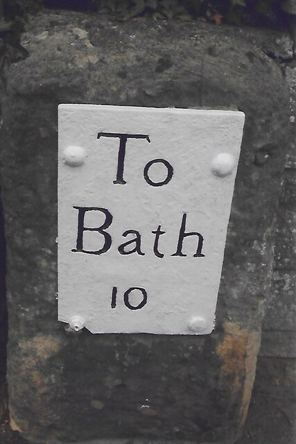
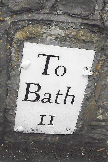
Chivers Knoll is located at Grid Ref: ST6556 (Lat: 51.308748, Lng: -2.4945655)

Unitary Authority: Bath and North East Somerset

Police Authority: Avon and Somerset

What 3 Words

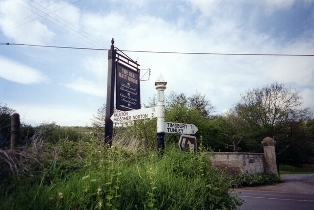
///easy.blotting.riders. Near Paulton, Somerset

Related Wikis

Paulton

Paulton (English: ) is a large village and civil parish, with a population of 5,302, located to the north of the Mendip Hills, very close to Norton Radstock...

Church of the Holy Trinity, Paulton

The Anglican Church of the Holy Trinity in Paulton, Somerset, England, was founded in 1235 and is a Grade II* listed building. It was built on the site...

Paulton Rovers F.C.

Paulton Rovers Football Club is an English football club based on Winterfield Road in the growing village of Paulton near Bristol. They were established...

Paulton Halt railway station

Paulton Halt railway station was on the Camerton branch of the Great Western Railway in Somerset, England. It was in use from 1914 until 1925, however...

Paulton Memorial Hospital

Paulton Memorial Hospital is a community hospital located in the village of Paulton, Somerset, approximately 12 miles (19 km) from Bath, managed by HCRG...

Bowlditch Quarry

Bowlditch Quarry (grid reference ST668558) is a 0.25 hectare geological Site of Special Scientific Interest near the village of Clandown, Bath and North...

Radford and Timsbury Halt railway station

Radford and Timsbury Halt railway station was on the Camerton branch of the Great Western Railway in Somerset, England. It was in use from 1910 until 1915...

High Littleton

High Littleton is a village and civil parish in Somerset, England, about 1.2 miles (1.9 km) north of Paulton and 7.5 miles (12 km) south-west of Bath....

Nearby Amenities

Located within 500m of 51.308748,-2.4945655
Bus Stop
Central Garage
Bus: yes
Naptan AtcoCode: 0180BAC30964
Naptan Bearing: NE
Naptan CommonName: Central Garage
Naptan Crossing: Brookside
Naptan NaptanCode: bthapdm
Naptan Street: Ham Lane
Naptan Verified: no
Public Transport: platform
Source: naptan_import
Lat/Long: 51.3058036/-2.4968351
Bus Stop
Central Garage
Bus: yes
Naptan AtcoCode: 0180BAC30965
Naptan Bearing: SW
Naptan CommonName: Central Garage
Naptan Crossing: Ham Grove
Naptan NaptanCode: bthapdp
Naptan Street: Ham Lane
Naptan Verified: no
Public Transport: platform
Source: naptan_import
Lat/Long: 51.3056779/-2.496805
Bus Stop
Wallenge Dr
Bus: yes
Naptan AtcoCode: 0180BAC30966
Naptan Bearing: SW
Naptan CommonName: Wallenge Dr
Naptan Crossing: Wallenge Drive
Naptan NaptanCode: bthapma
Naptan Street: Britten's Hill
Naptan Verified: no
Public Transport: platform
Source: naptan_import
Lat/Long: 51.3073513/-2.494456
Bus Stop
Wallenge Dr
Bus: yes
Naptan AtcoCode: 0180BAC30967
Naptan Bearing: NE
Naptan BusStopType: CUS
Naptan CommonName: Wallenge Dr
Naptan Crossing: Wallenge Drive
Naptan NaptanCode: bthapjt
Naptan Street: Britten's Hill
Naptan Verified: no
Public Transport: platform
Source: naptan_import
Lat/Long: 51.307477/-2.4945147
Bus Stop
Gregorys Tyning
Bus: yes
Naptan AtcoCode: 0180BAC30968
Naptan Bearing: N
Naptan CommonName: Gregorys Tyning
Naptan Crossing: Gregorys Tyning
Naptan NaptanCode: bthaptd
Naptan Street: Britten's Hill
Naptan Verified: no
Public Transport: platform
Source: naptan_import
Lat/Long: 51.309476/-2.4938475
Bus Stop
Gregorys Tyning
Bus: yes
Naptan AtcoCode: 0180BAC30969
Naptan Bearing: S
Naptan CommonName: Gregorys Tyning
Naptan Crossing: Gregorys Tyning
Naptan NaptanCode: bthapta
Naptan Street: Britten's Hill
Naptan Verified: no
Public Transport: platform
Source: naptan_import
Lat/Long: 51.3100239/-2.4939969
Bus Stop
Brookside
Bus: yes
Naptan AtcoCode: 0180BAC30970
Naptan Bearing: SW
Naptan BusStopType: CUS
Naptan CommonName: Brookside
Naptan Crossing: Brookside
Naptan NaptanCode: bthamwj
Naptan Street: Bath Road
Naptan Verified: no
Public Transport: platform
Source: naptan_import
Lat/Long: 51.3096422/-2.4991864
Bus Stop
Brookside
Bus: yes
Naptan AtcoCode: 0180BAC30971
Naptan Bearing: NE
Naptan CommonName: Brookside
Naptan Crossing: Brookside
Naptan NaptanCode: bthamwm
Naptan Street: Bath Road
Naptan Verified: no
Public Transport: platform
Source: naptan_import
Lat/Long: 51.3097231/-2.4992016
Power: pole
Lat/Long: 51.3063581/-2.4897244
Power: pole
Lat/Long: 51.3072251/-2.4900009
Power: pole
Lat/Long: 51.3080249/-2.4891692
Power: pole
Lat/Long: 51.3085792/-2.4885701
Power: pole
Lat/Long: 51.3095529/-2.4875657
Barrier: bollard
Lat/Long: 51.3061817/-2.4999678
The data included in this document is from www.openstreetmap.org. The data is made available under ODbL.

Have you been to Chivers Knoll?

Leave your review of Chivers Knoll below (or comments, questions and feedback).