Green Hill

Hill, Mountain in Lancashire Chorley

England

Green Hill

View of Cartridge Hill Moorland beside the A675 Belmont Road.
View of Cartridge Hill Credit: Richard Webb

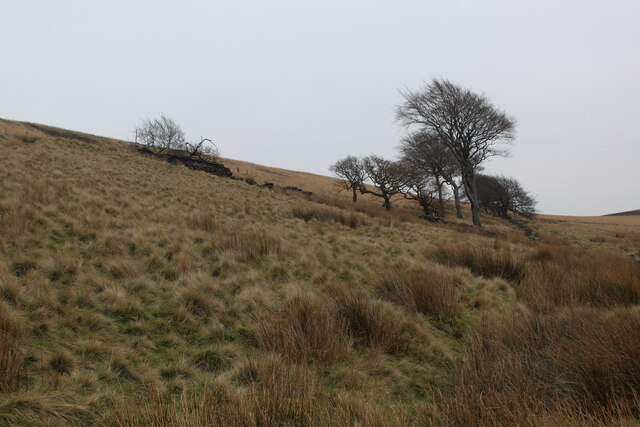
Green Hill, Lancashire is a picturesque hill located in the county of Lancashire, England. With an elevation of approximately 350 meters, it is considered a prominent landmark in the region. Situated on the outskirts of the small village of Green, the hill offers breathtaking views of the surrounding countryside and is a popular destination for outdoor enthusiasts.

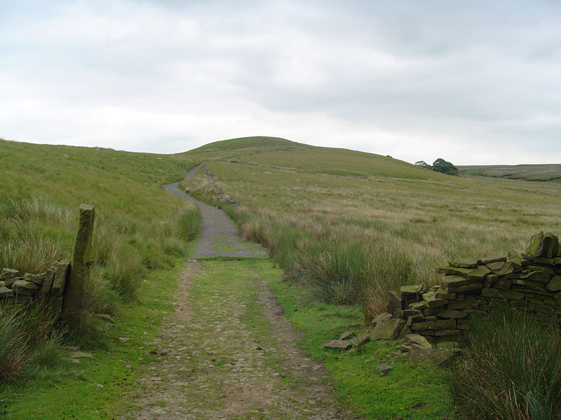
The hill is characterized by its lush greenery and rolling terrain, making it an ideal spot for walking, hiking, and nature observation. It is home to a diverse range of flora and fauna, including various species of trees, wildflowers, and small mammals. The hill's location also attracts a wide variety of birds, making it a paradise for birdwatchers.

At the summit of Green Hill, visitors can enjoy panoramic views of the Lancashire countryside, including the nearby Ribble Valley and the Forest of Bowland, an Area of Outstanding Natural Beauty. On a clear day, it is even possible to see as far as the Welsh mountains in the distance.

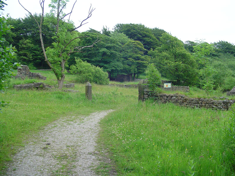
Green Hill is easily accessible by foot or by car, with several footpaths and trails leading to the summit. The hill's proximity to the village of Green means that amenities such as parking, refreshments, and accommodations are readily available for visitors.

Overall, Green Hill, Lancashire offers a tranquil and scenic escape for nature lovers and outdoor enthusiasts, providing an opportunity to immerse oneself in the beauty of the Lancashire countryside.

If you have any feedback on the listing, please let us know in the comments section below.

Green Hill Images

Images are sourced within 2km of 53.678385/-2.5219785 or Grid Reference SD6520. Thanks to Geograph Open Source API. All images are credited.

View of Cartridge Hill Moorland beside the A675 Belmont Road.
View of Cartridge Hill
Moorland beside the A675 Belmont Road.
Path from Crookfield car park Avoids the traffic on the Tockholes road.
Path from Crookfield car park
Avoids the traffic on the Tockholes road.
View towards Winter Hill Rough pasture above the Tockholes road near to Crookfield car park.
View towards Winter Hill
Rough pasture above the Tockholes road near to Crookfield car park.
Cartridge Hill At the time, Cartridge Hill was surveyed as the highest point of Darwen Moor. Taken during an ascent.
Cartridge Hill
At the time, Cartridge Hill was surveyed as the highest point of Darwen Moor. Taken during an ascent.
Darwen Moor Slopes of Cartridge Hill.
Darwen Moor
Slopes of Cartridge Hill.
Summit, Cartridge Hill The top is somewhere around here in a mass of wet peat. Not easy to identify the highest point.  The ground is disturbed, probably by digging fire breaks during a spell of severe moorland fires in 2018.
Summit, Cartridge Hill
The top is somewhere around here in a mass of wet peat. Not easy to identify the highest point. The ground is disturbed, probably by digging fire breaks during a spell of severe moorland fires in 2018.
Gate and stile, Cartridge Hill Rather wet peat.
Gate and stile, Cartridge Hill
Rather wet peat.
Cartridge Hill
Cartridge Hill
Path, Darwen Moor Crossing a dry bit, courtesy of a spoil heap from one of the trial workings. The upper reaches of the  track shown by the Ordnance Survey near here does not exist. Just tussock grass. It is however a good track from the tip of Conyries Wood down past Higher Pasture Barn to Crooklands.
Path, Darwen Moor
Crossing a dry bit, courtesy of a spoil heap from one of the trial workings. The upper reaches of the track shown by the Ordnance Survey near here does not exist. Just tussock grass. It is however a good track from the tip of Conyries Wood down past Higher Pasture Barn to Crooklands.
Track, Higher Pasture Barn Farm
Sheep, Higher Pasture Barn The farm is long gone, but the improved pasture beneath the moor is still grazed.
Sheep, Higher Pasture Barn
The farm is long gone, but the improved pasture beneath the moor is still grazed.
Summit Furnishings on Great Hill A well trodden path from the west leads onto the summit at 1,250 ft.
An old sign post and wind shelter make up the furniture, - with no trig point on this particular top.
Summit Furnishings on Great Hill
A well trodden path from the west leads onto the summit at 1,250 ft. An old sign post and wind shelter make up the furniture, - with no trig point on this particular top.
Footpath on the Summit of Great Hill The amount of footfall to the summit of Great Hill has warranted the placement of flagstones to combat erosion.
Footpath on the Summit of Great Hill
The amount of footfall to the summit of Great Hill has warranted the placement of flagstones to combat erosion.
Narrow Footpath on Wheelton Moor This footpath is not recorded on the map.
It leads down the northern flanks of Great Hill, and heads for the stile seen in the photograph. It then follows the fence for a mile or two in a straight line in the direction of Brinscall
Narrow Footpath on Wheelton Moor
This footpath is not recorded on the map. It leads down the northern flanks of Great Hill, and heads for the stile seen in the photograph. It then follows the fence for a mile or two in a straight line in the direction of Brinscall
Southern Flanks of Great Hill
On Wheelton Moor Long soggy trudge over Wheelton Moor towards Great Hill
On Wheelton Moor
Long soggy trudge over Wheelton Moor towards Great Hill
Crookfield Road Off the A675 north of Belmont. The clump of trees on the skyline is Conyries Plantation.
Crookfield Road
Off the A675 north of Belmont. The clump of trees on the skyline is Conyries Plantation.
Show me another place!

Green Hill is located at Grid Ref: SD6520 (Lat: 53.678385, Lng: -2.5219785)

Administrative County: Lancashire

District: Chorley

Police Authority: Lancashire

What 3 Words

///lifeguard.moons.multiple. Near Brinscall, Lancashire

Related Wikis

Hollinshead Hall

Hollinshead Hall was a manor house close to the village of Tockholes, Lancashire. It is unclear whether the hall was originally the manor house of Tockholes...

Roddlesworth

Roddlesworth is a hamlet in the parish of Withnell in Lancashire, England. It lies on the road connecting Preston with Bolton. The name is first encountered...

Great Hill

Great Hill is a hill in Lancashire, England, on Anglezarke Moor, between the towns of Chorley and Darwen. It is part of the West Pennine Moors and lies...

Black Brook (Chorley)

Black Brook in Lancashire has its source at Great Hill in the West Pennine Moors. The water is acidic due to a high level of peat in the uplands near to...

Nearby Amenities

Located within 500m of 53.678385,-2.5219785
Slipper Lowe Plantation
Natural: wood
Source: OS_OpenData_StreetView
Lat/Long: 53.6773715/-2.5171693
Roddlesworth No 4 Plantation
Natural: wood
Source: OS_OpenData_StreetView
Lat/Long: 53.6825442/-2.5200661
Cold Within Hill
Natural: peak
Lat/Long: 53.6779101/-2.5277503
Green Hill
Natural: peak
Lat/Long: 53.6779607/-2.5229044
Roddlesworth Waterfall
Waterway: waterfall
Lat/Long: 53.6786004/-2.5182319
The data included in this document is from www.openstreetmap.org. The data is made available under ODbL.

Have you been to Green Hill?

Leave your review of Green Hill below (or comments, questions and feedback).