Watch Craig

Hill, Mountain in Aberdeenshire

Scotland

Watch Craig

Summit of the Black Hill Part of the Benachie Range at a summit of 431m
Summit of the Black Hill Credit: Ralph Greig

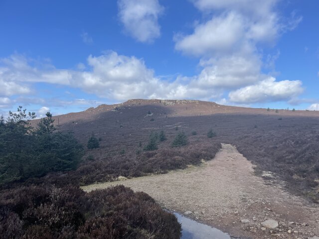
Watch Craig is a prominent hill located in Aberdeenshire, Scotland. With an elevation of approximately 490 meters (1,608 feet), it offers stunning panoramic views of the surrounding countryside. Situated near the town of Ballater, the hill is a popular destination for outdoor enthusiasts and hikers.

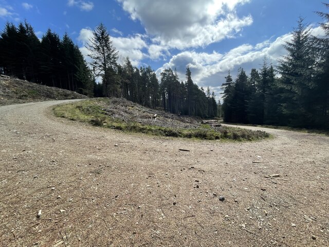
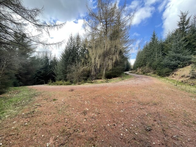
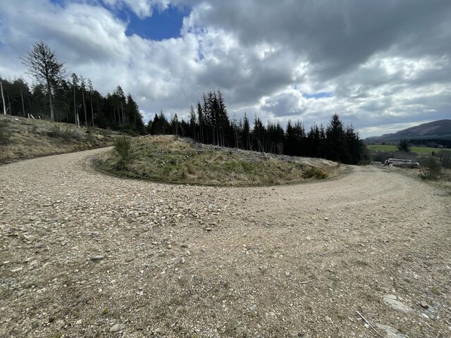
The ascent to Watch Craig is relatively moderate, making it accessible to individuals of various fitness levels. The hill is characterized by undulating terrain, featuring heather-covered slopes and scattered rock formations. As visitors make their way up, they are treated to breathtaking vistas of the Cairngorms National Park and the River Dee valley.

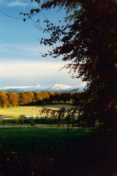
The summit of Watch Craig provides a picturesque vantage point, allowing for uninterrupted views in all directions. On clear days, it is possible to see as far as Lochnagar, one of Scotland's most iconic mountains. The hill is also home to a diverse range of flora and fauna, with sightings of red deer, grouse, and various bird species being common.

Watch Craig is not only renowned for its natural beauty but also for its historical significance. The hill was once a favored lookout spot during times of conflict, providing a strategic advantage to those who occupied it. Today, remnants of old fortifications can still be found, serving as a reminder of the area's past.

Overall, Watch Craig offers a rewarding outdoor experience, combining stunning views, diverse wildlife, and a touch of history. Whether it's a leisurely hike or a more challenging adventure, this Aberdeenshire hill has something to offer for everyone.

If you have any feedback on the listing, please let us know in the comments section below.
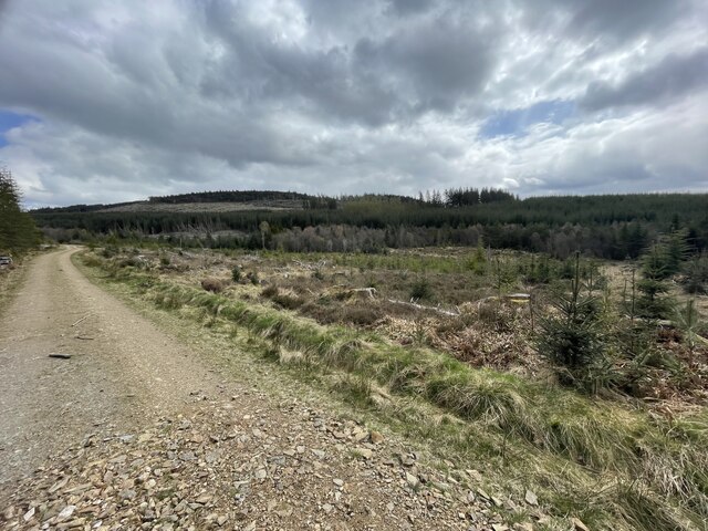
Watch Craig Images

Images are sourced within 2km of 57.290672/-2.5766755 or Grid Reference NJ6522. Thanks to Geograph Open Source API. All images are credited.

Summit of the Black Hill Part of the Benachie Range at a summit of 431m
Summit of the Black Hill
Part of the Benachie Range at a summit of 431m
Path to the Black Hill The path to or from the black hill
Path to the Black Hill
The path to or from the black hill
The Gordon Way Part of the Route.
The Gordon Way
Part of the Route.
Oxen Craig Summit The Summit of this Marilyn looking towards the Mither Tap which most people incorrectly think is the highest point of the range.
Oxen Craig Summit
The Summit of this Marilyn looking towards the Mither Tap which most people incorrectly think is the highest point of the range.
Peek a boo with a stone giant
Burntwood Tap The Gordon Way starts at the Bennachie Centre and runs for 11.5 miles (18.5 km) along the southern side of Bennachie and on to the Suie car park, 3 miles south east of Rhynie. You walk through forests, farmland and open moorland, stout boots are recommended as some sections are muddy.
Burntwood Tap
The Gordon Way starts at the Bennachie Centre and runs for 11.5 miles (18.5 km) along the southern side of Bennachie and on to the Suie car park, 3 miles south east of Rhynie. You walk through forests, farmland and open moorland, stout boots are recommended as some sections are muddy.
The Gordon Way The Gordon Way starts at the Bennachie Centre and runs for 11.5 miles (18.5 km) along the southern side of Bennachie and on to the Suie car park, 3 miles south east of Rhynie. You walk through forests, farmland and open moorland, stout boots are recommended as some sections are muddy.
The Gordon Way
The Gordon Way starts at the Bennachie Centre and runs for 11.5 miles (18.5 km) along the southern side of Bennachie and on to the Suie car park, 3 miles south east of Rhynie. You walk through forests, farmland and open moorland, stout boots are recommended as some sections are muddy.
Hairpin Forest Bends Bennachie is a range of hills in Aberdeenshire, Scotland.It has several tops, the highest of which, Oxen Craig, has a height of 528 metres (1,732 ft). Though not particularly high, compared to other peaks within Scotland, the mountain is very prominent, owing to its isolation and the relative flatness of the surrounding terrain, and dominates the skyline from several viewpoints.
Hairpin Forest Bends
Bennachie is a range of hills in Aberdeenshire, Scotland.It has several tops, the highest of which, Oxen Craig, has a height of 528 metres (1,732 ft). Though not particularly high, compared to other peaks within Scotland, the mountain is very prominent, owing to its isolation and the relative flatness of the surrounding terrain, and dominates the skyline from several viewpoints.
More forest hairpin bends Bennachie is a range of hills in Aberdeenshire, Scotland.It has several tops, the highest of which, Oxen Craig, has a height of 528 metres (1,732 ft). Though not particularly high, compared to other peaks within Scotland, the mountain is very prominent, owing to its isolation and the relative flatness of the surrounding terrain, and dominates the skyline from several viewpoints.
More forest hairpin bends
Bennachie is a range of hills in Aberdeenshire, Scotland.It has several tops, the highest of which, Oxen Craig, has a height of 528 metres (1,732 ft). Though not particularly high, compared to other peaks within Scotland, the mountain is very prominent, owing to its isolation and the relative flatness of the surrounding terrain, and dominates the skyline from several viewpoints.
Even more hairpin bends Bennachie is a range of hills in Aberdeenshire, Scotland.It has several tops, the highest of which, Oxen Craig, has a height of 528 metres (1,732 ft). Though not particularly high, compared to other peaks within Scotland, the mountain is very prominent, owing to its isolation and the relative flatness of the surrounding terrain, and dominates the skyline from several viewpoints.
Even more hairpin bends
Bennachie is a range of hills in Aberdeenshire, Scotland.It has several tops, the highest of which, Oxen Craig, has a height of 528 metres (1,732 ft). Though not particularly high, compared to other peaks within Scotland, the mountain is very prominent, owing to its isolation and the relative flatness of the surrounding terrain, and dominates the skyline from several viewpoints.
Forest roads around Bennachie Bennachie is a range of hills in Aberdeenshire, Scotland.It has several tops, the highest of which, Oxen Craig, has a height of 528 metres (1,732 ft). Though not particularly high, compared to other peaks within Scotland, the mountain is very prominent, owing to its isolation and the relative flatness of the surrounding terrain, and dominates the skyline from several viewpoints.
Forest roads around Bennachie
Bennachie is a range of hills in Aberdeenshire, Scotland.It has several tops, the highest of which, Oxen Craig, has a height of 528 metres (1,732 ft). Though not particularly high, compared to other peaks within Scotland, the mountain is very prominent, owing to its isolation and the relative flatness of the surrounding terrain, and dominates the skyline from several viewpoints.
Early Snow on Bennachie from near Drumrossie, Insch Looking over to early snow on Craigshannoch
Early Snow on Bennachie from near Drumrossie, Insch
Looking over to early snow on Craigshannoch
The path up Craigshannoch
Craigshannoch The path approaching Craigshannoch from the south is a well constructed and well maintained route with signposting of a high quality too - though not necessarily to everyone's taste! The path is surfaced with a granite gravel, the boulders and outcropping rocks ahead are also of that rock.
Craigshannoch
The path approaching Craigshannoch from the south is a well constructed and well maintained route with signposting of a high quality too - though not necessarily to everyone's taste! The path is surfaced with a granite gravel, the boulders and outcropping rocks ahead are also of that rock.
Heather moorland on north side of Bennachie The view northwards over wisps of grass and heather from a path between Craigshannoch and Oxen Craig is across farmland to Hill of Foundland and other minor hills of Aberdeenshire.
Heather moorland on north side of Bennachie
The view northwards over wisps of grass and heather from a path between Craigshannoch and Oxen Craig is across farmland to Hill of Foundland and other minor hills of Aberdeenshire.
Heather slope rising towards Bruntwood Tap The word tap, it seems, is used locally, (on hills of the minor range of Bennachie), to denote a rock tor. Bruntwood Tap lies on the south side of the main hilltop of the group which is Oxen Craig; its rocky nature is not apparent in this image of course. The view here is from one of the many excellent paths in the district, this one being known as Gordon Way.
Heather slope rising towards Bruntwood Tap
The word tap, it seems, is used locally, (on hills of the minor range of Bennachie), to denote a rock tor. Bruntwood Tap lies on the south side of the main hilltop of the group which is Oxen Craig; its rocky nature is not apparent in this image of course. The view here is from one of the many excellent paths in the district, this one being known as Gordon Way.
Little Oxen Craig quarry Bennachie Little Oxen Craig lintel quarry operation for about 40 years closing in 1891.  The quarry stopped working overnight when a serious build up of water burst and washed away the tracks leading to the rockface.  With no transport routes the quarry was unable to function.  The information is on the info board seen in the photo.
Little Oxen Craig quarry Bennachie
Little Oxen Craig lintel quarry operation for about 40 years closing in 1891. The quarry stopped working overnight when a serious build up of water burst and washed away the tracks leading to the rockface. With no transport routes the quarry was unable to function. The information is on the info board seen in the photo.
Show me another place!

Watch Craig is located at Grid Ref: NJ6522 (Lat: 57.290672, Lng: -2.5766755)

Unitary Authority: Aberdeenshire

Police Authority: North East

What 3 Words

///longingly.badge.crust. Near Insch, Aberdeenshire

Nearby Locations

Watch Craig

Related Wikis

Bennachie

Bennachie ( ben-ə-HEE; Scottish Gaelic: Beinn na Cìche) is a range of hills in Aberdeenshire, Scotland. It has several tops, the highest of which, Oxen...
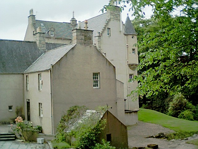
Lickleyhead Castle

Lickleyhead Castle is a well-restored L-plan castle, dating from around 1600, a little south of Auchleven, by the banks of the Gadie Burn, in Aberdeenshire...

Auchleven

Auchleven (Scottish Gaelic: Achadh Leamhan) is a village in Aberdeenshire, Scotland. Located approximately 4 miles (6 kilometres) south of Insch, 17 mi...

Buchanstone railway station

Buchanstone railway station is a former railway station in Aberdeenshire. On the Great North of Scotland Railway, the station was on the north side of...

Nearby Amenities

Located within 500m of 57.290672,-2.5766755
Watch Craig
Ele: 493
Natural: peak
Lat/Long: 57.2908698/-2.5768054
The data included in this document is from www.openstreetmap.org. The data is made available under ODbL.

Have you been to Watch Craig?

Leave your review of Watch Craig below (or comments, questions and feedback).